

$3,550 / Month
40 Joy St
Boston, MA 02114
Today
Favorites
-
Bedrooms
2
-
Bathrooms
1
-
Square Feet
750 sq ft
40 Joy St

Favorites
About This Home
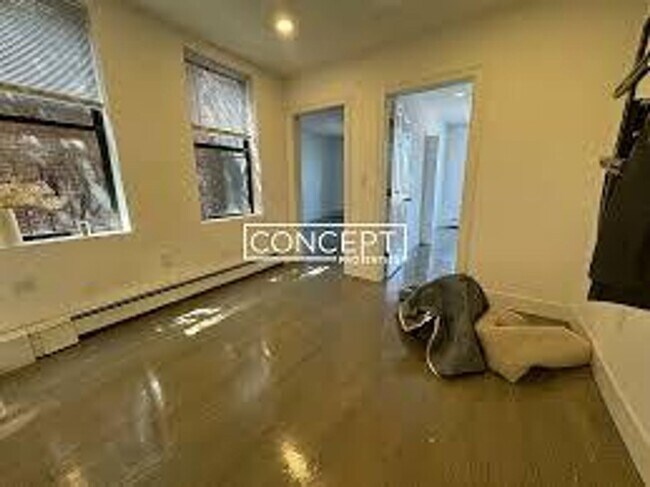
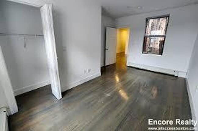
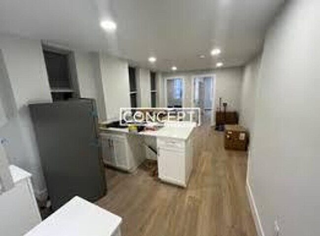
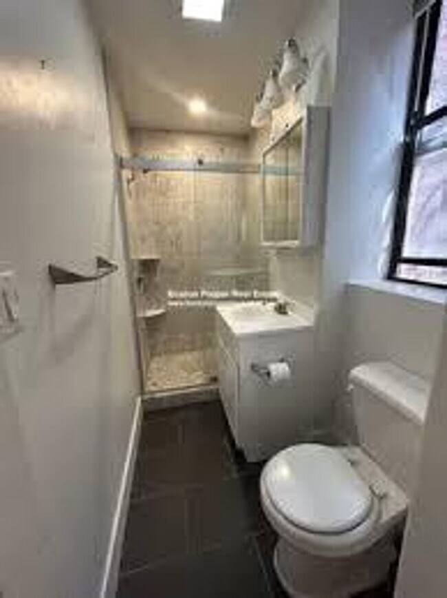
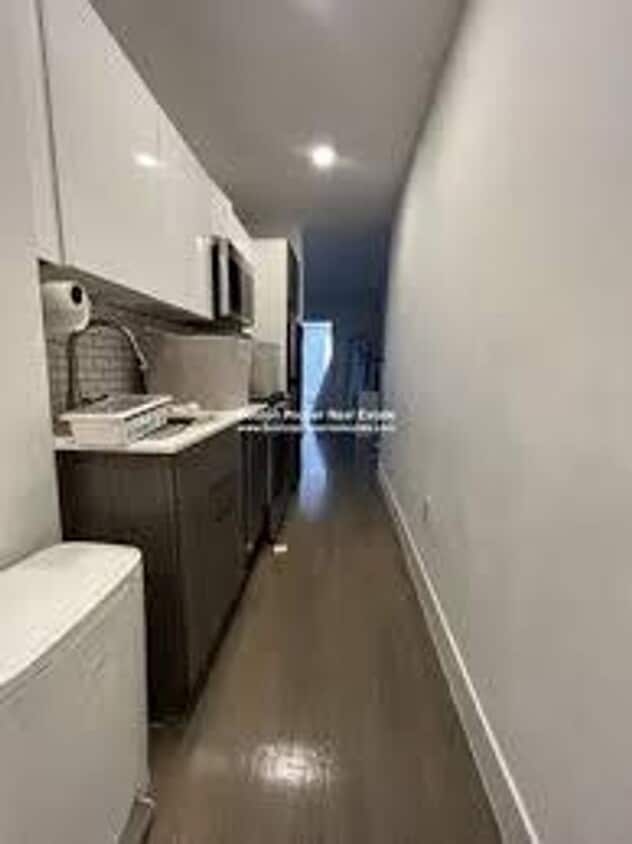
Available September 1 No Brokers Fee No Security Deposit Heat and Hot Water Included Central Beacon Hill Location The Unit is Recently Renovated New Kitchen With Stainless Steel Appliances Separate Living Room Both Bedrooms are a Good Size Ample Closet Space in Each Bedroom Laundry is in the Building PROPERTY INFO ID: 214663436 Rent: $3,550 / Month Beds: 2 Bath: 1 Available Date: 09/01/2025 Pet: Cats Allowed
40 Joy St is a condo located in Suffolk County and the 02114 ZIP Code. This area is served by the Boston Public Schools attendance zone.
* Price shown is base rent and may not include non-optional fees and utilities.
Price, availability, fees, and any applicable rent special are subject to change without notice.
* Square footage definitions vary. Displayed square footage is approximate.
Contact
- Listed by Modern Real Estate (AD) | Modern Real Estate (AD)
Location
Get Directions
Saint Elizabeth’s is a Brighton neighborhood situated about 10 miles away from Boston. Thanks to Saint Elizabeth’s top border sitting on Highway 20, commuting in and out of Brighton is easy. Some residents travel by car, but buses and railways make commuting via public transportation a breeze.
The neighborhood’s best amenities are two world-renowned hospitals, Saint Elizabeth’s Medical Center and Franciscan Children’s, that sit on the edge of town. Other great amenities of Saint Elizabeth’s include many local parks like Ringer Playground and Chestnut Hill Reservoir, which has great trails and greenspace. This neighborhood is also equipped with cozy coffee shops, restaurants serving international and American classics, and shopping plazas with grocers and convenience stores.
Saint Elizabeth’s has several rental options ranging from apartments to single-family homes.
Learn more about living in St Elizabeth's
Education
| Colleges & Universities | Distance | ||
|---|---|---|---|
| Colleges & Universities | Distance | ||
| Walk: | 7 min | 0.4 mi | |
| Walk: | 12 min | 0.6 mi | |
| Drive: | 4 min | 1.4 mi | |
| Drive: | 6 min | 2.7 mi |
40 Joy St is within 7 minutes or 0.4 mile from Suffolk University. It is also near Emerson College and Tufts University, Boston.
Schools


Public Elementary, Middle & High School
Grades 2-12
158 Students
Attendance Zone
Public Elementary & Middle School
Grades PK-8
352 Students
Attendance Zone
Public Middle & High School
Grades 7-12
2,423 Students
Attendance Zone
Public Middle & High School
Grades 7-12
26 Students
Attendance Zone
Charter High School
Grades 9-12
364 Students
Attendance Zone
Private Elementary & Middle School
Grades PK-8
127 Students
Nearby
Private Elementary School
Grades PK-6
349 Students
Nearby
Private Middle & High School
Grades 7-12
204 Students
Nearby
School data provided by
 The GreatSchools Rating helps parents compare schools within a state based on a variety of school quality indicators and provides a helpful picture of how effectively each school serves all of its students. Ratings are on a scale of 1 (below average) to 10 (above average) and can include test scores, college readiness, academic progress, advanced courses, equity, discipline and attendance data. We also advise parents to visit schools, consider other information on school performance and programs, and consider family needs as part of the school selection process.
View GreatSchools Rating Methodology
Data provided by GreatSchools.org © 2025. All rights reserved.
View GreatSchools Rating Methodology
Data provided by GreatSchools.org © 2025. All rights reserved.
Transportation options available in Boston include Bowdoin Station, located 0.2 mile from 40 Joy St. 40 Joy St is near General Edward Lawrence Logan International, located 3.6 miles or 9 minutes away.
| Transit / Subway | Distance | ||
|---|---|---|---|
| Transit / Subway | Distance | ||
|
|
Walk: | 4 min | 0.2 mi |
|
|
Walk: | 7 min | 0.4 mi |
|
|
Walk: | 7 min | 0.4 mi |
|
|
Walk: | 9 min | 0.5 mi |
|
|
Drive: | 5 min | 1.6 mi |
| Commuter Rail | Distance | ||
|---|---|---|---|
| Commuter Rail | Distance | ||
|
|
Walk: | 11 min | 0.6 mi |
|
|
Drive: | 4 min | 1.2 mi |
|
|
Drive: | 7 min | 1.7 mi |
|
|
Drive: | 9 min | 2.7 mi |
|
|
Drive: | 11 min | 5.5 mi |
| Airports | Distance | ||
|---|---|---|---|
| Airports | Distance | ||
|
General Edward Lawrence Logan International
|
Drive: | 9 min | 3.6 mi |
Time and distance from 40 Joy St.
| Shopping Centers | Distance | ||
|---|---|---|---|
| Shopping Centers | Distance | ||
| Walk: | 12 min | 0.6 mi | |
| Walk: | 14 min | 0.7 mi | |
| Walk: | 14 min | 0.7 mi |
40 Joy St has 3 shopping centers within 0.7 mile, which is about a 14-minute walk. The miles and minutes will be for the farthest away property.
| Parks and Recreation | Distance | ||
|---|---|---|---|
| Parks and Recreation | Distance | ||
|
Boston African American National Historic Site
|
Walk: | 5 min | 0.3 mi |
|
Boston National Historical Park
|
Walk: | 10 min | 0.6 mi |
|
Museum of Science
|
Drive: | 5 min | 1.1 mi |
|
Boston Harbor Islands National Recreation Area
|
Drive: | 4 min | 1.2 mi |
|
Boston Public Garden
|
Drive: | 5 min | 1.5 mi |
40 Joy St has 5 parks within 1.5 miles, including Boston African American National Historic Site, Boston Public Garden, and Boston National Historical Park.
| Hospitals | Distance | ||
|---|---|---|---|
| Hospitals | Distance | ||
| Walk: | 6 min | 0.3 mi | |
| Walk: | 6 min | 0.4 mi | |
| Walk: | 9 min | 0.5 mi |
40 Joy St has 3 hospitals within 0.5 mile, the nearest is Shriners Hospital for Children - Boston which is 0.3 mile away and a 6 minute walk.
| Military Bases | Distance | ||
|---|---|---|---|
| Military Bases | Distance | ||
| Drive: | 31 min | 16.3 mi | |
| Drive: | 32 min | 18.7 mi |
40 Joy St is 16.3 miles from Hanscom Air Force Base, and is convenient to other military bases, including Fort Miller.
You May Also Like
Similar Rentals Nearby


What Are Walk Score®, Transit Score®, and Bike Score® Ratings?
Walk Score® measures the walkability of any address. Transit Score® measures access to public transit. Bike Score® measures the bikeability of any address.
What is a Sound Score Rating?
A Sound Score Rating aggregates noise caused by vehicle traffic, airplane traffic and local sources
40 Joy St
Boston, MA 02114