
$2,300
/ Month
392 N 12th St Unit 2
Newark, NJ 07107
Today
|
Edit
Favorites
862-276-2944
-
Bedrooms
3
-
Bathrooms
1
-
Square Feet
9,999 sq ft
-
Available
Available Dec 15
392 N 12th St Unit 2

Favorites
About This Home
12 Month Lease,
$3,450 deposit,
Available Dec 15
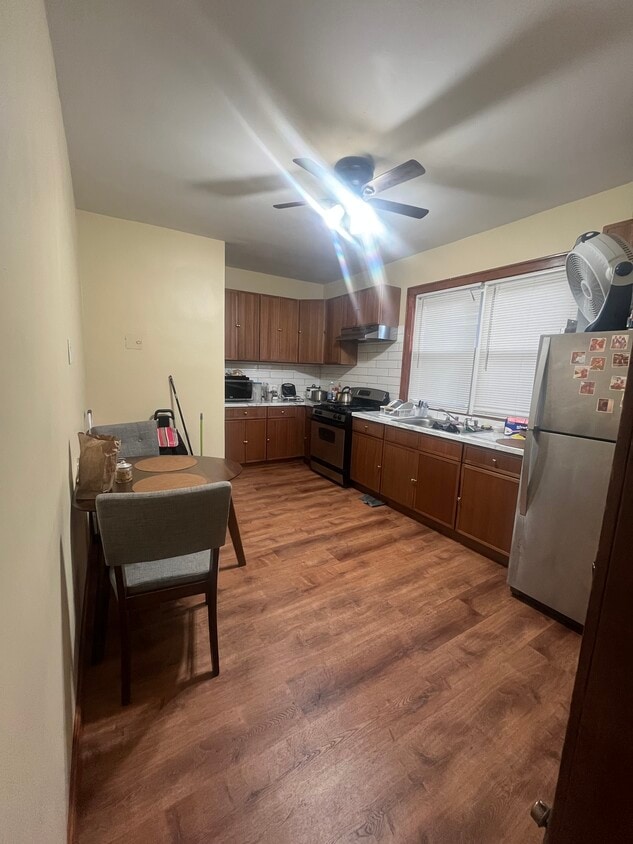
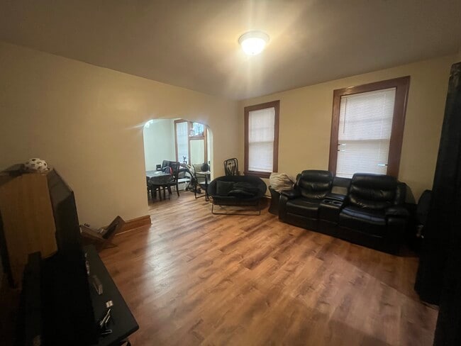
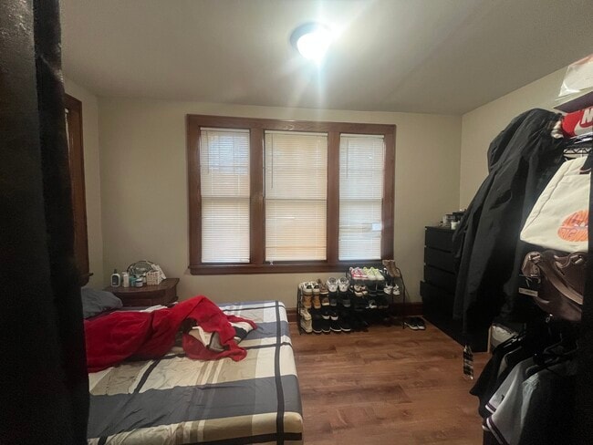
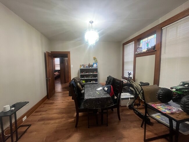
Spacious and clean 3-bedroom, 1-bath second-floor apartment in Newark’s desirable Roseville section. Features an eat-in kitchen, bright living area, and well-sized bedrooms. Conveniently located near shops, schools, and public transportation. Move-in December 15th!
392 N 12th St is an apartment community located in Essex County and the 07107 ZIP Code. This area is served by the The Newark Public attendance zone.
* Price shown is base rent. Excludes user-selected optional fees and variable or usage-based fees and required charges due at or prior to move-in or at move-out. Price, availability, fees, and any applicable rent special are subject to change without notice.
* Square footage definitions vary. Displayed square footage is approximate.
Apartment Features
- Eat-in Kitchen
Fees and Policies
The fees below are based on community-supplied data and may exclude additional fees and utilities.
- Parking
-
Street--
Details
Utilities Included
-
Water
Property Information
-
2 units
Contact
- Phone Number
- Contact
Location
Get Directions
Located just three miles north of Downtown Newark, the Upper Roseville area offers an array of affordable apartments for rent. Mass transit makes commuting simple. The Newark light rail will bring you to Midtown Manhattan in just an hour. Branch Brook Park sits next to the neighborhood, offering its famous cherry trees. The park also offers a playground, basketball and tennis courts, and ball fields. Be sure to check out the annual summer concert by the New Jersey Symphony Orchestra at the park. A variety of cuisines can be found in this charming neighborhood like Calandra’s Bakery.
Learn more about living in Upper Roseville
Education
| Colleges & Universities | Distance | ||
|---|---|---|---|
| Colleges & Universities | Distance | ||
| Drive: | 4 min | 2.1 mi | |
| Drive: | 5 min | 2.5 mi | |
| Drive: | 6 min | 2.7 mi | |
| Drive: | 6 min | 3.0 mi |
392 N 12th St Unit 2 is within 4 minutes or 2.1 miles from Bloomfield College. It is also near Rutgers, Newark Campus and N.J. Inst. of Technology.
Schools


Public Elementary & Middle School
Grades PK-8
1,083 Students
Attendance Zone
Public High School
Grades 9-12
665 Students
Attendance Zone
Public High School
Grades 9-12
1,734 Students
Attendance Zone
Private Elementary, Middle & High School
Grades PK-12
191 Students
Nearby
Private Elementary & Middle School
Grades PK-8
151 Students
Nearby
School data provided by
 The GreatSchools Rating helps parents compare schools within a state based on a variety of school quality indicators and provides a helpful picture of how effectively each school serves all of its students. Ratings are on a scale of 1 (below average) to 10 (above average) and can include test scores, college readiness, academic progress, advanced courses, equity, discipline and attendance data. We also advise parents to visit schools, consider other information on school performance and programs, and consider family needs as part of the school selection process.
View GreatSchools Rating Methodology
Data provided by GreatSchools.org © 2025. All rights reserved.
View GreatSchools Rating Methodology
Data provided by GreatSchools.org © 2025. All rights reserved.
Transportation options available in Newark include Bloomfield Avenue, located 0.6 mile from 392 N 12th St Unit 2. 392 N 12th St Unit 2 is near Newark Liberty International, located 8.3 miles or 14 minutes away, and LaGuardia, located 28.5 miles or 44 minutes away.
| Transit / Subway | Distance | ||
|---|---|---|---|
| Transit / Subway | Distance | ||
|
|
Walk: | 11 min | 0.6 mi |
|
|
Walk: | 14 min | 0.7 mi |
|
|
Walk: | 15 min | 0.8 mi |
|
|
Walk: | 17 min | 0.9 mi |
|
|
Drive: | 3 min | 1.6 mi |
| Commuter Rail | Distance | ||
|---|---|---|---|
| Commuter Rail | Distance | ||
|
|
Drive: | 3 min | 1.3 mi |
|
|
Drive: | 4 min | 1.9 mi |
|
|
Drive: | 5 min | 2.1 mi |
|
|
Drive: | 5 min | 2.4 mi |
|
|
Drive: | 6 min | 2.6 mi |
| Airports | Distance | ||
|---|---|---|---|
| Airports | Distance | ||
|
Newark Liberty International
|
Drive: | 14 min | 8.3 mi |
|
LaGuardia
|
Drive: | 44 min | 28.5 mi |
Time and distance from 392 N 12th St Unit 2.
| Shopping Centers | Distance | ||
|---|---|---|---|
| Shopping Centers | Distance | ||
| Walk: | 6 min | 0.3 mi | |
| Walk: | 15 min | 0.8 mi | |
| Drive: | 2 min | 1.2 mi |
392 N 12th St Unit 2 has 3 shopping centers within 1.2 miles, which is about a 2-minute walk. The miles and minutes will be for the farthest away property.
| Parks and Recreation | Distance | ||
|---|---|---|---|
| Parks and Recreation | Distance | ||
|
Branch Brook Park
|
Drive: | 4 min | 1.4 mi |
|
Newark Museum and Dreyfuss Planetarium
|
Drive: | 5 min | 2.6 mi |
|
Edison National Historic Site
|
Drive: | 9 min | 3.7 mi |
|
Kearny Marsh
|
Drive: | 11 min | 5.1 mi |
|
Richard W. DeKorte Park
|
Drive: | 14 min | 6.4 mi |
392 N 12th St Unit 2 has 5 parks within 6.4 miles, including Branch Brook Park, Newark Museum and Dreyfuss Planetarium, and Edison National Historic Site.
| Hospitals | Distance | ||
|---|---|---|---|
| Hospitals | Distance | ||
| Drive: | 6 min | 2.5 mi | |
| Drive: | 5 min | 2.5 mi | |
| Drive: | 6 min | 2.9 mi |
392 N 12th St Unit 2 has 3 hospitals within 2.9 miles, the nearest is East Orange General Hospital which is 2.5 miles away and a 6 minute drive.
| Military Bases | Distance | ||
|---|---|---|---|
| Military Bases | Distance | ||
| Drive: | 19 min | 12.2 mi | |
| Drive: | 29 min | 14.2 mi | |
| Drive: | 35 min | 20.3 mi |
392 N 12th St Unit 2 has 3 military bases within 20.3 miles, the nearest is Military Ocean Terminal which is 12.2 miles away and a 19 minute drive.
Amenities
- Eat-in Kitchen
392 N 12th St Unit 2 Photos
What Are Walk Score®, Transit Score®, and Bike Score® Ratings?
Walk Score® measures the walkability of any address. Transit Score® measures access to public transit. Bike Score® measures the bikeability of any address.
What is a Sound Score Rating?
A Sound Score Rating aggregates noise caused by vehicle traffic, airplane traffic and local sources

392 N 12th St
Newark, NJ 07107