
Aerie at Wardman Park
2650 Woodley Rd NW,
Washington, DC 20008
$3,932 - $9,047 Total Monthly Price
1-3 Beds

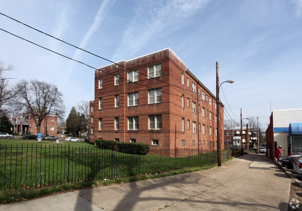

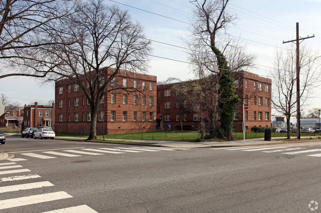
Explore a new place to live at 3867 Alabama Ave SE in Washington. The location in Washington's 20020 area has so much to offer its residents. The professional leasing team is available to assist you in finding the perfect new apartment. This community offers residents a wide variety of amenities and features like smoke free options and high-speed internet access. It's time to love where you live. Stop by for a visit today.
3867 Alabama Ave Se is an apartment community located in District of Columbia County and the 20020 ZIP Code. This area is served by the District Of Columbia Public Schools attendance zone.
Air Conditioning
Disposal
Oven
Range
The residential neighborhood of Fort Dupont sits just east of the Anacostia River in Southeast Washington, DC. The neighborhood has ample green space provided by two adjacent parks — Fort Circle Park and Fort Chaplin Park — and distinguishes itself within the Greater Anacostia area by housing the only public indoor ice rink in Washington, DC.
There’s a diverse mix of rentals in Fort Dupont, from more recent and upscale developments to long-standing apartment homes closer to the Anacostia River. Proximity to the Benning Road Metro Station makes Fort Dupont perfect for the Capitol Hill commuter who wishes to reside outside the bustle of DC.
Learn more about living in Fort DupontCompare neighborhood and city base rent averages by bedroom.
| Fort Dupont | Washington, DC | |
|---|---|---|
| Studio | $1,580 | $1,830 |
| 1 Bedroom | $1,291 | $2,268 |
| 2 Bedrooms | $1,398 | $3,117 |
| 3 Bedrooms | $2,143 | $3,939 |
| Colleges & Universities | Distance | ||
|---|---|---|---|
| Colleges & Universities | Distance | ||
| Drive: | 10 min | 4.9 mi | |
| Drive: | 10 min | 4.9 mi | |
| Drive: | 12 min | 5.5 mi | |
| Drive: | 11 min | 5.6 mi |


Transportation options available in Washington include Naylor Road, located 1.6 miles from 3867 Alabama Ave SE. 3867 Alabama Ave SE is near Ronald Reagan Washington Ntl, located 8.5 miles or 17 minutes away, and Baltimore/Washington International Thurgood Marshall, located 30.5 miles or 46 minutes away.
| Transit / Subway | Distance | ||
|---|---|---|---|
| Transit / Subway | Distance | ||
|
|
Drive: | 4 min | 1.6 mi |
|
|
Drive: | 5 min | 2.4 mi |
|
|
Drive: | 7 min | 2.7 mi |
|
|
Drive: | 8 min | 2.8 mi |
|
|
Drive: | 9 min | 3.0 mi |
| Commuter Rail | Distance | ||
|---|---|---|---|
| Commuter Rail | Distance | ||
|
|
Drive: | 12 min | 4.3 mi |
|
|
Drive: | 10 min | 4.5 mi |
|
|
Drive: | 10 min | 5.8 mi |
| Drive: | 16 min | 8.3 mi | |
| Drive: | 16 min | 9.7 mi |
| Airports | Distance | ||
|---|---|---|---|
| Airports | Distance | ||
|
Ronald Reagan Washington Ntl
|
Drive: | 17 min | 8.5 mi |
|
Baltimore/Washington International Thurgood Marshall
|
Drive: | 46 min | 30.5 mi |
Scores provided by
Traffic
-Airport
-Businesses
-Scores provided by
HowLoud What is a Sound Score Rating? A Sound Score Rating aggregates noise caused by vehicle traffic, airplane traffic and local sources. How It WorksTime and distance from 3867 Alabama Ave SE.
| Shopping Centers | Distance | ||
|---|---|---|---|
| Shopping Centers | Distance | ||
| Walk: | 1 min | 0.1 mi | |
| Walk: | 4 min | 0.2 mi | |
| Walk: | 34 min | 1.8 mi |
| Parks and Recreation | Distance | ||
|---|---|---|---|
| Parks and Recreation | Distance | ||
|
Fort Dupont Park
|
Drive: | 4 min | 1.3 mi |
|
Frederick Douglass National Historic Site
|
Drive: | 8 min | 2.6 mi |
|
Kenilworth Park & Aquatic Gardens
|
Drive: | 7 min | 2.9 mi |
|
Oxon Cove Park
|
Drive: | 7 min | 3.0 mi |
|
Kingman and Heritage Island Park
|
Drive: | 7 min | 3.8 mi |
| Hospitals | Distance | ||
|---|---|---|---|
| Hospitals | Distance | ||
| Drive: | 9 min | 3.0 mi | |
| Drive: | 9 min | 3.5 mi | |
| Drive: | 11 min | 5.7 mi |
| Military Bases | Distance | ||
|---|---|---|---|
| Military Bases | Distance | ||
| Drive: | 8 min | 3.3 mi | |
| Drive: | 10 min | 4.1 mi | |
| Drive: | 13 min | 4.5 mi |
Pets Allowed Fitness Center Pool Dishwasher Refrigerator Kitchen
Pets Allowed Fitness Center Pool Dishwasher In Unit Washer & Dryer Business Center Package Service

Pets Allowed Fitness Center In Unit Washer & Dryer Balcony Courtyard Concierge EV Charging
What Are Walk Score®, Transit Score®, and Bike Score® Ratings?
Walk Score® measures the walkability of any address. Transit Score® measures access to public transit. Bike Score® measures the bikeability of any address.
What is a Sound Score Rating?
A Sound Score Rating aggregates noise caused by vehicle traffic, airplane traffic and local sources.
3867 Alabama Ave SE
Washington, DC 20020


