
Portico Waterfront
37 8th Ave,
Oakland, CA 94606
Studio - 3 Beds $2,429 - $6,444
City of Oakland Alameda County Temescal neighborhood Located on Telegraph Avenue near MacArthur Blvd. Cross streets are 40th St. and Ruby Just 2 blocks to Telegraph shopping in Temescal District Very close to Piedmont Ave. excellent shopping, restaurants, bars, theater, and coffee houses. 1 block to Macarthur BART Walk Score of 94 (Walker's Paradise) Bike Score of 95 (Biker's Paradise) Transit Score of 75 Bus stops for AC Transit nearby on Telegraph Ave, 40th St., and Broadway Minutes to San Francisco, Berkeley, Hayward, and San Leandro Quick access to major highways 580, 80, 880, 24, and 13 Close to Downtown and Jack London Square GreenPoint Rated Building
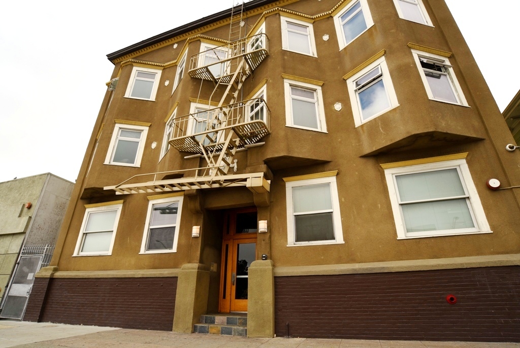
3833 Telegraph Ave is an apartment community located in Alameda County and the 94609 ZIP Code. This area is served by the Oakland Unified attendance zone.
Dishwasher
High Speed Internet Access
Hardwood Floors
Granite Countertops
Conveniently positioned in North Oakland at the junction of Interstates 580 and 980, Mosswood is a delightful neighborhood with a quirky personality. The community is mainly residential, with a full network of tree-lined sidewalks allowing residents to walk to the neighborhood’s various shops and cafes with ease.
On the southeast corner of the neighborhood, Mosswood Park is a terrific place to unwind, with playgrounds, sports fields, and a popular community amphitheater. Several branches of the Kaiser Permanente Medical Center are located within easy walking distance of the neighborhood, making Mosswood a highly convenient place for healthcare professionals to live.
Learn more about living in Mosswood| Colleges & Universities | Distance | ||
|---|---|---|---|
| Colleges & Universities | Distance | ||
| Walk: | 10 min | 0.6 mi | |
| Drive: | 5 min | 2.1 mi | |
| Drive: | 9 min | 3.2 mi | |
| Drive: | 7 min | 3.2 mi |


Transportation options available in Oakland include 19Th St Oakland Station, located 1.5 miles from 3833 Telegraph Ave. 3833 Telegraph Ave is near Metro Oakland International, located 11.2 miles or 18 minutes away, and San Francisco International, located 23.0 miles or 35 minutes away.
| Transit / Subway | Distance | ||
|---|---|---|---|
| Transit / Subway | Distance | ||
|
|
Drive: | 3 min | 1.5 mi |
|
|
Drive: | 4 min | 1.7 mi |
|
|
Drive: | 3 min | 1.7 mi |
|
|
Drive: | 5 min | 1.8 mi |
|
|
Drive: | 5 min | 2.4 mi |
| Commuter Rail | Distance | ||
|---|---|---|---|
| Commuter Rail | Distance | ||
|
|
Drive: | 7 min | 2.6 mi |
|
|
Drive: | 5 min | 2.9 mi |
|
|
Drive: | 8 min | 5.0 mi |
| Drive: | 17 min | 10.6 mi | |
| Drive: | 17 min | 10.7 mi |
| Airports | Distance | ||
|---|---|---|---|
| Airports | Distance | ||
|
Metro Oakland International
|
Drive: | 18 min | 11.2 mi |
|
San Francisco International
|
Drive: | 35 min | 23.0 mi |
Time and distance from 3833 Telegraph Ave.
| Shopping Centers | Distance | ||
|---|---|---|---|
| Shopping Centers | Distance | ||
| Walk: | 4 min | 0.2 mi | |
| Walk: | 8 min | 0.4 mi | |
| Walk: | 14 min | 0.7 mi |
| Parks and Recreation | Distance | ||
|---|---|---|---|
| Parks and Recreation | Distance | ||
|
Morcom Rose Garden
|
Drive: | 3 min | 1.3 mi |
|
Lakeside Park Garden Center
|
Drive: | 4 min | 1.6 mi |
|
Lakeside Park
|
Drive: | 3 min | 1.8 mi |
|
Juan Bautista de Anza National Historic Trail
|
Drive: | 5 min | 2.1 mi |
|
Rotary Nature Center
|
Drive: | 4 min | 2.2 mi |
| Hospitals | Distance | ||
|---|---|---|---|
| Hospitals | Distance | ||
| Walk: | 9 min | 0.5 mi | |
| Walk: | 11 min | 0.6 mi | |
| Walk: | 18 min | 1.0 mi |
| Military Bases | Distance | ||
|---|---|---|---|
| Military Bases | Distance | ||
| Drive: | 13 min | 4.9 mi | |
| Drive: | 13 min | 5.3 mi |
What Are Walk Score®, Transit Score®, and Bike Score® Ratings?
Walk Score® measures the walkability of any address. Transit Score® measures access to public transit. Bike Score® measures the bikeability of any address.
What is a Sound Score Rating?
A Sound Score Rating aggregates noise caused by vehicle traffic, airplane traffic and local sources

3833 Telegraph Ave
Oakland, CA 94609


