
Williamsburg
200 W Galbraith Rd,
Cincinnati, OH 45215
$850 - $2,619
Studio - 3 Beds


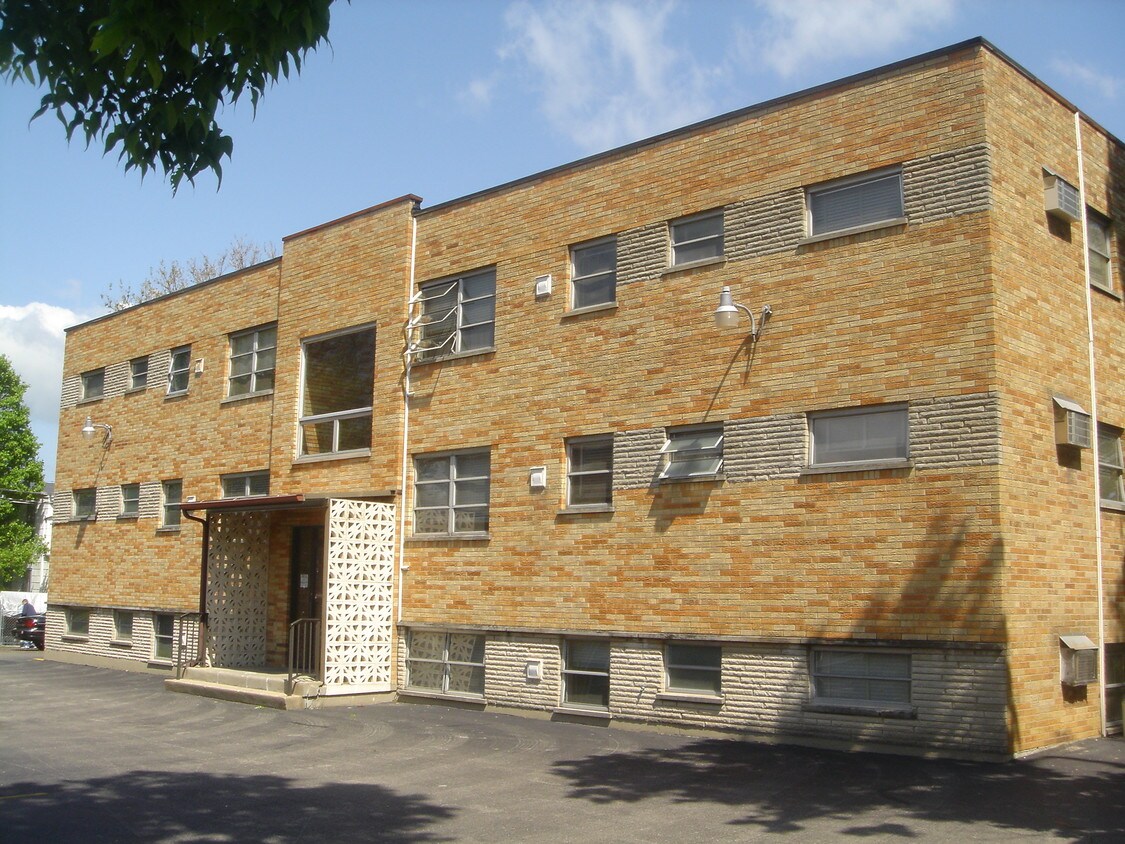
3828 Washington Ave in Cincinnati is ready for you to visit. In a location on Washington Ave in Cincinnati's 45211 area, residents can easily connect with a number of points of interest. From pricing to features, the professional leasing staff will be ready to help you find the perfect place. Make a visit to see the current floorplan options. Contact us or drop by to talk about leasing your next apartment and make your move to 3828 Washington Ave.
3828 Washington Ave is an apartment community located in Hamilton County and the 45211 ZIP Code. This area is served by the Cincinnati Public Schools attendance zone.
As one of the oldest cities in the United States west of the Appalachians, Cincinnati offers residents contemporary urban living in a historic, distinctive setting. One of the oldest cities in the US houses an influential youth culture. Students, professionals, artists, and musicians of all walks of life come to the southwest corner of Ohio to live and work. College and professional sports are wildly popular, with the Bearcats of the University of Cincinnati, the Reds, and the Bengals enjoying huge fan bases in their hometown.
Renters and visitors alike will delight in attractions like the Cincinnati Art Museum, the Newport Aquarium, and the city’s iconic zoo. The annual Oktoberfest is one of the biggest celebrations of its kind outside of Munich, drawing thousands to the streets to celebrate the city’s German heritage.
Learn more about living in CincinnatiCompare neighborhood and city base rent averages by bedroom.
| Northwest Cincinnati | Cincinnati, OH | |
|---|---|---|
| Studio | $700 | $1,057 |
| 1 Bedroom | $940 | $1,123 |
| 2 Bedrooms | $1,155 | $1,401 |
| 3 Bedrooms | $1,440 | $1,711 |
| Colleges & Universities | Distance | ||
|---|---|---|---|
| Colleges & Universities | Distance | ||
| Drive: | 14 min | 5.7 mi | |
| Drive: | 17 min | 6.4 mi | |
| Drive: | 15 min | 6.6 mi | |
| Drive: | 17 min | 7.1 mi |


Transportation options available in Cincinnati include Brewery District Station, Elm & Henry, located 6.5 miles from 3828 Washington Ave. 3828 Washington Ave is near Cincinnati/Northern Kentucky International, located 21.4 miles or 41 minutes away.
| Transit / Subway | Distance | ||
|---|---|---|---|
| Transit / Subway | Distance | ||
| Drive: | 16 min | 6.5 mi | |
| Drive: | 16 min | 6.7 mi | |
| Drive: | 17 min | 6.8 mi | |
| Drive: | 17 min | 6.9 mi | |
| Drive: | 17 min | 7.0 mi |
| Commuter Rail | Distance | ||
|---|---|---|---|
| Commuter Rail | Distance | ||
|
|
Drive: | 16 min | 7.3 mi |
| Airports | Distance | ||
|---|---|---|---|
| Airports | Distance | ||
|
Cincinnati/Northern Kentucky International
|
Drive: | 41 min | 21.4 mi |
Time and distance from 3828 Washington Ave.
| Shopping Centers | Distance | ||
|---|---|---|---|
| Shopping Centers | Distance | ||
| Walk: | 19 min | 1.0 mi | |
| Drive: | 4 min | 1.2 mi | |
| Drive: | 4 min | 1.2 mi |
| Parks and Recreation | Distance | ||
|---|---|---|---|
| Parks and Recreation | Distance | ||
|
Mt. Airy Forest
|
Drive: | 7 min | 3.0 mi |
|
Mitchell Memorial Forest
|
Drive: | 12 min | 5.1 mi |
|
Buttercup Valley
|
Drive: | 14 min | 5.3 mi |
|
Imago Earth Center
|
Drive: | 15 min | 5.4 mi |
|
LaBoiteaux Woods
|
Drive: | 16 min | 6.5 mi |
| Hospitals | Distance | ||
|---|---|---|---|
| Hospitals | Distance | ||
| Drive: | 8 min | 2.6 mi | |
| Drive: | 14 min | 5.9 mi | |
| Drive: | 17 min | 7.1 mi |
| Military Bases | Distance | ||
|---|---|---|---|
| Military Bases | Distance | ||
| Drive: | 77 min | 56.1 mi | |
| Drive: | 83 min | 61.2 mi | |
| Drive: | 85 min | 64.5 mi |
What Are Walk Score®, Transit Score®, and Bike Score® Ratings?
Walk Score® measures the walkability of any address. Transit Score® measures access to public transit. Bike Score® measures the bikeability of any address.
What is a Sound Score Rating?
A Sound Score Rating aggregates noise caused by vehicle traffic, airplane traffic and local sources
3828 Washington Ave
Cincinnati, OH 45211


