
$2,800
/ Month
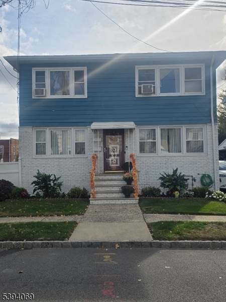
369 Watsessing Ave
Bloomfield, NJ 07003
Today
|
Edit
Favorites
973-509-4649
-
Bedrooms
3
-
Bathrooms
1
-
Square Feet
--
-
Available
Available Now
369 Watsessing Ave

Favorites
About This Home
Available Now
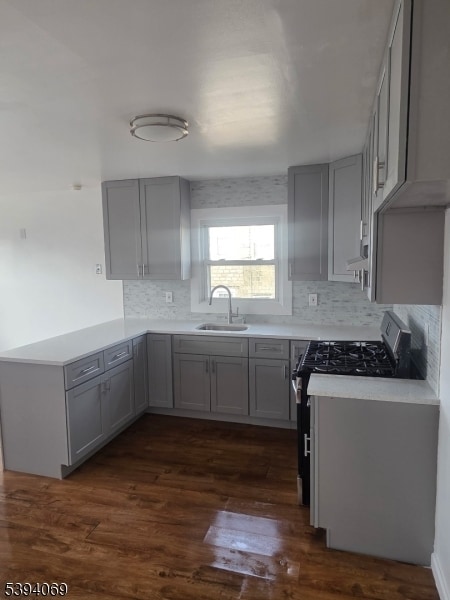
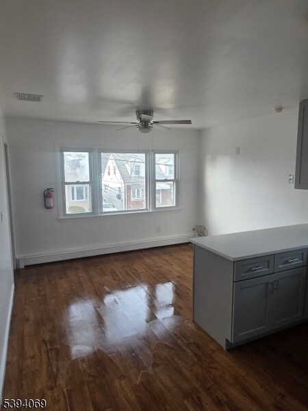
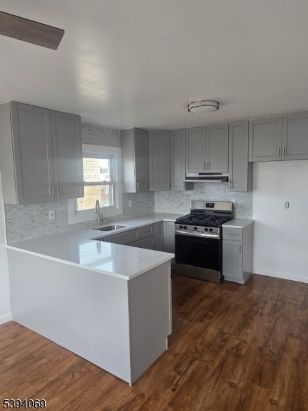
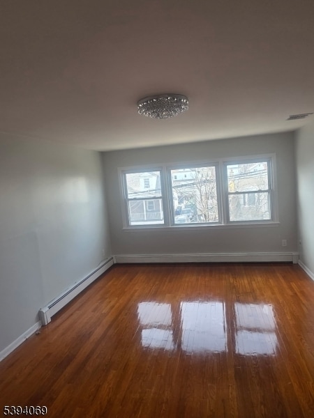
Now available! MASSIVE, newly updated 3 bedroom, 1 bath apartment located on the second floor of a well-maintained two-family home. This bright & airy unit features a freshly painted interior, refinished hardwood floors, and oversized sun-filled rooms! The updated eat-in kitchen offers quartz countertops, tile backsplash, & gray shaker cabinets. Bedrooms offer ample closet space & the living room provides plenty of natural light. !Excellent! commuter location and located on a lovely tree lined block. Steps to Watsessing Avenue Train Station (direct service to NYC) and down the road from Grove Street Light Rail with easy access to Newark, Hoboken, and Jersey City. Convenient to local bus lines, Garden State Parkway, shopping, dining, and neighborhood parks.
369 Watsessing Ave is an apartment community located in Essex County and the 07003 ZIP Code.
* Price shown is base rent. Excludes user-selected optional fees and variable or usage-based fees and required charges due at or prior to move-in or at move-out. Price, availability, fees, and any applicable rent special are subject to change without notice.
* Square footage definitions vary. Displayed square footage is approximate.
Home Details
Year Built
Built in 1964 | Remodeled
Bedrooms and Bathrooms
1 Full Bathroom
3 Bedrooms
Listing and Financial Details
Assessor Parcel Number 1602-00425-0000-00045-0000-
Tenant pays for electric, gas, heat, hot water, water
Lot Details
41 Sq Ft Lot
Parking
On-Street Parking
Schools
Bloomfield Middle School
Bloomfield High School
Utilities
Window Unit Cooling System
Community Details
Contact
- Listed by ANDREA A CRESPO | GardenStateMLS#NJ
- Phone Number
- Contact
-
Source
Garden State Multiple Listing Service, LLC
Copyright © 2025 Garden State MLS, LLC. All rights reserved. All information provided by the listing agent/broker is deemed reliable but is not guaranteed and should be independently verified.
Location
Get Directions
Amenities
- Air Conditioning
Located 12 miles from Manhattan, Bloomfield combines small-town atmosphere with metropolitan accessibility. This Essex County township features established neighborhoods with housing options from classic single-family homes to contemporary apartment communities. The historic Bloomfield Green, anchored by the Presbyterian Church dating to 1794, serves as the town center. With two NJ Transit stations connecting to New York City and Newark, Bloomfield offers convenient transportation options for commuters. Current rental data shows one-bedroom apartments averaging $2,012, while three-bedroom units average $2,828.
Brookdale Park, spanning 77 acres, provides recreational opportunities with walking paths and athletic facilities. The downtown area near Bloomfield College features local shops and dining establishments. The Garden State Parkway and other major routes make commuting convenient from Bloomfield.
Learn more about living in Bloomfield
Education
| Colleges & Universities | Distance | ||
|---|---|---|---|
| Colleges & Universities | Distance | ||
| Drive: | 3 min | 1.4 mi | |
| Drive: | 6 min | 3.4 mi | |
| Drive: | 7 min | 3.6 mi | |
| Drive: | 7 min | 3.9 mi |
369 Watsessing Ave is within 3 minutes or 1.4 miles from Bloomfield College. It is also near Rutgers, Newark Campus and N.J. Inst. of Technology.
Transportation options available in Bloomfield include Silver Lake, located 0.5 mile from 369 Watsessing Ave. 369 Watsessing Ave is near Newark Liberty International, located 9.3 miles or 15 minutes away, and LaGuardia, located 26.2 miles or 45 minutes away.
| Transit / Subway | Distance | ||
|---|---|---|---|
| Transit / Subway | Distance | ||
|
|
Walk: | 9 min | 0.5 mi |
|
|
Walk: | 11 min | 0.6 mi |
|
|
Walk: | 17 min | 0.9 mi |
|
|
Drive: | 3 min | 1.2 mi |
|
|
Drive: | 3 min | 1.6 mi |
| Commuter Rail | Distance | ||
|---|---|---|---|
| Commuter Rail | Distance | ||
|
|
Walk: | 19 min | 1.0 mi |
|
|
Drive: | 3 min | 1.3 mi |
|
|
Drive: | 3 min | 1.8 mi |
|
|
Drive: | 5 min | 2.4 mi |
|
|
Drive: | 5 min | 2.6 mi |
| Airports | Distance | ||
|---|---|---|---|
| Airports | Distance | ||
|
Newark Liberty International
|
Drive: | 15 min | 9.3 mi |
|
LaGuardia
|
Drive: | 45 min | 26.2 mi |
Time and distance from 369 Watsessing Ave.
| Shopping Centers | Distance | ||
|---|---|---|---|
| Shopping Centers | Distance | ||
| Walk: | 4 min | 0.2 mi | |
| Walk: | 11 min | 0.6 mi | |
| Drive: | 4 min | 1.1 mi |
369 Watsessing Ave has 3 shopping centers within 1.1 miles, which is about a 4-minute drive. The miles and minutes will be for the farthest away property.
| Parks and Recreation | Distance | ||
|---|---|---|---|
| Parks and Recreation | Distance | ||
|
Branch Brook Park
|
Drive: | 5 min | 2.3 mi |
|
Newark Museum and Dreyfuss Planetarium
|
Drive: | 6 min | 3.5 mi |
|
Van Vleck House & Gardens
|
Drive: | 7 min | 3.9 mi |
|
Edison National Historic Site
|
Drive: | 9 min | 4.2 mi |
|
Kearny Marsh
|
Drive: | 11 min | 5.2 mi |
369 Watsessing Ave has 5 parks within 5.2 miles, including Branch Brook Park, Edison National Historic Site, and Newark Museum and Dreyfuss Planetarium.
| Hospitals | Distance | ||
|---|---|---|---|
| Hospitals | Distance | ||
| Drive: | 6 min | 3.0 mi | |
| Drive: | 6 min | 3.4 mi | |
| Drive: | 7 min | 3.8 mi |
369 Watsessing Ave has 3 hospitals within 3.8 miles, the nearest is East Orange General Hospital which is 3.0 miles away and a 6 minute drive.
| Military Bases | Distance | ||
|---|---|---|---|
| Military Bases | Distance | ||
| Drive: | 21 min | 13.1 mi | |
| Drive: | 31 min | 15.1 mi | |
| Drive: | 36 min | 21.2 mi |
369 Watsessing Ave has 3 military bases within 21.2 miles, the nearest is Military Ocean Terminal which is 13.1 miles away and a 21 minute drive.
You May Also Like
How do I access Social Services in New Jersey?
Statewide service is free, confidential, multilingual and always open. Three easy ways to reach Social Services in NJ: Dial 2-1-1; text your zip code to 898-211; or chat at https://www.nj211.org
Similar Rentals Nearby
-
-
-
-
-
-
-
-
-
1 / 22

-


What Are Walk Score®, Transit Score®, and Bike Score® Ratings?
Walk Score® measures the walkability of any address. Transit Score® measures access to public transit. Bike Score® measures the bikeability of any address.
What is a Sound Score Rating?
A Sound Score Rating aggregates noise caused by vehicle traffic, airplane traffic and local sources
369 Watsessing Ave
Bloomfield, NJ 07003