
$2,600
/ Month
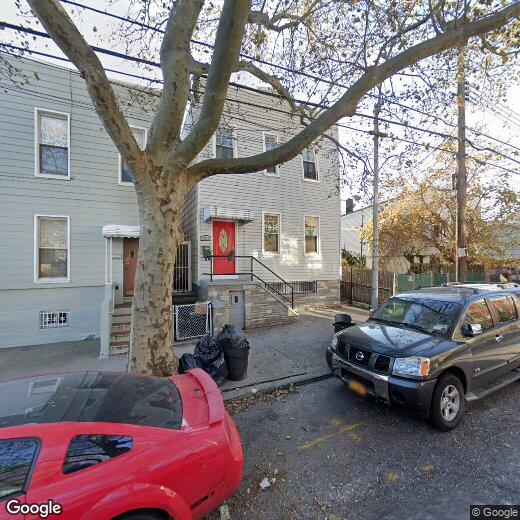
36-11 10th St
Long Island City, NY
2 Weeks Ago
|
Edit
Favorites
36-11 10th St

Favorites
Check Back Soon for Upcoming Availability
| Beds | Baths | Average SF |
|---|---|---|
| 2 Bedrooms 2 Bedrooms 2 Br | 1 Bath 1 Bath 1 Ba | — |
Fees and Policies
The fees below are based on community-supplied data and may exclude additional fees and utilities.
About This Property
Amazing 2 bedroom apartment in LIC $2600 1 King size bedroom and a smaller bedroom on the 2nd floor in a 2-family house Spacious living room Eat-in kitchen with great cabinet space Full bathroom with wall to floor tiles Hardwood floors Windows through the apartment, natural light Cat and small dog upon approval Heat and Hot water included 5 Blocks away from Queensboro subway station (7, N, W trains) Available now
36-11 10th St is a house located in Queens County and the ZIP Code. This area is served by the New York City Geographic District #30 attendance zone.
House Features
Hardwood Floors
Fireplace
Smoke Free
Eat-in Kitchen
- Smoke Free
- Fireplace
- Eat-in Kitchen
- Hardwood Floors
Location
Get Directions
Just one subway stop from Midtown Manhattan and the Upper East Side, Long Island City sits along the East River with spectacular views of the city skyline. Since it once served as a manufacturing hub, a variety of former industrial buildings now house historic lofts. Luxury condos also dominate the landscape, along with a smattering of low-rise apartment buildings and single-family houses, providing a unique mix of architecture to suit any renter’s lifestyle. Living in this Queens neighborhood will put you close to not only Manhattan, but also trendy neighborhoods like Williamsburg in Brooklyn.
If you're planning to move to Long Island City, you might be wondering what the cost of living is, and how it compares to the rest of New York. Like much of NYC, the cost of living in Long Island City is high — roughly 80 percent higher than the national average. Those fantastic views and being less than 10 minutes from Manhattan by subway come at a cost.
Learn more about living in Long Island CityBelow are rent ranges for similar nearby apartments
Amenities
- Smoke Free
- Fireplace
- Eat-in Kitchen
- Hardwood Floors
Education
| Colleges & Universities | Distance | ||
|---|---|---|---|
| Colleges & Universities | Distance | ||
| Drive: | 3 min | 1.8 mi | |
| Drive: | 7 min | 3.2 mi | |
| Drive: | 7 min | 3.3 mi | |
| Drive: | 8 min | 3.5 mi |
36-11 10th St is within 3 minutes or 1.8 miles from LaGuardia Community College. It is also near Weill Cornell Medical College and Marymount Manhattan College.
Schools


Public Elementary & Middle School
Grades PK-8
397 Students
Attendance Zone
Public Middle School
Grades 6-8
341 Students
Attendance Zone
Public High School
Grades 9-12
1,924 Students
Attendance Zone
Private Elementary, Middle & High School
Grades PK-12
437 Students
Nearby
Private Elementary, Middle & High School
Grades K-12
340 Students
Nearby
School data provided by
 The GreatSchools Rating helps parents compare schools within a state based on a variety of school quality indicators and provides a helpful picture of how effectively each school serves all of its students. Ratings are on a scale of 1 (below average) to 10 (above average) and can include test scores, college readiness, academic progress, advanced courses, equity, discipline and attendance data. We also advise parents to visit schools, consider other information on school performance and programs, and consider family needs as part of the school selection process.
View GreatSchools Rating Methodology
Data provided by GreatSchools.org © 2025. All rights reserved.
View GreatSchools Rating Methodology
Data provided by GreatSchools.org © 2025. All rights reserved.
Transportation options available in Long Island City include 21 Street-Queensbridge, located 0.6 mile from 36-11 10th St. 36-11 10th St is near LaGuardia, located 4.4 miles or 10 minutes away, and John F Kennedy International, located 15.7 miles or 23 minutes away.
| Transit / Subway | Distance | ||
|---|---|---|---|
| Transit / Subway | Distance | ||
|
|
Walk: | 12 min | 0.6 mi |
| Walk: | 13 min | 0.7 mi | |
| Walk: | 17 min | 0.9 mi | |
|
|
Drive: | 6 min | 1.3 mi |
| Drive: | 8 min | 4.0 mi |
| Commuter Rail | Distance | ||
|---|---|---|---|
| Commuter Rail | Distance | ||
|
|
Drive: | 4 min | 1.8 mi |
|
|
Drive: | 5 min | 2.1 mi |
|
|
Drive: | 7 min | 3.3 mi |
|
|
Drive: | 8 min | 3.5 mi |
|
|
Drive: | 9 min | 3.7 mi |
| Airports | Distance | ||
|---|---|---|---|
| Airports | Distance | ||
|
LaGuardia
|
Drive: | 10 min | 4.4 mi |
|
John F Kennedy International
|
Drive: | 23 min | 15.7 mi |
Time and distance from 36-11 10th St.
| Shopping Centers | Distance | ||
|---|---|---|---|
| Shopping Centers | Distance | ||
| Drive: | 5 min | 1.8 mi | |
| Drive: | 4 min | 1.9 mi | |
| Drive: | 6 min | 2.0 mi |
36-11 10th St has 3 shopping centers within 2.0 miles, which is about a 6-minute drive. The miles and minutes will be for the farthest away property.
| Parks and Recreation | Distance | ||
|---|---|---|---|
| Parks and Recreation | Distance | ||
|
Socrates Sculpture Park
|
Walk: | 10 min | 0.6 mi |
|
Queensbridge Park
|
Walk: | 11 min | 0.6 mi |
|
Hallets Cove Playground
|
Walk: | 16 min | 0.9 mi |
|
St. Catherine's Park
|
Drive: | 7 min | 2.9 mi |
|
John Jay Park
|
Drive: | 9 min | 3.9 mi |
36-11 10th St has 5 parks within 3.9 miles, including Socrates Sculpture Park, Queensbridge Park, and Hallets Cove Playground.
| Hospitals | Distance | ||
|---|---|---|---|
| Hospitals | Distance | ||
| Drive: | 7 min | 3.3 mi | |
| Drive: | 8 min | 3.7 mi | |
| Drive: | 10 min | 4.8 mi |
36-11 10th St has 3 hospitals within 4.8 miles, the nearest is Hospital for Special Surgery which is 3.3 miles away and a 7 minute drive.
| Military Bases | Distance | ||
|---|---|---|---|
| Military Bases | Distance | ||
| Drive: | 21 min | 9.8 mi | |
| Drive: | 20 min | 10.8 mi |
36-11 10th St is 9.8 miles from Governors Island Support Center, and is convenient to other military bases, including Fort Totten US Govt Reservation.
You May Also Like
Similar Rentals Nearby


What Are Walk Score®, Transit Score®, and Bike Score® Ratings?
Walk Score® measures the walkability of any address. Transit Score® measures access to public transit. Bike Score® measures the bikeability of any address.
What is a Sound Score Rating?
A Sound Score Rating aggregates noise caused by vehicle traffic, airplane traffic and local sources

36-11 10th St
Long Island City, NY