$800
/ Month
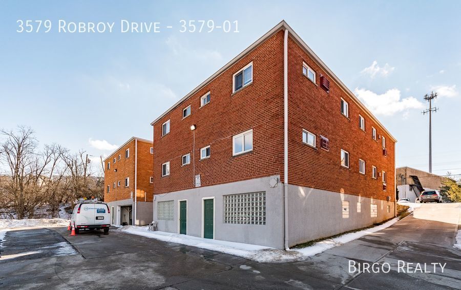
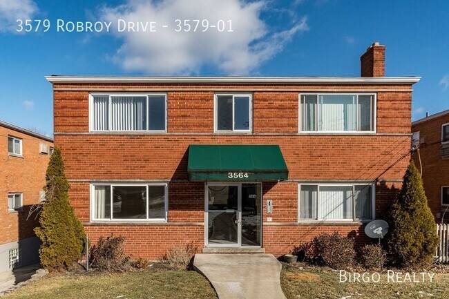
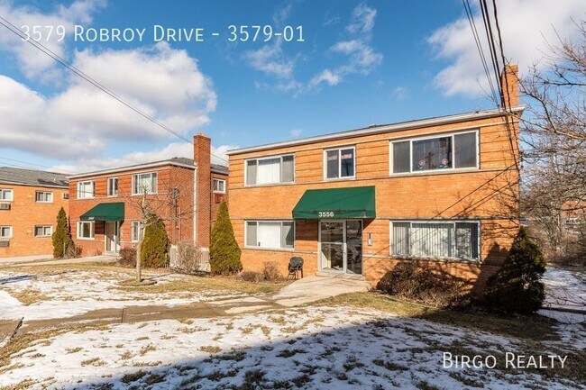
3579 Robroy Dr Unit 3579-01
Cincinnati, OH 45247
2 Weeks Ago
|
Edit
Favorites
3579 Robroy Dr Unit 3579-01

Favorites
Check Back Soon for Upcoming Availability
| Beds | Baths | Average SF |
|---|---|---|
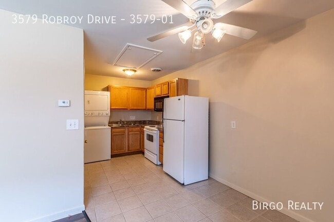
| 1 Bedroom 1 Bedroom 1 Br | 1 Bath 1 Bath 1 Ba | 525 SF |
Fees and Policies
The fees listed below are community-provided and may exclude utilities or add-ons. All payments are made directly to the property and are non-refundable unless otherwise specified.
- Cats Allowed
-
Fees not specified
-
Weight limit--
-
Pet Limit--
About This Property
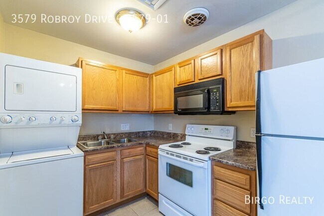
---- SCHEDULE A SHOWING ONLINE AT: ---- APARTMENT BENEFITS: - Located in Monfort Heights - Conveniences are nearby: grocery stores, gas stations, bus lines, banks, restaurants and shopping centers - Close to local schools and parks - Near I-74 with easy access to Cincinnati - Build your credit automatically! - Birgo reports your on-time rent payments to the credit agencies, which can raise your credit score! - Unlike our competitors, your rent will never be raised above the market rate for your unit! - Last (but not least) you get landlords who care! APARTMENT AMENITIES: - Well-kept green space and walkways - Air conditioning - On-site laundry - Convenient parking *To schedule a showing, click on one of the times at the top of the page to put your showing on the calendar. *If you’re ready to apply, start our online application by clicking the “Apply Now” tab at the top of this page. *Optional flexible rent payment schedules are available with our partner, Flex. Note: Photos of the apartment shown in this listing may be replicas and may not be the actual apartment you’re looking to lease. Please schedule a showing to see the actual apartment. Free Parking Garbage Gas Green Space Heat Pump In Building Laundry Sewage Water
3579 Robroy Dr is an apartment community located in Hamilton County and the 45247 ZIP Code.
3579 Robroy Dr,
Cincinnati,
OH
45247
Cincinnati sits on the northern bank of the Ohio River, where rolling hills meet a city that helped establish the Midwest long before other major metros existed. Settled in 1788, the Queen City sits west of the Appalachian Mountains and combines historic culture with urban living.
Today, neighborhoods like Over-the-Rhine, Hyde Park, and Mount Adams each bring a distinct character to city life. Over-the-Rhine is packed with restored 19th-century architecture, Findlay Market, and Music Hall. Mount Adams perches beside Eden Park with stunning river views, while Hyde Park Square draws locals and tourists alike with local cafes and walkable streets.
Renters will find a wide range of housing options across the city, from converted lofts and townhouses in Over-the-Rhine to sleek high-rise apartment communities along the riverfront at The Banks. Clifton and Oakley offer everything from charming older buildings to newer developments with modern amenities.
Learn more about living in Cincinnati
Education
| Colleges & Universities | Distance | ||
|---|---|---|---|
| Colleges & Universities | Distance | ||
| Drive: | 14 min | 6.7 mi | |
| Drive: | 14 min | 8.0 mi | |
| Drive: | 15 min | 8.5 mi | |
| Drive: | 20 min | 8.5 mi |
3579 Robroy Dr Unit 3579-01 is within 14 minutes or 6.7 miles from Cincinnati State. It is also near University of Cincinnati and Univ. of Cincinnati, Medical.
Transportation options available in Cincinnati include Brewery District Station - Elm & Henry, located 8.8 miles from 3579 Robroy Dr Unit 3579-01. 3579 Robroy Dr Unit 3579-01 is near Cincinnati/Northern Kentucky International, located 22.8 miles or 38 minutes away.
| Transit / Subway | Distance | ||
|---|---|---|---|
| Transit / Subway | Distance | ||
| Drive: | 14 min | 8.8 mi | |
| Drive: | 15 min | 8.8 mi | |
| Drive: | 15 min | 8.9 mi | |
| Drive: | 15 min | 9.0 mi | |
| Drive: | 15 min | 9.1 mi |
| Commuter Rail | Distance | ||
|---|---|---|---|
| Commuter Rail | Distance | ||
|
|
Drive: | 14 min | 8.7 mi |
| Airports | Distance | ||
|---|---|---|---|
| Airports | Distance | ||
|
Cincinnati/Northern Kentucky International
|
Drive: | 38 min | 22.8 mi |
Walkability Near 3579 Robroy Dr Cincinnati, OH 45247
Getting Around
 What do Walkability, Transit, Drivability, and Bikeability mean?
Walkability measures the walking distance to day-to-day needs.
Transit measures access to public transportation.
Drivability measures congestion, parking availability, and access to major roads.
Bikeability measures the suitability for cycling.
How It Works
What do Walkability, Transit, Drivability, and Bikeability mean?
Walkability measures the walking distance to day-to-day needs.
Transit measures access to public transportation.
Drivability measures congestion, parking availability, and access to major roads.
Bikeability measures the suitability for cycling.
How It Works
Fairly Walkable
Walkability
50
/ 100
Limited Public Transit
Transit
30
/ 100
Exceptionally Drivable
Drivability
100
/ 100
Fairly Bikeable
Bikeability
40
/ 100
Scores provided by
Active
Soundscore™
71
/ 100
Traffic
ActiveAirport
CalmBusinesses
ActiveScores provided by
HowLoud What is a Sound Score Rating? A Sound Score Rating aggregates noise caused by vehicle traffic, airplane traffic and local sources. How It WorksTime and distance from 3579 Robroy Dr Unit 3579-01.
| Shopping Centers | Distance | ||
|---|---|---|---|
| Shopping Centers | Distance | ||
| Walk: | 4 min | 0.2 mi | |
| Walk: | 6 min | 0.4 mi | |
| Walk: | 7 min | 0.4 mi |
3579 Robroy Dr Unit 3579-01 has 3 shopping centers within 0.4 mile, which is about a 7-minute walk. The miles and minutes will be for the farthest away property.
| Parks and Recreation | Distance | ||
|---|---|---|---|
| Parks and Recreation | Distance | ||
|
Mt. Airy Forest
|
Drive: | 5 min | 2.0 mi |
|
Farbach-Werner Nature Preserve
|
Drive: | 9 min | 3.7 mi |
|
LaBoiteaux Woods
|
Drive: | 10 min | 4.1 mi |
|
Buttercup Valley
|
Drive: | 12 min | 4.6 mi |
|
Mitchell Memorial Forest
|
Drive: | 13 min | 6.8 mi |
3579 Robroy Dr Unit 3579-01 has 5 parks within 6.8 miles, including Mt. Airy Forest, Farbach-Werner Nature Preserve, and LaBoiteaux Woods.
| Hospitals | Distance | ||
|---|---|---|---|
| Hospitals | Distance | ||
| Drive: | 4 min | 1.3 mi | |
| Drive: | 12 min | 7.3 mi | |
| Drive: | 15 min | 8.5 mi |
3579 Robroy Dr Unit 3579-01 has 3 hospitals within 8.5 miles, the nearest is Mercy Health - West Hospital which is 1.3 miles away and a 4 minute drive.
| Military Bases | Distance | ||
|---|---|---|---|
| Military Bases | Distance | ||
| Drive: | 73 min | 56.5 mi | |
| Drive: | 79 min | 61.5 mi | |
| Drive: | 82 min | 64.8 mi |
3579 Robroy Dr Unit 3579-01 has 3 military bases within 64.8 miles, the nearest is Gentile Air Force Station which is 56.5 miles away and a 73 minute drive.
You May Also Like
Similar Rentals Nearby


What Are Walk Score®, Transit Score®, and Bike Score® Ratings?
Walk Score® measures the walkability of any address. Transit Score® measures access to public transit. Bike Score® measures the bikeability of any address.
What is a Sound Score Rating?
A Sound Score Rating aggregates noise caused by vehicle traffic, airplane traffic and local sources.

3579 Robroy Dr
Cincinnati, OH 45247