
$900
Total Monthly Price
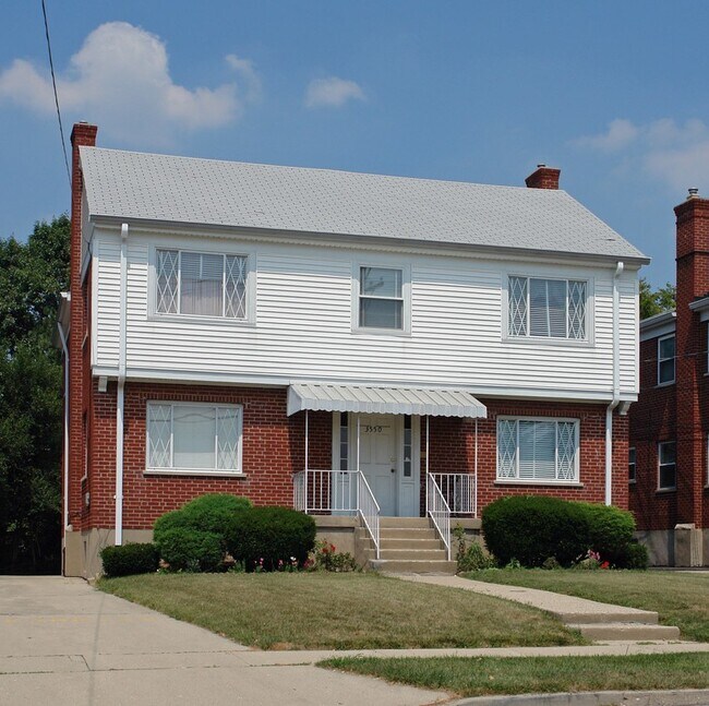
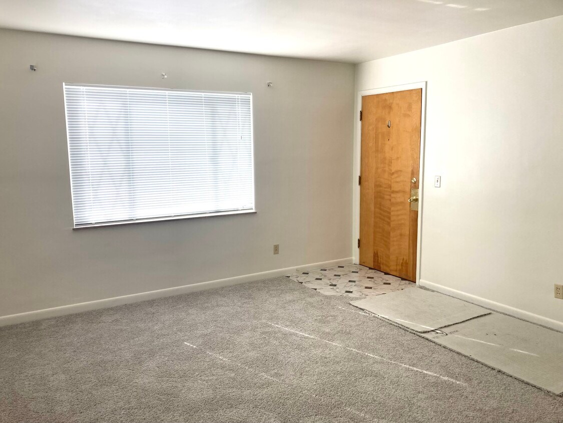
3550 Schwartze Ave Unit 2
Cincinnati, OH 45211
2 Weeks Ago
|
Edit
Favorites
3550 Schwartze Ave Unit 2

Favorites
Check Back Soon for Upcoming Availability
| Beds | Baths | Average SF |
|---|---|---|
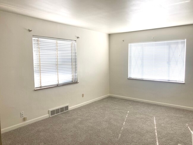
| 1 Bedroom 1 Bedroom 1 Br | 1 Bath 1 Bath 1 Ba | 900 SF |
Fees and Policies
The fees listed below are community-provided and may exclude utilities or add-ons. All payments are made directly to the property and are non-refundable unless otherwise specified.
- Parking
-
Street--
Details
Utilities Included
-
Gas
-
Water
-
Heat
-
Trash Removal
-
Sewer
-
Air Conditioning
Property Information
-
4 units
About This Property
Spacious 1 bedroom unit conveniently located near Target, Kroger, Western Hills Plaza. Month to Month Lease agreement. Income Requirement: Applicant must make at least is 2.5 times the monthly rent amount of $900 We verify income and rental history as we also obtain a background check and credit history. Owner pays gas, trash, sewer, and water. Tenant pays for electric. No smoking allowed on the premises. No pets allowed. All applicants 18 years and up must submit rental application. No past evictions. Please contact us to schedule a viewing.
3550 Schwartze Ave is an apartment community located in Hamilton County and the 45211 ZIP Code.
Apartment Features
Air Conditioning
Tub/Shower
Ceiling Fans
Smoke Free
- Air Conditioning
- Heating
- Ceiling Fans
- Smoke Free
- Tub/Shower
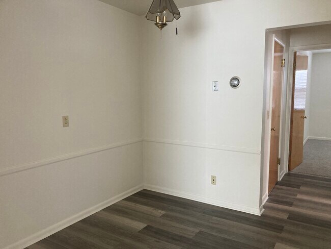
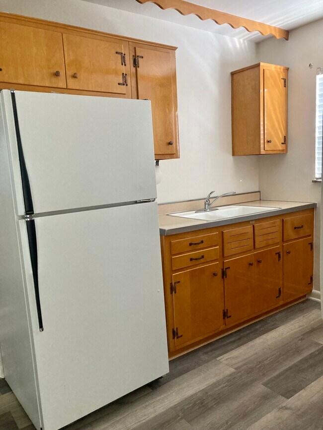
- Kitchen
- Carpet
- Dining Room
- Laundry Facilities
3550 Schwartze Ave,
Cincinnati,
OH
45211
Situated about five miles northwest of Downtown Cincinnati, Westwood is the largest neighborhood in the city. Residents flock to Westwood for its many affordable historic homes and modern apartments available for rent in addition to its close proximity to I-74, I-75, and all that Downtown Cincinnati has to offer.
While Westwood is a predominantly residential neighborhood, it is also home to a slew of convenient stores and restaurants. Shopping opportunities abound in Westwood, with plenty of national retailers in Western Hills Plaza and local shops in the growing Town Hall District. Numerous neighborhood parks provide ample space to enjoy the outdoors in town as well as the sprawling 1,400-acre Mount Airy Forest, which is partially located in Westwood.
Learn more about living in WestwoodBelow are rent ranges for similar nearby apartments
Amenities
- Air Conditioning
- Heating
- Ceiling Fans
- Smoke Free
- Tub/Shower
- Kitchen
- Carpet
- Dining Room
- Laundry Facilities
Expenses
Utilities Included
Gas, Water, Heat, Trash Removal, Sewer, Air Conditioning
Included
Education
| Colleges & Universities | Distance | ||
|---|---|---|---|
| Colleges & Universities | Distance | ||
| Drive: | 12 min | 4.9 mi | |
| Drive: | 16 min | 6.4 mi | |
| Drive: | 15 min | 6.7 mi | |
| Drive: | 16 min | 7.1 mi |
3550 Schwartze Ave Unit 2 is within 12 minutes or 4.9 miles from College of Mount St. Joseph. It is also near Cincinnati State and University of Cincinnati.
Transportation options available in Cincinnati include Brewery District Station - Elm & Henry, located 6.5 miles from 3550 Schwartze Ave Unit 2. 3550 Schwartze Ave Unit 2 is near Cincinnati/Northern Kentucky International, located 21.4 miles or 40 minutes away.
| Transit / Subway | Distance | ||
|---|---|---|---|
| Transit / Subway | Distance | ||
| Drive: | 15 min | 6.5 mi | |
| Drive: | 16 min | 6.7 mi | |
| Drive: | 16 min | 6.8 mi | |
| Drive: | 16 min | 6.9 mi | |
| Drive: | 16 min | 7.0 mi |
| Commuter Rail | Distance | ||
|---|---|---|---|
| Commuter Rail | Distance | ||
|
|
Drive: | 16 min | 7.3 mi |
| Airports | Distance | ||
|---|---|---|---|
| Airports | Distance | ||
|
Cincinnati/Northern Kentucky International
|
Drive: | 40 min | 21.4 mi |
Walkability Near 3550 Schwartze Ave Cincinnati, OH 45211
Getting Around
 What do Walkability, Transit, Drivability, and Bikeability mean?
Walkability measures the walking distance to day-to-day needs.
Transit measures access to public transportation.
Drivability measures congestion, parking availability, and access to major roads.
Bikeability measures the suitability for cycling.
How It Works
What do Walkability, Transit, Drivability, and Bikeability mean?
Walkability measures the walking distance to day-to-day needs.
Transit measures access to public transportation.
Drivability measures congestion, parking availability, and access to major roads.
Bikeability measures the suitability for cycling.
How It Works
Fairly Walkable
Walkability
50
/ 100
Some Public Transit
Transit
40
/ 100
Very Drivable
Drivability
80
/ 100
Fairly Bikeable
Bikeability
40
/ 100
Scores provided by
-
Soundscore™
-
/ 100
Traffic
-Airport
-Businesses
-Scores provided by
HowLoud What is a Sound Score Rating? A Sound Score Rating aggregates noise caused by vehicle traffic, airplane traffic and local sources. How It WorksTime and distance from 3550 Schwartze Ave Unit 2.
| Shopping Centers | Distance | ||
|---|---|---|---|
| Shopping Centers | Distance | ||
| Walk: | 7 min | 0.4 mi | |
| Walk: | 9 min | 0.5 mi | |
| Walk: | 11 min | 0.6 mi |
3550 Schwartze Ave Unit 2 has 3 shopping centers within 0.6 mile, which is about a 11-minute walk. The miles and minutes will be for the farthest away property.
| Parks and Recreation | Distance | ||
|---|---|---|---|
| Parks and Recreation | Distance | ||
|
Mt. Airy Forest
|
Drive: | 10 min | 3.8 mi |
|
Imago Earth Center
|
Drive: | 13 min | 4.6 mi |
|
Embshoff Woods
|
Drive: | 15 min | 5.1 mi |
|
Wilson Commons
|
Drive: | 15 min | 5.3 mi |
|
Mitchell Memorial Forest
|
Drive: | 14 min | 5.9 mi |
3550 Schwartze Ave Unit 2 has 5 parks within 5.9 miles, including Mt. Airy Forest, Imago Earth Center, and Embshoff Woods.
| Hospitals | Distance | ||
|---|---|---|---|
| Hospitals | Distance | ||
| Drive: | 10 min | 3.9 mi | |
| Drive: | 13 min | 5.9 mi | |
| Drive: | 16 min | 7.2 mi |
3550 Schwartze Ave Unit 2 has 3 hospitals within 7.2 miles, the nearest is Mercy Health - West Hospital which is 3.9 miles away and a 10 minute drive.
| Military Bases | Distance | ||
|---|---|---|---|
| Military Bases | Distance | ||
| Drive: | 76 min | 56.1 mi | |
| Drive: | 82 min | 61.2 mi | |
| Drive: | 84 min | 64.5 mi |
3550 Schwartze Ave Unit 2 has 3 military bases within 64.5 miles, the nearest is Gentile Air Force Station which is 56.1 miles away and a 76 minute drive.
You May Also Like
Similar Rentals Nearby


What Are Walk Score®, Transit Score®, and Bike Score® Ratings?
Walk Score® measures the walkability of any address. Transit Score® measures access to public transit. Bike Score® measures the bikeability of any address.
What is a Sound Score Rating?
A Sound Score Rating aggregates noise caused by vehicle traffic, airplane traffic and local sources.
3550 Schwartze Ave
Cincinnati, OH 45211