
$1,850
/ Month
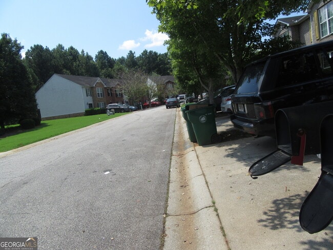
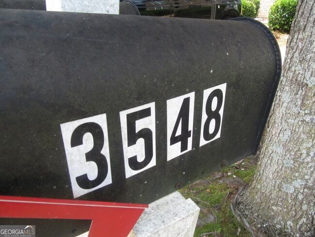
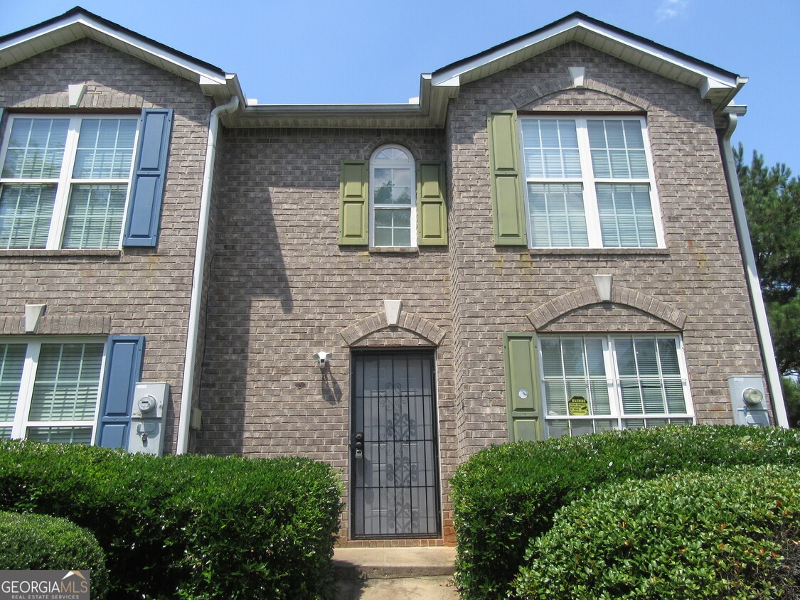
3548 Waldrop Trail
Decatur, GA 30034
Today
|
Edit
Favorites
404-867-9137
-
Bedrooms
3
-
Bathrooms
2.5
-
Square Feet
1,560 sq ft
-
Available
Available Now
Highlights
- Property is near public transit
- Corner Lot
- Soaking Tub
- Walk-In Closet
- Laundry Room
- Tile Flooring
3548 Waldrop Trail

Favorites
About This Home
$1,985 deposit,
Available Now
This was previous renovated! You would love to call this unit home! The unit is close to all the major highways, to shopping, to transit and much more! We are looking for a tenant who wants to take care of this townhome and call it home! A background and credit check is important to selecting the new tenant! We welcome everyone! NO EVICTIONS! AND NO EVICTIONS! Housing voucher okay but you still must have your SECURITY DEPOSIT ON $1985.
3548 Waldrop Trail is a townhome located in DeKalb County and the 30034 ZIP Code. This area is served by the DeKalb County attendance zone.
* Price shown is base rent. Excludes user-selected optional fees and variable or usage-based fees and required charges due at or prior to move-in or at move-out. Price, availability, fees, and any applicable rent special are subject to change without notice.
* Square footage definitions vary. Displayed square footage is approximate.
Home Details
Home Type
Townhome
Year Built
Built in 2006 | Remodeled
Attic
Pull Down Stairs to Attic
Expansion Attic
Bedrooms and Bathrooms
Soaking Tub
Walk-In Closet
Bathtub Includes Tile Surround
2.5 Bathrooms
3 Bedrooms
Flooring
Tile
Carpet
Laminate
Home Design
Brick Front
Wood Siding
Vinyl Siding
Composition Roof
Garden Home
Interior Spaces
Ceiling Fan
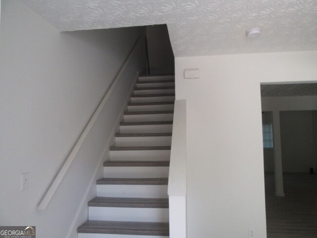
Two Story Entrance Foyer
1,560 Sq Ft Home
Multi-Level Property
Kitchen
Oven or Range
Dishwasher
Laundry
Laundry Room
Laundry on upper level
Listing and Financial Details
Security Deposit $1,985
12-Month Lease Term
$50 Application Fee
Location
Property is near public transit
Property is near schools
Property is near shops
Lot Details
4,356 Sq Ft Lot
Corner Lot
Parking
Carport
Schools
Oak View Elementary School
Cedar Grove Middle School
Cedar Grove High School
Utilities
Central Heating and Cooling System
Heat Pump System
Community Details
Overview
Property has a Home Owners Association
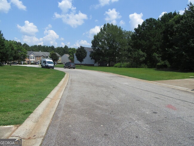
Waldrop Station Phase 4 Subdivision
Association fees include facilities fee, management fee
Pet Policy
No Pets Allowed
Fees and Policies
The fees below are based on community-supplied data and may exclude additional fees and utilities.
-
One-Time Basics
-
Due at Application
-
Application Fee Per ApplicantCharged per applicant.$50
-
-
Due at Move-In
-
Security Deposit - RefundableCharged per unit.$1,985
-
-
Due at Application
Property Fee Disclaimer: Based on community-supplied data and independent market research. Subject to change without notice. May exclude fees for mandatory or optional services and usage-based utilities.
Contact
- Listed by Tabitha Daniel | SouthOwens Realty
- Phone Number
- Contact
-
Source
 Georgia Multiple Listing Service
Copyright © 2025 Georgia Multiple Listing Service. All rights reserved. All information provided by the listing agent / broker is deemed reliable but is not guaranteed and should be independently verified.
Location
Get Directions
Amenities
- Dishwasher
- Range
- Refrigerator
- Attic
Southeast DeKalb refers to a sprawling region in the southeastern portion of DeKalb County. Among the many communities in this area are the communities of Clarkston, Stone Mountain, Lithonia, Panthersville, Gresham Park, and Sheffield Woods.
Each community in this region has its own distinct character. Southeast DeKalb offers ample opportunities for outdoor recreation at destinations such as Stone Mountain Park, Panola Mountain State Park, and Arabia Mountain National Heritage Area. Southeast DeKalb sits within easy driving distance of all that Greater Atlanta has to offer, with close proximity to major thoroughfares like I-285, I-20, and U.S. 278.
Learn more about living in Southeast DeKalb
Education
| Colleges & Universities | Distance | ||
|---|---|---|---|
| Colleges & Universities | Distance | ||
| Drive: | 7 min | 2.4 mi | |
| Drive: | 16 min | 7.1 mi | |
| Drive: | 18 min | 10.1 mi | |
| Drive: | 22 min | 13.5 mi |
3548 Waldrop Trail is within 7 minutes or 2.4 miles from Georgia Perim. Coll., Decatur. It is also near Agnes Scott College and Georgia Perim., Clarkston.
Schools


Public Elementary School
Grades PK-5
668 Students
Attendance Zone
Public Middle School
Grades 6-8
777 Students
Attendance Zone
Public High School
Grades 9-12
1,123 Students
Attendance Zone
Private Elementary, Middle & High School
Grades PK-12
133 Students
Nearby
Private Elementary & Middle School
Grades PK-9
Nearby
Private Elementary School
Grades PK-3
Nearby
School data provided by
 The GreatSchools Rating helps parents compare schools within a state based on a variety of school quality indicators and provides a helpful picture of how effectively each school serves all of its students. Ratings are on a scale of 1 (below average) to 10 (above average) and can include test scores, college readiness, academic progress, advanced courses, equity, discipline and attendance data. We also advise parents to visit schools, consider other information on school performance and programs, and consider family needs as part of the school selection process.
View GreatSchools Rating Methodology
Data provided by GreatSchools.org © 2025. All rights reserved.
View GreatSchools Rating Methodology
Data provided by GreatSchools.org © 2025. All rights reserved.
Transportation options available in Decatur include Indian Creek, located 7.7 miles from 3548 Waldrop Trail. 3548 Waldrop Trail is near Hartsfield - Jackson Atlanta International, located 13.4 miles or 24 minutes away.
| Transit / Subway | Distance | ||
|---|---|---|---|
| Transit / Subway | Distance | ||
|
|
Drive: | 13 min | 7.7 mi |
|
|
Drive: | 17 min | 8.0 mi |
|
|
Drive: | 18 min | 8.5 mi |
|
|
Drive: | 15 min | 8.7 mi |
|
|
Drive: | 18 min | 10.3 mi |
| Commuter Rail | Distance | ||
|---|---|---|---|
| Commuter Rail | Distance | ||
|
|
Drive: | 26 min | 15.4 mi |
| Airports | Distance | ||
|---|---|---|---|
| Airports | Distance | ||
|
Hartsfield - Jackson Atlanta International
|
Drive: | 24 min | 13.4 mi |
Time and distance from 3548 Waldrop Trail.
| Shopping Centers | Distance | ||
|---|---|---|---|
| Shopping Centers | Distance | ||
| Drive: | 4 min | 1.4 mi | |
| Drive: | 6 min | 2.1 mi | |
| Drive: | 6 min | 2.2 mi |
3548 Waldrop Trail has 3 shopping centers within 2.2 miles, which is about a 6-minute drive. The miles and minutes will be for the farthest away property.
| Parks and Recreation | Distance | ||
|---|---|---|---|
| Parks and Recreation | Distance | ||
|
Ferns of the World Garden
|
Drive: | 6 min | 2.2 mi |
|
Wylde Center and Oakhurst Community Garden
|
Drive: | 15 min | 6.9 mi |
|
Bradley Observatory
|
Drive: | 16 min | 7.4 mi |
|
South River Watershed Alliance
|
Drive: | 18 min | 8.1 mi |
|
Panola Mountain State Park
|
Drive: | 17 min | 8.2 mi |
3548 Waldrop Trail has 5 parks within 8.2 miles, including Ferns of the World Garden, Wylde Center and Oakhurst Community Garden, and Bradley Observatory.
| Hospitals | Distance | ||
|---|---|---|---|
| Hospitals | Distance | ||
| Drive: | 6 min | 2.3 mi | |
| Drive: | 17 min | 9.1 mi | |
| Drive: | 19 min | 9.1 mi |
3548 Waldrop Trail has 3 hospitals within 9.1 miles, the nearest is Georgia Regional Hospital Atlanta which is 2.3 miles away and a 6 minute drive.
| Military Bases | Distance | ||
|---|---|---|---|
| Military Bases | Distance | ||
| Drive: | 21 min | 11.1 mi | |
| Drive: | 26 min | 15.7 mi |
3548 Waldrop Trail is 11.1 miles from Fort Gillem, and is convenient to other military bases, including Fort McPherson.
You May Also Like
Similar Rentals Nearby
-
-
-
-
-
-
-
1 / 58

-
-
-


What Are Walk Score®, Transit Score®, and Bike Score® Ratings?
Walk Score® measures the walkability of any address. Transit Score® measures access to public transit. Bike Score® measures the bikeability of any address.
What is a Sound Score Rating?
A Sound Score Rating aggregates noise caused by vehicle traffic, airplane traffic and local sources
3548 Waldrop Trail
Decatur, GA 30034