
$1,410
/ Month
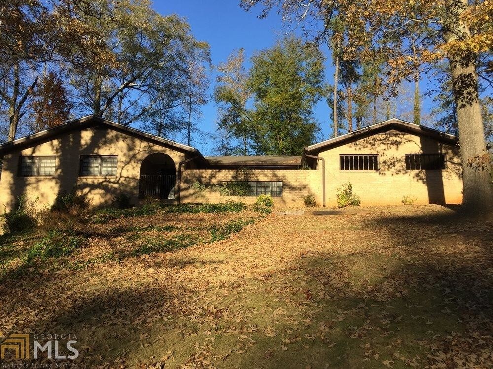
3526 Moonlight Ct
Decatur, GA 30034
2 Weeks Ago
|
Edit
Favorites
3526 Moonlight Ct

Favorites
Check Back Soon for Upcoming Availability
| Beds | Baths | Average SF |
|---|---|---|
| 4 Bedrooms 4 Bedrooms 4 Br | 2 Baths 2 Baths 2 Ba | — |
Fees and Policies
The fees below are based on community-supplied data and may exclude additional fees and utilities.
- Parking
-
Other--
About This Property
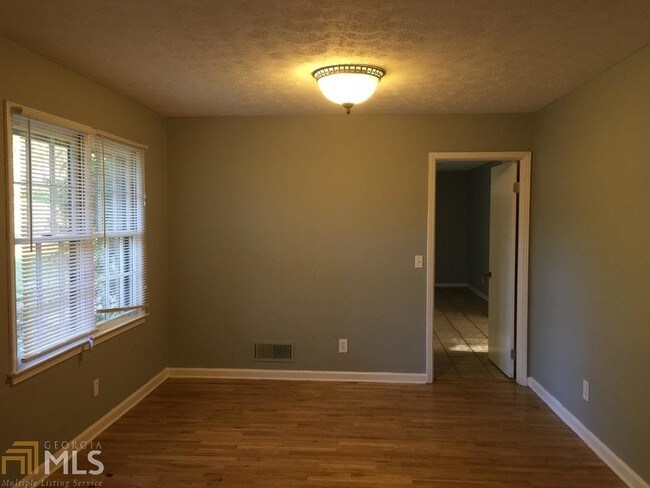
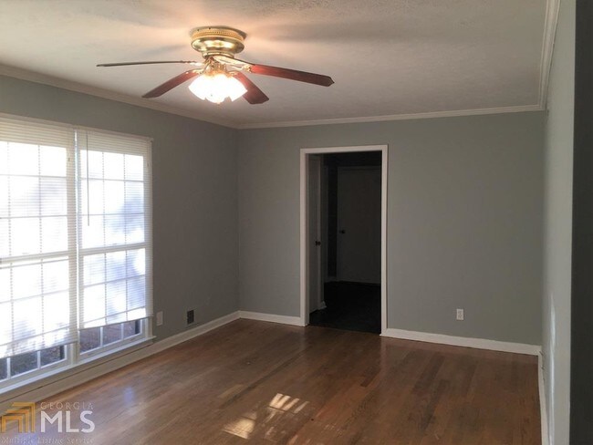
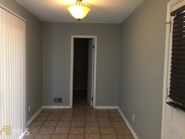
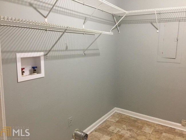
***Ask About Our Move-In Specials! *** This 4 BR / 2 BA Mission Style Home Sits On A Quiet Cul-de-sac Lot.All-brick Exterior Means Low Maintenance! Kitchen Features Stainless Steel Appliances, & Neutral Paint, Floor Plan Is Large W/ Baths, & Hardwood Floors On The Main & Includes A Large Partial Basement That's Finished W/ Rec Rm & Extra Bonus Rm. NOTE: Pest Control Included On Lease For Add'l $33/MTH.
3526 Moonlight Ct is a house located in DeKalb County and the 30034 ZIP Code. This area is served by the DeKalb County attendance zone.
House Features
Dishwasher
Hardwood Floors
Refrigerator
Ceiling Fans
- Ceiling Fans
- Dishwasher
- Range
- Refrigerator
- Hardwood Floors
- Family Room
- Deck
Location
Get Directions
Southeast DeKalb refers to a sprawling region in the southeastern portion of DeKalb County. Among the many communities in this area are the communities of Clarkston, Stone Mountain, Lithonia, Panthersville, Gresham Park, and Sheffield Woods.
Each community in this region has its own distinct character. Southeast DeKalb offers ample opportunities for outdoor recreation at destinations such as Stone Mountain Park, Panola Mountain State Park, and Arabia Mountain National Heritage Area. Southeast DeKalb sits within easy driving distance of all that Greater Atlanta has to offer, with close proximity to major thoroughfares like I-285, I-20, and U.S. 278.
Learn more about living in Southeast DeKalb
Amenities
- Ceiling Fans
- Dishwasher
- Range
- Refrigerator
- Hardwood Floors
- Family Room
- Deck
Education
| Colleges & Universities | Distance | ||
|---|---|---|---|
| Colleges & Universities | Distance | ||
| Drive: | 6 min | 2.5 mi | |
| Drive: | 15 min | 7.2 mi | |
| Drive: | 17 min | 10.2 mi | |
| Drive: | 21 min | 13.6 mi |
3526 Moonlight Ct is within 6 minutes or 2.5 miles from Georgia Perim. Coll., Decatur. It is also near Agnes Scott College and Georgia Perim., Clarkston.
Schools


Public Elementary School
Grades PK-5
373 Students
Attendance Zone
Public Middle School
Grades 6-8
692 Students
Attendance Zone
Public High School
Grades 9-12
1,307 Students
Attendance Zone
Private Elementary, Middle & High School
Grades PK-12
133 Students
Nearby
Private Elementary & Middle School
Grades PK-9
Nearby
School data provided by
 The GreatSchools Rating helps parents compare schools within a state based on a variety of school quality indicators and provides a helpful picture of how effectively each school serves all of its students. Ratings are on a scale of 1 (below average) to 10 (above average) and can include test scores, college readiness, academic progress, advanced courses, equity, discipline and attendance data. We also advise parents to visit schools, consider other information on school performance and programs, and consider family needs as part of the school selection process.
View GreatSchools Rating Methodology
Data provided by GreatSchools.org © 2025. All rights reserved.
View GreatSchools Rating Methodology
Data provided by GreatSchools.org © 2025. All rights reserved.
Transportation options available in Decatur include Indian Creek, located 7.8 miles from 3526 Moonlight Ct. 3526 Moonlight Ct is near Hartsfield - Jackson Atlanta International, located 13.5 miles or 23 minutes away.
| Transit / Subway | Distance | ||
|---|---|---|---|
| Transit / Subway | Distance | ||
|
|
Drive: | 12 min | 7.8 mi |
|
|
Drive: | 16 min | 8.1 mi |
|
|
Drive: | 17 min | 8.6 mi |
|
|
Drive: | 14 min | 8.7 mi |
|
|
Drive: | 17 min | 10.4 mi |
| Commuter Rail | Distance | ||
|---|---|---|---|
| Commuter Rail | Distance | ||
|
|
Drive: | 25 min | 15.5 mi |
| Airports | Distance | ||
|---|---|---|---|
| Airports | Distance | ||
|
Hartsfield - Jackson Atlanta International
|
Drive: | 23 min | 13.5 mi |
Time and distance from 3526 Moonlight Ct.
| Shopping Centers | Distance | ||
|---|---|---|---|
| Shopping Centers | Distance | ||
| Drive: | 4 min | 1.4 mi | |
| Drive: | 3 min | 1.5 mi | |
| Drive: | 4 min | 1.6 mi |
3526 Moonlight Ct has 3 shopping centers within 1.6 miles, which is about a 4-minute drive. The miles and minutes will be for the farthest away property.
| Parks and Recreation | Distance | ||
|---|---|---|---|
| Parks and Recreation | Distance | ||
|
Ferns of the World Garden
|
Drive: | 5 min | 2.3 mi |
|
Wylde Center and Oakhurst Community Garden
|
Drive: | 14 min | 6.9 mi |
|
Panola Mountain State Park
|
Drive: | 14 min | 7.3 mi |
|
Bradley Observatory
|
Drive: | 15 min | 7.5 mi |
|
Glenn Creek Nature Preserve
|
Drive: | 18 min | 10.8 mi |
3526 Moonlight Ct has 5 parks within 10.8 miles, including Ferns of the World Garden, Wylde Center and Oakhurst Community Garden, and Panola Mountain State Park.
| Hospitals | Distance | ||
|---|---|---|---|
| Hospitals | Distance | ||
| Drive: | 5 min | 2.4 mi | |
| Drive: | 14 min | 7.6 mi | |
| Drive: | 18 min | 9.2 mi |
3526 Moonlight Ct has 3 hospitals within 9.2 miles, the nearest is Georgia Regional Hospital Atlanta which is 2.4 miles away and a 5 minute drive.
| Military Bases | Distance | ||
|---|---|---|---|
| Military Bases | Distance | ||
| Drive: | 20 min | 11.2 mi | |
| Drive: | 25 min | 15.8 mi |
3526 Moonlight Ct is 11.2 miles from Fort Gillem, and is convenient to other military bases, including Fort McPherson.
You May Also Like
Similar Rentals Nearby
-
-
-
1 / 58

-
-
-

-
-
-

-


What Are Walk Score®, Transit Score®, and Bike Score® Ratings?
Walk Score® measures the walkability of any address. Transit Score® measures access to public transit. Bike Score® measures the bikeability of any address.
What is a Sound Score Rating?
A Sound Score Rating aggregates noise caused by vehicle traffic, airplane traffic and local sources

3526 Moonlight Ct
Decatur, GA 30034