
$4,000
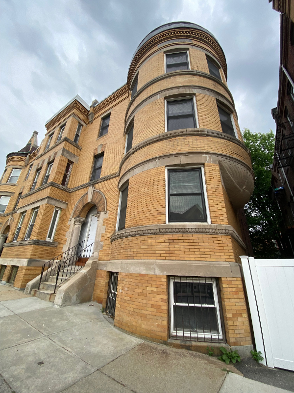
35 Vine St Unit 3
Boston, MA 02119
2 Weeks Ago
|
Edit
Favorites
35 Vine St Unit 3

Favorites
Check Back Soon for Upcoming Availability
| Beds | Baths | Average SF |
|---|---|---|
| 4 Bedrooms 4 Bedrooms 4 Br | 2 Baths 2 Baths 2 Ba | 1,200 SF |
Fees and Policies
The fees below are based on community-supplied data and may exclude additional fees and utilities.
- Dogs Allowed
-
Fees not specified
- Cats Allowed
-
Fees not specified
Details
Utilities Included
-
Water
-
Trash Removal
-
Sewer
About This Property
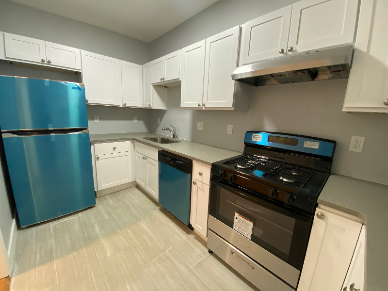
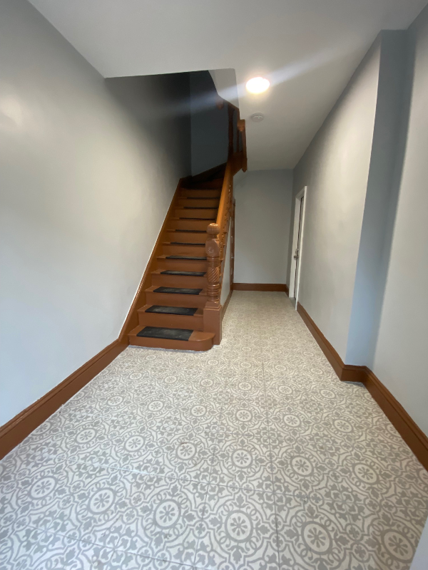
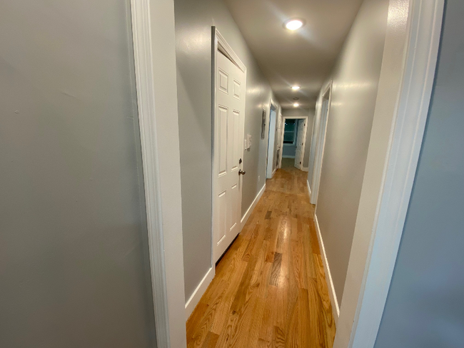
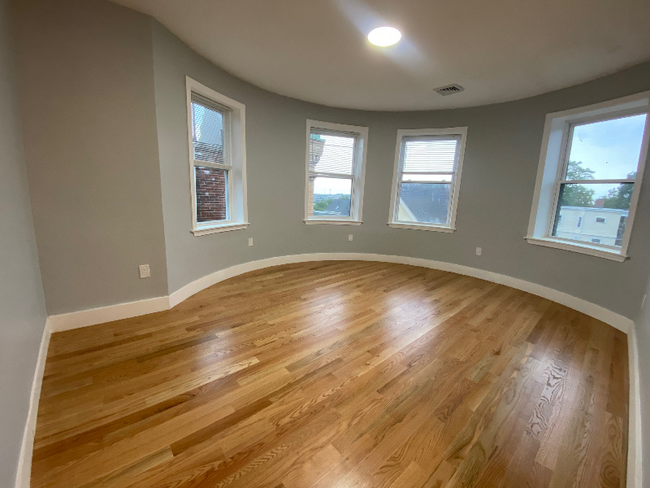
Property Id: 1520956 BRAND NEW RENOVATION ~ AVAILABLE SEPT 1ST! This is a gorgeous & spacious 4 bedroom 2 bathroom 3RD floor unit with all of the amenities you'd expect in a newly renovated building. - Top Floor / 3rd Floor Unit - 4 bedrooms & 2 full bathrooms - Brand new kitchen - Quartz countertops - Stainless Steel Appliances - Central AC & Heat - Hardwood floors - Small Pets Negotiable - Deleaded, Lead Cert Available Available NOW Owner asking strong credit & references. VOUCHERS WELCOMED! MOVE IN COSTS: 1ST, LAST & 1 MONTH SECURITY = 3 MONTHS DUE UPON ACCEPTANCE @ LEASE SIGNING **VIRTUAL TOUR AVAILABLE** Agent Disclosure: As the listing agent, and in accordance with Massachusetts law (effective August 1, 2025), tenants are not required to pay a broker fee for landlord-represented listings. However, if you'd like my assistance with your rental search, I offer tenant representation services for a broker fee equal to one month's rent, payable at lease signing once I secure a unit.
35 Vine St is a condo located in Suffolk County and the 02119 ZIP Code. This area is served by the Boston Public Schools attendance zone.
Condo Features
Dishwasher
Hardwood Floors
Microwave
Refrigerator
- Cable Ready
- Intercom
- Dishwasher
- Microwave
- Oven
- Refrigerator
- Freezer
- Hardwood Floors
Location
Get Directions
Situated between the South End and Dudley Square, Lower Roxbury is a predominantly residential neighborhood brimming with apartments and town houses available for rent. Residents enjoy a walkable urban environment filled with diverse historical architecture.
Warren Street and Washington Street are the neighborhood’s main commercial thoroughfares, touting rows of specialty shops, markets, and eateries in historic buildings. Northeastern University, Wentworth Institute of Technology, and Massachusetts College of Art and Design are all just northwest of Lower Roxbury, offering the community a bevy of cultural and educational amenities. Getting around from Lower Roxbury is easy with access to multiple T stops on the Orange Line.
Learn more about living in Lower RoxburyBelow are rent ranges for similar nearby apartments
| Beds | Average Size | Lowest | Typical | Premium |
|---|---|---|---|---|
| Studio Studio Studio | 1477-1482 Sq Ft | $1,725 | $2,503 | $2,790 |
| 1 Bed 1 Bed 1 Bed | 2560-2565 Sq Ft | $1,500 | $2,658 | $3,699 |
| 2 Beds 2 Beds 2 Beds | 3444-3447 Sq Ft | $2,100 | $3,277 | $8,700 |
| 3 Beds 3 Beds 3 Beds | 4671 Sq Ft | $1,075 | $4,451 | $6,600 |
| 4 Beds 4 Beds 4 Beds | 5913 Sq Ft | $775 | $5,416 | $9,500 |
Amenities
- Cable Ready
- Intercom
- Dishwasher
- Microwave
- Oven
- Refrigerator
- Freezer
- Hardwood Floors
Expenses
Utilities Included
Water, Trash Removal, Sewer
Included
Education
| Colleges & Universities | Distance | ||
|---|---|---|---|
| Colleges & Universities | Distance | ||
| Drive: | 3 min | 1.5 mi | |
| Drive: | 4 min | 1.9 mi | |
| Drive: | 5 min | 2.0 mi | |
| Drive: | 4 min | 2.0 mi |
35 Vine St Unit 3 is within 5 minutes or 2.0 miles from Northeastern University. It is also near Wentworth Inst. of Technology and MassArt.
Schools


Charter Elementary School
Grades PK-5
278 Students
Attendance Zone
Public Elementary & Middle School
Grades PK-8
724 Students
Attendance Zone
Public Middle School
Grades 6-8
205 Students
Attendance Zone
Public Middle & High School
Grades 7-12
1,567 Students
Attendance Zone
Public High School
Grades 9-12
1,087 Students
Attendance Zone
Charter High School
Grades 9-10 & 12
321 Students
Attendance Zone
Private Elementary School
Grades PK-6
128 Students
Nearby
Private Middle & High School
Grades 7-12
292 Students
Nearby
School data provided by
 The GreatSchools Rating helps parents compare schools within a state based on a variety of school quality indicators and provides a helpful picture of how effectively each school serves all of its students. Ratings are on a scale of 1 (below average) to 10 (above average) and can include test scores, college readiness, academic progress, advanced courses, equity, discipline and attendance data. We also advise parents to visit schools, consider other information on school performance and programs, and consider family needs as part of the school selection process.
View GreatSchools Rating Methodology
Data provided by GreatSchools.org © 2025. All rights reserved.
View GreatSchools Rating Methodology
Data provided by GreatSchools.org © 2025. All rights reserved.
Transportation options available in Boston include Roxbury Crossing Station, located 1.2 miles from 35 Vine St Unit 3. 35 Vine St Unit 3 is near General Edward Lawrence Logan International, located 5.7 miles or 11 minutes away.
| Transit / Subway | Distance | ||
|---|---|---|---|
| Transit / Subway | Distance | ||
|
|
Drive: | 2 min | 1.2 mi |
|
|
Drive: | 3 min | 1.6 mi |
|
|
Drive: | 3 min | 1.7 mi |
|
|
Drive: | 5 min | 1.9 mi |
|
|
Drive: | 5 min | 2.0 mi |
| Commuter Rail | Distance | ||
|---|---|---|---|
| Commuter Rail | Distance | ||
| Walk: | 16 min | 0.8 mi | |
|
|
Walk: | 18 min | 1.0 mi |
|
|
Drive: | 4 min | 2.1 mi |
|
|
Drive: | 5 min | 2.2 mi |
| Drive: | 4 min | 2.2 mi |
| Airports | Distance | ||
|---|---|---|---|
| Airports | Distance | ||
|
General Edward Lawrence Logan International
|
Drive: | 11 min | 5.7 mi |
Time and distance from 35 Vine St Unit 3.
| Shopping Centers | Distance | ||
|---|---|---|---|
| Shopping Centers | Distance | ||
| Drive: | 2 min | 1.1 mi | |
| Drive: | 3 min | 1.2 mi | |
| Drive: | 4 min | 1.6 mi |
35 Vine St Unit 3 has 3 shopping centers within 1.6 miles, which is about a 4-minute drive. The miles and minutes will be for the farthest away property.
| Parks and Recreation | Distance | ||
|---|---|---|---|
| Parks and Recreation | Distance | ||
|
Roxbury Heritage State Park
|
Walk: | 16 min | 0.8 mi |
|
Lower Neponset River Trail
|
Drive: | 4 min | 1.7 mi |
|
Franklin Park Zoo
|
Drive: | 4 min | 1.9 mi |
|
Dorchester Shores Reservation
|
Drive: | 6 min | 2.6 mi |
|
Boston Public Garden
|
Drive: | 7 min | 2.8 mi |
35 Vine St Unit 3 has 5 parks within 2.8 miles, including Roxbury Heritage State Park, Lower Neponset River Trail, and Franklin Park Zoo.
| Hospitals | Distance | ||
|---|---|---|---|
| Hospitals | Distance | ||
| Walk: | 15 min | 0.8 mi | |
| Walk: | 18 min | 0.9 mi | |
| Drive: | 4 min | 1.8 mi |
35 Vine St Unit 3 has 3 hospitals within 1.8 miles, the nearest is Boston Medical Center which is 0.8 mile away and a 15 minute walk.
| Military Bases | Distance | ||
|---|---|---|---|
| Military Bases | Distance | ||
| Drive: | 33 min | 17.2 mi |
35 Vine St Unit 3 is 17.2 miles and a 33 minute drive from Hanscom Air Force Base.
You May Also Like
Similar Rentals Nearby


What Are Walk Score®, Transit Score®, and Bike Score® Ratings?
Walk Score® measures the walkability of any address. Transit Score® measures access to public transit. Bike Score® measures the bikeability of any address.
What is a Sound Score Rating?
A Sound Score Rating aggregates noise caused by vehicle traffic, airplane traffic and local sources

35 Vine St
Boston, MA 02119