
Ashton
301 Executive Park Blvd,
San Francisco, CA 94134
$5,553 - $5,688 Total Monthly Price
Studio - 2 Beds 12 Month Lease
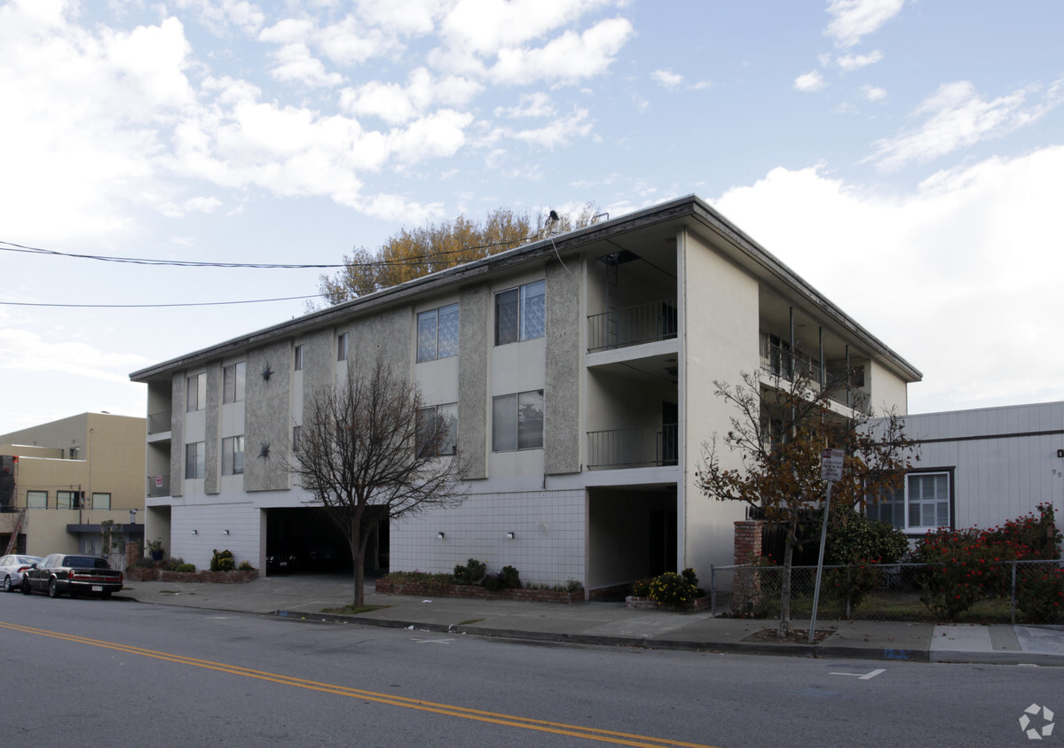
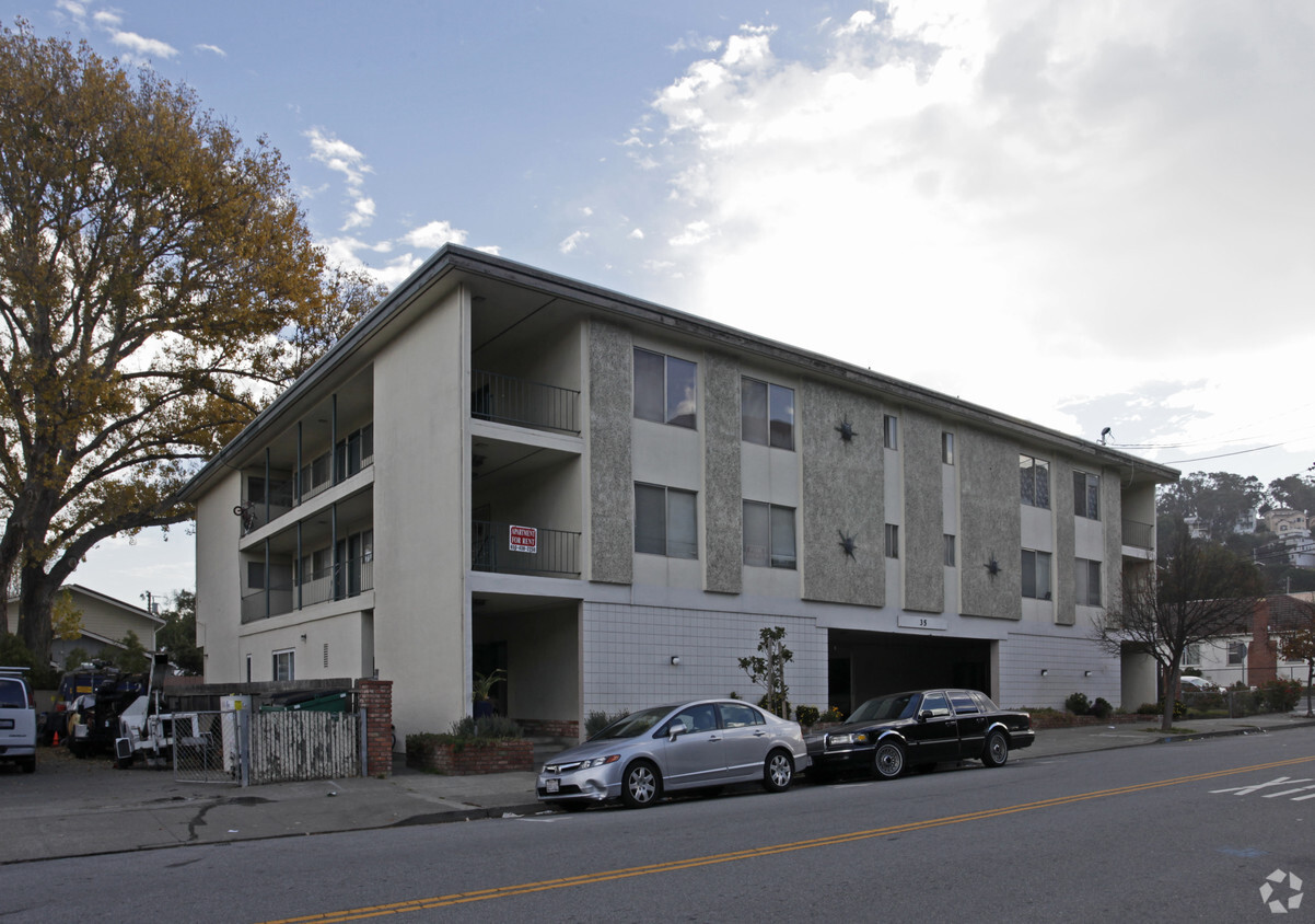

Find your next place to live at 35 San Bruno Ave in Brisbane. Situated in the 94005 area of Brisbane on San Bruno Ave, residents have connection to a number of attractions. Be sure to come for a visit to check out the apartment floorplan options. At this community, you'll have access to top features and amenities. Some of these include: smoke free options, convenient on-site parking options, and high-speed internet access. Drop by to talk about your next apartment.
35 San Bruno Ave is an apartment community located in San Mateo County and the 94005 ZIP Code. This area is served by the Brisbane Elementary School District attendance zone.
High Speed Internet Access
Smoke Free
Heating
Kitchen
Brisbane is a gorgeous coastal town between San Francisco and South San Francisco, nestled along the San Francisco Bay. This small area is right next to the scenic San Bruno Mountain State and Country Park. Brisbane is mostly residential with many industrial, manufacturing, and home improvement companies in the area.
With quick access to the beauty of land and sea, residents take full advantage and spend their free time enjoying the outdoors. You can find locals taking in picturesque views of the city and the bay at San Bruno Mountain, boating at the marina near downtown Brisbane, or taking a walk at Park Sierra Point, a waterfront park. After a long day of fun, enjoy a meal at one of the locally-owned eateries in downtown along Old Country Road. Less than 15 minutes from San Francisco, South Francisco and the San Francisco International Airport, Brisbane is also a great choice for commuters.
Learn more about living in BrisbaneCompare neighborhood and city base rent averages by bedroom.
| Central Brisbane | Brisbane, CA | |
|---|---|---|
| Studio | $2,346 | $2,346 |
| 1 Bedroom | $2,249 | $2,249 |
| 2 Bedrooms | $2,008 | $2,008 |
| 3 Bedrooms | $1,488 | $1,488 |
| Colleges & Universities | Distance | ||
|---|---|---|---|
| Colleges & Universities | Distance | ||
| Drive: | 11 min | 4.7 mi | |
| Drive: | 11 min | 6.5 mi | |
| Drive: | 15 min | 8.4 mi | |
| Drive: | 16 min | 8.6 mi |


Transportation options available in Brisbane include Bayshore Blvd & Sunnydale Ave, located 2.0 miles from 35 San Bruno Ave. 35 San Bruno Ave is near San Francisco International, located 6.6 miles or 12 minutes away, and Metro Oakland International, located 26.1 miles or 40 minutes away.
| Transit / Subway | Distance | ||
|---|---|---|---|
| Transit / Subway | Distance | ||
| Drive: | 3 min | 2.0 mi | |
| Drive: | 4 min | 2.3 mi | |
|
|
Drive: | 4 min | 2.3 mi |
| Drive: | 5 min | 2.8 mi | |
|
|
Drive: | 6 min | 3.1 mi |
| Commuter Rail | Distance | ||
|---|---|---|---|
| Commuter Rail | Distance | ||
| Drive: | 5 min | 2.1 mi | |
| Drive: | 6 min | 3.2 mi | |
| Drive: | 8 min | 5.2 mi | |
| Drive: | 11 min | 7.6 mi | |
| Drive: | 12 min | 7.6 mi |
| Airports | Distance | ||
|---|---|---|---|
| Airports | Distance | ||
|
San Francisco International
|
Drive: | 12 min | 6.6 mi |
|
Metro Oakland International
|
Drive: | 40 min | 26.1 mi |
Scores provided by
Traffic
-Airport
-Businesses
-Scores provided by
HowLoud What is a Sound Score Rating? A Sound Score Rating aggregates noise caused by vehicle traffic, airplane traffic and local sources. How It WorksTime and distance from 35 San Bruno Ave.
| Shopping Centers | Distance | ||
|---|---|---|---|
| Shopping Centers | Distance | ||
| Walk: | 4 min | 0.2 mi |
| Parks and Recreation | Distance | ||
|---|---|---|---|
| Parks and Recreation | Distance | ||
|
Candlestick Point State Recreation Area
|
Drive: | 11 min | 4.2 mi |
|
San Bruno Mountain State Park
|
Drive: | 12 min | 4.7 mi |
|
Heron's Head Park
|
Drive: | 12 min | 6.5 mi |
|
San Francisco State Univ. Observatory
|
Drive: | 17 min | 9.3 mi |
|
Charles F. Hagar Planetarium
|
Drive: | 17 min | 9.3 mi |
| Hospitals | Distance | ||
|---|---|---|---|
| Hospitals | Distance | ||
| Drive: | 9 min | 4.9 mi | |
| Drive: | 10 min | 5.3 mi | |
| Drive: | 13 min | 7.3 mi |
| Military Bases | Distance | ||
|---|---|---|---|
| Military Bases | Distance | ||
| Drive: | 28 min | 12.4 mi | |
| Drive: | 36 min | 20.5 mi | |
| Drive: | 36 min | 20.7 mi |
Pets Allowed Fitness Center In Unit Washer & Dryer Walk-In Closets Stainless Steel Appliances Hardwood Floors EV Charging
Pets Allowed Fitness Center In Unit Washer & Dryer Stainless Steel Appliances Business Center Package Service Elevator
What Are Walk Score®, Transit Score®, and Bike Score® Ratings?
Walk Score® measures the walkability of any address. Transit Score® measures access to public transit. Bike Score® measures the bikeability of any address.
What is a Sound Score Rating?
A Sound Score Rating aggregates noise caused by vehicle traffic, airplane traffic and local sources.

35 San Bruno Ave
Brisbane, CA 94005


