
$2,400 / Month
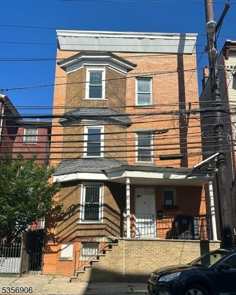
35 Norfolk St
Newark, NJ 07103
Today
Favorites
201-939-0050
-
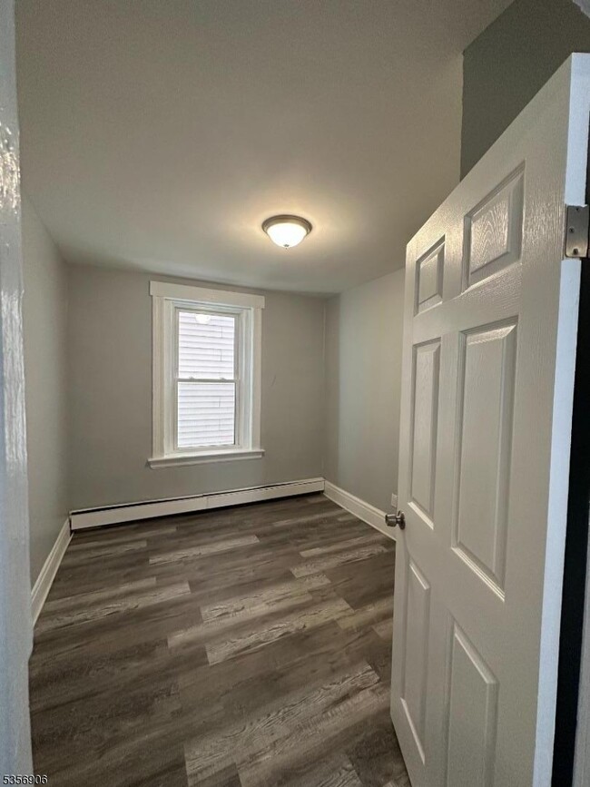
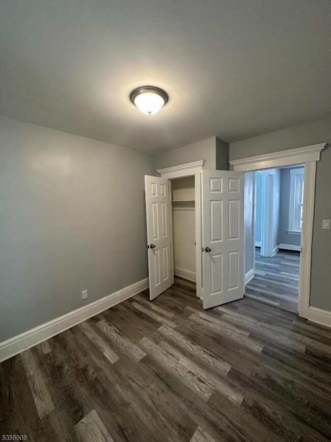
Bedrooms
4
-
Bathrooms
1
-
Square Feet
--
-
Available
Available Now
Highlights
- Main Floor Bedroom
- Formal Dining Room
- Eat-In Kitchen
- Bathtub with Shower
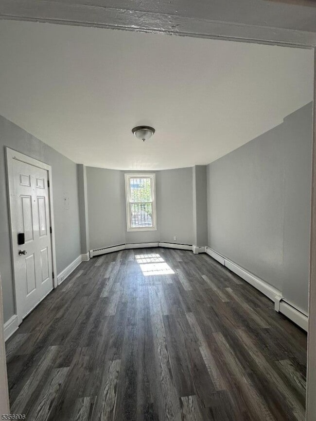
- Living Room
35 Norfolk St

Favorites
About This Home
Available Now
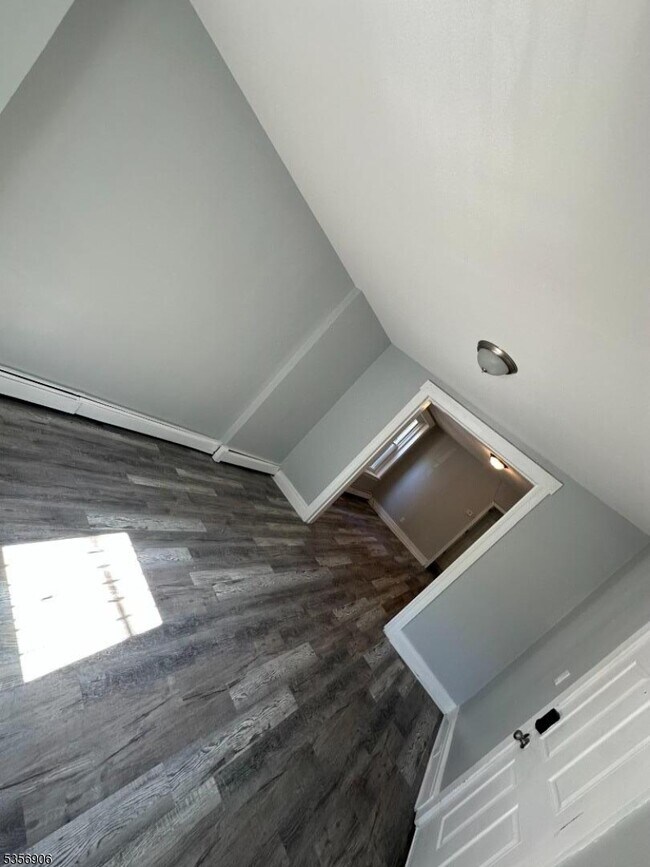
Enjoy this beautifully updated 1ST FLOOR 4-bedroom, 1-bath apartment in prime Newark location - University Heights. The bright and freshly painted apartment features a spacious living room, a dining room, eat-in-kitchen with modern cabinetry and stainless steel appliances. Convenient location - just a 5-minute walk to the Norfolk Street Light Rail (easy NYC commute!) and several bus stops nearby including NJ Transit 99, 41 and bus 108 that takes you to NYC. You'll also find yourself close to Rutgers University, NJIT, Essex County College, highly rated charter schools and a variety of restaurants, parks - including Branch Brook Park , and shopping options. Quick access to I-280, Garden State Parkway, and major highways makes getting around a breeze. Energy-efficient windows ensure a comfortable and cost-effective living environment. Shared backyard access and coin-operated laundry facility. Tenant pays utilities. NO PARKING. Don't miss out! Schedule your showing today!
35 Norfolk St is an apartment community located in Essex County and the 07103 ZIP Code.
* Price shown is base rent and may not include non-optional fees and utilities.
Price, availability, fees, and any applicable rent special are subject to change without notice.
* Square footage definitions vary. Displayed square footage is approximate.
Home Details
Year Built
Built in 1907 | Remodeled
Bedrooms and Bathrooms
Main Floor Bedroom
Bathtub with Shower
1 Full Bathroom
4 Bedrooms
Home Design
Tile
Home Security
Carbon Monoxide Detectors
Fire and Smoke Detector
Interior Spaces
Formal Dining Room
Living Room
Laminate Flooring
Kitchen
Eat-In Kitchen
Gas Oven or Range
Microwave
Self-Cleaning Oven
Recirculated Exhaust Fan
Listing and Financial Details
Assessor Parcel Number 1614-02851-0000-00023-0000-
Tenant pays for cable t.v., electric, gas, heat, hot water
Lot Details
3,049 Sq Ft Lot
Parking
On-Street Parking
Schools
Science High School
Utilities
Gas Water Heater
Standard Electricity
Community Details
Pet Policy
Limit on the number of pets
Pet Size Limit
Fees and Policies
The fees below are based on community-supplied data and may exclude additional fees and utilities.
- Dogs Allowed
-
Fees not specified
- Cats Allowed
-
Fees not specified
Contact
- Listed by ALYNE RIBEIRO | GardenStateMLS#NJ
- Phone Number
- Contact
-
Source
Garden State Multiple Listing Service, LLC
Copyright © 2025 Garden State MLS, LLC. All rights reserved. All information provided by the listing agent/broker is deemed reliable but is not guaranteed and should be independently verified.
Location
Get Directions
As its name implies, University Heights houses several academic institutions. University Heights is home to Essex County College, the New Jersey Institute of Technology, and Rutgers University-Newark Campus. Sprawling campuses, along with several medical facilities like Saint Michael's Medical Center and Rutger’s University Hospital, dominate the neighborhood but there still plenty of rentals to choose from. Ideal for all renters, University Heights has affordable to upscale rentals available.
This urban neighborhood is nestled beside Downtown Newark, giving easy access to some of the city’s best dining, shopping, and entertainment options. Bike lanes and a light rail system provide transportation options that make it easy to get around, although you may opt to simply lace up your shoes in this walkable neighborhood. Locals enjoy being able to stroll downtown entertainment hubs like the New Jersey Performing Arts Center and Prudential Center.
Learn more about living in University Heights
Education
| Colleges & Universities | Distance | ||
|---|---|---|---|
| Colleges & Universities | Distance | ||
| Walk: | 10 min | 0.6 mi | |
| Walk: | 12 min | 0.6 mi | |
| Walk: | 16 min | 0.9 mi | |
| Drive: | 7 min | 3.8 mi |
35 Norfolk St is within 10 minutes or 0.6 mile from N.J. Inst. of Technology. It is also near Rutgers, Newark Campus and Essex County College.
Transportation options available in Newark include Norfolk Street, located 0.2 mile from 35 Norfolk St. 35 Norfolk St is near Newark Liberty International, located 6.4 miles or 11 minutes away, and LaGuardia, located 27.1 miles or 40 minutes away.
| Transit / Subway | Distance | ||
|---|---|---|---|
| Transit / Subway | Distance | ||
|
|
Walk: | 4 min | 0.2 mi |
|
|
Walk: | 6 min | 0.3 mi |
|
|
Walk: | 9 min | 0.5 mi |
|
|
Walk: | 13 min | 0.7 mi |
|
|
Drive: | 2 min | 1.2 mi |
| Commuter Rail | Distance | ||
|---|---|---|---|
| Commuter Rail | Distance | ||
|
|
Walk: | 14 min | 0.7 mi |
|
|
Drive: | 3 min | 1.7 mi |
|
|
Drive: | 3 min | 1.9 mi |
|
|
Drive: | 3 min | 2.0 mi |
|
|
Drive: | 4 min | 2.4 mi |
| Airports | Distance | ||
|---|---|---|---|
| Airports | Distance | ||
|
Newark Liberty International
|
Drive: | 11 min | 6.4 mi |
|
LaGuardia
|
Drive: | 40 min | 27.1 mi |
Time and distance from 35 Norfolk St.
| Shopping Centers | Distance | ||
|---|---|---|---|
| Shopping Centers | Distance | ||
| Walk: | 12 min | 0.6 mi | |
| Walk: | 17 min | 0.9 mi | |
| Walk: | 19 min | 1.0 mi |
35 Norfolk St has 3 shopping centers within 1.0 mile, which is about a 19-minute walk. The miles and minutes will be for the farthest away property.
| Parks and Recreation | Distance | ||
|---|---|---|---|
| Parks and Recreation | Distance | ||
|
Newark Museum and Dreyfuss Planetarium
|
Walk: | 14 min | 0.7 mi |
|
Branch Brook Park
|
Drive: | 4 min | 1.7 mi |
|
Kearny Marsh
|
Drive: | 7 min | 3.6 mi |
|
Edison National Historic Site
|
Drive: | 9 min | 4.4 mi |
|
Richard W. DeKorte Park
|
Drive: | 12 min | 6.1 mi |
35 Norfolk St has 5 parks within 6.1 miles, including Newark Museum and Dreyfuss Planetarium, Branch Brook Park, and Kearny Marsh.
| Hospitals | Distance | ||
|---|---|---|---|
| Hospitals | Distance | ||
| Walk: | 10 min | 0.6 mi | |
| Walk: | 18 min | 0.9 mi | |
| Drive: | 3 min | 1.8 mi |
35 Norfolk St has 3 hospitals within 1.8 miles, the nearest is Saint Michael's Medical Center which is 0.6 mile away and a 10 minute walk.
| Military Bases | Distance | ||
|---|---|---|---|
| Military Bases | Distance | ||
| Drive: | 16 min | 10.3 mi | |
| Drive: | 26 min | 12.7 mi | |
| Drive: | 32 min | 18.3 mi |
35 Norfolk St has 3 military bases within 18.3 miles, the nearest is Military Ocean Terminal which is 10.3 miles away and a 16 minute drive.
You May Also Like
Similar Rentals Nearby


")


What Are Walk Score®, Transit Score®, and Bike Score® Ratings?
Walk Score® measures the walkability of any address. Transit Score® measures access to public transit. Bike Score® measures the bikeability of any address.
What is a Sound Score Rating?
A Sound Score Rating aggregates noise caused by vehicle traffic, airplane traffic and local sources
35 Norfolk St
Newark, NJ 07103