
$1,495
Total Monthly Price
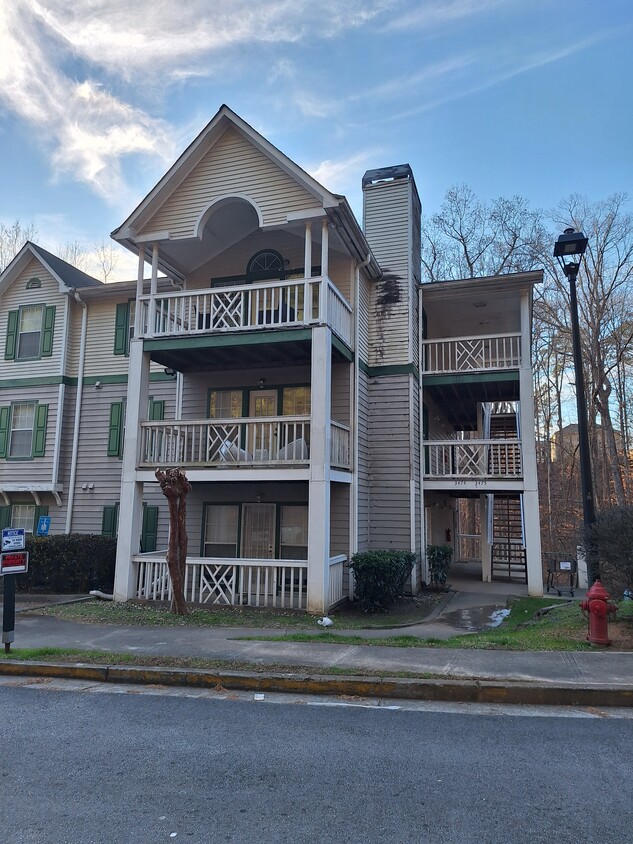
3487 Shepherds Path
Decatur, GA 30034
Favorites
3487 Shepherds Path

Favorites
Check Back Soon for Upcoming Availability
| Beds | Baths | Average SF |
|---|---|---|
| 3 Bedrooms 3 Bedrooms 3 Br | 2 Baths 2 Baths 2 Ba | 1,279 SF |
Fees and Policies
The fees listed below are community-provided and may exclude utilities or add-ons. All payments are made directly to the property and are non-refundable unless otherwise specified.
- Parking
-
Street--
About This Property
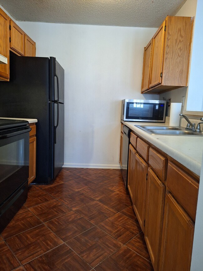
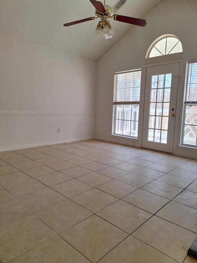
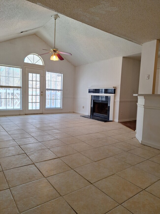
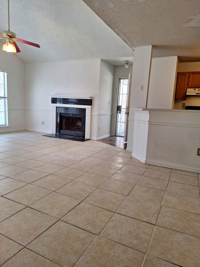
Spacious and naturally bright 3 bedroom / 2 bathroom condo in Decatur. This condo offers a large living room with fireplace. The kitchen overlooks the family room and dining area. It's a perfect space for family and entertaining guests. It also has a deck. Conveniently located close to shopping, Marta bus stop, highway i20 and 285.
3487 Shepherds Path is a condo located in DeKalb County and the 30034 ZIP Code. This area is served by the Dekalb County School District attendance zone.
Condo Features
Washer/Dryer Hookup
Fireplace
Dining Room
Kitchen
- Washer/Dryer Hookup
- Fireplace
- Kitchen
- Dining Room
- Family Room
- Deck
3487 Shepherds Path,
Decatur,
GA
30034
Located just five miles northeast of downtown Atlanta, Decatur offers a blend of historic charm and contemporary living. The city's pedestrian-friendly downtown, anchored by the courthouse square, features independent shops and restaurants. Current rental trends show moderate stability in the market, with one-bedroom units averaging $1,367 and two-bedroom homes at $1,550, experiencing slight decreases of 2.32% and 1.42% respectively over the past year. Housing options range from historic homes in the MAK Historic District to apartment communities near the three MARTA rail stations, providing convenient access to downtown Atlanta.
The city is home to Agnes Scott College and Columbia Theological Seminary, adding to its educational landscape. Residents enjoy outdoor spaces like the 7-acre Woodlands Garden and the historic Decatur Cemetery, established in 1823. The Oakhurst and Winnona Park areas feature tree-lined streets and classic architecture.
Learn more about living in Decatur
Amenities
- Washer/Dryer Hookup
- Fireplace
- Kitchen
- Dining Room
- Family Room
- Deck
Education
| Colleges & Universities | Distance | ||
|---|---|---|---|
| Colleges & Universities | Distance | ||
| Drive: | 8 min | 3.3 mi | |
| Drive: | 16 min | 8.0 mi | |
| Drive: | 18 min | 10.4 mi | |
| Drive: | 23 min | 14.4 mi |
3487 Shepherds Path is within 8 minutes or 3.3 miles from Georgia Perim. Coll., Decatur. It is also near Agnes Scott College and Georgia Perim., Clarkston.
Schools


Public Elementary School
Grades PK-5
384 Students
Attendance Zone
Public Middle School
Grades 6-8
603 Students
Attendance Zone
Public High School
Grades 9-12
1,244 Students
Attendance Zone
Private Elementary, Middle & High School
Grades PK-12
Nearby
Private Elementary & Middle School
Grades PK-9
Nearby
Private Elementary & Middle School
Grades PK-8
100 Students
Nearby
School data provided by
 The GreatSchools Rating helps parents compare schools within a state based on a variety of school quality indicators and provides a helpful picture of how effectively each school serves all of its students. Ratings are on a scale of 1 (below average) to 10 (above average) and can include test scores, college readiness, academic progress, advanced courses, equity, discipline and attendance data. We also advise parents to visit schools, consider other information on school performance and programs, and consider family needs as part of the school selection process.
View GreatSchools Rating Methodology
Data provided by GreatSchools.org © 2026. All rights reserved.
View GreatSchools Rating Methodology
Data provided by GreatSchools.org © 2026. All rights reserved.
Transportation options available in Decatur include Indian Creek, located 8.1 miles from 3487 Shepherds Path. 3487 Shepherds Path is near Hartsfield - Jackson Atlanta International, located 14.3 miles or 24 minutes away.
| Transit / Subway | Distance | ||
|---|---|---|---|
| Transit / Subway | Distance | ||
|
|
Drive: | 13 min | 8.1 mi |
|
|
Drive: | 15 min | 8.3 mi |
|
|
Drive: | 18 min | 8.9 mi |
|
|
Drive: | 18 min | 9.4 mi |
|
|
Drive: | 17 min | 10.0 mi |
| Commuter Rail | Distance | ||
|---|---|---|---|
| Commuter Rail | Distance | ||
|
|
Drive: | 26 min | 16.2 mi |
| Airports | Distance | ||
|---|---|---|---|
| Airports | Distance | ||
|
Hartsfield - Jackson Atlanta International
|
Drive: | 24 min | 14.3 mi |
Walkability Near 3487 Shepherds Path Decatur, GA 30034
Getting Around
 What do Walkability, Transit, Drivability, and Bikeability mean?
Walkability measures the walking distance to day-to-day needs.
Transit measures access to public transportation.
Drivability measures congestion, parking availability, and access to major roads.
Bikeability measures the suitability for cycling.
How It Works
What do Walkability, Transit, Drivability, and Bikeability mean?
Walkability measures the walking distance to day-to-day needs.
Transit measures access to public transportation.
Drivability measures congestion, parking availability, and access to major roads.
Bikeability measures the suitability for cycling.
How It Works
Fairly Walkable
Walkability
40
/ 100
Minimal Public Transit
Transit
0
/ 100
Exceptionally Drivable
Drivability
90
/ 100
Somewhat Bikeable
Bikeability
30
/ 100
Scores provided by
-
Soundscore™
-
/ 100
Traffic
-Airport
-Businesses
-Scores provided by
HowLoud What is a Sound Score Rating? A Sound Score Rating aggregates noise caused by vehicle traffic, airplane traffic and local sources. How It WorksTime and distance from 3487 Shepherds Path.
| Shopping Centers | Distance | ||
|---|---|---|---|
| Shopping Centers | Distance | ||
| Walk: | 11 min | 0.6 mi | |
| Walk: | 12 min | 0.7 mi | |
| Walk: | 15 min | 0.8 mi |
3487 Shepherds Path has 3 shopping centers within 0.8 mile, which is about a 15-minute walk. The miles and minutes will be for the farthest away property.
| Parks and Recreation | Distance | ||
|---|---|---|---|
| Parks and Recreation | Distance | ||
|
Ferns of the World Garden
|
Drive: | 6 min | 3.1 mi |
|
Panola Mountain State Park
|
Drive: | 12 min | 6.6 mi |
|
Wylde Center and Oakhurst Community Garden
|
Drive: | 15 min | 7.7 mi |
|
Bradley Observatory
|
Drive: | 16 min | 8.3 mi |
|
Arabia Mountain Heritage Area and Nature Center
|
Drive: | 18 min | 9.0 mi |
3487 Shepherds Path has 5 parks within 9.0 miles, including Ferns of the World Garden, Panola Mountain State Park, and Wylde Center and Oakhurst Community Garden.
| Hospitals | Distance | ||
|---|---|---|---|
| Hospitals | Distance | ||
| Drive: | 7 min | 3.1 mi | |
| Drive: | 13 min | 7.5 mi | |
| Drive: | 19 min | 10.0 mi |
3487 Shepherds Path has 3 hospitals within 10.0 miles, the nearest is Georgia Regional Hospital Atlanta which is 3.1 miles away and a 7 minute drive.
| Military Bases | Distance | ||
|---|---|---|---|
| Military Bases | Distance | ||
| Drive: | 21 min | 12.0 mi | |
| Drive: | 27 min | 16.6 mi | |
| Drive: | 47 min | 29.8 mi |
3487 Shepherds Path has 3 military bases within 29.8 miles, the nearest is Fort Gillem which is 12.0 miles away and a 21 minute drive.
You May Also Like
Similar Rentals Nearby


What Are Walk Score®, Transit Score®, and Bike Score® Ratings?
Walk Score® measures the walkability of any address. Transit Score® measures access to public transit. Bike Score® measures the bikeability of any address.
What is a Sound Score Rating?
A Sound Score Rating aggregates noise caused by vehicle traffic, airplane traffic and local sources.

3487 Shepherds Path
Decatur, GA 30034