
$2,450
/ Month
3428 Baker St NE
Washington, DC 20019
Today
|
Edit
Favorites
202-759-7678
-
Bedrooms
2
-
Bathrooms
3.5
-
Square Feet
1,542 sq ft
-
Available
Available Jan 1, 2026
3428 Baker St NE

Favorites
About This Home
$2,450 deposit,
Available Jan 1, 2026
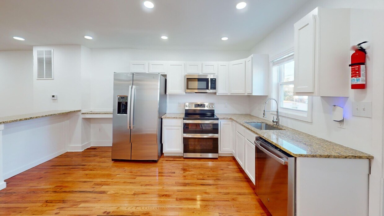
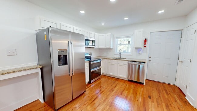
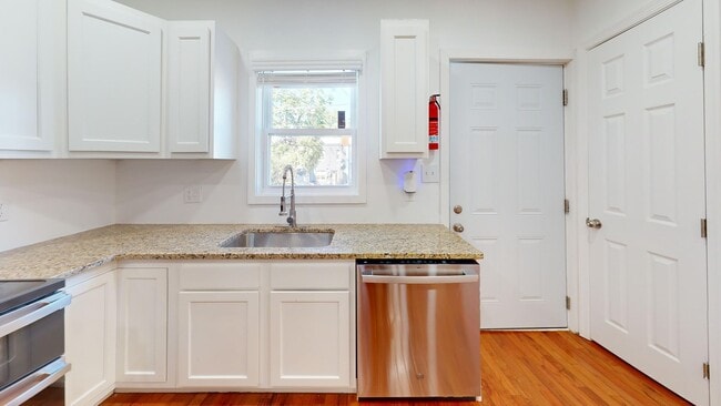
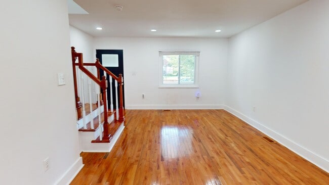
3D Virtual Tour: Address: 3428 Baker Street NE Market Rent: $2,450 for a 17-24 Month Lease OR $2,625 for a 12 Month Lease Tenant Responsible for All Utilities Pets: Yes, Case by case Square Footage: 1,542 Square Feet Parking: Street Parking Available: Now! Bedrooms: Two Bedrooms Bathrooms: Three & a Half Bathrooms Appliances: Stove, Oven, Refrigerator, Dishwasher, Washer, & Dryer Security Deposit: Equal to One Month's Rent Pet Fees: $30 Pet Screening Fee- Nominal Monthly Pet Rent Application Fee: $52/person Resident Benefit Package: $35/month EJF Rentals 1428 U Street NW, Second Floor Washington, DC 20009 Main Line:
Unique Features
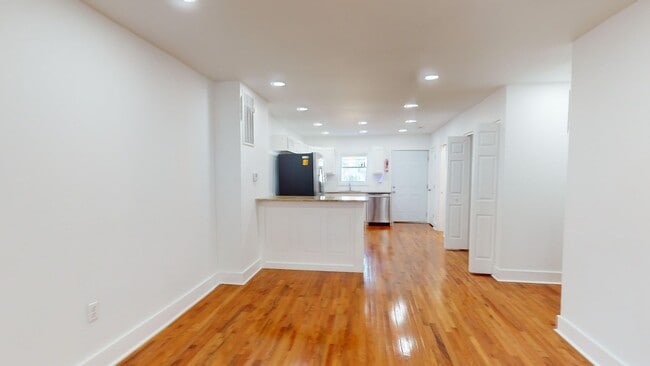
- Renovated House
3428 Baker St NE is a house located in District of Columbia County and the 20019 ZIP Code. This area is served by the District Of Columbia Public Schools attendance zone.
* Price shown is base rent. Excludes user-selected optional fees and variable or usage-based fees and required charges due at or prior to move-in or at move-out. Price, availability, fees, and any applicable rent special are subject to change without notice.
* Square footage definitions vary. Displayed square footage is approximate.
Fees and Policies
The fees below are based on community-supplied data and may exclude additional fees and utilities.
-
One-Time Basics
-
Due at Move-In
-
Security Deposit - RefundableCharged per unit.$2,450
-
-
Due at Move-In
Property Fee Disclaimer: Based on community-supplied data and independent market research. Subject to change without notice. May exclude fees for mandatory or optional services and usage-based utilities.
Contact
- Listed by EJF Rental Services LLC | EJF Rental Services LLC
- Phone Number
- Contact
Location
Get Directions
Amenities
- Renovated House
The Minnesota Avenue neighborhood follows Minnesota Avenue from Capitol Street northward to Nannie Helen Burroughs Avenue. It extends east from the Anacostia River to the Capitol View neighborhood. It includes the Minnesota Avenue Metro Station, located on the Orange line. Fort Mahan Park, located on a hill in the middle of the neighborhood, features hiking trails, a lake, and remnants of a Civil War fort. The Minnesota Avenue neighborhood is located about four miles southeast of Downtown DC.
Learn more about living in Minnesota Ave
Education
| Colleges & Universities | Distance | ||
|---|---|---|---|
| Colleges & Universities | Distance | ||
| Drive: | 7 min | 2.7 mi | |
| Drive: | 7 min | 3.7 mi | |
| Drive: | 7 min | 3.7 mi | |
| Drive: | 9 min | 4.7 mi |
3428 Baker St NE is within 7 minutes or 2.7 miles from Gallaudet University. It is also near Georgetown and Georgetown Law.
Schools


Public Elementary School
Grades PK-5
273 Students
Attendance Zone
Public Middle School
Grades 6-8
351 Students
Attendance Zone
Public High School
Grades 9-12
543 Students
Attendance Zone
Private Elementary, Middle & High School
Grades PK-12
149 Students
Nearby
School data provided by
 The GreatSchools Rating helps parents compare schools within a state based on a variety of school quality indicators and provides a helpful picture of how effectively each school serves all of its students. Ratings are on a scale of 1 (below average) to 10 (above average) and can include test scores, college readiness, academic progress, advanced courses, equity, discipline and attendance data. We also advise parents to visit schools, consider other information on school performance and programs, and consider family needs as part of the school selection process.
View GreatSchools Rating Methodology
Data provided by GreatSchools.org © 2025. All rights reserved.
View GreatSchools Rating Methodology
Data provided by GreatSchools.org © 2025. All rights reserved.
Transportation options available in Washington include Benning Rd And Oklahoma Ave Ne (Tk 2), located 1.0 mile from 3428 Baker St NE. 3428 Baker St NE is near Ronald Reagan Washington Ntl, located 9.2 miles or 17 minutes away, and Baltimore/Washington International Thurgood Marshall, located 28.3 miles or 42 minutes away.
| Transit / Subway | Distance | ||
|---|---|---|---|
| Transit / Subway | Distance | ||
| Walk: | 18 min | 1.0 mi | |
|
|
Drive: | 4 min | 1.4 mi |
|
|
Drive: | 3 min | 1.4 mi |
| Drive: | 3 min | 1.5 mi | |
|
|
Drive: | 5 min | 2.5 mi |
| Commuter Rail | Distance | ||
|---|---|---|---|
| Commuter Rail | Distance | ||
|
|
Drive: | 6 min | 3.0 mi |
|
|
Drive: | 7 min | 3.1 mi |
|
|
Drive: | 9 min | 4.5 mi |
|
|
Drive: | 9 min | 4.5 mi |
|
|
Drive: | 12 min | 6.1 mi |
| Airports | Distance | ||
|---|---|---|---|
| Airports | Distance | ||
|
Ronald Reagan Washington Ntl
|
Drive: | 17 min | 9.2 mi |
|
Baltimore/Washington International Thurgood Marshall
|
Drive: | 42 min | 28.3 mi |
Time and distance from 3428 Baker St NE.
| Shopping Centers | Distance | ||
|---|---|---|---|
| Shopping Centers | Distance | ||
| Walk: | 12 min | 0.7 mi | |
| Walk: | 14 min | 0.8 mi | |
| Drive: | 3 min | 1.6 mi |
3428 Baker St NE has 3 shopping centers within 1.6 miles, which is about a 3-minute drive. The miles and minutes will be for the farthest away property.
| Parks and Recreation | Distance | ||
|---|---|---|---|
| Parks and Recreation | Distance | ||
|
Kingman and Heritage Island Park
|
Walk: | 18 min | 0.9 mi |
|
Fort Dupont Park
|
Drive: | 6 min | 2.4 mi |
|
Washington Youth Garden
|
Drive: | 4 min | 2.4 mi |
|
National Arboretum
|
Drive: | 9 min | 3.2 mi |
|
Frederick Douglass National Historic Site
|
Drive: | 8 min | 3.8 mi |
3428 Baker St NE has 5 parks within 3.8 miles, including Kingman and Heritage Island Park, Fort Dupont Park, and Washington Youth Garden.
| Hospitals | Distance | ||
|---|---|---|---|
| Hospitals | Distance | ||
| Drive: | 9 min | 4.1 mi | |
| Drive: | 9 min | 4.7 mi | |
| Drive: | 12 min | 5.3 mi |
3428 Baker St NE has 3 hospitals within 5.3 miles, the nearest is Howard University Hospital which is 4.1 miles away and a 9 minute drive.
| Military Bases | Distance | ||
|---|---|---|---|
| Military Bases | Distance | ||
| Drive: | 8 min | 3.9 mi | |
| Drive: | 13 min | 5.4 mi |
3428 Baker St NE is 3.9 miles from Washington Navy Yard, and is convenient to other military bases, including Fort McNair.
You May Also Like
Similar Rentals Nearby


What Are Walk Score®, Transit Score®, and Bike Score® Ratings?
Walk Score® measures the walkability of any address. Transit Score® measures access to public transit. Bike Score® measures the bikeability of any address.
What is a Sound Score Rating?
A Sound Score Rating aggregates noise caused by vehicle traffic, airplane traffic and local sources

3428 Baker St NE
Washington, DC 20019