
Baxter on Broadway
4901 Broadway,
Oakland, CA 94611
$2,785 - $2,798 Total Monthly Price
Studio - 3 Beds

Sq footage not tracked or recorded. Input as estimate only, owner agent does not confirm accuracy. Applicant to confirm sq footage. City of Oakland Alameda County Pill Hill neighborhood Cross streets are 34th street and Andover. Just 1 block to Telegraph shopping Very close to Piedmont Ave. excellent shopping, restaurants, bars, theatre, and coffee houses: .6 miles! NO CAR?...Bike Racks on site Bus stop one block. BART 6 blocks (MacArthur Station) Walk to Samuel Merritt College, Piedmont Grocery, Piedmont Ave. HAVE CAR?...Parking available in gated garage 5 minutes to Highways 580, 80, 980, 24 8 min. to 880, Jack London Square/Safeway/Whole Foods Near Alta Bates Summit Hospital Convenient location. EZ Commute to Emeryville, Berkeley and San Francisco!
3422 Andover St is an apartment community located in Alameda County and the 94609 ZIP Code. This area is served by the Oakland Unified School District attendance zone.
Unique Features
Laundry Facilities
Elevator
Gated
Property Manager on Site
Walk-In Closets
Microwave
Fireplace
Smoke Free
Pill Hill is a small neighborhood located about a mile north of Downtown Oakland. Various medical facilities are located in the neighborhood, hence the name. Along with pharmacies and doctor’s offices, Pill Hill is home to the Alta Bates Summit Medical Center. Pill Hill has apartments and condos available for rent. The iconic Telegraph Avenue runs through Pill Hill so residents have access to cafes, coffee shops, and grocery stores within walking distance, but many residents take advantage of the neighborhood’s central location by traveling into neighboring communities for more shopping, dining, and entertainment options. Explore eateries on Piedmont Avenue, or head to Adams Point to access Lake Merritt. Pill Hill is nestled between Interstate 580 and 980 so it’s a great choice for anyone who wants to be able to travel across the Bay Area with ease into other major cities like Berkeley and San Francisco.
Learn more about living in Pill HillCompare neighborhood and city base rent averages by bedroom.
| Pill Hill | Oakland, CA | |
|---|---|---|
| Studio | $1,902 | $1,761 |
| 1 Bedroom | $2,404 | $2,126 |
| 2 Bedrooms | $3,470 | $2,755 |
| 3 Bedrooms | $5,662 | $3,311 |
| Colleges & Universities | Distance | ||
|---|---|---|---|
| Colleges & Universities | Distance | ||
| Walk: | 5 min | 0.3 mi | |
| Drive: | 5 min | 1.7 mi | |
| Drive: | 8 min | 3.1 mi | |
| Drive: | 10 min | 3.6 mi |

Transportation options available in Oakland include 19Th Street Oakland, located 1.3 miles from 3422 Andover St. 3422 Andover St is near Metro Oakland International, located 10.8 miles or 19 minutes away, and San Francisco International, located 22.9 miles or 36 minutes away.
| Transit / Subway | Distance | ||
|---|---|---|---|
| Transit / Subway | Distance | ||
|
|
Drive: | 4 min | 1.3 mi |
|
|
Drive: | 4 min | 1.5 mi |
|
|
Drive: | 6 min | 2.2 mi |
|
|
Drive: | 6 min | 2.3 mi |
|
|
Drive: | 6 min | 2.9 mi |
| Commuter Rail | Distance | ||
|---|---|---|---|
| Commuter Rail | Distance | ||
|
|
Drive: | 7 min | 2.4 mi |
| Drive: | 7 min | 3.3 mi | |
|
|
Drive: | 8 min | 4.9 mi |
| Drive: | 17 min | 10.5 mi | |
| Drive: | 17 min | 11.1 mi |
| Airports | Distance | ||
|---|---|---|---|
| Airports | Distance | ||
|
Metro Oakland International
|
Drive: | 19 min | 10.8 mi |
|
San Francisco International
|
Drive: | 36 min | 22.9 mi |
Scores provided by
Traffic
-Airport
-Businesses
-Scores provided by
HowLoud What is a Sound Score Rating? A Sound Score Rating aggregates noise caused by vehicle traffic, airplane traffic and local sources. How It WorksTime and distance from 3422 Andover St.
| Shopping Centers | Distance | ||
|---|---|---|---|
| Shopping Centers | Distance | ||
| Walk: | 8 min | 0.4 mi | |
| Walk: | 12 min | 0.7 mi | |
| Walk: | 16 min | 0.9 mi |
| Parks and Recreation | Distance | ||
|---|---|---|---|
| Parks and Recreation | Distance | ||
|
Morcom Rose Garden
|
Drive: | 4 min | 1.3 mi |
|
Lakeside Park Garden Center
|
Drive: | 4 min | 1.4 mi |
|
Lakeside Park
|
Drive: | 4 min | 1.9 mi |
|
Juan Bautista de Anza National Historic Trail
|
Drive: | 5 min | 2.0 mi |
|
Rotary Nature Center
|
Drive: | 5 min | 2.2 mi |
| Hospitals | Distance | ||
|---|---|---|---|
| Hospitals | Distance | ||
| Walk: | 5 min | 0.3 mi | |
| Walk: | 10 min | 0.5 mi | |
| Drive: | 3 min | 1.4 mi |
| Military Bases | Distance | ||
|---|---|---|---|
| Military Bases | Distance | ||
| Drive: | 14 min | 4.9 mi | |
| Drive: | 13 min | 5.1 mi | |
| Drive: | 14 min | 5.3 mi |
What Are Walk Score®, Transit Score®, and Bike Score® Ratings?
Walk Score® measures the walkability of any address. Transit Score® measures access to public transit. Bike Score® measures the bikeability of any address.
What is a Sound Score Rating?
A Sound Score Rating aggregates noise caused by vehicle traffic, airplane traffic and local sources.
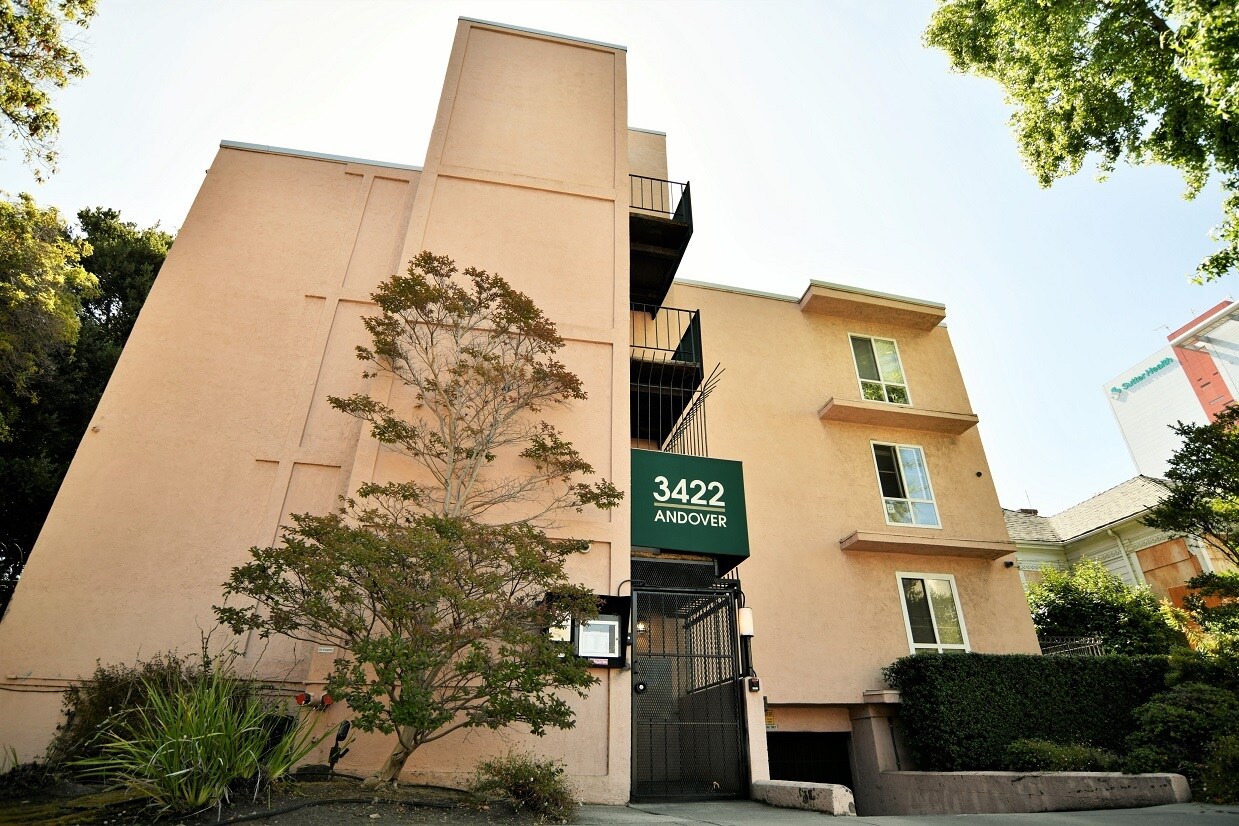
3422 Andover St
Oakland, CA 94609


