
$2,495 - $3,300
Total Monthly Price
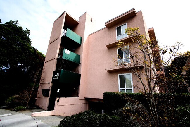
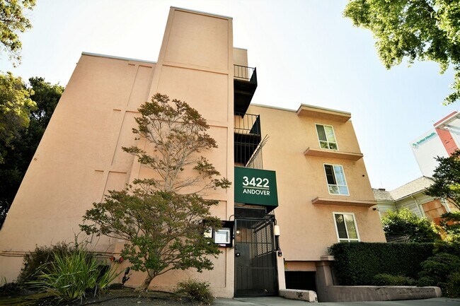
3422 Andover St
Oakland, CA 94609
Favorites
3422 Andover St

Favorites
Check Back Soon for Upcoming Availability
| Beds | Baths | Average SF |
|---|---|---|
| 2 Bedrooms 2 Bedrooms 2 Br | 1 Bath 1 Bath 1 Ba | 686 SF |
| 2 Bedrooms 2 Bedrooms 2 Br | 2 Baths 2 Baths 2 Ba | 600 SF |
Fees and Policies
The fees listed below are community-provided and may exclude utilities or add-ons. All payments are made directly to the property and are non-refundable unless otherwise specified.
- Parking
-
Garage$100/mo
Details
Utilities Included
-
Water
-
Trash Removal
Property Information
-
22 units
About 3422 Andover St Oakland, CA 94609
City of Oakland Alameda County Pill Hill neighborhood Cross streets are 34th street and Andover. Just 1 block to Telegraph shopping Very close to Piedmont Ave. excellent shopping, restaurants, bars, theater, and coffee houses: .6 miles! NO CAR?...Bike Racks on site Bus stop one block. BART 6 blocks (MacArthur Station) Walk to Samuel Merritt College, Piedmont Grocery, Piedmont Ave. 5 minutes to Highways 580, 80, 980, 24 8 min. to 880, Jack London Square/Safeway/Whole Foods Near Alta Bates Summit Hospital Convenient location. EZ Commute to Emeryville, Berkeley and San Francisco!
3422 Andover St is an apartment community located in Alameda County and the 94609 ZIP Code.
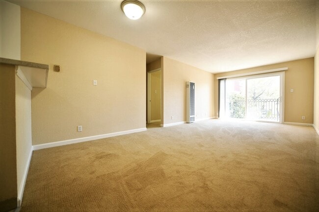
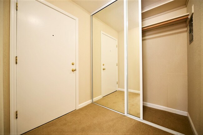
Apartment Features
Granite Countertops
Smoke Free
Carpet
Eat-in Kitchen
- Smoke Free
- Granite Countertops
- Eat-in Kitchen
- Carpet
- Laundry Facilities
- Elevator
- Deck
3422 Andover St,
Oakland,
CA
94609
Pill Hill is a small neighborhood located about a mile north of Downtown Oakland. Various medical facilities are located in the neighborhood, hence the name. Along with pharmacies and doctor’s offices, Pill Hill is home to the Alta Bates Summit Medical Center. Pill Hill has apartments and condos available for rent. The iconic Telegraph Avenue runs through Pill Hill so residents have access to cafes, coffee shops, and grocery stores within walking distance, but many residents take advantage of the neighborhood’s central location by traveling into neighboring communities for more shopping, dining, and entertainment options. Explore eateries on Piedmont Avenue, or head to Adams Point to access Lake Merritt. Pill Hill is nestled between Interstate 580 and 980 so it’s a great choice for anyone who wants to be able to travel across the Bay Area with ease into other major cities like Berkeley and San Francisco.
Learn more about living in Pill HillBelow are rent ranges for similar nearby apartments
Amenities
- Smoke Free
- Granite Countertops
- Eat-in Kitchen
- Carpet
- Laundry Facilities
- Elevator
- Deck
Expenses
Recurring
Unassigned Garage Parking
$100
Utilities Included
Water, Trash Removal
Included
Education
| Colleges & Universities | Distance | ||
|---|---|---|---|
| Colleges & Universities | Distance | ||
| Walk: | 5 min | 0.3 mi | |
| Drive: | 5 min | 1.7 mi | |
| Drive: | 8 min | 3.1 mi | |
| Drive: | 10 min | 3.6 mi |
3422 Andover St is within 5 minutes or 0.3 mile from Samuel Merritt University. It is also near Lincoln University, Oakland and Laney College.
Transportation options available in Oakland include 19Th Street Oakland, located 1.3 miles from 3422 Andover St. 3422 Andover St is near Metro Oakland International, located 10.8 miles or 19 minutes away, and San Francisco International, located 22.9 miles or 36 minutes away.
| Transit / Subway | Distance | ||
|---|---|---|---|
| Transit / Subway | Distance | ||
|
|
Drive: | 4 min | 1.3 mi |
|
|
Drive: | 4 min | 1.5 mi |
|
|
Drive: | 6 min | 2.2 mi |
|
|
Drive: | 6 min | 2.3 mi |
|
|
Drive: | 6 min | 2.9 mi |
| Commuter Rail | Distance | ||
|---|---|---|---|
| Commuter Rail | Distance | ||
|
|
Drive: | 7 min | 2.4 mi |
| Drive: | 7 min | 3.3 mi | |
|
|
Drive: | 8 min | 4.9 mi |
| Drive: | 17 min | 10.5 mi | |
| Drive: | 17 min | 11.1 mi |
| Airports | Distance | ||
|---|---|---|---|
| Airports | Distance | ||
|
Metro Oakland International
|
Drive: | 19 min | 10.8 mi |
|
San Francisco International
|
Drive: | 36 min | 22.9 mi |
Walkability Near 3422 Andover St Oakland, CA 94609
Getting Around
 What do Walkability, Transit, Drivability, and Bikeability mean?
Walkability measures the walking distance to day-to-day needs.
Transit measures access to public transportation.
Drivability measures congestion, parking availability, and access to major roads.
Bikeability measures the suitability for cycling.
How It Works
What do Walkability, Transit, Drivability, and Bikeability mean?
Walkability measures the walking distance to day-to-day needs.
Transit measures access to public transportation.
Drivability measures congestion, parking availability, and access to major roads.
Bikeability measures the suitability for cycling.
How It Works
Moderately Walkable
Walkability
60
/ 100
Strong Public Transit
Transit
80
/ 100
Exceptionally Drivable
Drivability
90
/ 100
Fairly Bikeable
Bikeability
50
/ 100
Scores provided by
-
Soundscore™
-
/ 100
Traffic
-Airport
-Businesses
-Scores provided by
HowLoud What is a Sound Score Rating? A Sound Score Rating aggregates noise caused by vehicle traffic, airplane traffic and local sources. How It WorksTime and distance from 3422 Andover St.
| Shopping Centers | Distance | ||
|---|---|---|---|
| Shopping Centers | Distance | ||
| Walk: | 8 min | 0.4 mi | |
| Walk: | 12 min | 0.7 mi | |
| Walk: | 16 min | 0.9 mi |
3422 Andover St has 3 shopping centers within 0.9 mile, which is about a 16-minute walk. The miles and minutes will be for the farthest away property.
| Parks and Recreation | Distance | ||
|---|---|---|---|
| Parks and Recreation | Distance | ||
|
Morcom Rose Garden
|
Drive: | 4 min | 1.3 mi |
|
Lakeside Park Garden Center
|
Drive: | 4 min | 1.4 mi |
|
Lakeside Park
|
Drive: | 4 min | 1.9 mi |
|
Juan Bautista de Anza National Historic Trail
|
Drive: | 5 min | 2.0 mi |
|
Rotary Nature Center
|
Drive: | 5 min | 2.2 mi |
3422 Andover St has 5 parks within 2.2 miles, including Morcom Rose Garden, Lakeside Park Garden Center, and Rotary Nature Center.
| Hospitals | Distance | ||
|---|---|---|---|
| Hospitals | Distance | ||
| Walk: | 5 min | 0.3 mi | |
| Walk: | 10 min | 0.5 mi | |
| Drive: | 3 min | 1.4 mi |
3422 Andover St has 3 hospitals within 1.4 miles, the nearest is Alta Bates Summit Medical Center which is 0.3 mile away and a 5 minute walk.
| Military Bases | Distance | ||
|---|---|---|---|
| Military Bases | Distance | ||
| Drive: | 14 min | 4.9 mi | |
| Drive: | 13 min | 5.1 mi | |
| Drive: | 14 min | 5.3 mi |
3422 Andover St has 3 military bases within 5.3 miles, the nearest is Oakland Army Base which is 4.9 miles away and a 14 minute drive.
You May Also Like
Similar Rentals Nearby


What Are Walk Score®, Transit Score®, and Bike Score® Ratings?
Walk Score® measures the walkability of any address. Transit Score® measures access to public transit. Bike Score® measures the bikeability of any address.
What is a Sound Score Rating?
A Sound Score Rating aggregates noise caused by vehicle traffic, airplane traffic and local sources.
3422 Andover St
Oakland, CA 94609