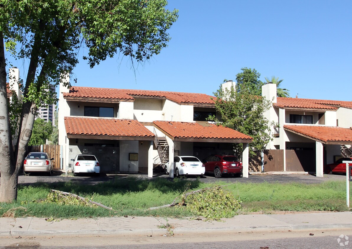
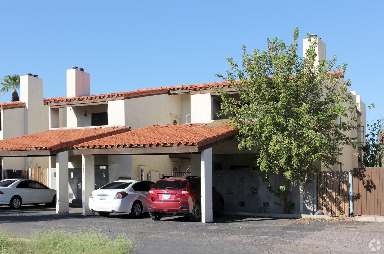
3418 N 12th Pl
3418 N 12th Pl,
Phoenix,
AZ
85014
2 Weeks Ago
Favorites
3418 N 12th Pl
Favorites
Check Back Soon for Upcoming Availability
Fees and Policies
The fees below are based on community-supplied data and may exclude additional fees and utilities.
- Parking
-
Surface Lot--1 Max
Details
Property Information
-
Built in 1983
-
4 units
About 3418 N 12th Pl Phoenix, AZ 85014
Welcome home to 3418 N 12th Pl. The address for this community is at 3418 N. 12th Pl in Phoenix. Come by to see the current floorplan options. The professional leasing team is ready to match you with your perfect fit. Drop by the leasing office to check current floorplan availability.
3418 N 12th Pl is an apartment community located in Maricopa County and the 85014 ZIP Code. This area is served by the Osborn Elementary District attendance zone.
Location
Get Directions
Midtown Phoenix offers a wide variety of rental communities within close proximity to major highways, the light rail, and Downtown Phoenix, making it an ideal neighborhood for commuters. Midtown Phoenix also touts exceptional dining options with a slew of cozy cafes, tasty restaurants, and modern eateries located along North Central Avenue and East Camelback Road.
Shopping opportunities abound near Midtown Phoenix as well, with retail destinations like Camelback Colonnade and Biltmore Fashion Park situated within close proximity. Midtown Phoenix is also nearby plenty of recreational activities at local parks as well as the sprawling Phoenix Mountains Preserve, which is just a short drive away.
Learn more about living in Midtown PhoenixBelow are rent ranges for similar nearby apartments
| Beds | Average Size | Lowest | Typical | Premium |
|---|---|---|---|---|
| Studio Studio Studio | 481-482 Sq Ft | $522 | $1,176 | $2,553 |
| 1 Bed 1 Bed 1 Bed | 713-714 Sq Ft | $705 | $1,527 | $4,114 |
| 2 Beds 2 Beds 2 Beds | 1075-1077 Sq Ft | $799 | $1,971 | $5,995 |
| 3 Beds 3 Beds 3 Beds | 1473-1477 Sq Ft | $1,325 | $2,791 | $16,000 |
| 4 Beds 4 Beds 4 Beds | 1993 Sq Ft | $1,720 | $3,233 | $12,000 |
Education
| Colleges & Universities | Distance | ||
|---|---|---|---|
| Colleges & Universities | Distance | ||
| Drive: | 6 min | 2.2 mi | |
| Drive: | 7 min | 3.0 mi | |
| Drive: | 8 min | 3.3 mi | |
| Drive: | 11 min | 6.1 mi |
3418 N 12th Pl is within 6 minutes or 2.2 miles from Phoenix College. It is also near University of Arizona and Arizona State Univ., Downtown.
Schools


Public Elementary & Middle School
Grades PK-8
466 Students
Attendance Zone
Public Middle School
Grades 7-8
504 Students
Attendance Zone
Public High School
Grades 9-12
2,135 Students
Attendance Zone
Private Elementary, Middle & High School
Grades K-11
Nearby
Private Elementary, Middle & High School
Grades 2-12
Nearby
Private Elementary & Middle School
Grades PK-8
651 Students
Nearby
School data provided by
 The GreatSchools Rating helps parents compare schools within a state based on a variety of school quality indicators and provides a helpful picture of how effectively each school serves all of its students. Ratings are on a scale of 1 (below average) to 10 (above average) and can include test scores, college readiness, academic progress, advanced courses, equity, discipline and attendance data. We also advise parents to visit schools, consider other information on school performance and programs, and consider family needs as part of the school selection process.
View GreatSchools Rating Methodology
Data provided by GreatSchools.org © 2025. All rights reserved.
View GreatSchools Rating Methodology
Data provided by GreatSchools.org © 2025. All rights reserved.
Transportation options available in Phoenix include Osborn/Central Ave, located 1.2 miles from 3418 N 12th Pl. 3418 N 12th Pl is near Phoenix Sky Harbor International, located 6.9 miles or 13 minutes away, and Phoenix-Mesa Gateway, located 33.7 miles or 46 minutes away.
| Transit / Subway | Distance | ||
|---|---|---|---|
| Transit / Subway | Distance | ||
|
|
Drive: | 3 min | 1.2 mi |
|
|
Drive: | 3 min | 1.6 mi |
|
|
Drive: | 5 min | 2.0 mi |
|
|
Drive: | 5 min | 2.2 mi |
|
|
Drive: | 5 min | 2.2 mi |
| Commuter Rail | Distance | ||
|---|---|---|---|
| Commuter Rail | Distance | ||
|
|
Drive: | 45 min | 34.8 mi |
| Airports | Distance | ||
|---|---|---|---|
| Airports | Distance | ||
|
Phoenix Sky Harbor International
|
Drive: | 13 min | 6.9 mi |
|
Phoenix-Mesa Gateway
|
Drive: | 46 min | 33.7 mi |
Time and distance from 3418 N 12th Pl.
| Shopping Centers | Distance | ||
|---|---|---|---|
| Shopping Centers | Distance | ||
| Walk: | 16 min | 0.9 mi | |
| Drive: | 3 min | 1.1 mi | |
| Drive: | 3 min | 1.3 mi |
3418 N 12th Pl has 3 shopping centers within 1.3 miles, which is about a 3-minute walk. The miles and minutes will be for the farthest away property.
| Parks and Recreation | Distance | ||
|---|---|---|---|
| Parks and Recreation | Distance | ||
|
Steele Indian School Park
|
Drive: | 3 min | 1.4 mi |
|
Margaret T. Hance Park
|
Drive: | 6 min | 2.9 mi |
|
Japanese Friendship Garden
|
Drive: | 8 min | 3.5 mi |
|
Civic Space Park
|
Drive: | 8 min | 3.9 mi |
|
Desert Storm Park
|
Drive: | 8 min | 3.9 mi |
3418 N 12th Pl has 5 parks within 3.9 miles, including Steele Indian School Park, Desert Storm Park, and Margaret T. Hance Park.
| Hospitals | Distance | ||
|---|---|---|---|
| Hospitals | Distance | ||
| Drive: | 2 min | 1.2 mi | |
| Drive: | 3 min | 1.4 mi | |
| Drive: | 4 min | 1.9 mi |
3418 N 12th Pl has 3 hospitals within 1.9 miles, the nearest is Phoenix Indian Medical Center which is 1.2 miles away and a 2 minute drive.
| Military Bases | Distance | ||
|---|---|---|---|
| Military Bases | Distance | ||
| Drive: | 14 min | 6.8 mi | |
| Drive: | 34 min | 23.9 mi | |
| Drive: | 101 min | 76.4 mi |
3418 N 12th Pl has 3 military bases within 76.4 miles, the nearest is Phoenix Sky Harbor Airport Air Guard Station which is 6.8 miles away and a 14 minute drive.
You May Also Like
What neighborhood is the property located in?
3418 N 12th Pl Phoenix, AZ 85014 is in Midtown Phoenix in the city of Phoenix. Here you’ll find three shopping centers within 1.3 miles of the property. Five parks are within 3.9 miles, including Steele Indian School Park, Desert Storm Park, and Margaret T. Hance Park.
Similar Rentals Nearby
-
-
-
-
-
-
-
-
-
-
1 / 16


What Are Walk Score®, Transit Score®, and Bike Score® Ratings?
Walk Score® measures the walkability of any address. Transit Score® measures access to public transit. Bike Score® measures the bikeability of any address.
What is a Sound Score Rating?
A Sound Score Rating aggregates noise caused by vehicle traffic, airplane traffic and local sources
Responded To This Review