
The Vitagraph
1277 E 14th St,
Brooklyn, NY 11230
$2,770 - $3,668
1-3 Beds
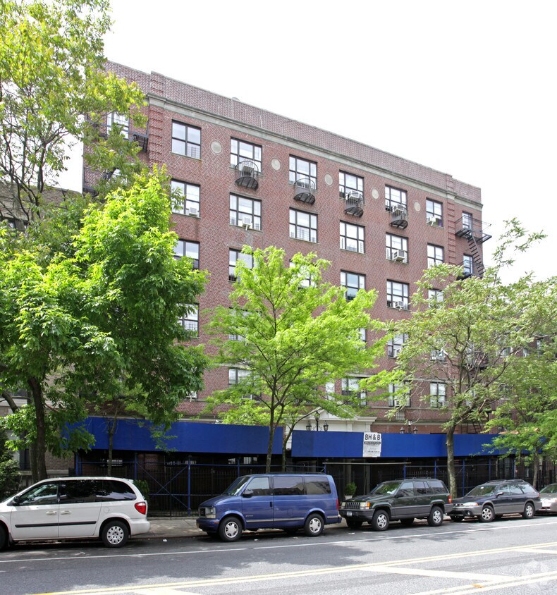
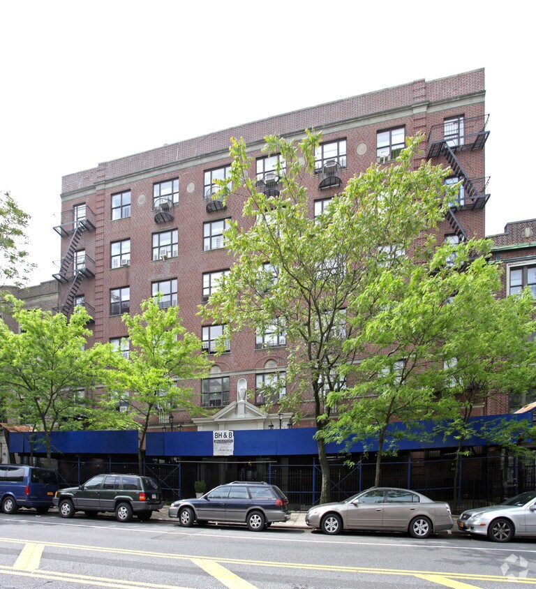
340 St Johns Pl in Brooklyn is ready for you to visit. The location of this community is in Brooklyn at 340 St. Johns Pl in the 11238 area. The professional leasing staff will be ready to help you find your perfect new place. Make sure you to view the available floorplans. Drop by the leasing office to find out the current floorplan availability.
340 St Johns Pl is an apartment community located in Kings County and the 11238 ZIP Code. This area is served by the New York City Geographic District #13 attendance zone.
With its tree-lined streets and welcoming community, Prospect Heights is a wonderful tight-knit community to come home to. The Grand Army Plaza at Mount Prospect Park is probably the first thing you’ll notice, especially the Soldiers’ and Sailors’ Arch monument. The Saturday market is held at the plaza, which makes buying groceries all the more fun!
Across from the arch is the Brooklyn Public Library, one of the community’s iconic buildings. The Brooklyn Museum is close by on Eastern Parkway – the same thoroughfare that holds the West Indian Day Parade on Labor Day. The Botanic Garden is in walking distance of both attractions and features acres of cherry blossoms.
Vanderbilt and Washington Avenues act as the main commercial district, scattered with shops, restaurants, and bars. Locals enjoy the famous lemon ricotta pancakes at Tom’s Restaurant plus sweet treats at Ample Hills Creamery. Prospect Heights has a lot to do and see – like a Nets game at Barclays Center.
Learn more about living in Prospect HeightsCompare neighborhood and city base rent averages by bedroom.
| Prospect Heights | Brooklyn, NY | |
|---|---|---|
| Studio | $3,529 | $2,674 |
| 1 Bedroom | $3,779 | $2,996 |
| 2 Bedrooms | $5,448 | $3,925 |
| 3 Bedrooms | $6,996 | $4,864 |
| Colleges & Universities | Distance | ||
|---|---|---|---|
| Colleges & Universities | Distance | ||
| Walk: | 15 min | 0.8 mi | |
| Drive: | 4 min | 1.5 mi | |
| Drive: | 5 min | 1.6 mi | |
| Drive: | 5 min | 1.7 mi |

Transportation options available in Brooklyn include Eastern Parkway-Brooklyn Museum, located 0.3 mile from 340 St Johns Pl. 340 St Johns Pl is near LaGuardia, located 10.3 miles or 20 minutes away, and John F Kennedy International, located 12.7 miles or 23 minutes away.
| Transit / Subway | Distance | ||
|---|---|---|---|
| Transit / Subway | Distance | ||
|
|
Walk: | 5 min | 0.3 mi |
|
|
Walk: | 6 min | 0.3 mi |
|
|
Walk: | 9 min | 0.5 mi |
|
|
Walk: | 9 min | 0.5 mi |
|
|
Walk: | 11 min | 0.6 mi |
| Commuter Rail | Distance | ||
|---|---|---|---|
| Commuter Rail | Distance | ||
|
|
Drive: | 4 min | 1.1 mi |
|
|
Drive: | 4 min | 1.3 mi |
|
|
Drive: | 9 min | 3.7 mi |
|
|
Drive: | 14 min | 5.0 mi |
|
|
Drive: | 20 min | 7.6 mi |
| Airports | Distance | ||
|---|---|---|---|
| Airports | Distance | ||
|
LaGuardia
|
Drive: | 20 min | 10.3 mi |
|
John F Kennedy International
|
Drive: | 23 min | 12.7 mi |
Scores provided by
Traffic
-Airport
-Businesses
-Scores provided by
HowLoud What is a Sound Score Rating? A Sound Score Rating aggregates noise caused by vehicle traffic, airplane traffic and local sources. How It WorksTime and distance from 340 St Johns Pl.
| Shopping Centers | Distance | ||
|---|---|---|---|
| Shopping Centers | Distance | ||
| Drive: | 4 min | 1.3 mi | |
| Drive: | 7 min | 2.6 mi |
| Parks and Recreation | Distance | ||
|---|---|---|---|
| Parks and Recreation | Distance | ||
|
Brooklyn Botanic Garden
|
Walk: | 12 min | 0.6 mi |
|
Prospect Park
|
Walk: | 19 min | 1.0 mi |
|
Prospect Park Zoo
|
Walk: | 20 min | 1.1 mi |
|
Prospect Park Audubon Center at the Boathouse
|
Drive: | 2 min | 1.1 mi |
|
Crispus Attucks Playground
|
Drive: | 3 min | 1.1 mi |
| Hospitals | Distance | ||
|---|---|---|---|
| Hospitals | Distance | ||
| Drive: | 4 min | 1.2 mi | |
| Drive: | 5 min | 1.9 mi | |
| Drive: | 7 min | 2.0 mi |
| Military Bases | Distance | ||
|---|---|---|---|
| Military Bases | Distance | ||
| Drive: | 15 min | 6.5 mi | |
| Drive: | 16 min | 7.5 mi |
What Are Walk Score®, Transit Score®, and Bike Score® Ratings?
Walk Score® measures the walkability of any address. Transit Score® measures access to public transit. Bike Score® measures the bikeability of any address.
What is a Sound Score Rating?
A Sound Score Rating aggregates noise caused by vehicle traffic, airplane traffic and local sources.

340 St Johns Pl
Brooklyn, NY 11238


