
Williamsburg
200 W Galbraith Rd,
Cincinnati, OH 45215
$718 - $2,776
Studio - 3 Beds
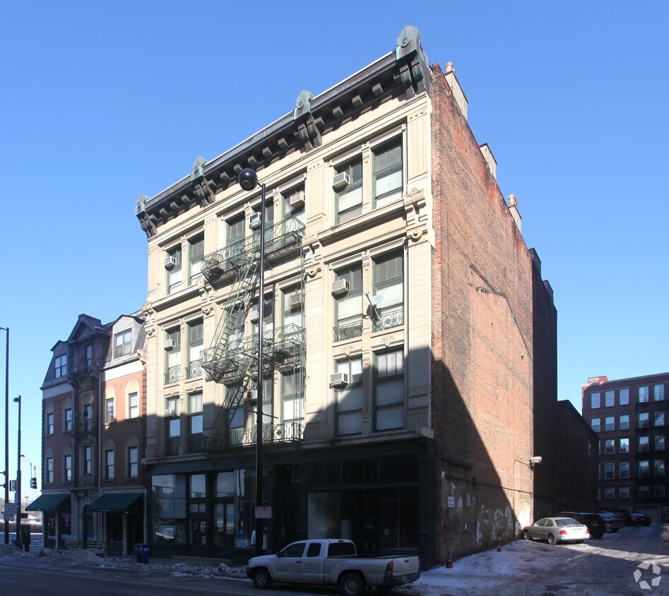
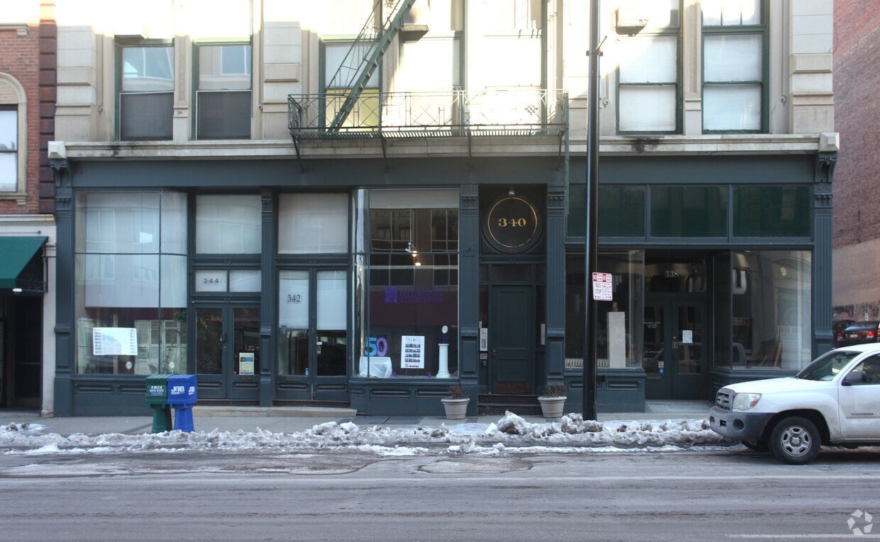
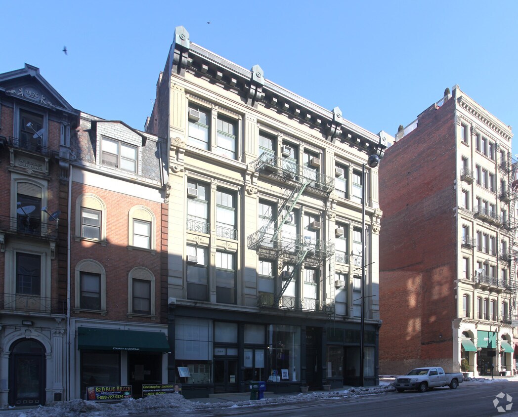

Discover 338-344 W 4th St in Cincinnati, OH. The 338-344 W. 4th St. location in the Downtown Cincinnati neighborhood of Cincinnati has much to offer its residents. From pricing to features, the professional leasing staff is excited to help you find your perfect new place. Start living the good life at 338-344 W 4th St. Contact us or stop by the leasing office to discuss your new apartment.
338-344 W 4th St is an apartment community located in Hamilton County and the 45202 ZIP Code. This area is served by the Cincinnati Public Schools attendance zone.
Cincinnati’s City Center is the central business district of this thriving metropolis. It’s home to an array of entertainment options, from the Taft Theatre to Fountain Square. Although Cincinnati is a major metro area, City Center is rather quiet for a downtown district. It has a quaint charm to it that’s adored by residents. Locals appreciate the variety of apartments available in the area, ranging from affordable to upscale. City Center features views of the Ohio River and is home to several stadiums, including the Great American Ball Park and Paul Brown Stadium. Light rail stations can be found along all major streets in City Center, making commuting simple. For additional travel benefits, Cincinnati’s City Center offers proximity to Interstates 75, 71, and 471.
Learn more about living in City CenterCompare neighborhood and city base rent averages by bedroom.
| City Center | Cincinnati, OH | |
|---|---|---|
| Studio | $1,318 | $1,065 |
| 1 Bedroom | $1,662 | $1,142 |
| 2 Bedrooms | $2,491 | $1,435 |
| 3 Bedrooms | $3,753 | $1,754 |
| Colleges & Universities | Distance | ||
|---|---|---|---|
| Colleges & Universities | Distance | ||
| Drive: | 10 min | 3.7 mi | |
| Drive: | 9 min | 4.7 mi | |
| Drive: | 10 min | 4.7 mi | |
| Drive: | 13 min | 5.3 mi |


Transportation options available in Cincinnati include Fountain Square Station - 5Th & Walnut, located 0.5 mile from 338-344 W 4th St. 338-344 W 4th St is near Cincinnati/Northern Kentucky International, located 14.4 miles or 27 minutes away.
| Transit / Subway | Distance | ||
|---|---|---|---|
| Transit / Subway | Distance | ||
| Walk: | 9 min | 0.5 mi | |
| Walk: | 10 min | 0.5 mi | |
| Walk: | 11 min | 0.6 mi | |
| Walk: | 13 min | 0.7 mi | |
| Walk: | 13 min | 0.7 mi |
| Commuter Rail | Distance | ||
|---|---|---|---|
| Commuter Rail | Distance | ||
|
|
Drive: | 4 min | 1.5 mi |
| Airports | Distance | ||
|---|---|---|---|
| Airports | Distance | ||
|
Cincinnati/Northern Kentucky International
|
Drive: | 27 min | 14.4 mi |
Scores provided by
Traffic
-Airport
-Businesses
-Scores provided by
HowLoud What is a Sound Score Rating? A Sound Score Rating aggregates noise caused by vehicle traffic, airplane traffic and local sources. How It WorksTime and distance from 338-344 W 4th St.
| Shopping Centers | Distance | ||
|---|---|---|---|
| Shopping Centers | Distance | ||
| Walk: | 8 min | 0.4 mi | |
| Drive: | 4 min | 1.4 mi | |
| Drive: | 6 min | 1.8 mi |
| Parks and Recreation | Distance | ||
|---|---|---|---|
| Parks and Recreation | Distance | ||
|
John G. & Phyllis W. Smale Riverfront Park
|
Walk: | 8 min | 0.5 mi |
|
OMNIMAX Theater
|
Drive: | 4 min | 1.5 mi |
|
Duke Energy Children's Museum
|
Drive: | 4 min | 1.5 mi |
|
Museum of Natural History and Science
|
Drive: | 4 min | 1.5 mi |
|
Newport Aquarium
|
Drive: | 6 min | 2.0 mi |
| Hospitals | Distance | ||
|---|---|---|---|
| Hospitals | Distance | ||
| Drive: | 7 min | 2.1 mi | |
| Drive: | 9 min | 3.5 mi | |
| Drive: | 7 min | 4.0 mi |
| Military Bases | Distance | ||
|---|---|---|---|
| Military Bases | Distance | ||
| Drive: | 71 min | 55.2 mi | |
| Drive: | 77 min | 60.2 mi | |
| Drive: | 80 min | 63.5 mi |
What Are Walk Score®, Transit Score®, and Bike Score® Ratings?
Walk Score® measures the walkability of any address. Transit Score® measures access to public transit. Bike Score® measures the bikeability of any address.
What is a Sound Score Rating?
A Sound Score Rating aggregates noise caused by vehicle traffic, airplane traffic and local sources.

338-344 W 4th St
Cincinnati, OH 45202


