
$925
Total Monthly Price
3341 Parkcrest Ln Unit 3
Cincinnati, OH 45211
Favorites
3341 Parkcrest Ln Unit 3

Favorites
Check Back Soon for Upcoming Availability
| Beds | Baths | Average SF |
|---|---|---|
| 2 Bedrooms 2 Bedrooms 2 Br | 1 Bath 1 Bath 1 Ba | 801 SF |
Fees and Policies
The fees listed below are community-provided and may exclude utilities or add-ons. All payments are made directly to the property and are non-refundable unless otherwise specified.
- Parking
-
Surface Lot--
Details
Utilities Included
-
Gas
-
Water
-
Heat
-
Trash Removal
-
Sewer
Property Information
-
4 units
About This Property
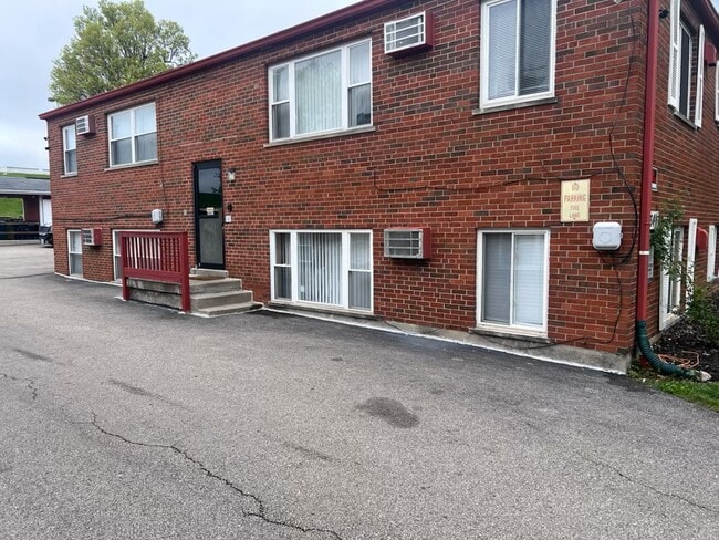
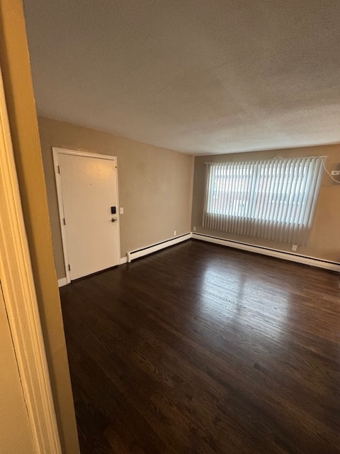
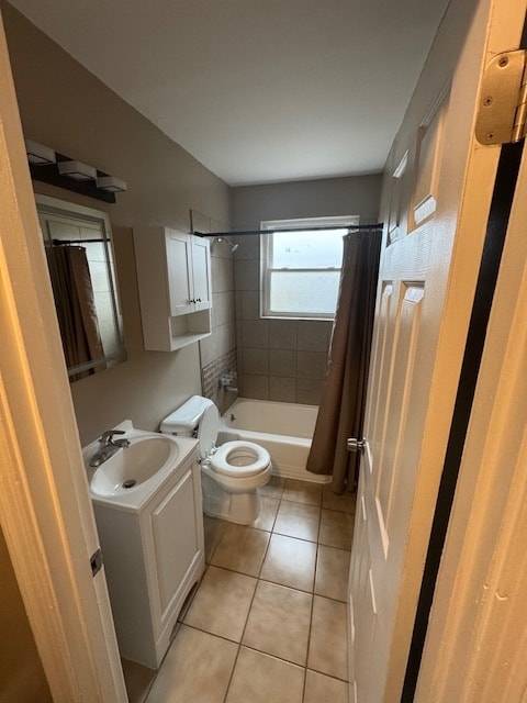
A two-bedroom, one-bathroom non-smoking unit is available for occupancy. The owner pays for heating and water.. Ceramic tile floors are throughout the unit. A laundry room is located within the building. It features security door and security cameras. The building is situated on a bus line and is surrounded by a diverse range of restaurants and shops.
3341 Parkcrest Ln is an apartment community located in Hamilton County and the 45211 ZIP Code.
Apartment Features
Washer/Dryer
Air Conditioning
Hardwood Floors
Refrigerator
- Washer/Dryer
- Air Conditioning
- Heating
- Ceiling Fans
- Smoke Free
- Cable Ready
- Tub/Shower
- Eat-in Kitchen
- Kitchen
- Oven
- Range
- Refrigerator
- Hardwood Floors
- Tile Floors
- Dining Room
- Window Coverings
- Laundry Facilities
- Video Patrol
3341 Parkcrest Ln,
Cincinnati,
OH
45211
Situated about five miles northwest of Downtown Cincinnati, Westwood is the largest neighborhood in the city. Residents flock to Westwood for its many affordable historic homes and modern apartments available for rent in addition to its close proximity to I-74, I-75, and all that Downtown Cincinnati has to offer.
While Westwood is a predominantly residential neighborhood, it is also home to a slew of convenient stores and restaurants. Shopping opportunities abound in Westwood, with plenty of national retailers in Western Hills Plaza and local shops in the growing Town Hall District. Numerous neighborhood parks provide ample space to enjoy the outdoors in town as well as the sprawling 1,400-acre Mount Airy Forest, which is partially located in Westwood.
Learn more about living in WestwoodBelow are rent ranges for similar nearby apartments
Amenities
- Washer/Dryer
- Air Conditioning
- Heating
- Ceiling Fans
- Smoke Free
- Cable Ready
- Tub/Shower
- Eat-in Kitchen
- Kitchen
- Oven
- Range
- Refrigerator
- Hardwood Floors
- Tile Floors
- Dining Room
- Window Coverings
- Laundry Facilities
- Video Patrol
Expenses
Utilities Included
Gas, Water, Heat, Trash Removal, Sewer
Included
Education
| Colleges & Universities | Distance | ||
|---|---|---|---|
| Colleges & Universities | Distance | ||
| Drive: | 11 min | 4.7 mi | |
| Drive: | 17 min | 6.5 mi | |
| Drive: | 15 min | 6.7 mi | |
| Drive: | 17 min | 7.2 mi |
3341 Parkcrest Ln Unit 3 is within 11 minutes or 4.7 miles from College of Mount St. Joseph. It is also near Cincinnati State and University of Cincinnati.
Transportation options available in Cincinnati include Brewery District Station - Elm & Henry, located 6.6 miles from 3341 Parkcrest Ln Unit 3. 3341 Parkcrest Ln Unit 3 is near Cincinnati/Northern Kentucky International, located 21.5 miles or 41 minutes away.
| Transit / Subway | Distance | ||
|---|---|---|---|
| Transit / Subway | Distance | ||
| Drive: | 16 min | 6.6 mi | |
| Drive: | 16 min | 6.8 mi | |
| Drive: | 17 min | 6.9 mi | |
| Drive: | 17 min | 7.0 mi | |
| Drive: | 17 min | 7.1 mi |
| Commuter Rail | Distance | ||
|---|---|---|---|
| Commuter Rail | Distance | ||
|
|
Drive: | 16 min | 7.4 mi |
| Airports | Distance | ||
|---|---|---|---|
| Airports | Distance | ||
|
Cincinnati/Northern Kentucky International
|
Drive: | 41 min | 21.5 mi |
Walkability Near 3341 Parkcrest Ln Cincinnati, OH 45211
Getting Around
 What do Walkability, Transit, Drivability, and Bikeability mean?
Walkability measures the walking distance to day-to-day needs.
Transit measures access to public transportation.
Drivability measures congestion, parking availability, and access to major roads.
Bikeability measures the suitability for cycling.
How It Works
What do Walkability, Transit, Drivability, and Bikeability mean?
Walkability measures the walking distance to day-to-day needs.
Transit measures access to public transportation.
Drivability measures congestion, parking availability, and access to major roads.
Bikeability measures the suitability for cycling.
How It Works
Fairly Walkable
Walkability
50
/ 100
Some Public Transit
Transit
50
/ 100
Very Drivable
Drivability
80
/ 100
Somewhat Bikeable
Bikeability
30
/ 100
Scores provided by
-
Soundscore™
-
/ 100
Traffic
-Airport
-Businesses
-Scores provided by
HowLoud What is a Sound Score Rating? A Sound Score Rating aggregates noise caused by vehicle traffic, airplane traffic and local sources. How It WorksTime and distance from 3341 Parkcrest Ln Unit 3.
| Shopping Centers | Distance | ||
|---|---|---|---|
| Shopping Centers | Distance | ||
| Walk: | 4 min | 0.2 mi | |
| Walk: | 9 min | 0.5 mi | |
| Walk: | 11 min | 0.6 mi |
3341 Parkcrest Ln Unit 3 has 3 shopping centers within 0.6 mile, which is about a 11-minute walk. The miles and minutes will be for the farthest away property.
| Parks and Recreation | Distance | ||
|---|---|---|---|
| Parks and Recreation | Distance | ||
|
Mt. Airy Forest
|
Drive: | 10 min | 3.9 mi |
|
Imago Earth Center
|
Drive: | 13 min | 4.8 mi |
|
Embshoff Woods
|
Drive: | 15 min | 5.3 mi |
|
Wilson Commons
|
Drive: | 15 min | 5.5 mi |
|
Mitchell Memorial Forest
|
Drive: | 13 min | 5.6 mi |
3341 Parkcrest Ln Unit 3 has 5 parks within 5.6 miles, including Mt. Airy Forest, Imago Earth Center, and Embshoff Woods.
| Hospitals | Distance | ||
|---|---|---|---|
| Hospitals | Distance | ||
| Drive: | 11 min | 4.0 mi | |
| Drive: | 14 min | 6.0 mi | |
| Drive: | 17 min | 7.2 mi |
3341 Parkcrest Ln Unit 3 has 3 hospitals within 7.2 miles, the nearest is Mercy Health - West Hospital which is 4.0 miles away and a 11 minute drive.
| Military Bases | Distance | ||
|---|---|---|---|
| Military Bases | Distance | ||
| Drive: | 76 min | 56.2 mi | |
| Drive: | 82 min | 61.3 mi | |
| Drive: | 85 min | 64.6 mi |
3341 Parkcrest Ln Unit 3 has 3 military bases within 64.6 miles, the nearest is Gentile Air Force Station which is 56.2 miles away and a 76 minute drive.
You May Also Like
Similar Rentals Nearby


What Are Walk Score®, Transit Score®, and Bike Score® Ratings?
Walk Score® measures the walkability of any address. Transit Score® measures access to public transit. Bike Score® measures the bikeability of any address.
What is a Sound Score Rating?
A Sound Score Rating aggregates noise caused by vehicle traffic, airplane traffic and local sources.

3341 Parkcrest Ln
Cincinnati, OH 45211