
Venue Residences
3688 Overland Ave,
Los Angeles, CA 90034
$3,550 - $4,795
1-2 Beds

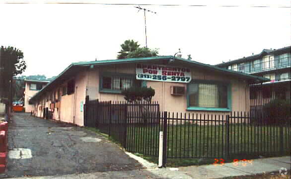

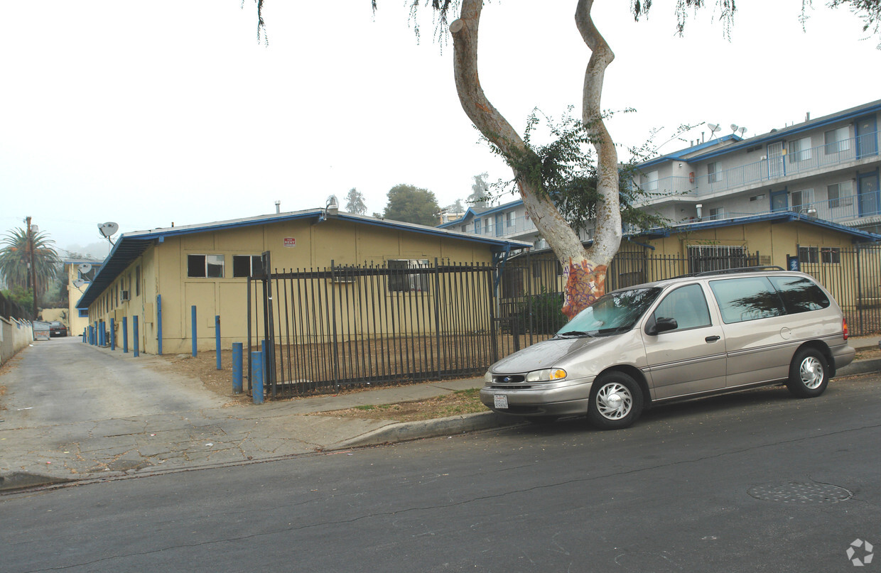

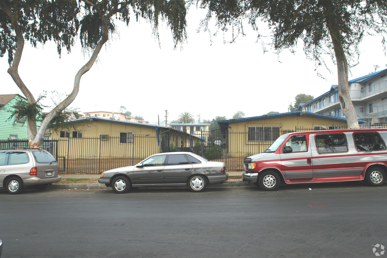
Find your next place to live at 3333-3339 Drew St in Los Angeles, CA. This apartment community is located on Drew St. in the 90065 area of Los Angeles. Make sure you to view the available floorplans. The team of leasing professionals will be ready to help you find your perfect place. Get a head start on your move right now. Contact or stop by 3333-3339 Drew St to check the current floorplan availability!
3333-3339 Drew St is an apartment community located in Los Angeles County and the 90065 ZIP Code. This area is served by the Los Angeles Unified Rocp School District attendance zone.
Nestled between the Los Angeles River and the city of Glendale, Atwater Village boasts convenient access to some of Los Angeles’ most popular neighborhoods and attractions. Burbank, Universal City, Hollywood Hills, and Chinatown are just a few of the neighboring areas that attract residents to this convenient location. And with Downtown LA and Dodger Stadium just five miles south, you’ll never tire of available entertainment, shopping, and dining options.
Adjacent to the infamous Griffith Park, residents have unbeatable access to the city’s urban oasis with hiking and horseback riding trails, incredible views of LA’s skyline, the Greek Theatre, golf courses, and even the Los Angeles Zoo! For a quaint community park, visit North Atwater Park, a beautiful urban area overlooking the LA River.
Smaller Spanish-style homes line this neighborhood’s busy residential streets, while newer apartment complexes reside near the area’s commercial district.
Learn more about living in Atwater VillageCompare neighborhood and city base rent averages by bedroom.
| Atwater Village | Los Angeles, CA | |
|---|---|---|
| Studio | $1,985 | $1,710 |
| 1 Bedroom | $1,914 | $2,178 |
| 2 Bedrooms | $1,942 | $3,017 |
| 3 Bedrooms | $2,048 | $4,259 |
| Colleges & Universities | Distance | ||
|---|---|---|---|
| Colleges & Universities | Distance | ||
| Drive: | 7 min | 2.6 mi | |
| Drive: | 10 min | 4.8 mi | |
| Drive: | 9 min | 4.9 mi | |
| Drive: | 16 min | 8.9 mi |


Transportation options available in Los Angeles include Lincoln Heights/Cypress Park Station, located 3.4 miles from 3333-3339 Drew St. 3333-3339 Drew St is near Bob Hope, located 13.1 miles or 20 minutes away, and Los Angeles International, located 20.2 miles or 33 minutes away.
| Transit / Subway | Distance | ||
|---|---|---|---|
| Transit / Subway | Distance | ||
|
|
Drive: | 7 min | 3.4 mi |
|
|
Drive: | 9 min | 3.8 mi |
|
|
Drive: | 9 min | 4.1 mi |
|
|
Drive: | 9 min | 4.4 mi |
|
|
Drive: | 9 min | 4.4 mi |
| Commuter Rail | Distance | ||
|---|---|---|---|
| Commuter Rail | Distance | ||
|
|
Drive: | 4 min | 1.7 mi |
|
|
Drive: | 13 min | 5.8 mi |
|
|
Drive: | 11 min | 6.2 mi |
|
|
Drive: | 12 min | 7.7 mi |
| Drive: | 15 min | 10.2 mi |
| Airports | Distance | ||
|---|---|---|---|
| Airports | Distance | ||
|
Bob Hope
|
Drive: | 20 min | 13.1 mi |
|
Los Angeles International
|
Drive: | 33 min | 20.2 mi |
Scores provided by
Traffic
-Airport
-Businesses
-Scores provided by
HowLoud What is a Sound Score Rating? A Sound Score Rating aggregates noise caused by vehicle traffic, airplane traffic and local sources. How It WorksTime and distance from 3333-3339 Drew St.
| Shopping Centers | Distance | ||
|---|---|---|---|
| Shopping Centers | Distance | ||
| Walk: | 9 min | 0.5 mi | |
| Walk: | 17 min | 0.9 mi | |
| Drive: | 4 min | 1.6 mi |
| Parks and Recreation | Distance | ||
|---|---|---|---|
| Parks and Recreation | Distance | ||
|
Elyria Canyon Park
|
Drive: | 6 min | 1.9 mi |
|
Marsh Park
|
Drive: | 6 min | 2.0 mi |
|
Chavez Ravine Arboretum
|
Drive: | 6 min | 3.2 mi |
|
Elysian Park
|
Drive: | 10 min | 4.0 mi |
|
Audubon Center at Debs Park
|
Drive: | 10 min | 5.1 mi |
| Hospitals | Distance | ||
|---|---|---|---|
| Hospitals | Distance | ||
| Drive: | 4 min | 1.8 mi | |
| Drive: | 7 min | 3.6 mi | |
| Drive: | 8 min | 3.8 mi |
| Military Bases | Distance | ||
|---|---|---|---|
| Military Bases | Distance | ||
| Drive: | 31 min | 21.8 mi |
What Are Walk Score®, Transit Score®, and Bike Score® Ratings?
Walk Score® measures the walkability of any address. Transit Score® measures access to public transit. Bike Score® measures the bikeability of any address.
What is a Sound Score Rating?
A Sound Score Rating aggregates noise caused by vehicle traffic, airplane traffic and local sources.
3333-3339 Drew St
Los Angeles, CA 90065


