
$550
/ Month
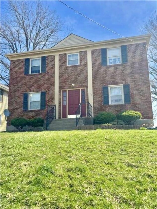
3310 Stanhope Ave Unit 4
Cincinnati, OH 45211
Today
|
Edit
Favorites
513-880-8708
-
Bedrooms
1
-
Bathrooms
1
-
Square Feet
--
-
Available
Available Now
3310 Stanhope Ave Unit 4

Favorites
About This Home
Available Now
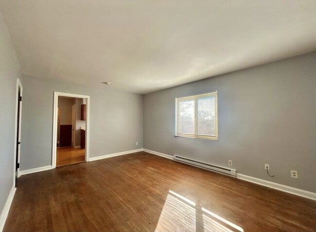
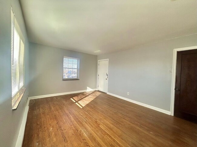
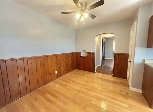
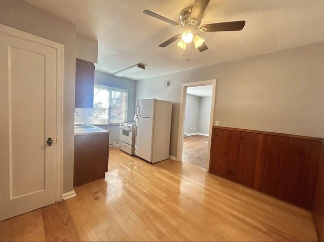
Call or text us today to schedule a tour! Important! The advertised rent amount is for the first three months of a new lease. After three months, the rent will be $775. This spacious 1-bedroom apartment is located in a four-family building at the end of a quiet cul-de-sac in Westwood. It features beautifully refinished hardwood floors and a separate dining area. The bedroom provides access to the back balcony. Coin-operated laundry is available in the basement. The tenant is responsible for electric, heat, and gas. No smoking. Pets are not allowed. Background checks are required. A credit score of 600+ or a co-signer with 700+ is required. By submitting your information on this page you consent to being contacted by the Property Manager and RentEngine via SMS, phone, or email.
3310 Stanhope Ave is an apartment community located in Hamilton County and the 45211 ZIP Code.
* Price shown is base rent. Excludes user-selected optional fees and variable or usage-based fees and required charges due at or prior to move-in or at move-out. Price, availability, fees, and any applicable rent special are subject to change without notice.
* Square footage definitions vary. Displayed square footage is approximate.
Fees and Policies
The fees below are based on community-supplied data and may exclude additional fees and utilities.
-
One-Time Basics
-
Due at Application
-
Application Fee Per ApplicantCharged per applicant.$60
-
-
Due at Application
Property Fee Disclaimer: Based on community-supplied data and independent market research. Subject to change without notice. May exclude fees for mandatory or optional services and usage-based utilities.
Contact
- Listed by TLP Property Management | TLP Property Management
- Phone Number
- Contact
Location
Get Directions
Situated about five miles northwest of Downtown Cincinnati, Westwood is the largest neighborhood in the city. Residents flock to Westwood for its many affordable historic homes and modern apartments available for rent in addition to its close proximity to I-74, I-75, and all that Downtown Cincinnati has to offer.
While Westwood is a predominantly residential neighborhood, it is also home to a slew of convenient stores and restaurants. Shopping opportunities abound in Westwood, with plenty of national retailers in Western Hills Plaza and local shops in the growing Town Hall District. Numerous neighborhood parks provide ample space to enjoy the outdoors in town as well as the sprawling 1,400-acre Mount Airy Forest, which is partially located in Westwood.
Learn more about living in Westwood
Education
| Colleges & Universities | Distance | ||
|---|---|---|---|
| Colleges & Universities | Distance | ||
| Drive: | 11 min | 4.8 mi | |
| Drive: | 15 min | 6.2 mi | |
| Drive: | 14 min | 6.4 mi | |
| Drive: | 15 min | 6.9 mi |
3310 Stanhope Ave Unit 4 is within 11 minutes or 4.8 miles from College of Mount St. Joseph. It is also near Cincinnati State and University of Cincinnati.
Transportation options available in Cincinnati include Brewery District Station, Elm & Henry, located 6.3 miles from 3310 Stanhope Ave Unit 4. 3310 Stanhope Ave Unit 4 is near Cincinnati/Northern Kentucky International, located 21.2 miles or 39 minutes away.
| Transit / Subway | Distance | ||
|---|---|---|---|
| Transit / Subway | Distance | ||
| Drive: | 15 min | 6.3 mi | |
| Drive: | 15 min | 6.5 mi | |
| Drive: | 15 min | 6.6 mi | |
| Drive: | 15 min | 6.7 mi | |
| Drive: | 16 min | 6.8 mi |
| Commuter Rail | Distance | ||
|---|---|---|---|
| Commuter Rail | Distance | ||
|
|
Drive: | 15 min | 7.1 mi |
| Airports | Distance | ||
|---|---|---|---|
| Airports | Distance | ||
|
Cincinnati/Northern Kentucky International
|
Drive: | 39 min | 21.2 mi |
Time and distance from 3310 Stanhope Ave Unit 4.
| Shopping Centers | Distance | ||
|---|---|---|---|
| Shopping Centers | Distance | ||
| Walk: | 11 min | 0.6 mi | |
| Walk: | 13 min | 0.7 mi | |
| Drive: | 3 min | 1.1 mi |
3310 Stanhope Ave Unit 4 has 3 shopping centers within 1.1 miles, which is about a 3-minute drive. The miles and minutes will be for the farthest away property.
| Parks and Recreation | Distance | ||
|---|---|---|---|
| Parks and Recreation | Distance | ||
|
Mt. Airy Forest
|
Drive: | 9 min | 3.6 mi |
|
Imago Earth Center
|
Drive: | 12 min | 4.5 mi |
|
Embshoff Woods
|
Drive: | 15 min | 5.0 mi |
|
Buttercup Valley
|
Drive: | 12 min | 5.1 mi |
|
Wilson Commons
|
Drive: | 14 min | 5.2 mi |
3310 Stanhope Ave Unit 4 has 5 parks within 5.2 miles, including Mt. Airy Forest, Imago Earth Center, and Embshoff Woods.
| Hospitals | Distance | ||
|---|---|---|---|
| Hospitals | Distance | ||
| Drive: | 9 min | 3.7 mi | |
| Drive: | 12 min | 5.7 mi | |
| Drive: | 16 min | 6.9 mi |
3310 Stanhope Ave Unit 4 has 3 hospitals within 6.9 miles, the nearest is Mercy Health - West Hospital which is 3.7 miles away and a 9 minute drive.
| Military Bases | Distance | ||
|---|---|---|---|
| Military Bases | Distance | ||
| Drive: | 75 min | 55.9 mi | |
| Drive: | 81 min | 61.0 mi | |
| Drive: | 83 min | 64.3 mi |
3310 Stanhope Ave Unit 4 has 3 military bases within 64.3 miles, the nearest is Gentile Air Force Station which is 55.9 miles away and a 75 minute drive.
You May Also Like
Similar Rentals Nearby


What Are Walk Score®, Transit Score®, and Bike Score® Ratings?
Walk Score® measures the walkability of any address. Transit Score® measures access to public transit. Bike Score® measures the bikeability of any address.
What is a Sound Score Rating?
A Sound Score Rating aggregates noise caused by vehicle traffic, airplane traffic and local sources
3310 Stanhope Ave
Cincinnati, OH 45211