
$800 / Month
33 Poe Ave Unit 1
Newark, NJ 07106
2 Weeks Ago
Favorites
33 Poe Ave Unit 1

Favorites
Check Back Soon for Upcoming Availability
| Beds | Baths | Average SF |
|---|---|---|
| 1 Bedroom 1 Bedroom 1 Br | 1 Bath 1 Bath 1 Ba | — |
Fees and Policies
The fees below are based on community-supplied data and may exclude additional fees and utilities.
- Dogs Allowed
-
Fees not specified
- Cats Allowed
-
Fees not specified
Details
Utilities Included
-
Gas
-
Water
-
Electricity
About This Property
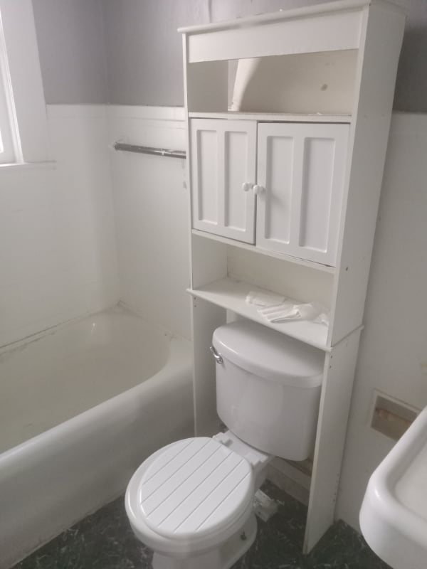
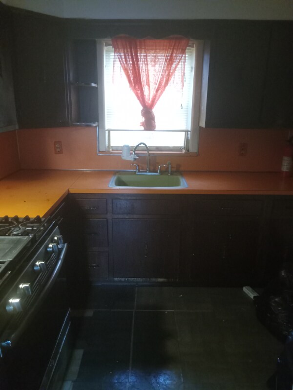
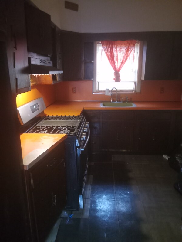
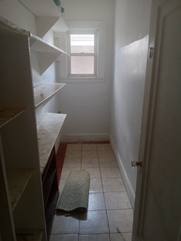
Property Id: 1065137 This is a lovely shared apartment it has 1 bedroom for you and another bedroom for another tennant..you will share the bathroom and kitchen with 1 other person..great location close to south orange and Seton hall university college..close to bus stops new jersey transit ..joe supermarket gas stations ..beauty salon..candy stores ,drug stores and more..call rashaun for more info
33 Poe Ave is an apartment community located in Essex County and the 07106 ZIP Code.
Location
Get Directions
Upper Vailsburg is a hilltop neighborhood in the city of Newark that features Victorian and Dutch colonial-style homes and a variety of local shops. The peninsula-shaped area sits on the eastern border of the city and neighbors Maplewood, South Orange, and Irvington. The neighborhood is just minutes from Seton Hall University and various medical facilities. Upper Vailsburg is known for its close-knit community and suits renters looking for a quiet neighborhood with quick commutes to greater Newark destinations and beyond, like New York City.
Learn more about living in Upper VailsburgBelow are rent ranges for similar nearby apartments
Expenses
Utilities Included
Gas, Water, Electricity
Included
Education
| Colleges & Universities | Distance | ||
|---|---|---|---|
| Colleges & Universities | Distance | ||
| Drive: | 4 min | 1.3 mi | |
| Drive: | 8 min | 3.6 mi | |
| Drive: | 7 min | 3.6 mi | |
| Drive: | 8 min | 3.9 mi |
33 Poe Ave Unit 1 is within 4 minutes or 1.3 miles from Seton Hall University. It is also near Essex County College and N.J. Inst. of Technology.
Transportation options available in Newark include Norfolk Street Light Rail Station, located 3.4 miles from 33 Poe Ave Unit 1. 33 Poe Ave Unit 1 is near Newark Liberty International, located 8.4 miles or 14 minutes away, and LaGuardia, located 30.9 miles or 48 minutes away.
| Transit / Subway | Distance | ||
|---|---|---|---|
| Transit / Subway | Distance | ||
| Drive: | 7 min | 3.4 mi | |
| Drive: | 7 min | 3.5 mi | |
| Drive: | 7 min | 3.6 mi | |
| Drive: | 8 min | 4.0 mi | |
| Drive: | 10 min | 4.8 mi |
| Commuter Rail | Distance | ||
|---|---|---|---|
| Commuter Rail | Distance | ||
| Drive: | 4 min | 1.7 mi | |
| Drive: | 5 min | 1.9 mi | |
| Drive: | 5 min | 2.2 mi | |
| Drive: | 7 min | 2.4 mi | |
| Drive: | 5 min | 2.6 mi |
| Airports | Distance | ||
|---|---|---|---|
| Airports | Distance | ||
|
Newark Liberty International
|
Drive: | 14 min | 8.4 mi |
|
LaGuardia
|
Drive: | 48 min | 30.9 mi |
Time and distance from 33 Poe Ave Unit 1.
| Shopping Centers | Distance | ||
|---|---|---|---|
| Shopping Centers | Distance | ||
| Drive: | 4 min | 1.9 mi | |
| Drive: | 5 min | 2.1 mi | |
| Drive: | 6 min | 2.2 mi |
33 Poe Ave Unit 1 has 3 shopping centers within 2.2 miles, which is about a 6-minute drive. The miles and minutes will be for the farthest away property.
| Parks and Recreation | Distance | ||
|---|---|---|---|
| Parks and Recreation | Distance | ||
|
Edison National Historic Site
|
Drive: | 8 min | 3.7 mi |
|
Newark Museum and Dreyfuss Planetarium
|
Drive: | 8 min | 4.0 mi |
|
Branch Brook Park
|
Drive: | 11 min | 5.2 mi |
|
Turtle Back Zoo
|
Drive: | 12 min | 5.5 mi |
|
Greenwood Gardens
|
Drive: | 13 min | 5.5 mi |
33 Poe Ave Unit 1 has 5 parks within 5.5 miles, including Edison National Historic Site, Newark Museum and Dreyfuss Planetarium, and Turtle Back Zoo.
| Hospitals | Distance | ||
|---|---|---|---|
| Hospitals | Distance | ||
| Drive: | 4 min | 1.9 mi | |
| Drive: | 5 min | 2.6 mi | |
| Drive: | 8 min | 3.8 mi |
33 Poe Ave Unit 1 has 3 hospitals within 3.8 miles, the nearest is East Orange General Hospital which is 1.9 miles away and a 4 minute drive.
| Military Bases | Distance | ||
|---|---|---|---|
| Military Bases | Distance | ||
| Drive: | 19 min | 12.2 mi | |
| Drive: | 25 min | 13.2 mi | |
| Drive: | 22 min | 13.6 mi |
33 Poe Ave Unit 1 has 3 military bases within 13.6 miles, the nearest is Military Ocean Terminal which is 12.2 miles away and a 19 minute drive.
You May Also Like
Similar Rentals Nearby


What Are Walk Score®, Transit Score®, and Bike Score® Ratings?
Walk Score® measures the walkability of any address. Transit Score® measures access to public transit. Bike Score® measures the bikeability of any address.
What is a Sound Score Rating?
A Sound Score Rating aggregates noise caused by vehicle traffic, airplane traffic and local sources
33 Poe Ave
Newark, NJ 07106