
$3,750 / Month
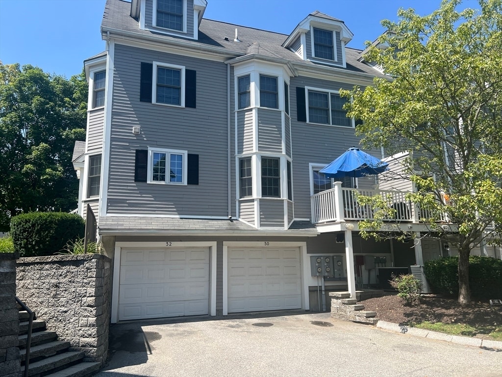
32 Westwood St
Newton, MA 02465
Today
Favorites
617-928-9200
-
Bedrooms
3
-
Bathrooms
2.5
-
Square Feet
1,800 sq ft
-
Available
Available Aug 19
Highlights
- Property is near public transit
- Jogging Path
- Cooling Available
- Park
- Shops
- Laundry Facilities
32 Westwood St

Favorites
About This Home
$3,550 deposit,
Available Aug 19
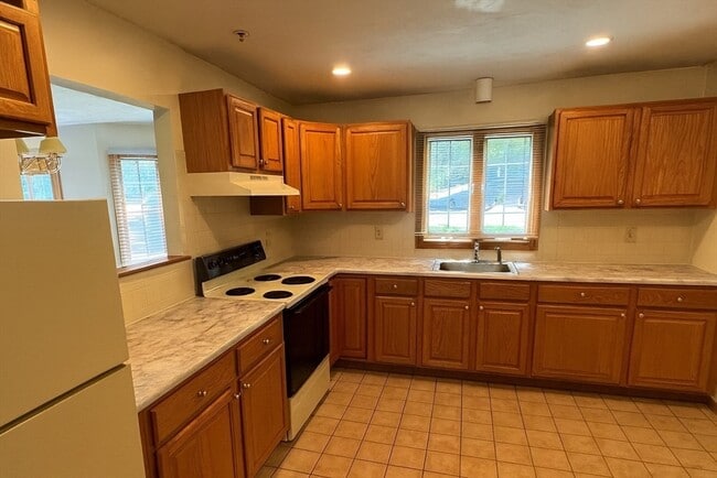
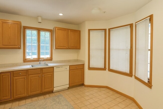
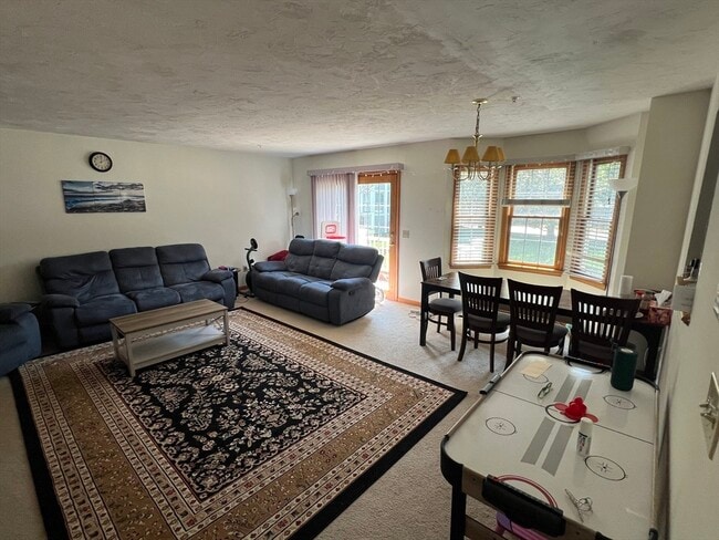
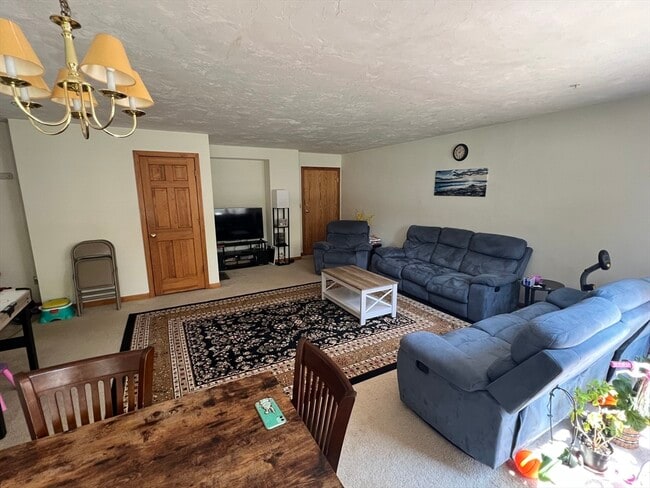
Rarely available and highly sought after 3 level Town home in convenient West Newton location! - Direct access 2 car heated garage - Additional parking in rear of complex - Easy access to Washington Street,Rt. 30,95 and I90 - Beautiful 3+ BR,2.5 Bath Townhouse on three levels - Professionally landscaped and managed - Neutral wall to wall carpeting throughout - Modern kitchen includes refrigerator,dishwasher/disposal - Washer Dryer in unit! - Glass sliders from living area lead to private deck - **Central Air** - Cat ok! - MLS# 73412310
32 Westwood St is a townhome located in Middlesex County and the 02465 ZIP Code. This area is served by the Newton attendance zone.
* Price shown is base rent and may not include non-optional fees and utilities.
Price, availability, fees, and any applicable rent special are subject to change without notice.
* Square footage definitions vary. Displayed square footage is approximate.
Home Details
Accessible Home Design
Entry on the 1st floor
Bedrooms and Bathrooms
2.5 Bathrooms
3 Bedrooms
Home Design
Property Attached
Interior Spaces
1,800 Sq Ft Home
Kitchen
Range
Dishwasher
Disposal
Laundry
Dryer
Washer
Listing and Financial Details
Security Deposit $3,550
Property Available on 8/19/25
Rent includes water, sewer, snow removal, gardener
Location
Property is near public transit
Parking
2 Car Parking Spaces
Utilities
Cooling Available
Heating System Uses Natural Gas
Community Details
Amenities
Shops
Laundry Facilities
Common Area
Overview
No Home Owners Association
Pet Policy
Call for details about the types of pets allowed
Recreation
Jogging Path
Park
Bike Trail
Fees and Policies
The fees below are based on community-supplied data and may exclude additional fees and utilities.
Pet policies are negotiable.
Contact
- Listed by Tammy Depamphilis | Exclusive Realty
- Phone Number
-
Source
 MLS Property Information Network
The property listing data and information set forth herein were provided to MLS Property Information Network, Inc. from third party sources, including sellers, lessors and public records, and were compiled by MLS Property Information Network, Inc. The property listing data and information are for the personal, non-commercial use of consumers having a good faith interest in purchasing or leasing listed properties of the type displayed to them and may not be used for any purpose other than to identify prospective properties which such consumers may have a good faith interest in purchasing or leasing. MLS Property Information Network, Inc. and its subscribers disclaim any and all representations and warranties as to the accuracy of the property listing data and information set forth herein. All properties are subject to prior sale, change or withdrawal. Copyright © 2025 MLS Property Information Network, Inc. All rights reserved.
Location
Get Directions
Amenities
- Dishwasher
- Disposal
- Range
- Refrigerator
An affluent suburb just 10 miles west of downtown Boston, Newton is a family-friendly area with plentiful amenities. Newton, Massachusetts houses part of Boston College, as well as a few private universities. Newton prides itself on its great public school district, Newton Public Schools, offering options like Newton South High School. Luxury apartment and condo rentals are spread throughout Newton, giving you a wide range of upscale options to choose from.
Residents appreciate access to the Massachusetts Bay Transportation Authority’s commuter rail, affording them easy commutes to neighboring areas. Enjoy shopping malls like the Shops at Chestnut Hill and Chestnut Hill Square for popular retailers and a variety of eateries. Get outdoors at Cold Spring Park, complete with nature trails and sports fields and courts.
Learn more about living in Newton
Education
| Colleges & Universities | Distance | ||
|---|---|---|---|
| Colleges & Universities | Distance | ||
| Drive: | 9 min | 3.5 mi | |
| Drive: | 10 min | 3.8 mi | |
| Drive: | 10 min | 4.6 mi | |
| Drive: | 12 min | 5.0 mi |
32 Westwood St is within 9 minutes or 3.5 miles from Brandeis University. It is also near Bentley University and Boston College.
Schools


Public Elementary School
Grades K-5
368 Students
Attendance Zone
Public Elementary School
Grades PK-5
383 Students
Nearby
Public Middle School
Grades 6-8
920 Students
Attendance Zone
Public High School
Grades 9-12
2,099 Students
Attendance Zone
Private Elementary, Middle & High School
Grades 3-12
161 Students
Nearby
Private Elementary & Middle School
Grades PK-9
517 Students
Nearby
School data provided by
 The GreatSchools Rating helps parents compare schools within a state based on a variety of school quality indicators and provides a helpful picture of how effectively each school serves all of its students. Ratings are on a scale of 1 (below average) to 10 (above average) and can include test scores, college readiness, academic progress, advanced courses, equity, discipline and attendance data. We also advise parents to visit schools, consider other information on school performance and programs, and consider family needs as part of the school selection process.
View GreatSchools Rating Methodology
Data provided by GreatSchools.org © 2025. All rights reserved.
View GreatSchools Rating Methodology
Data provided by GreatSchools.org © 2025. All rights reserved.
Transportation options available in Newton include Riverside Station, located 1.6 miles from 32 Westwood St. 32 Westwood St is near General Edward Lawrence Logan International, located 13.6 miles or 22 minutes away, and Worcester Regional, located 39.3 miles or 57 minutes away.
| Transit / Subway | Distance | ||
|---|---|---|---|
| Transit / Subway | Distance | ||
|
|
Drive: | 5 min | 1.6 mi |
|
|
Drive: | 4 min | 1.7 mi |
|
|
Drive: | 6 min | 2.5 mi |
|
|
Drive: | 8 min | 3.1 mi |
|
|
Drive: | 8 min | 3.3 mi |
| Commuter Rail | Distance | ||
|---|---|---|---|
| Commuter Rail | Distance | ||
| Drive: | 7 min | 2.4 mi | |
|
|
Drive: | 7 min | 3.1 mi |
|
|
Drive: | 8 min | 4.5 mi |
|
|
Drive: | 10 min | 5.8 mi |
|
|
Drive: | 11 min | 6.6 mi |
| Airports | Distance | ||
|---|---|---|---|
| Airports | Distance | ||
|
General Edward Lawrence Logan International
|
Drive: | 22 min | 13.6 mi |
|
Worcester Regional
|
Drive: | 57 min | 39.3 mi |
Time and distance from 32 Westwood St.
| Shopping Centers | Distance | ||
|---|---|---|---|
| Shopping Centers | Distance | ||
| Walk: | 12 min | 0.6 mi | |
| Drive: | 4 min | 1.9 mi | |
| Drive: | 7 min | 2.5 mi |
32 Westwood St has 3 shopping centers within 2.5 miles, which is about a 7-minute walk. The miles and minutes will be for the farthest away property.
| Parks and Recreation | Distance | ||
|---|---|---|---|
| Parks and Recreation | Distance | ||
|
Hemlock Gorge Reservation
|
Drive: | 9 min | 3.8 mi |
|
Land's Sake Farm
|
Drive: | 9 min | 4.0 mi |
|
Hammond Pond Reservation
|
Drive: | 9 min | 4.0 mi |
|
Beaver Brook Reservation
|
Drive: | 10 min | 4.4 mi |
|
Cutler Park Reservation
|
Drive: | 11 min | 5.9 mi |
32 Westwood St has 5 parks within 5.9 miles, including Hemlock Gorge Reservation, Hammond Pond Reservation, and Land's Sake Farm.
| Hospitals | Distance | ||
|---|---|---|---|
| Hospitals | Distance | ||
| Drive: | 4 min | 1.8 mi | |
| Drive: | 7 min | 2.5 mi | |
| Drive: | 10 min | 4.8 mi |
32 Westwood St has 3 hospitals within 4.8 miles, the nearest is Newton - Wellesley Hospital which is 1.8 miles away and a 4 minute drive.
| Military Bases | Distance | ||
|---|---|---|---|
| Military Bases | Distance | ||
| Drive: | 18 min | 9.5 mi | |
| Drive: | 20 min | 10.6 mi |
32 Westwood St is 9.5 miles from US Military Reservation, and is convenient to other military bases, including Hanscom Air Force Base.
You May Also Like
Similar Rentals Nearby


What Are Walk Score®, Transit Score®, and Bike Score® Ratings?
Walk Score® measures the walkability of any address. Transit Score® measures access to public transit. Bike Score® measures the bikeability of any address.
What is a Sound Score Rating?
A Sound Score Rating aggregates noise caused by vehicle traffic, airplane traffic and local sources

32 Westwood St
Newton, MA 02465