
Stonebridge of Arlington Heights
650 W Rand Rd,
Arlington Heights, IL 60004
$1,609 - $4,182
1-2 Beds
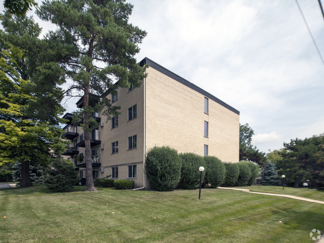

ALL brick building with elevator close to down town Arlington heights Close to Tran station, Restaurants and NW Community Hospital Walk to train Wasters and Dryers on every floor Security entrance Off street assigned Parking
315 SALEM LLC is an apartment community located in Cook County and the 60005 ZIP Code. This area is served by the Arlington Heights School District 25 attendance zone.
Unique Features
Washer/Dryer
Air Conditioning
Hardwood Floors
Walk-In Closets
Downtown Arlington Heights encompasses a central part of Arlington Heights that’s home to the bulk of the city’s dining, retail, and entertainment options. Arlington Heights is a popular municipality on the outskirts of Chicago because it blends urban convenience in a more laidback suburban package. Downtown Arlington Heights centers on a collection of diverse local restaurants, shops, an upscale movie theater, and newly constructed apartment complexes all conveniently located off Northwest Highway. This is a very walkable area, so renters looking for a convenient apartment where all the necessities are close at hand will love Downtown Arlington Heights. Of course, the rest of this family-friendly area is easily explored in minutes, and Chicago is just 26 miles southeast via Interstate 90.
Learn more about living in Downtown Arlington HeightsCompare neighborhood and city base rent averages by bedroom.
| Downtown Arlington Heights | Arlington Heights, IL | |
|---|---|---|
| Studio | $1,940 | $1,906 |
| 1 Bedroom | $2,018 | $1,950 |
| 2 Bedrooms | $2,390 | $2,398 |
| 3 Bedrooms | $1,796 | $2,692 |
| Colleges & Universities | Distance | ||
|---|---|---|---|
| Colleges & Universities | Distance | ||
| Drive: | 12 min | 5.3 mi | |
| Drive: | 12 min | 5.6 mi | |
| Drive: | 14 min | 7.1 mi | |
| Drive: | 23 min | 13.2 mi |


Transportation options available in Arlington Heights include Rosemont Station, located 12.3 miles from 315 SALEM LLC. 315 SALEM LLC is near Chicago O'Hare International, located 12.5 miles or 21 minutes away, and Chicago Midway International, located 33.2 miles or 48 minutes away.
| Transit / Subway | Distance | ||
|---|---|---|---|
| Transit / Subway | Distance | ||
|
|
Drive: | 19 min | 12.3 mi |
|
|
Drive: | 23 min | 13.0 mi |
| Commuter Rail | Distance | ||
|---|---|---|---|
| Commuter Rail | Distance | ||
|
|
Walk: | 11 min | 0.6 mi |
|
|
Drive: | 3 min | 1.4 mi |
|
|
Drive: | 6 min | 3.6 mi |
|
|
Drive: | 10 min | 4.4 mi |
|
|
Drive: | 10 min | 5.5 mi |
| Airports | Distance | ||
|---|---|---|---|
| Airports | Distance | ||
|
Chicago O'Hare International
|
Drive: | 21 min | 12.5 mi |
|
Chicago Midway International
|
Drive: | 48 min | 33.2 mi |
Scores provided by
Traffic
ActiveAirport
CalmBusinesses
ActiveScores provided by
HowLoud What is a Sound Score Rating? A Sound Score Rating aggregates noise caused by vehicle traffic, airplane traffic and local sources. How It WorksTime and distance from 315 SALEM LLC.
| Shopping Centers | Distance | ||
|---|---|---|---|
| Shopping Centers | Distance | ||
| Walk: | 6 min | 0.4 mi | |
| Walk: | 7 min | 0.4 mi | |
| Walk: | 10 min | 0.5 mi |
| Parks and Recreation | Distance | ||
|---|---|---|---|
| Parks and Recreation | Distance | ||
|
Dam No. 2 Woods
|
Drive: | 11 min | 5.7 mi |
|
Busse Lake / Busse Woods South
|
Drive: | 17 min | 6.0 mi |
|
Ned Brown / Busse Woods Preserve
|
Drive: | 15 min | 6.0 mi |
|
Spring Valley and Vera Meineke Nature Center
|
Drive: | 15 min | 8.2 mi |
|
Buffalo Creek
|
Drive: | 15 min | 8.3 mi |
| Hospitals | Distance | ||
|---|---|---|---|
| Hospitals | Distance | ||
| Drive: | 5 min | 2.6 mi | |
| Drive: | 11 min | 6.8 mi | |
| Drive: | 13 min | 7.3 mi |
| Military Bases | Distance | ||
|---|---|---|---|
| Military Bases | Distance | ||
| Drive: | 7 min | 2.9 mi | |
| Drive: | 39 min | 25.9 mi | |
| Drive: | 42 min | 27.4 mi |
What Are Walk Score®, Transit Score®, and Bike Score® Ratings?
Walk Score® measures the walkability of any address. Transit Score® measures access to public transit. Bike Score® measures the bikeability of any address.
What is a Sound Score Rating?
A Sound Score Rating aggregates noise caused by vehicle traffic, airplane traffic and local sources.

315 N Salem Ave
Arlington Heights, IL 60005


