
$695
/ Month
311 Garrard St Unit 5
Covington, KY 41011
2 Weeks Ago
Favorites
311 Garrard St Unit 5

Favorites
Check Back Soon for Upcoming Availability
| Beds | Baths | Average SF |
|---|---|---|
| 1 Bedroom 1 Bedroom 1 Br | 1 Bath 1 Bath 1 Ba | 650 SF |
About This Property
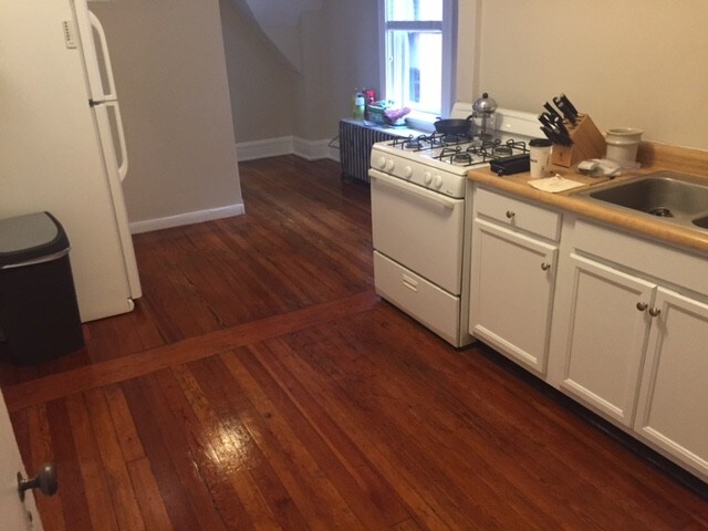
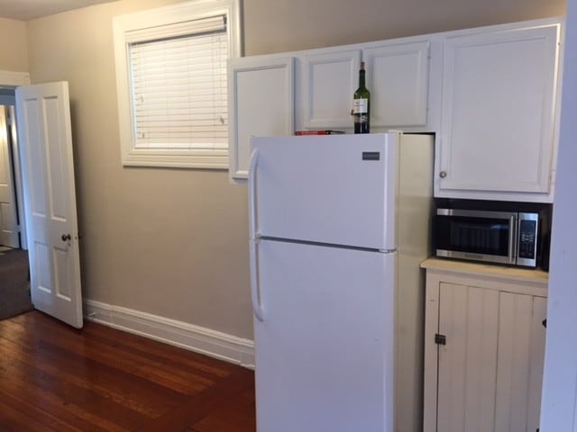
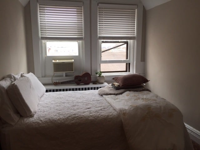
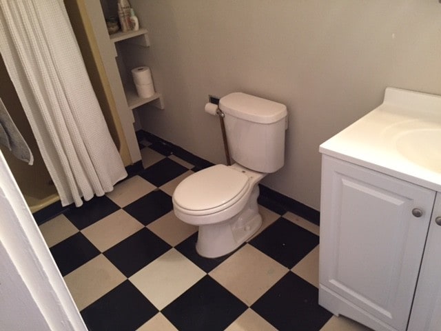
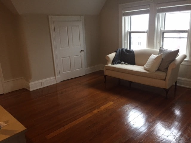
Historic Apartment located in the Licking Riverside area of Covington. Just two blocks from Suspension Bridge.Walk to Newport on the Levee or downtown. Licking Riverside is just an awesome location. If unaware of this neighborhood along the riverfront of Covington you must check it out. This apartment includes coin operated washer dryer in basement.Window AC provided. Red Bike located on this block along with a Southbank shuttle stop that leaves for Downtown every 15 minutes when you don't feel like walking. Apartment is located on third floor. Free Radiant Heat! 9 Unit Historic Apartment building designed in 1880 by famous local Architect Samuel Hannaford. Walking Distance to several Bars and Restaurants along with downtown Cincinnati.Washer and Dryer in basement. Off-Street Parking available for a $50 fee.
311 Garrard St is an apartment community located in Kenton County and the 41011 ZIP Code.
Location
Get Directions
Northern Kentucky is a sprawling region located just south of Cincinnati, Ohio. The Ohio River hugs the northern, eastern, and western portions of the region, serving as a scenic destination for all kinds of outdoor recreation throughout the year. Florence, Dayton, Newport, Covington, Burlington, and Highland Heights are among the many communities included in the Northern Kentucky region.
Each community in Northern Kentucky offers its own unique identity and sense of character. The rentals in the area are just as diverse as Northern Kentucky itself, ranging from luxury apartments to charming houses and everything in between. Getting around the region is a breeze with convenience to Interstates 71, 75, 275, and 471.
Learn more about living in Northern KentuckyBelow are rent ranges for similar nearby apartments
Education
| Colleges & Universities | Distance | ||
|---|---|---|---|
| Colleges & Universities | Distance | ||
| Drive: | 11 min | 4.6 mi | |
| Drive: | 12 min | 5.6 mi | |
| Drive: | 11 min | 6.4 mi | |
| Drive: | 13 min | 6.4 mi |
311 Garrard St Unit 5 is within 11 minutes or 6.4 miles from University of Cincinnati. It is also near Univ. of Cincinnati, Medical and Cincinnati State.
Transportation options available in Covington include The Banks Station, 2Nd & Main, located 0.9 mile from 311 Garrard St Unit 5. 311 Garrard St Unit 5 is near Cincinnati/Northern Kentucky International, located 13.5 miles or 27 minutes away.
| Transit / Subway | Distance | ||
|---|---|---|---|
| Transit / Subway | Distance | ||
| Walk: | 16 min | 0.9 mi | |
| Drive: | 5 min | 1.2 mi | |
| Drive: | 5 min | 1.3 mi | |
| Drive: | 5 min | 1.4 mi | |
| Drive: | 6 min | 1.6 mi |
| Commuter Rail | Distance | ||
|---|---|---|---|
| Commuter Rail | Distance | ||
|
|
Drive: | 8 min | 3.3 mi |
| Airports | Distance | ||
|---|---|---|---|
| Airports | Distance | ||
|
Cincinnati/Northern Kentucky International
|
Drive: | 27 min | 13.5 mi |
Time and distance from 311 Garrard St Unit 5.
| Shopping Centers | Distance | ||
|---|---|---|---|
| Shopping Centers | Distance | ||
| Walk: | 17 min | 0.9 mi | |
| Drive: | 5 min | 1.3 mi | |
| Drive: | 4 min | 1.4 mi |
311 Garrard St Unit 5 has 3 shopping centers within 1.4 miles, which is about a 4-minute walk. The miles and minutes will be for the farthest away property.
| Parks and Recreation | Distance | ||
|---|---|---|---|
| Parks and Recreation | Distance | ||
|
Newport Aquarium
|
Drive: | 4 min | 1.2 mi |
|
John G. & Phyllis W. Smale Riverfront Park
|
Drive: | 5 min | 2.0 mi |
|
Theodore M. Berry Friendship Park
|
Drive: | 6 min | 2.2 mi |
|
Krohn Conservatory
|
Drive: | 7 min | 2.9 mi |
|
William H. Taft National Historic Site
|
Drive: | 9 min | 3.5 mi |
311 Garrard St Unit 5 has 5 parks within 3.5 miles, including Newport Aquarium, John G. & Phyllis W. Smale Riverfront Park, and Theodore M. Berry Friendship Park.
| Hospitals | Distance | ||
|---|---|---|---|
| Hospitals | Distance | ||
| Drive: | 7 min | 3.5 mi | |
| Drive: | 9 min | 3.8 mi | |
| Drive: | 10 min | 4.3 mi |
311 Garrard St Unit 5 has 3 hospitals within 4.3 miles, the nearest is St. Elizabeth Ft. Thomas Hospital which is 3.5 miles away and a 7 minute drive.
| Military Bases | Distance | ||
|---|---|---|---|
| Military Bases | Distance | ||
| Drive: | 74 min | 56.8 mi | |
| Drive: | 80 min | 61.9 mi | |
| Drive: | 82 min | 65.2 mi |
311 Garrard St Unit 5 has 3 military bases within 65.2 miles, the nearest is Gentile Air Force Station which is 56.8 miles away and a 74 minute drive.
You May Also Like
Similar Rentals Nearby


What Are Walk Score®, Transit Score®, and Bike Score® Ratings?
Walk Score® measures the walkability of any address. Transit Score® measures access to public transit. Bike Score® measures the bikeability of any address.
What is a Sound Score Rating?
A Sound Score Rating aggregates noise caused by vehicle traffic, airplane traffic and local sources
311 Garrard St
Covington, KY 41011