
$1,500 / Month
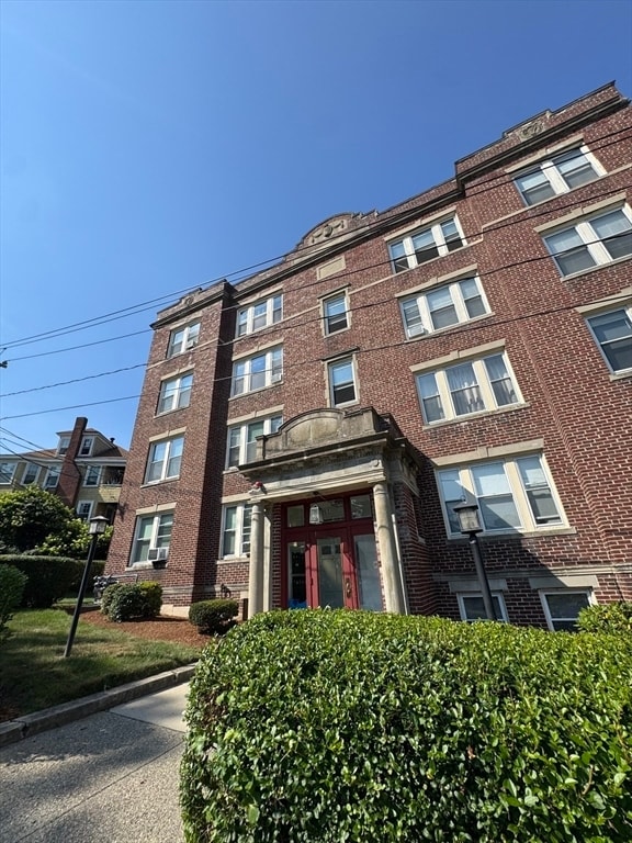
31 Dennison Ave Unit D
Framingham, MA 01702
Today
Favorites
508-904-1667
-
Bedrooms
1
-
Bathrooms
1
-
Square Feet
600 sq ft
-
Available
Available Aug 15
Highlights
- Medical Services
- Property is near public transit
- No Cooling
- Park
- Shops
- 1-Story Property
31 Dennison Ave Unit D

Favorites
About This Home
$1,500 deposit,
Available Aug 15
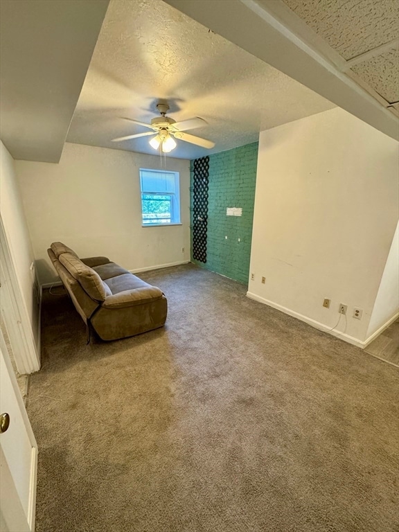
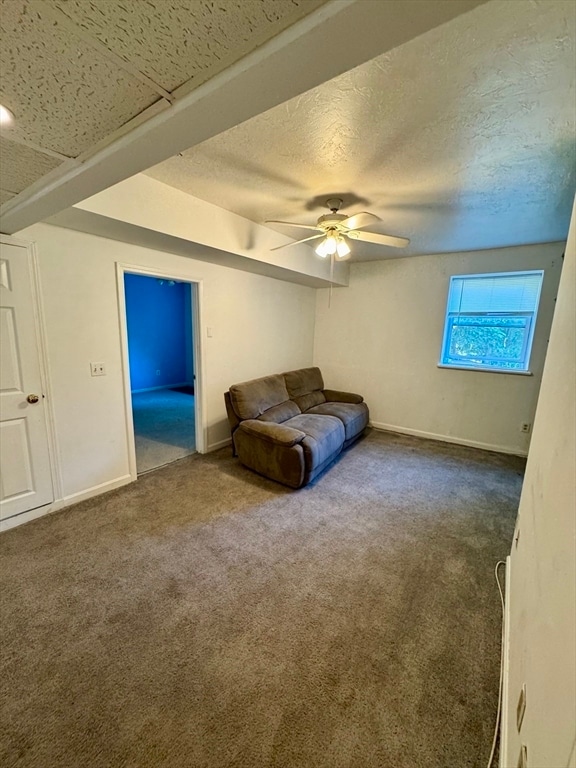
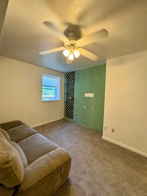
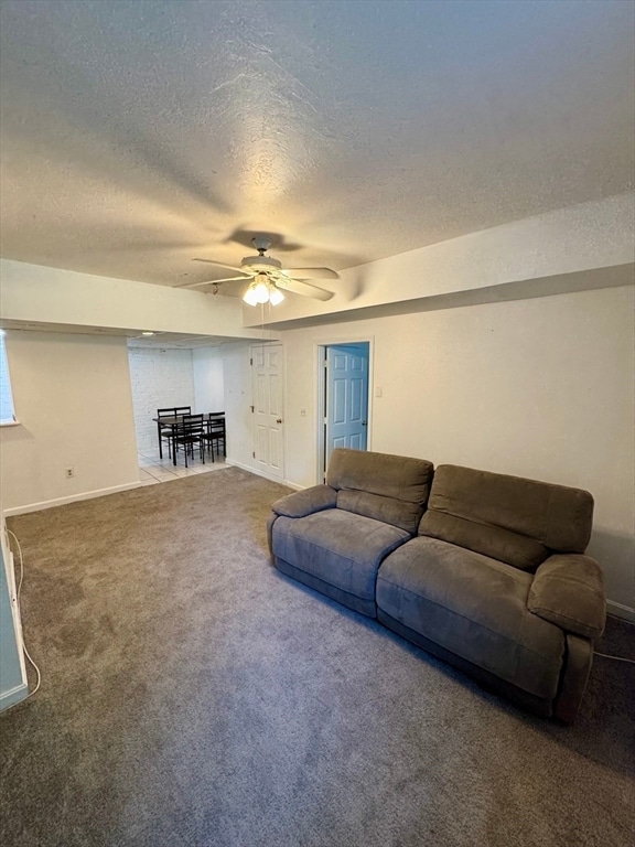
Cozy and comfortable basement-level one-bedroom apartment available August 15th. Features an updated kitchen,carpet throughout the living and bedroom areas,and will be freshly painted prior to move-in. All utilities are included in the rent for added convenience. Located close to shops,dining,and public transportation. Includes one off-street parking space and access to coin-op laundry in the building. All applicants are subject to a credit/background check and references. Move in funds include first,last and security. MLS# 73411945
31 Dennison Ave is an apartment community located in Middlesex County and the 01702 ZIP Code.
* Price shown is base rent and may not include non-optional fees and utilities.
Price, availability, fees, and any applicable rent special are subject to change without notice.
* Square footage definitions vary. Displayed square footage is approximate.
Home Details
Accessible Home Design
Entry on the 1st floor
Bedrooms and Bathrooms
1 Full Bathroom
1 Bedroom
Home Design
Apartment
Interior Spaces
1-Story Property
600 Sq Ft Home
Listing and Financial Details
Security Deposit $1,500
Property Available on 8/15/25
12 Month Lease Term
Assessor Parcel Number 490429
Rent includes heat, hot water, electricity, gas, water, sewer, trash collection, snow removal, gardener
Location
Property is near public transit
Lot Details
0.52 Acre Lot
Parking
1 Car Parking Space
Utilities
No Cooling
Heating System Uses Steam
Community Details
Amenities
Medical Services
Shops
Laundry Facilities
Overview
No Home Owners Association
Pet Policy
Call for details about the types of pets allowed
Recreation
Park
Contact
- Listed by Winter Properties Realty Group | Century 21 Custom Home Realty
- Phone Number
Location
Get Directions
Just west of Boston and East of Worcester sits Metro West, a region that houses a group of towns and cities with significant historical backgrounds. A total of 19 municipalities make up the core of this community, but other municipalities are considered to be a part of the Interstate 495/Metro West Corridor.
Learn more about living in Metro West
Education
| Colleges & Universities | Distance | ||
|---|---|---|---|
| Colleges & Universities | Distance | ||
| Drive: | 6 min | 2.3 mi | |
| Drive: | 16 min | 6.7 mi | |
| Drive: | 17 min | 9.1 mi | |
| Drive: | 22 min | 12.3 mi |
31 Dennison Ave Unit D is within 6 minutes or 2.3 miles from Framingham State College. It is also near Wellesley College and Babson College.
Transportation options available in Framingham include Woodland Station, located 10.5 miles from 31 Dennison Ave Unit D. 31 Dennison Ave Unit D is near General Edward Lawrence Logan International, located 24.4 miles or 37 minutes away, and Worcester Regional, located 26.2 miles or 46 minutes away.
| Transit / Subway | Distance | ||
|---|---|---|---|
| Transit / Subway | Distance | ||
|
|
Drive: | 18 min | 10.5 mi |
|
|
Drive: | 20 min | 11.1 mi |
|
|
Drive: | 19 min | 11.3 mi |
| Commuter Rail | Distance | ||
|---|---|---|---|
| Commuter Rail | Distance | ||
|
|
Walk: | 16 min | 0.9 mi |
|
|
Walk: | 18 min | 1.0 mi |
|
|
Drive: | 5 min | 1.7 mi |
|
|
Drive: | 9 min | 4.2 mi |
|
|
Drive: | 16 min | 5.2 mi |
| Airports | Distance | ||
|---|---|---|---|
| Airports | Distance | ||
|
General Edward Lawrence Logan International
|
Drive: | 37 min | 24.4 mi |
|
Worcester Regional
|
Drive: | 46 min | 26.2 mi |
Time and distance from 31 Dennison Ave Unit D.
| Shopping Centers | Distance | ||
|---|---|---|---|
| Shopping Centers | Distance | ||
| Walk: | 10 min | 0.6 mi | |
| Walk: | 18 min | 0.9 mi | |
| Drive: | 4 min | 1.5 mi |
31 Dennison Ave Unit D has 3 shopping centers within 1.5 miles, which is about a 4-minute walk. The miles and minutes will be for the farthest away property.
| Parks and Recreation | Distance | ||
|---|---|---|---|
| Parks and Recreation | Distance | ||
|
Callahan State Park
|
Drive: | 9 min | 4.4 mi |
|
Cowassock Woods and Ashland Town Forest
|
Drive: | 10 min | 4.5 mi |
|
Hop Brook Natural Area
|
Drive: | 9 min | 4.6 mi |
|
Garden in the Woods
|
Drive: | 12 min | 5.7 mi |
|
Cochituate State Park
|
Drive: | 18 min | 10.8 mi |
31 Dennison Ave Unit D has 5 parks within 10.8 miles, including Cochituate State Park, Callahan State Park, and Cowassock Woods and Ashland Town Forest.
| Hospitals | Distance | ||
|---|---|---|---|
| Hospitals | Distance | ||
| Walk: | 11 min | 0.6 mi | |
| Drive: | 17 min | 10.2 mi | |
| Drive: | 19 min | 11.0 mi |
31 Dennison Ave Unit D has 3 hospitals within 11.0 miles, the nearest is MetroWest Medical Center which is 0.6 mile away and a 11 minute walk.
| Military Bases | Distance | ||
|---|---|---|---|
| Military Bases | Distance | ||
| Drive: | 9 min | 4.5 mi | |
| Drive: | 33 min | 16.9 mi |
31 Dennison Ave Unit D is 4.5 miles from US Military Reservation, and is convenient to other military bases, including Hanscom Air Force Base.
You May Also Like
Similar Rentals Nearby


What Are Walk Score®, Transit Score®, and Bike Score® Ratings?
Walk Score® measures the walkability of any address. Transit Score® measures access to public transit. Bike Score® measures the bikeability of any address.
What is a Sound Score Rating?
A Sound Score Rating aggregates noise caused by vehicle traffic, airplane traffic and local sources
31 Dennison Ave
Framingham, MA 01702