$1,600
/ Month
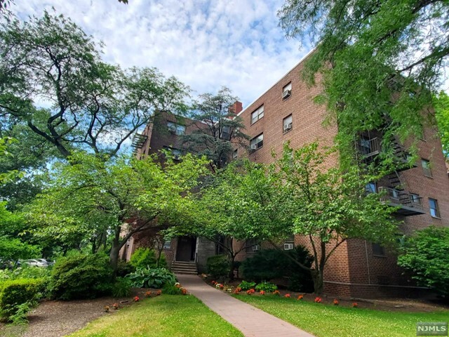
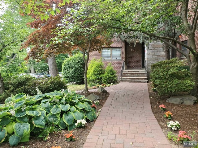
3001 Edwin Ave Unit 2D
Fort Lee, NJ 07024
2 Weeks Ago
|
Edit
Favorites
3001 Edwin Ave Unit 2D

Favorites
Check Back Soon for Upcoming Availability
| Beds | Baths | Average SF |
|---|---|---|
| Studio Studio 0 Br | 1 Bath 1 Bath 1 Ba | — |
About This Property
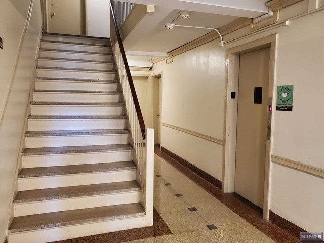
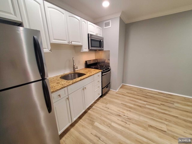
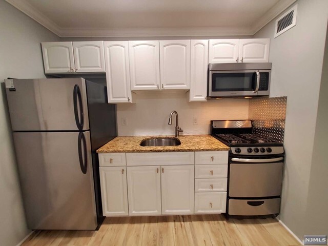
2ND FLOOR LARGE STUDIO APT. NEWLY PAINTED IN VERY RELAXING COLOR. NEW WOODEN FLOOR THROUGHOUT. NO CARPET IS NEEDED. NEWLY RENOVATED BATHROOM AND CLOSETS. SS APPLIANCES. LAUNDRY ON 5TH FLR. PARKING PERMIT $300/Y. ONLY A FEW STEPS TO SHOPPING, NYC TRANSPORTATION, AND RESTAURANTS. OFFER WITH 2 YEAR INCOME TAX RETURNS AND CREDIT REPORT PLS. 3:1 INCOME RATIO TO QUALIFY.
3001 Edwin Ave is an apartment community located in Bergen County and the 07024 ZIP Code.
Location
Get Directions
Fort Lee sits atop the Palisades cliffs overlooking the Hudson River, just minutes from Manhattan via the George Washington Bridge. The borough combines residential high-rises with established neighborhoods, while its downtown area along Main Street serves as a community hub. The area is particularly known for its Korean dining scene along Main Street, where restaurants and specialty shops contribute to the local culture. Current rental trends show average apartment rates of $3,121, though the market has seen a slight decline of -3.7% over the past year, with one-bedroom units averaging $3,083 and two-bedrooms at $3,774.
The Barrymore Film Center celebrates Fort Lee's history as an early filmmaking hub through screenings and exhibits. Outdoor enthusiasts appreciate Constitution Park and Fort Lee Historic Park, which provides views of the Hudson River and Manhattan skyline.
Learn more about living in Fort Lee
Education
| Colleges & Universities | Distance | ||
|---|---|---|---|
| Colleges & Universities | Distance | ||
| Drive: | 6 min | 3.5 mi | |
| Drive: | 10 min | 4.9 mi | |
| Drive: | 10 min | 5.1 mi | |
| Drive: | 9 min | 5.3 mi |
3001 Edwin Ave Unit 2D is within 6 minutes or 3.5 miles from Yeshiva University, Wilf. It is also near Bronx Community College and The City College of New York.
Transportation options available in Fort Lee include 181 Street (A Line), located 2.5 miles from 3001 Edwin Ave Unit 2D. 3001 Edwin Ave Unit 2D is near LaGuardia, located 12.0 miles or 22 minutes away, and Newark Liberty International, located 17.8 miles or 21 minutes away.
| Transit / Subway | Distance | ||
|---|---|---|---|
| Transit / Subway | Distance | ||
|
|
Drive: | 5 min | 2.5 mi |
|
|
Drive: | 5 min | 2.9 mi |
|
|
Drive: | 6 min | 2.9 mi |
|
|
Drive: | 6 min | 3.2 mi |
|
|
Drive: | 7 min | 3.5 mi |
| Commuter Rail | Distance | ||
|---|---|---|---|
| Commuter Rail | Distance | ||
| Drive: | 7 min | 4.0 mi | |
|
|
Drive: | 9 min | 4.8 mi |
|
|
Drive: | 10 min | 4.8 mi |
|
|
Drive: | 13 min | 5.7 mi |
|
|
Drive: | 12 min | 6.2 mi |
| Airports | Distance | ||
|---|---|---|---|
| Airports | Distance | ||
|
LaGuardia
|
Drive: | 22 min | 12.0 mi |
|
Newark Liberty International
|
Drive: | 21 min | 17.8 mi |
Time and distance from 3001 Edwin Ave Unit 2D.
| Shopping Centers | Distance | ||
|---|---|---|---|
| Shopping Centers | Distance | ||
| Walk: | 2 min | 0.1 mi | |
| Walk: | 15 min | 0.8 mi | |
| Drive: | 3 min | 1.2 mi |
3001 Edwin Ave Unit 2D has 3 shopping centers within 1.2 miles, which is about a 3-minute drive. The miles and minutes will be for the farthest away property.
| Parks and Recreation | Distance | ||
|---|---|---|---|
| Parks and Recreation | Distance | ||
|
Flat Rock Brook Nature Center
|
Drive: | 3 min | 1.3 mi |
|
Overpeck County Park
|
Drive: | 5 min | 2.5 mi |
|
J Hood Wright Park
|
Drive: | 6 min | 2.8 mi |
|
Fort Tryon Park
|
Drive: | 9 min | 3.8 mi |
|
Fort Washington Park
|
Drive: | 10 min | 5.7 mi |
3001 Edwin Ave Unit 2D has 5 parks within 5.7 miles, including Flat Rock Brook Nature Center, Overpeck County Park, and J Hood Wright Park.
| Hospitals | Distance | ||
|---|---|---|---|
| Hospitals | Distance | ||
| Drive: | 6 min | 3.2 mi | |
| Drive: | 6 min | 3.2 mi | |
| Drive: | 5 min | 3.7 mi |
3001 Edwin Ave Unit 2D has 3 hospitals within 3.7 miles, the nearest is New York State Psychiatric Institute which is 3.2 miles away and a 6 minute drive.
| Military Bases | Distance | ||
|---|---|---|---|
| Military Bases | Distance | ||
| Drive: | 23 min | 13.6 mi |
3001 Edwin Ave Unit 2D is 13.6 miles and a 23 minute drive from Fort Totten US Govt Reservation.
You May Also Like
How do I access Social Services in New Jersey?
Statewide service is free, confidential, multilingual and always open. Three easy ways to reach Social Services in NJ: Dial 2-1-1; text your zip code to 898-211; or chat at https://www.nj211.org
Similar Rentals Nearby


What Are Walk Score®, Transit Score®, and Bike Score® Ratings?
Walk Score® measures the walkability of any address. Transit Score® measures access to public transit. Bike Score® measures the bikeability of any address.
What is a Sound Score Rating?
A Sound Score Rating aggregates noise caused by vehicle traffic, airplane traffic and local sources

3001 Edwin Ave
Fort Lee, NJ 07024