
30 N 12th St
Newark, NJ 07107
-
Bedrooms
3
-
Bathrooms
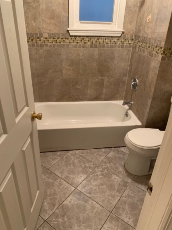
1
-
Square Feet
1,000 sq ft
-
Available
Available Now
Highlights
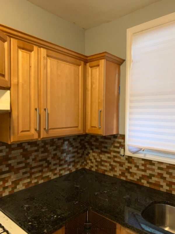
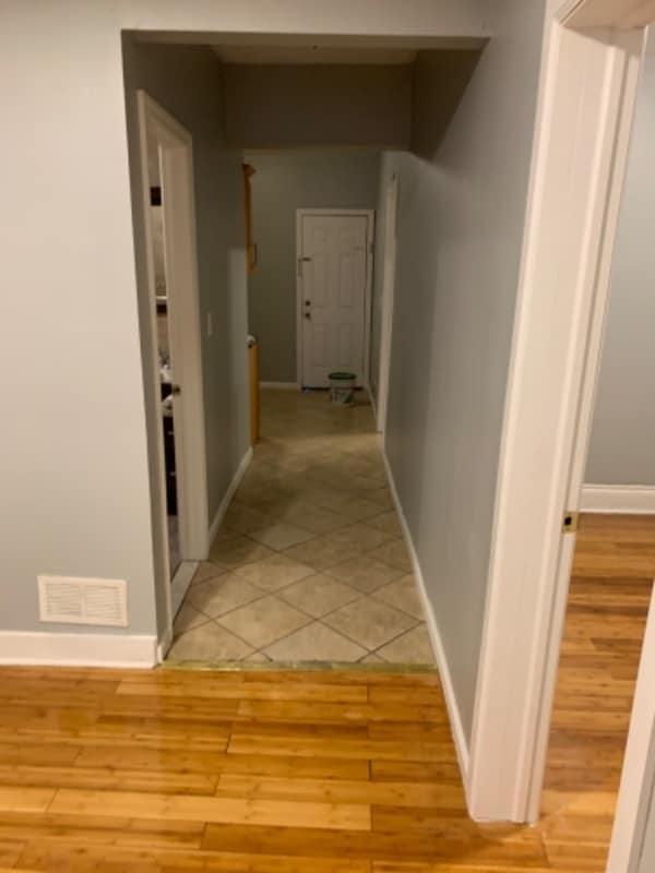
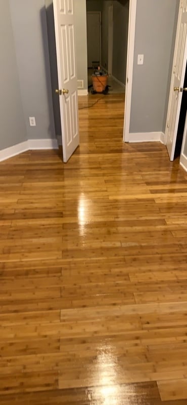
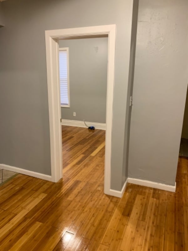
- Hardwood Floors
- Fenced Lot
- Security System

About This Home
Property Id: 243742 Section 8 Programs Welcome. 3 bedroom apartment 1bath. stainless steelappliances. FAMILY friendly block. Rented by Owner
30 N 12th St is an apartment community located in Essex County and the 07107 ZIP Code.
Fees and Policies
The fees below are based on community-supplied data and may exclude additional fees and utilities. Use the Cost Calculator to add these fees to the base price.
- One-Time Basics
- Due at Move-In
- Security Deposit - RefundableCharged per unit.$2,200
- Due at Move-In
Property Fee Disclaimer: Based on community-supplied data and independent market research. Subject to change without notice. May exclude fees for mandatory or optional services and usage-based utilities.
Details
Utilities Included
-
Water
Features
- Security System
- Microwave
- Hardwood Floors
- Fenced Lot
Contact
- Phone Number
- Contact
-
Source

- Security System
- Microwave
- Hardwood Floors
- Fenced Lot
Lower Roseville is located in northwest Newark, making up the second part of the Roseville neighborhood. The area has a long history going back to Old Newark and is known for its laid-back lifestyle and close-knit community. The neighborhood is mainly residential, but there are a variety of restaurants, cafes, retailers, and parks as well. Lower Roseville sits alongside Branch Brook Park and the Cathedral Basilica. A historic piece of architecture and culture and a scenic, 360-acre park are at the fingertips of Lower Roseville residents.
Learn more about living in Lower Roseville| Colleges & Universities | Distance | ||
|---|---|---|---|
| Colleges & Universities | Distance | ||
| Drive: | 4 min | 1.7 mi | |
| Drive: | 4 min | 1.8 mi | |
| Drive: | 4 min | 2.0 mi | |
| Drive: | 7 min | 3.4 mi |
Transportation options available in Newark include Park Avenue, located 0.7 mile from 30 N 12th St. 30 N 12th St is near Newark Liberty International, located 7.3 miles or 13 minutes away, and LaGuardia, located 28.1 miles or 43 minutes away.
| Transit / Subway | Distance | ||
|---|---|---|---|
| Transit / Subway | Distance | ||
|
|
Walk: | 13 min | 0.7 mi |
|
|
Walk: | 16 min | 0.8 mi |
|
|
Drive: | 3 min | 1.4 mi |
|
|
Drive: | 3 min | 1.5 mi |
|
|
Drive: | 3 min | 1.5 mi |
| Commuter Rail | Distance | ||
|---|---|---|---|
| Commuter Rail | Distance | ||
|
|
Drive: | 3 min | 1.2 mi |
|
|
Drive: | 3 min | 1.6 mi |
|
|
Drive: | 4 min | 1.7 mi |
|
|
Drive: | 5 min | 2.3 mi |
|
|
Drive: | 6 min | 2.8 mi |
| Airports | Distance | ||
|---|---|---|---|
| Airports | Distance | ||
|
Newark Liberty International
|
Drive: | 13 min | 7.3 mi |
|
LaGuardia
|
Drive: | 43 min | 28.1 mi |
Time and distance from 30 N 12th St.
| Shopping Centers | Distance | ||
|---|---|---|---|
| Shopping Centers | Distance | ||
| Walk: | 11 min | 0.6 mi | |
| Walk: | 19 min | 1.0 mi | |
| Drive: | 4 min | 1.4 mi |
| Parks and Recreation | Distance | ||
|---|---|---|---|
| Parks and Recreation | Distance | ||
|
Branch Brook Park
|
Drive: | 5 min | 1.9 mi |
|
Newark Museum and Dreyfuss Planetarium
|
Drive: | 4 min | 1.9 mi |
|
Edison National Historic Site
|
Drive: | 8 min | 3.3 mi |
|
Kearny Marsh
|
Drive: | 10 min | 4.6 mi |
|
Richard W. DeKorte Park
|
Drive: | 14 min | 6.5 mi |
| Hospitals | Distance | ||
|---|---|---|---|
| Hospitals | Distance | ||
| Drive: | 3 min | 1.4 mi | |
| Drive: | 4 min | 1.5 mi | |
| Drive: | 4 min | 1.7 mi |
| Military Bases | Distance | ||
|---|---|---|---|
| Military Bases | Distance | ||
| Drive: | 18 min | 11.1 mi | |
| Drive: | 29 min | 13.7 mi | |
| Drive: | 34 min | 19.2 mi |
30 N 12th St Photos
Nearby Apartments
Within 50 Miles of 30 N 12th St Newark, NJ 07107
-
Cosmo440 Luxury Apartments
440 Elizabeth Ave
Newark, NJ 07112
$2,999 - $3,419
3 Br 3.3 mi
-
The Journal
36 Journal Sq
Jersey City, NJ 07306
$7,100
3 Br 7.1 mi
-
Cast Iron Lofts
300 Coles St
Jersey City, NJ 07310
$5,403 - $8,668
3 Br 8.0 mi
-
The Lexington
619 Adams St
Hoboken, NJ 07030
$17,500
3 Br 8.4 mi
-
Rosera Wesmont
200 Rosie Sq
Wood-Ridge, NJ 07075
$4,377 - $4,775
3 Br 9.1 mi
-
Arrive Fort Lee
900 Crest Ln
Fort Lee, NJ 07024
$3,609 - $5,129
3 Br 13.9 mi
Statewide service is free, confidential, multilingual and always open. Three easy ways to reach Social Services in NJ: Dial 2-1-1; text your zip code to 898-211; or chat at https://www.nj211.org
What Are Walk Score®, Transit Score®, and Bike Score® Ratings?
Walk Score® measures the walkability of any address. Transit Score® measures access to public transit. Bike Score® measures the bikeability of any address.
What is a Sound Score Rating?
A Sound Score Rating aggregates noise caused by vehicle traffic, airplane traffic and local sources
30 N 12th St
Newark, NJ 07107