

$2,200
/ Month
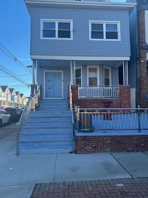
296 Avenue B Unit 2
Bayonne, NJ 07002
Today
|
Edit
Favorites
201-888-9109
-
Bedrooms
3
-
Bathrooms
1
-
Square Feet
--
-
Available
Available Now
Highlights
- Living Room
- Dining Room
296 Avenue B Unit 2

Favorites
About This Home
Available Now
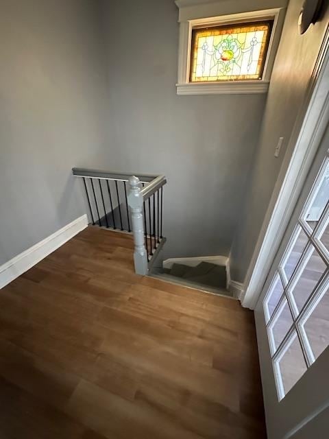
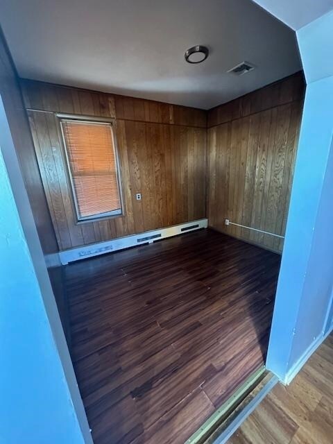
On the second floor of a two-family house is a large three-bedroom apartment. The apartment has an enclosed front sunporch, additional storage space, and a hardwood floor.
296 Avenue B is an apartment community located in Hudson County and the 07002 ZIP Code.
* Price shown is base rent. Excludes user-selected optional fees and variable or usage-based fees and required charges due at or prior to move-in or at move-out. Price, availability, fees, and any applicable rent special are subject to change without notice.
* Square footage definitions vary. Displayed square footage is approximate.
Home Details
Bedrooms and Bathrooms
1 Full Bathroom
3 Bedrooms
Home Design
Apartment
Interior Spaces
Living Room
Dining Room
Multi-Level Property
Utilities
Heating System Uses Gas
Community Details
Contact
- Listed by CHARLENE CRAWFORD | VRI REALTORS BETTER HOMES NJ
- Phone Number
- Contact
-
Source
Hudson County Multiple Listing Service
Copyright © 2026 Hudson County Multiple Listing Service. All rights reserved. All information provided by the listing agent/broker is deemed reliable but is not guaranteed and should be independently verified.
Location
Get Directions
Amenities
- Oven
Located on New Jersey's Bergen Neck peninsula, Bayonne combines waterfront living with easy city access. This historic city, situated between Newark Bay and Upper New York Bay, offers views of the Manhattan skyline and the Bayonne Bridge. Housing options include single-family homes, apartments, and renovated brownstones, with current average rents ranging from $2,054 for studios to $3,938 for three-bedroom units. The Peninsula at Bayonne Harbor area continues to grow with new residential developments near the Cape Liberty Cruise Port.
Broadway serves as Bayonne's main commercial corridor, where the Bayonne Town Center features local shops and restaurants. The city's green spaces include Stephen R. Gregg Hudson County Park and the Hackensack RiverWalk, offering waterfront paths and recreation areas. Residents can access neighboring communities via the Hudson-Bergen Light Rail.
Learn more about living in Bayonne
Education
| Colleges & Universities | Distance | ||
|---|---|---|---|
| Colleges & Universities | Distance | ||
| Drive: | 5 min | 2.2 mi | |
| Drive: | 7 min | 3.5 mi | |
| Drive: | 9 min | 4.1 mi | |
| Drive: | 18 min | 9.1 mi |
296 Avenue B Unit 2 is within 5 minutes or 2.2 miles from New Jersey City University. It is also near Saint Peter's College and Hudson Co. Comm. College.
Transportation options available in Bayonne include Danforth Avenue, located 1.3 miles from 296 Avenue B Unit 2. 296 Avenue B Unit 2 is near Newark Liberty International, located 5.6 miles or 9 minutes away, and LaGuardia, located 18.0 miles or 35 minutes away.
| Transit / Subway | Distance | ||
|---|---|---|---|
| Transit / Subway | Distance | ||
|
|
Drive: | 3 min | 1.3 mi |
|
|
Drive: | 4 min | 1.4 mi |
|
|
Drive: | 3 min | 1.5 mi |
|
|
Drive: | 4 min | 1.9 mi |
|
|
Drive: | 6 min | 3.2 mi |
| Commuter Rail | Distance | ||
|---|---|---|---|
| Commuter Rail | Distance | ||
|
|
Drive: | 9 min | 4.1 mi |
|
|
Drive: | 8 min | 5.2 mi |
|
|
Drive: | 14 min | 7.5 mi |
|
|
Drive: | 22 min | 9.7 mi |
|
|
Drive: | 23 min | 10.1 mi |
| Airports | Distance | ||
|---|---|---|---|
| Airports | Distance | ||
|
Newark Liberty International
|
Drive: | 9 min | 5.6 mi |
|
LaGuardia
|
Drive: | 35 min | 18.0 mi |
Time and distance from 296 Avenue B Unit 2.
| Shopping Centers | Distance | ||
|---|---|---|---|
| Shopping Centers | Distance | ||
| Walk: | 10 min | 0.5 mi | |
| Walk: | 10 min | 0.5 mi | |
| Drive: | 2 min | 1.1 mi |
296 Avenue B Unit 2 has 3 shopping centers within 1.1 miles, which is about a 2-minute drive. The miles and minutes will be for the farthest away property.
| Parks and Recreation | Distance | ||
|---|---|---|---|
| Parks and Recreation | Distance | ||
|
Stephen Gregg Park
|
Walk: | 15 min | 0.8 mi |
|
G. Thomas DiDomenico Park
|
Drive: | 6 min | 2.6 mi |
|
Liberty Science Center
|
Drive: | 6 min | 3.6 mi |
|
Snug Harbor Cultural Center & Botanical Garden
|
Drive: | 17 min | 7.9 mi |
|
Staten Island Children's Museum
|
Drive: | 17 min | 7.9 mi |
296 Avenue B Unit 2 has 5 parks within 7.9 miles, including Stephen Gregg Park, G. Thomas DiDomenico Park, and Liberty Science Center.
| Hospitals | Distance | ||
|---|---|---|---|
| Hospitals | Distance | ||
| Drive: | 4 min | 1.8 mi | |
| Drive: | 8 min | 4.5 mi | |
| Drive: | 9 min | 6.3 mi |
296 Avenue B Unit 2 has 3 hospitals within 6.3 miles, the nearest is Bayonne Medical Center which is 1.8 miles away and a 4 minute drive.
| Military Bases | Distance | ||
|---|---|---|---|
| Military Bases | Distance | ||
| Drive: | 7 min | 2.6 mi | |
| Drive: | 24 min | 9.7 mi | |
| Drive: | 19 min | 10.2 mi |
296 Avenue B Unit 2 has 3 military bases within 10.2 miles, the nearest is Military Ocean Terminal which is 2.6 miles away and a 7 minute drive.
You May Also Like
How do I access Social Services in New Jersey?
Statewide service is free, confidential, multilingual and always open. Three easy ways to reach Social Services in NJ: Dial 2-1-1; text your zip code to 898-211; or chat at https://www.nj211.org
Similar Rentals Nearby
-
-
-
-
1 / 22

-
-
-
-
1 / 19

-
-


What Are Walk Score®, Transit Score®, and Bike Score® Ratings?
Walk Score® measures the walkability of any address. Transit Score® measures access to public transit. Bike Score® measures the bikeability of any address.
What is a Sound Score Rating?
A Sound Score Rating aggregates noise caused by vehicle traffic, airplane traffic and local sources

296 Avenue B
Bayonne, NJ 07002