
REV by Vermella
630 Washington Ave,
Belleville, NJ 07109
$2,175 - $4,160
Studio - 2 Beds
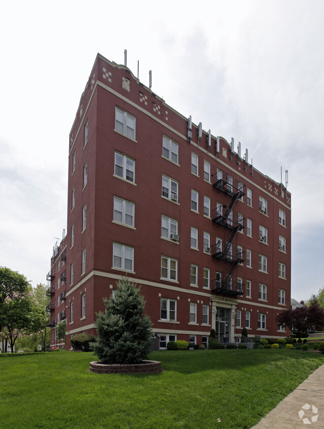
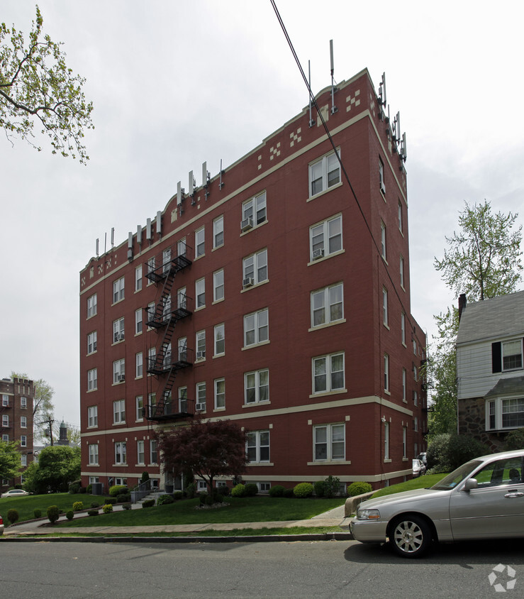
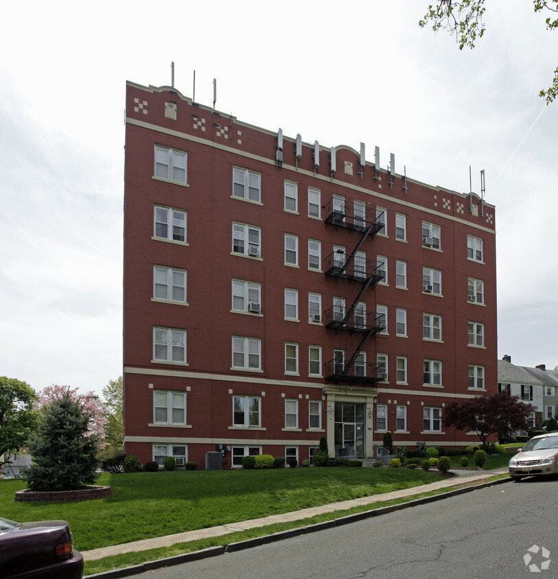

Experience your new apartment at 293 Chestnut St. The location of this community is in Nutley on Chestnut St. in the 07110 area. The professional leasing staff will assist you in finding the perfect place to live. Make a visit to view the available floorplans. It's all waiting for you at 293 Chestnut St. Stop by the leasing office to check the current floorplan availability today.
293 Chestnut St is an apartment community located in Essex County and the 07110 ZIP Code. This area is served by the Nutley Public attendance zone.
Air Conditioning
Refrigerator
Tub/Shower
Freezer
Located fifteen miles northwest of New York City, Nutley is a fairly large township of around 30,000 people on the banks of the Passaic River. The close proximity to NYC makes Nutley a popular choice among commuters, who are often drawn to the area’s quiet neighborhood streets and small-town vibe. Franklin Avenue serves as the backbone of Nutley’s Downtown district, lined with a rich assortment of locally-owned restaurants and specialty shops in a walkable layout.
Just north of town, a cluster of larger shopping centers offers more big-box options as well as the local multiplex theater. The greenbelt following Third River as it flows through town provides a beautiful area for you to enjoy the tranquility of nature, within a short walk of almost anywhere in the community.
Learn more about living in Nutley| Colleges & Universities | Distance | ||
|---|---|---|---|
| Colleges & Universities | Distance | ||
| Drive: | 7 min | 3.6 mi | |
| Drive: | 7 min | 3.6 mi | |
| Drive: | 10 min | 4.4 mi | |
| Drive: | 9 min | 4.7 mi |


Transportation options available in Nutley include Branch Brook Park, located 3.1 miles from 293 Chestnut St. 293 Chestnut St is near Newark Liberty International, located 15.1 miles or 20 minutes away, and LaGuardia, located 21.7 miles or 40 minutes away.
| Transit / Subway | Distance | ||
|---|---|---|---|
| Transit / Subway | Distance | ||
|
|
Drive: | 6 min | 3.1 mi |
|
|
Drive: | 7 min | 3.5 mi |
|
|
Drive: | 7 min | 3.5 mi |
|
|
Drive: | 8 min | 4.0 mi |
|
|
Drive: | 9 min | 4.1 mi |
| Commuter Rail | Distance | ||
|---|---|---|---|
| Commuter Rail | Distance | ||
|
|
Drive: | 5 min | 2.4 mi |
|
|
Drive: | 7 min | 3.3 mi |
|
|
Drive: | 7 min | 3.4 mi |
|
|
Drive: | 8 min | 3.6 mi |
|
|
Drive: | 8 min | 3.9 mi |
| Airports | Distance | ||
|---|---|---|---|
| Airports | Distance | ||
|
Newark Liberty International
|
Drive: | 20 min | 15.1 mi |
|
LaGuardia
|
Drive: | 40 min | 21.7 mi |
Time and distance from 293 Chestnut St.
| Shopping Centers | Distance | ||
|---|---|---|---|
| Shopping Centers | Distance | ||
| Drive: | 4 min | 1.5 mi | |
| Drive: | 4 min | 1.6 mi | |
| Drive: | 4 min | 1.8 mi |
| Parks and Recreation | Distance | ||
|---|---|---|---|
| Parks and Recreation | Distance | ||
|
Van Vleck House & Gardens
|
Drive: | 10 min | 4.4 mi |
|
Branch Brook Park
|
Drive: | 10 min | 4.7 mi |
|
Presby Memorial Iris Gardens
|
Drive: | 11 min | 4.9 mi |
|
Richard W. DeKorte Park
|
Drive: | 14 min | 5.7 mi |
|
Meadowlands Environment Center
|
Drive: | 16 min | 6.4 mi |
| Hospitals | Distance | ||
|---|---|---|---|
| Hospitals | Distance | ||
| Drive: | 8 min | 4.4 mi | |
| Drive: | 14 min | 6.1 mi | |
| Drive: | 11 min | 6.9 mi |
| Military Bases | Distance | ||
|---|---|---|---|
| Military Bases | Distance | ||
| Drive: | 25 min | 16.4 mi | |
| Drive: | 29 min | 17.4 mi |
What Are Walk Score®, Transit Score®, and Bike Score® Ratings?
Walk Score® measures the walkability of any address. Transit Score® measures access to public transit. Bike Score® measures the bikeability of any address.
What is a Sound Score Rating?
A Sound Score Rating aggregates noise caused by vehicle traffic, airplane traffic and local sources


