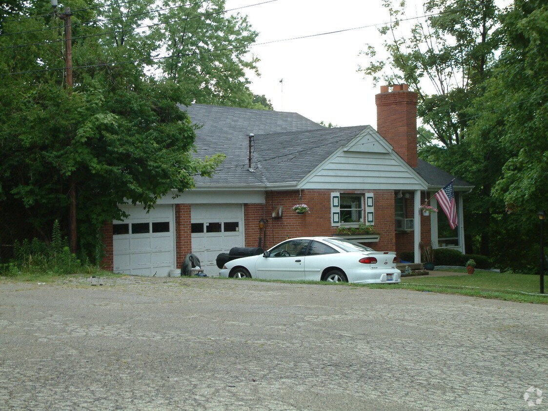
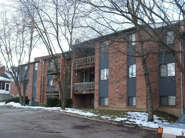
2926-2930 Banning Rd
2926-2930 Banning Rd,
Cincinnati,
OH
45239
2 Weeks Ago
Favorites
2926-2930 Banning Rd
Favorites
Check Back Soon for Upcoming Availability
| Beds | Baths | Average SF | Availability |
|---|---|---|---|
| Studio Studio 0 Br | 1 Bath 1 Bath 1 Ba | — | Not Available |
| 1 Bedroom 1 Bedroom 1 Br | 1 Bath 1 Bath 1 Ba | — | Not Available |
| 2 Bedrooms 2 Bedrooms 2 Br | 1 Bath 1 Bath 1 Ba | — | Not Available |
| 2 Bedrooms 2 Bedrooms 2 Br | 1.5 Baths 1.5 Baths 1.5 Ba | — | Not Available |
Fees and Policies
Details
Property Information
-
Built in 1981
-
26 units/3 stories
About 2926-2930 Banning Rd Cincinnati, OH 45239
Discover your new home at 2926-2930 Banning Rd. You'll find this community in the White Oak area of Cincinnati. The leasing team is eager to show off our wonderful community. Contact us or stop by today.
2926-2930 Banning Rd is an apartment community located in Hamilton County and the 45239 ZIP Code. This area is served by the Northwest Local attendance zone.
Location
Get Directions
As one of the oldest cities in the United States west of the Appalachians, Cincinnati offers residents contemporary urban living in a historic, distinctive setting. One of the oldest cities in the US houses an influential youth culture. Students, professionals, artists, and musicians of all walks of life come to the southwest corner of Ohio to live and work. College and professional sports are wildly popular, with the Bearcats of the University of Cincinnati, the Reds, and the Bengals enjoying huge fan bases in their hometown.
Renters and visitors alike will delight in attractions like the Cincinnati Art Museum, the Newport Aquarium, and the city’s iconic zoo. The annual Oktoberfest is one of the biggest celebrations of its kind outside of Munich, drawing thousands to the streets to celebrate the city’s German heritage.
Learn more about living in CincinnatiBelow are rent ranges for similar nearby apartments
Education
| Colleges & Universities | Distance | ||
|---|---|---|---|
| Colleges & Universities | Distance | ||
| Drive: | 16 min | 6.1 mi | |
| Drive: | 17 min | 7.8 mi | |
| Drive: | 19 min | 8.2 mi | |
| Drive: | 21 min | 12.9 mi |
2926-2930 Banning Rd is within 16 minutes or 6.1 miles from Cincinnati State. It is also near University of Cincinnati and Univ. of Cincinnati, Medical.
Schools


Public Elementary & Middle School
Grades PK-7
569 Students
Nearby
Public Elementary School
Grades K-2
413 Students
Nearby
Public Elementary School
Grades K-5
875 Students
Attendance Zone
Public Middle School
Grades 6-8
729 Students
Attendance Zone
Public High School
Grades 9-12
1,747 Students
Attendance Zone
Private Elementary & Middle School
Grades PK-8
105 Students
Nearby
Private Elementary & Middle School
Grades K-8
549 Students
Nearby
Private High School
Grades 9-12
568 Students
Nearby
School data provided by
 The GreatSchools Rating helps parents compare schools within a state based on a variety of school quality indicators and provides a helpful picture of how effectively each school serves all of its students. Ratings are on a scale of 1 (below average) to 10 (above average) and can include test scores, college readiness, academic progress, advanced courses, equity, discipline and attendance data. We also advise parents to visit schools, consider other information on school performance and programs, and consider family needs as part of the school selection process.
View GreatSchools Rating Methodology
Data provided by GreatSchools.org © 2025. All rights reserved.
View GreatSchools Rating Methodology
Data provided by GreatSchools.org © 2025. All rights reserved.
Transportation options available in Cincinnati include Brewery District Station, Elm & Henry, located 8.5 miles from 2926-2930 Banning Rd. 2926-2930 Banning Rd is near Cincinnati/Northern Kentucky International, located 22.5 miles or 42 minutes away.
| Transit / Subway | Distance | ||
|---|---|---|---|
| Transit / Subway | Distance | ||
| Drive: | 18 min | 8.5 mi | |
| Drive: | 18 min | 8.6 mi | |
| Drive: | 18 min | 8.7 mi | |
| Drive: | 18 min | 8.7 mi | |
| Drive: | 19 min | 8.8 mi |
| Commuter Rail | Distance | ||
|---|---|---|---|
| Commuter Rail | Distance | ||
|
|
Drive: | 17 min | 8.4 mi |
| Airports | Distance | ||
|---|---|---|---|
| Airports | Distance | ||
|
Cincinnati/Northern Kentucky International
|
Drive: | 42 min | 22.5 mi |
Time and distance from 2926-2930 Banning Rd.
| Shopping Centers | Distance | ||
|---|---|---|---|
| Shopping Centers | Distance | ||
| Walk: | 13 min | 0.7 mi | |
| Walk: | 14 min | 0.7 mi | |
| Walk: | 14 min | 0.8 mi |
2926-2930 Banning Rd has 3 shopping centers within 0.8 mile, which is about a 14-minute walk. The miles and minutes will be for the farthest away property.
| Parks and Recreation | Distance | ||
|---|---|---|---|
| Parks and Recreation | Distance | ||
|
Farbach-Werner Nature Preserve
|
Drive: | 5 min | 2.0 mi |
|
LaBoiteaux Woods
|
Drive: | 7 min | 2.9 mi |
|
Mt. Airy Forest
|
Drive: | 9 min | 3.4 mi |
|
Buttercup Valley
|
Drive: | 9 min | 4.0 mi |
|
Winton Woods Park
|
Drive: | 15 min | 8.1 mi |
2926-2930 Banning Rd has 5 parks within 8.1 miles, including Farbach-Werner Nature Preserve, LaBoiteaux Woods, and Mt. Airy Forest.
| Hospitals | Distance | ||
|---|---|---|---|
| Hospitals | Distance | ||
| Drive: | 9 min | 3.8 mi | |
| Drive: | 16 min | 7.0 mi | |
| Drive: | 13 min | 8.9 mi |
2926-2930 Banning Rd has 3 hospitals within 8.9 miles, the nearest is Mercy Health - West Hospital which is 3.8 miles away and a 9 minute drive.
| Military Bases | Distance | ||
|---|---|---|---|
| Military Bases | Distance | ||
| Drive: | 68 min | 53.2 mi | |
| Drive: | 74 min | 58.3 mi | |
| Drive: | 76 min | 61.5 mi |
2926-2930 Banning Rd has 3 military bases within 61.5 miles, the nearest is Gentile Air Force Station which is 53.2 miles away and a 68 minute drive.
You May Also Like
What neighborhood is the property located in?
2926-2930 Banning Rd Cincinnati, OH 45239 is in the city of Cincinnati. Here you’ll find three shopping centers within 0.8 mile of the property.Five parks are within 8.1 miles, including Farbach-Werner Nature Preserve, LaBoiteaux Woods, and Mt. Airy Forest.
Similar Rentals Nearby


What Are Walk Score®, Transit Score®, and Bike Score® Ratings?
Walk Score® measures the walkability of any address. Transit Score® measures access to public transit. Bike Score® measures the bikeability of any address.
What is a Sound Score Rating?
A Sound Score Rating aggregates noise caused by vehicle traffic, airplane traffic and local sources

2926-2930 Banning Rd
Cincinnati, OH 45239
Responded To This Review