
$2,100 / Month
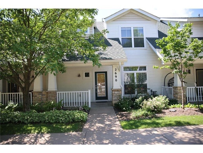
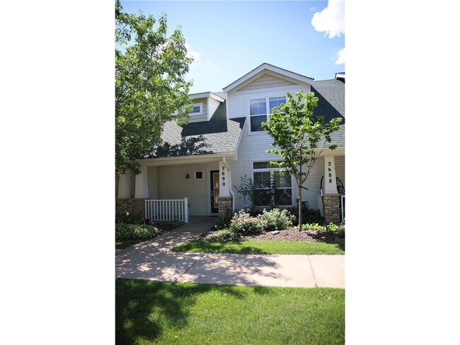
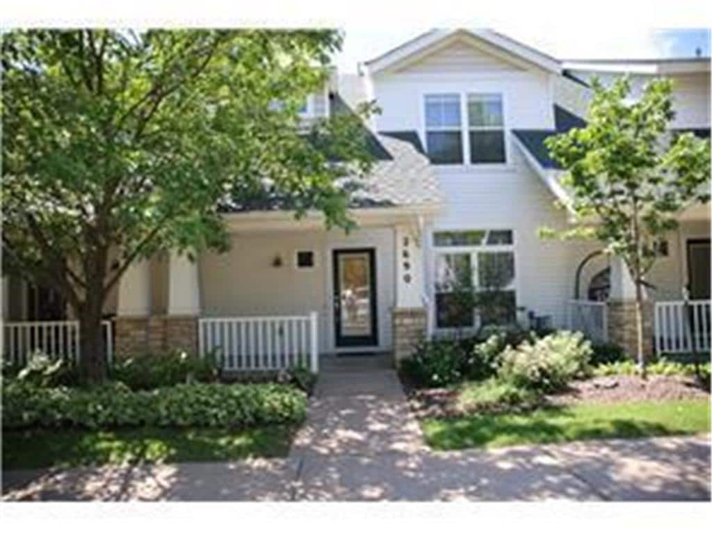
2690 Pinkspire Ln E
Maplewood, MN 55119
Today
Favorites
612-644-7665
-
Bedrooms
2
-
Bathrooms
2
-
Square Feet
1,698 sq ft
-
Available
Available Now
Highlights
- Fireplace
- Basement
2690 Pinkspire Ln E

Favorites
About This Home
$2,100 deposit,
Available Now
Step into comfort and style in this beautifully updated home! Featuring gleaming hardwood floors, a fully renovated kitchen with granite countertops, and brand-new stainless steel appliances, this property offers both modern convenience and timeless charm. With numerous updates throughout, this home is move-in ready and waiting for you to make it your own. Don’t miss out on this fantastic opportunity in a great Maplewood location!
2690 Pinkspire Ln E is a townhome located in Ramsey County and the 55119 ZIP Code. This area is served by the North St Paul-Maplewood School Dist attendance zone.
* Price shown is base rent and may not include non-optional fees and utilities.
Price, availability, fees, and any applicable rent special are subject to change without notice.
* Square footage definitions vary. Displayed square footage is approximate.
Townhome Features
Washer/Dryer
Air Conditioning
Dishwasher
Microwave
- Washer/Dryer
- Air Conditioning
- Heating
- Fireplace
- Dishwasher
- Kitchen
- Microwave
- Range
- Refrigerator
- Dining Room
- Basement
Fees and Policies
The fees below are based on community-supplied data and may exclude additional fees and utilities.
- Parking
-
Garage--
Contact
- Listed by Demissie G Kebede | Universal Realty LLC
- Phone Number
- Contact
-
Source
 NorthstarMLS®
Copyright © 2025 Regional Multiple Listing Service of Minnesota [NorthStarMLS]. All rights reserved. All information provided by the listing agent/broker is deemed reliable but is not guaranteed and should be independently verified.
Location
Get Directions
Amenities
- Washer/Dryer
- Air Conditioning
- Heating
- Fireplace
- Dishwasher
- Kitchen
- Microwave
- Range
- Refrigerator
- Dining Room
- Basement
Thanks to some odd geography, Maplewood has something of a split personality. This first-ring St. Paul suburb can be described as being shaped like a frying pan. The main business and residential area lies primarily to the north and east of St. Paul, while the chief amenities, such as the community center and an indoor mall, lie in the "pan." South Maplewood, or the "pan handle," runs south along Interstate 494 and has fewer business amenities. Residents of this area tend to shop in bordering Woodbury, since it takes a good half hour to get from the southern tip of Maplewood to the main northern business district.
Meanwhile, Oakdale lies between the two sections, just east of Maplewood's pan handle and north of Woodbury. This young suburb is a quiet bedroom community with a scattering of business districts. Cornfields make up its eastern portion, giving the area a distinctly rural vibe, even though it's just 10 minutes outside of downtown St. Paul.
Learn more about living in Maplewood-Oakdale
Education
| Colleges & Universities | Distance | ||
|---|---|---|---|
| Colleges & Universities | Distance | ||
| Drive: | 12 min | 7.2 mi | |
| Drive: | 15 min | 8.9 mi | |
| Drive: | 17 min | 10.0 mi | |
| Drive: | 18 min | 11.3 mi |
2690 Pinkspire Ln E is within 12 minutes or 7.2 miles from Metropolitan State University. It is also near Saint Paul College and Inver Hills Community College.
Schools


Public Elementary School
Grades PK-5
878 Students
Attendance Zone
Public Middle School
Grades 6-8
557 Students
Attendance Zone
Public High School
Grades 9-12
1,683 Students
Attendance Zone
Private Elementary & Middle School
Grades K-8
16 Students
Nearby
Private Elementary, Middle & High School
Grades PK-12
763 Students
Nearby
School data provided by
 The GreatSchools Rating helps parents compare schools within a state based on a variety of school quality indicators and provides a helpful picture of how effectively each school serves all of its students. Ratings are on a scale of 1 (below average) to 10 (above average) and can include test scores, college readiness, academic progress, advanced courses, equity, discipline and attendance data. We also advise parents to visit schools, consider other information on school performance and programs, and consider family needs as part of the school selection process.
View GreatSchools Rating Methodology
Data provided by GreatSchools.org © 2025. All rights reserved.
View GreatSchools Rating Methodology
Data provided by GreatSchools.org © 2025. All rights reserved.
Transportation options available in Maplewood include Union Depot Crossing, located 7.4 miles from 2690 Pinkspire Ln E. 2690 Pinkspire Ln E is near Minneapolis-St Paul International/Wold-Chamberlain, located 15.5 miles or 25 minutes away.
| Transit / Subway | Distance | ||
|---|---|---|---|
| Transit / Subway | Distance | ||
| Drive: | 12 min | 7.4 mi | |
| Drive: | 13 min | 7.6 mi | |
| Drive: | 13 min | 7.7 mi | |
| Drive: | 13 min | 8.2 mi | |
| Drive: | 14 min | 8.4 mi |
| Commuter Rail | Distance | ||
|---|---|---|---|
| Commuter Rail | Distance | ||
|
|
Drive: | 13 min | 7.6 mi |
|
|
Drive: | 31 min | 18.1 mi |
|
|
Drive: | 33 min | 24.0 mi |
|
|
Drive: | 43 min | 32.1 mi |
|
|
Drive: | 45 min | 33.8 mi |
| Airports | Distance | ||
|---|---|---|---|
| Airports | Distance | ||
|
Minneapolis-St Paul International/Wold-Chamberlain
|
Drive: | 25 min | 15.5 mi |
Time and distance from 2690 Pinkspire Ln E.
| Shopping Centers | Distance | ||
|---|---|---|---|
| Shopping Centers | Distance | ||
| Drive: | 3 min | 1.1 mi | |
| Drive: | 4 min | 1.5 mi | |
| Drive: | 4 min | 1.5 mi |
2690 Pinkspire Ln E has 3 shopping centers within 1.5 miles, which is about a 4-minute drive. The miles and minutes will be for the farthest away property.
| Parks and Recreation | Distance | ||
|---|---|---|---|
| Parks and Recreation | Distance | ||
|
Maplewood Nature Center
|
Drive: | 9 min | 4.1 mi |
|
Indian Mounds Park
|
Drive: | 11 min | 5.8 mi |
|
Kellogg Mall Park
|
Drive: | 13 min | 7.6 mi |
|
Science Museum of Minnesota
|
Drive: | 13 min | 8.2 mi |
|
Dodge Nature Center
|
Drive: | 14 min | 9.1 mi |
2690 Pinkspire Ln E has 5 parks within 9.1 miles, including Maplewood Nature Center, Indian Mounds Park, and Kellogg Mall Park.
| Hospitals | Distance | ||
|---|---|---|---|
| Hospitals | Distance | ||
| Drive: | 3 min | 1.3 mi | |
| Drive: | 13 min | 8.1 mi | |
| Drive: | 14 min | 8.3 mi |
2690 Pinkspire Ln E has 3 hospitals within 8.3 miles, the nearest is Healtheast Woodwinds Hospital which is 1.3 miles away and a 3 minute drive.
| Military Bases | Distance | ||
|---|---|---|---|
| Military Bases | Distance | ||
| Drive: | 22 min | 14.3 mi |
2690 Pinkspire Ln E is 14.3 miles and a 22 minute drive from Fort Snelling Military Reservation.
You May Also Like
Similar Rentals Nearby


What Are Walk Score®, Transit Score®, and Bike Score® Ratings?
Walk Score® measures the walkability of any address. Transit Score® measures access to public transit. Bike Score® measures the bikeability of any address.
What is a Sound Score Rating?
A Sound Score Rating aggregates noise caused by vehicle traffic, airplane traffic and local sources
2690 Pinkspire Ln E
Maplewood, MN 55119