
$1,900 / Month
2655 Prosperity Ave Unit 419
FAIRFAX, VA 22031
2 Weeks Ago
Favorites
2655 Prosperity Ave Unit 419

Favorites
Check Back Soon for Upcoming Availability
| Beds | Baths | Average SF |
|---|---|---|
| 1 Bedroom 1 Bedroom 1 Br | 1 Bath 1 Bath 1 Ba | 835 SF |
About This Property
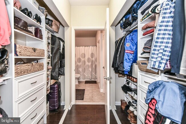
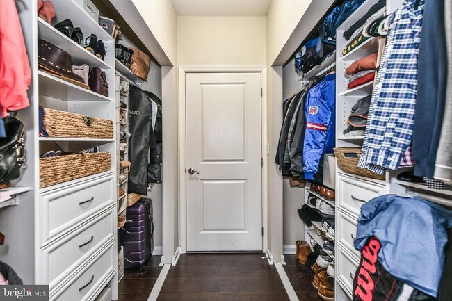
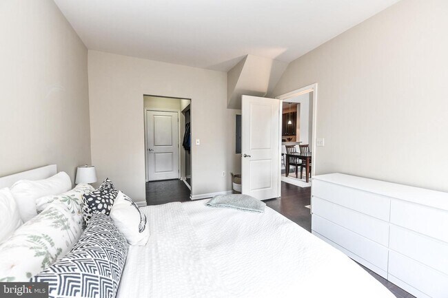
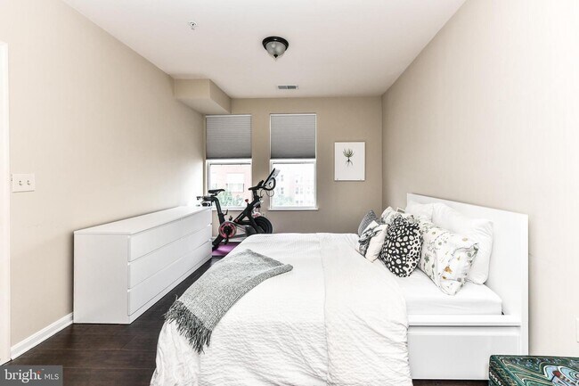
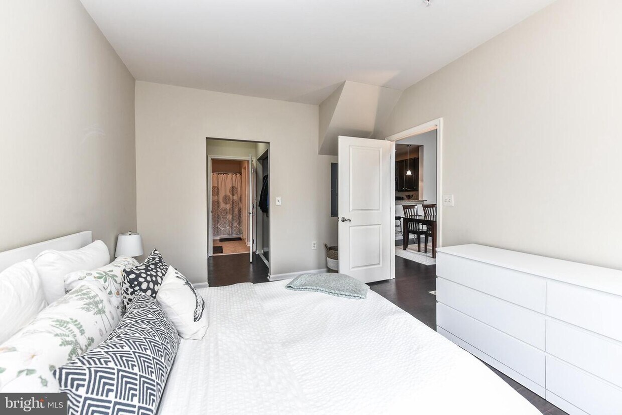
Luxury & Convenient Living in this beautiful top-floor 1BR, 1BA Penthouse in highly desirable Halstead at the Metro community! Prime location & steps from Dunn Loring Metro! Bright & Open with lots of natural sunlight streaming throughout showcasing the gorgeous hardwood floors throughout! Upscale Kitchen with granite counters, ample cabinetry, Stainless Steel appliances & tiled floors*2-story dining + living room with cathedral ceiling*Upper level loft overlooking living room could be used as office/den*Washer & Dryer in unit*Spacious Master suite with custom built-ins in walk-in closet*2 garage parking spots convey (4-006,6-005)*Community amenities include secure entrance, newer gym, indoor basketball court, pool, hot tub & party room*Excellent location not only close to Metro but also near shopping & dining at the Mosaic District + grocery! Close to Tysons & Fairfax Hospital*Easy access to I-66, 495, 50 & 29! *Available 11.1.20*
2655 Prosperity Ave is an apartment community located in Fairfax County and the 22031 ZIP Code.
Features
- Dishwasher

Halstead at The Metro
202 Units
5 Stories
Built in 2005
202,034 Sq Ft
Halstead at The Metro, completed in 2005, stands as a contemporary residential complex in the vibrant Merrifield neighborhood. This five-story condominium building houses 202 units, offering a blend of urban convenience and suburban comfort. Situated across from the Dunn Loring Metro Station, the Halstead provides residents with easy access to Washington D.C. and the surrounding areas. The building's design incorporates a mix of brick and siding, creating a balanced aesthetic that fits seamlessly into the evolving Merrifield landscape.
Learn more about Halstead at The Metro
Location
Get Directions
Less than twenty miles west of Washington on Interstate 66, Fairfax is a small suburban community that has become quite popular with DC-area commuters seeking a quiet home environment. Families love the quaint atmosphere, excellent public schools, and friendly neighbors. Local community festivals celebrating everything from Irish heritage to the arts to chocolate are always popular with the locals, and the city’s public parks, playgrounds, and walkable downtown district give folks ample opportunities to spend time outdoors.
The student body of neighboring George Mason University is actually larger than the entire population of Fairfax, and many students, faculty, and staff members call the city home—consequently, locals enjoy access to the attractions and resources of the campus as well as a unique blend of amenities catering to the college.
Learn more about living in Fairfax
Amenities
- Dishwasher
Education
| Colleges & Universities | Distance | ||
|---|---|---|---|
| Colleges & Universities | Distance | ||
| Drive: | 10 min | 4.9 mi | |
| Drive: | 15 min | 6.9 mi | |
| Drive: | 15 min | 7.4 mi | |
| Drive: | 16 min | 8.2 mi |
2655 Prosperity Ave Unit 419 is within 10 minutes or 4.9 miles from NOVA, Annandale Campus. It is also near George Mason Univ., Fairfax and Marymount University.
Transportation options available in FAIRFAX include Tysons Corner, located 3.5 miles from 2655 Prosperity Ave Unit 419. 2655 Prosperity Ave Unit 419 is near Ronald Reagan Washington Ntl, located 12.6 miles or 26 minutes away, and Washington Dulles International, located 17.7 miles or 31 minutes away.
| Transit / Subway | Distance | ||
|---|---|---|---|
| Transit / Subway | Distance | ||
|
|
Drive: | 6 min | 3.5 mi |
|
|
Drive: | 7 min | 3.8 mi |
|
|
Drive: | 8 min | 5.0 mi |
|
|
Drive: | 9 min | 5.5 mi |
|
|
Drive: | 13 min | 7.5 mi |
| Commuter Rail | Distance | ||
|---|---|---|---|
| Commuter Rail | Distance | ||
|
|
Drive: | 15 min | 8.5 mi |
|
|
Drive: | 16 min | 8.6 mi |
|
|
Drive: | 20 min | 10.7 mi |
|
|
Drive: | 22 min | 11.3 mi |
|
|
Drive: | 22 min | 11.9 mi |
| Airports | Distance | ||
|---|---|---|---|
| Airports | Distance | ||
|
Ronald Reagan Washington Ntl
|
Drive: | 26 min | 12.6 mi |
|
Washington Dulles International
|
Drive: | 31 min | 17.7 mi |
Time and distance from 2655 Prosperity Ave Unit 419.
| Shopping Centers | Distance | ||
|---|---|---|---|
| Shopping Centers | Distance | ||
| Walk: | 5 min | 0.3 mi | |
| Walk: | 12 min | 0.6 mi | |
| Walk: | 13 min | 0.7 mi |
2655 Prosperity Ave Unit 419 has 3 shopping centers within 0.7 mile, which is about a 13-minute walk. The miles and minutes will be for the farthest away property.
| Parks and Recreation | Distance | ||
|---|---|---|---|
| Parks and Recreation | Distance | ||
|
Eakin Community Park
|
Drive: | 5 min | 2.5 mi |
|
Gateway Regional Park
|
Drive: | 6 min | 3.5 mi |
|
Nottoway Park
|
Drive: | 7 min | 3.8 mi |
|
Hidden Oaks Nature Center
|
Drive: | 8 min | 4.0 mi |
|
W&OD Trail
|
Drive: | 9 min | 4.6 mi |
2655 Prosperity Ave Unit 419 has 5 parks within 4.6 miles, including Eakin Community Park, Nottoway Park, and Gateway Regional Park.
| Hospitals | Distance | ||
|---|---|---|---|
| Hospitals | Distance | ||
| Drive: | 3 min | 1.7 mi | |
| Drive: | 3 min | 1.8 mi | |
| Drive: | 9 min | 4.8 mi |
2655 Prosperity Ave Unit 419 has 3 hospitals within 4.8 miles, the nearest is Inova Fairfax Hospital which is 1.7 miles away and a 3 minute drive.
| Military Bases | Distance | ||
|---|---|---|---|
| Military Bases | Distance | ||
| Drive: | 19 min | 9.6 mi |
2655 Prosperity Ave Unit 419 is 9.6 miles and a 19 minute drive from Fort Myer.
You May Also Like
Similar Rentals Nearby


What Are Walk Score®, Transit Score®, and Bike Score® Ratings?
Walk Score® measures the walkability of any address. Transit Score® measures access to public transit. Bike Score® measures the bikeability of any address.
What is a Sound Score Rating?
A Sound Score Rating aggregates noise caused by vehicle traffic, airplane traffic and local sources
2655 Prosperity Ave
FAIRFAX, VA 22031