263 Marion St
263 Marion St,
Brooklyn,
NY
11233
2 Weeks Ago
Favorites
263 Marion St

Favorites
Check Back Soon for Upcoming Availability
Fees and Policies
The fees below are based on community-supplied data and may exclude additional fees and utilities.
- Dogs Allowed
-
Fees not specified
- Cats Allowed
-
Fees not specified
- Parking
-
Street--
Details
Lease Options
-
12 Months
About 263 Marion St Brooklyn, NY 11233
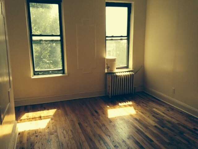
No fee Excellent large 1 bedroom Could be used as a 1.5 bedroom Large apartment Heat and hot water inc Large kitchen Large Bedroom Next to Ralph A & C subway (Only 6 min walk) GREAT PRICE WILL NOT LAST CONTACT ME ASAP. MOVE IN ASAP!
263 Marion St is an apartment community located in Kings County and the 11233 ZIP Code.
Location
Get Directions
Bedford-Stuyvesant, often shortened to Bed-Stuy, sits in north central Brooklyn, touting plenty of classic brownstones along tree-lined streets. Bed-Stuy is revered for its historic architecture, containing one of the highest concentrations of Victorian properties in all of New York City.
Residents enjoy a strong sense of community in Bed-Stuy along with an array of diverse eateries, cafes, and bodegas. Herbert Von King Park lies at the center of the neighborhood, exuding a lively town-square atmosphere with an outdoor amphitheater, Cultural Arts Center, and athletic facilities. Convenience to public transportation and I-278 makes commuting and traveling from Bed-Stuy a breeze.
Learn more about living in Bedford-StuyvesantBelow are rent ranges for similar nearby apartments
| Beds | Average Size | Lowest | Typical | Premium |
|---|---|---|---|---|
| Studio Studio Studio | 484-485 Sq Ft | $2,158 | $2,812 | $3,995 |
| 1 Bed 1 Bed 1 Bed | 568-576 Sq Ft | $1,200 | $3,026 | $4,751 |
| 2 Beds 2 Beds 2 Beds | 922 Sq Ft | $2,550 | $4,061 | $6,457 |
| 3 Beds 3 Beds 3 Beds | 1115 Sq Ft | $900 | $4,049 | $14,000 |
| 4 Beds 4 Beds 4 Beds | 439 Sq Ft | $1,178 | $2,504 | $12,500 |
Education
| Colleges & Universities | Distance | ||
|---|---|---|---|
| Colleges & Universities | Distance | ||
| Drive: | 9 min | 3.0 mi | |
| Drive: | 9 min | 3.0 mi | |
| Drive: | 8 min | 3.2 mi | |
| Drive: | 10 min | 3.8 mi |
263 Marion St is within 9 minutes or 3.0 miles from Medgar Evers College, CUNY. It is also near Pratt Institute and Saint Joseph's Coll, Brooklyn.
Transportation options available in Brooklyn include Ralph Avenue, located 0.3 mile from 263 Marion St. 263 Marion St is near LaGuardia, located 8.8 miles or 20 minutes away, and John F Kennedy International, located 9.7 miles or 19 minutes away.
| Transit / Subway | Distance | ||
|---|---|---|---|
| Transit / Subway | Distance | ||
|
|
Walk: | 5 min | 0.3 mi |
|
|
Walk: | 9 min | 0.5 mi |
|
|
Walk: | 10 min | 0.5 mi |
|
|
Walk: | 10 min | 0.5 mi |
|
|
Walk: | 12 min | 0.7 mi |
| Commuter Rail | Distance | ||
|---|---|---|---|
| Commuter Rail | Distance | ||
|
|
Drive: | 3 min | 1.3 mi |
|
|
Drive: | 6 min | 2.0 mi |
|
|
Drive: | 9 min | 3.3 mi |
|
|
Drive: | 16 min | 5.4 mi |
|
|
Drive: | 15 min | 6.2 mi |
| Airports | Distance | ||
|---|---|---|---|
| Airports | Distance | ||
|
LaGuardia
|
Drive: | 20 min | 8.8 mi |
|
John F Kennedy International
|
Drive: | 19 min | 9.7 mi |
Time and distance from 263 Marion St.
| Shopping Centers | Distance | ||
|---|---|---|---|
| Shopping Centers | Distance | ||
| Drive: | 6 min | 1.9 mi | |
| Drive: | 6 min | 2.3 mi | |
| Drive: | 6 min | 2.4 mi |
263 Marion St has 3 shopping centers within 2.4 miles, which is about a 6-minute drive. The miles and minutes will be for the farthest away property.
| Parks and Recreation | Distance | ||
|---|---|---|---|
| Parks and Recreation | Distance | ||
|
St. John's Park
|
Drive: | 4 min | 1.2 mi |
|
Betsy Head Memorial Playground
|
Drive: | 6 min | 1.7 mi |
|
Brooklyn Children's Museum
|
Drive: | 6 min | 1.8 mi |
|
Maria Hernandez Park
|
Drive: | 6 min | 2.1 mi |
|
Highland Park Childrens Garden
|
Drive: | 5 min | 2.1 mi |
263 Marion St has 5 parks within 2.1 miles, including St. John's Park, Betsy Head Memorial Playground, and Brooklyn Children's Museum.
| Hospitals | Distance | ||
|---|---|---|---|
| Hospitals | Distance | ||
| Drive: | 3 min | 1.2 mi | |
| Drive: | 5 min | 2.0 mi | |
| Drive: | 6 min | 2.3 mi |
263 Marion St has 3 hospitals within 2.3 miles, the nearest is Interfaith Medical Center which is 1.2 miles away and a 3 minute drive.
| Military Bases | Distance | ||
|---|---|---|---|
| Military Bases | Distance | ||
| Drive: | 21 min | 8.5 mi | |
| Drive: | 26 min | 9.7 mi |
263 Marion St is 8.5 miles from Governors Island Support Center, and is convenient to other military bases, including US Coast Guard Heliport.
You May Also Like
Similar Rentals Nearby


What Are Walk Score®, Transit Score®, and Bike Score® Ratings?
Walk Score® measures the walkability of any address. Transit Score® measures access to public transit. Bike Score® measures the bikeability of any address.
What is a Sound Score Rating?
A Sound Score Rating aggregates noise caused by vehicle traffic, airplane traffic and local sources

263 Marion St
Brooklyn, NY 11233