
$5,700 / Month
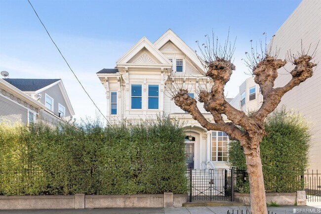
2619 California St
San Francisco, CA 94115
2 Weeks Ago
Favorites
2619 California St

Favorites
Check Back Soon for Upcoming Availability
| Beds | Baths | Average SF |
|---|---|---|
| 3 Bedrooms 3 Bedrooms 3 Br | 2 Baths 2 Baths 2 Ba | 1,500 SF |
Fees and Policies
The fees below are based on community-supplied data and may exclude additional fees and utilities.
- Parking
-
Surface Lot--
-
Garage--
About This Property
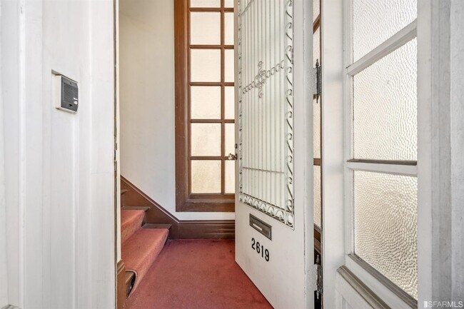
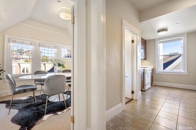
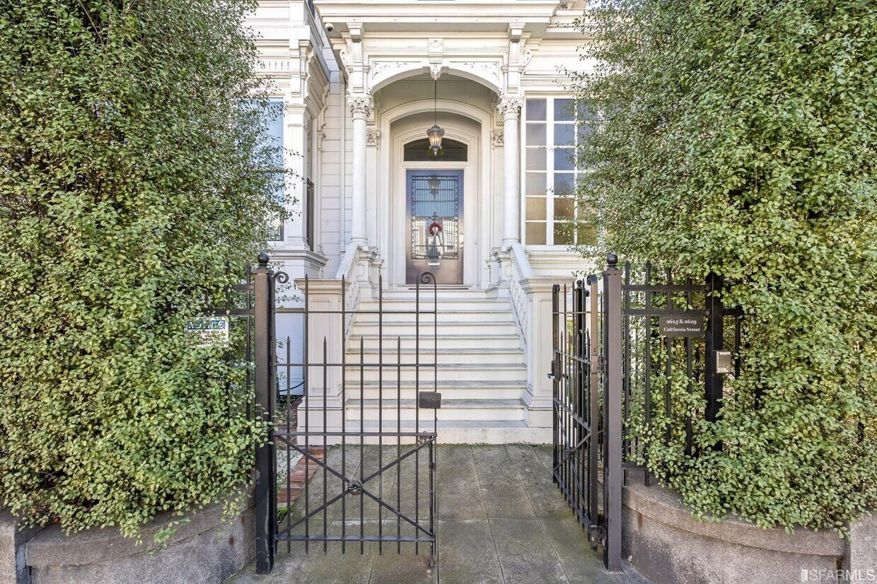
Full floor flat on the top level of a building designed by Julia Morgan in the best part of Pacific Heights at California & Fillmore Streets in small gated building with allergen-free radiant heat (no cold nights or old banging radiators), security cameras, fire sprinklers, soundproofing, new kitchen & bathrooms with Ann Sacks tile, Jonathan Adler lighting, full size in-unit laundry machines & Sonic gigabit internet. Quiet and bright with city views. The home has its own private entrance and 11 foot ceilings. Just a short walk to great restaurants (Pizzeria Delfina, Roam Burger, B Patisserie, Routier, El Burrito Express, Tataki, Eliza's, Sweet Maple, Noosh, Jane, The Snug, Salt & Straw, Wise Sons, Bun Mee, apizza, Marufuku Ramen & Scopo Divino) & to Alta Plaza Park or Japantown. Corporate shuttles are within 1 block. Street parking is always available on this block with $144 annual permit or rent a garage nearby. Dining room & office can be used as bedrooms if needed.
2619 California St is an apartment community located in San Francisco County and the 94115 ZIP Code.
Features
Air Conditioning
Hardwood Floors
Tub/Shower
Smoke Free
- Air Conditioning
- Smoke Free
- Tub/Shower
- Sprinkler System
- Oven
- Range
- Breakfast Nook
- Hardwood Floors
- Carpet
- Patio
Location
Get Directions
Lower Pacific Heights is a vibrant San Francisco neighborhood situated between Pacific Heights, Japantown, the Fillmore District, and Laurel Heights. Formerly known as Upper Fillmore, Lower Pacific Heights offers residents a wide variety of apartments, condos, and houses available for rent, many of which boast scenic views due to the neighborhood’s hilly environment.
Lower Pacific Heights is regarded for its walkable layout, with many rentals situated within easy walking distance of the diverse restaurants, shops, coffeehouses, and bars that line Fillmore Street, the community’s main commercial thoroughfare. The neighborhood’s central locale is a major part of its allure, providing quick access to Union Square, the University of San Francisco, the Financial District, several prominent medical centers, tech employers, landmarks, and more.
Learn more about living in Lower Pacific HeightsBelow are rent ranges for similar nearby apartments
Amenities
- Air Conditioning
- Smoke Free
- Tub/Shower
- Sprinkler System
- Oven
- Range
- Breakfast Nook
- Hardwood Floors
- Carpet
- Patio
Education
| Colleges & Universities | Distance | ||
|---|---|---|---|
| Colleges & Universities | Distance | ||
| Walk: | 6 min | 0.3 mi | |
| Drive: | 4 min | 1.4 mi | |
| Drive: | 5 min | 1.8 mi | |
| Drive: | 7 min | 2.5 mi |
2619 California St is within 6 minutes or 0.3 mile from UC San Francisco, Mount Zion. It is also near University of San Francisco and Academy of Art University.
Transportation options available in San Francisco include Van Ness And California, located 0.9 mile from 2619 California St. 2619 California St is near San Francisco International, located 15.1 miles or 25 minutes away, and Metro Oakland International, located 21.0 miles or 34 minutes away.
| Transit / Subway | Distance | ||
|---|---|---|---|
| Transit / Subway | Distance | ||
|
|
Walk: | 17 min | 0.9 mi |
|
|
Walk: | 20 min | 1.0 mi |
|
|
Drive: | 3 min | 1.1 mi |
|
|
Drive: | 3 min | 1.3 mi |
|
|
Drive: | 3 min | 1.4 mi |
| Commuter Rail | Distance | ||
|---|---|---|---|
| Commuter Rail | Distance | ||
| Drive: | 8 min | 4.1 mi | |
| Drive: | 8 min | 4.2 mi | |
| Drive: | 10 min | 4.9 mi | |
| Drive: | 10 min | 5.0 mi | |
| Drive: | 13 min | 7.2 mi |
| Airports | Distance | ||
|---|---|---|---|
| Airports | Distance | ||
|
San Francisco International
|
Drive: | 25 min | 15.1 mi |
|
Metro Oakland International
|
Drive: | 34 min | 21.0 mi |
Time and distance from 2619 California St.
| Shopping Centers | Distance | ||
|---|---|---|---|
| Shopping Centers | Distance | ||
| Walk: | 13 min | 0.7 mi | |
| Drive: | 4 min | 1.2 mi | |
| Drive: | 3 min | 1.2 mi |
2619 California St has 3 shopping centers within 1.2 miles, which is about a 3-minute walk. The miles and minutes will be for the farthest away property.
| Parks and Recreation | Distance | ||
|---|---|---|---|
| Parks and Recreation | Distance | ||
|
Exploratorium
|
Drive: | 4 min | 1.7 mi |
|
Buena Vista Park
|
Drive: | 6 min | 1.7 mi |
|
Conservatory of Flowers
|
Drive: | 4 min | 2.0 mi |
|
San Francisco Maritime National Historical Park
|
Drive: | 6 min | 2.3 mi |
|
Randall Museum
|
Drive: | 7 min | 2.4 mi |
2619 California St has 5 parks within 2.4 miles, including Exploratorium, Buena Vista Park, and Randall Museum.
| Hospitals | Distance | ||
|---|---|---|---|
| Hospitals | Distance | ||
| Walk: | 13 min | 0.7 mi | |
| Drive: | 3 min | 1.2 mi | |
| Drive: | 3 min | 1.3 mi |
2619 California St has 3 hospitals within 1.3 miles, the nearest is Kaiser Foundation Hospital - San Francisco which is 0.7 mile away and a 13 minute walk.
| Military Bases | Distance | ||
|---|---|---|---|
| Military Bases | Distance | ||
| Drive: | 10 min | 3.7 mi | |
| Drive: | 12 min | 4.1 mi | |
| Drive: | 17 min | 7.1 mi |
2619 California St has 3 military bases within 7.1 miles, the nearest is East Fort Miley which is 3.7 miles away and a 10 minute drive.
You May Also Like
Similar Rentals Nearby


What Are Walk Score®, Transit Score®, and Bike Score® Ratings?
Walk Score® measures the walkability of any address. Transit Score® measures access to public transit. Bike Score® measures the bikeability of any address.
What is a Sound Score Rating?
A Sound Score Rating aggregates noise caused by vehicle traffic, airplane traffic and local sources
2619 California St
San Francisco, CA 94115