
$2,150 / Month
2608 W 8th St Unit A
Austin, TX 78703
2 Weeks Ago
Favorites
2608 W 8th St Unit A

Favorites
Check Back Soon for Upcoming Availability
| Beds | Baths | Average SF |
|---|---|---|
| 2 Bedrooms 2 Bedrooms 2 Br | 1 Bath 1 Bath 1 Ba | 1,000 SF |
About This Property
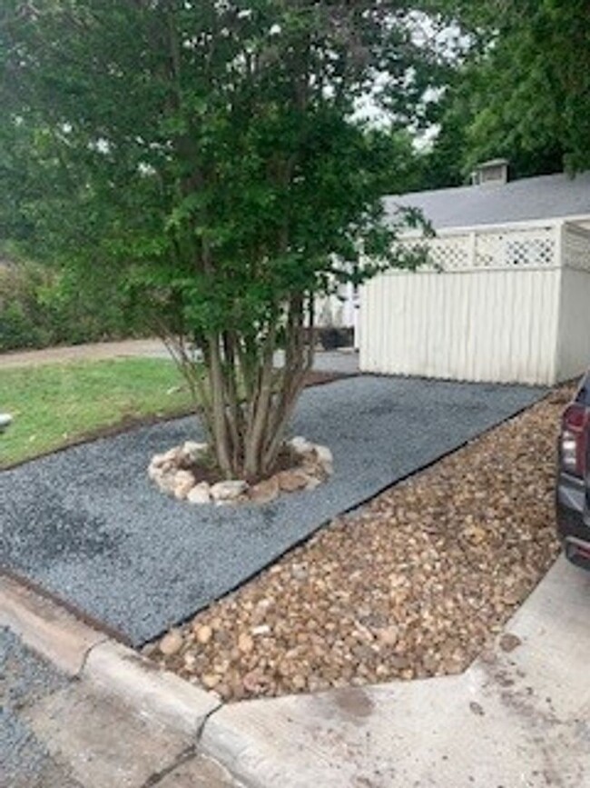
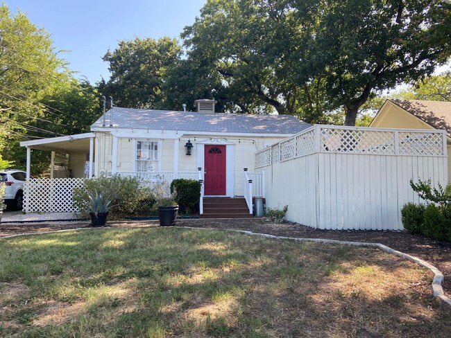
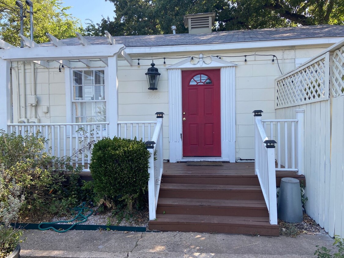
Discover your new rental in Austin, TX. This property is located at 2608 W 8th St in the 78703 area of Austin. Get a jump start on your move to a new home. To learn more about this property, contact us.
2608 W 8th St is an apartment community located in Travis County and the 78703 ZIP Code.
Location
Get Directions
Following a bend in the Colorado River, Westfield extends from the river north to Enfield Road, following the road until it reaches the Mopac Expressway. The neighborhood contains a stretch of parks from the river northward, including Eilers Park, home to the historic Deep Eddy. A large portion of this small neighborhood is occupied by the Lions Municipal Golf Course, an 18-hole course that opened in 1924.
The historic Stone Windmill, once home to Effie Cara and Wylie Wilson Bennett, is a unique feature in the Johnson Creek Greenbelt, which also features a hiking and biking trail. Westenfield Neighborhood Park, located at the north end of the greenbelt, contains a playground, a swimming pool, and a walkway. If you’re moving to Westfield with a dog, you’ll appreciate having Redbud Isle Park, home to a leash-free dog park, nearby.
While Westfield is primarily residential, there are some great destinations to try. The Hula Hut, located on the river, provides great views of Lake Austin.
Learn more about living in WestfieldBelow are rent ranges for similar nearby apartments
| Beds | Average Size | Lowest | Typical | Premium |
|---|---|---|---|---|
| Studio Studio Studio | 458-478 Sq Ft | $995 | $1,335 | $1,950 |
| 1 Bed 1 Bed 1 Bed | 712 Sq Ft | $1,245 | $1,895 | $2,880 |
| 2 Beds 2 Beds 2 Beds | 1233 Sq Ft | $1,800 | $2,902 | $5,200 |
| 3 Beds 3 Beds 3 Beds | 1243 Sq Ft | $2,400 | $2,900 | $3,300 |
| 4 Beds 4 Beds 4 Beds | 2423 Sq Ft | $4,400 | $6,495 | $14,000 |
Education
| Colleges & Universities | Distance | ||
|---|---|---|---|
| Colleges & Universities | Distance | ||
| Drive: | 5 min | 2.5 mi | |
| Drive: | 8 min | 3.7 mi | |
| Drive: | 12 min | 5.0 mi | |
| Drive: | 11 min | 5.1 mi |
2608 W 8th St Unit A is within 5 minutes or 2.5 miles from Austin C.C., Rio Grande Campus. It is also near University of Texas at Austin and St. Edward's University.
Transportation options available in Austin include Downtown Station, located 2.8 miles from 2608 W 8th St Unit A. 2608 W 8th St Unit A is near Austin-Bergstrom International, located 13.9 miles or 28 minutes away.
| Transit / Subway | Distance | ||
|---|---|---|---|
| Transit / Subway | Distance | ||
| Drive: | 6 min | 2.8 mi | |
| Drive: | 8 min | 3.8 mi | |
| Drive: | 10 min | 5.0 mi | |
| Drive: | 14 min | 6.7 mi | |
| Drive: | 13 min | 7.4 mi |
| Commuter Rail | Distance | ||
|---|---|---|---|
| Commuter Rail | Distance | ||
|
|
Drive: | 5 min | 2.1 mi |
|
|
Drive: | 43 min | 33.6 mi |
|
|
Drive: | 46 min | 37.4 mi |
| Airports | Distance | ||
|---|---|---|---|
| Airports | Distance | ||
|
Austin-Bergstrom International
|
Drive: | 28 min | 13.9 mi |
Time and distance from 2608 W 8th St Unit A.
| Shopping Centers | Distance | ||
|---|---|---|---|
| Shopping Centers | Distance | ||
| Walk: | 2 min | 0.1 mi | |
| Drive: | 3 min | 1.2 mi | |
| Drive: | 3 min | 1.3 mi |
2608 W 8th St Unit A has 3 shopping centers within 1.3 miles, which is about a 3-minute walk. The miles and minutes will be for the farthest away property.
| Parks and Recreation | Distance | ||
|---|---|---|---|
| Parks and Recreation | Distance | ||
|
Red Bud Isle
|
Drive: | 3 min | 1.2 mi |
|
Zilker Botanical Garden
|
Drive: | 5 min | 2.5 mi |
|
Austin Nature and Science Center
|
Drive: | 6 min | 3.1 mi |
|
Zilker Nature Preserve
|
Drive: | 6 min | 3.1 mi |
|
Umlauf Sculpture Garden and Museum
|
Drive: | 6 min | 3.2 mi |
2608 W 8th St Unit A has 5 parks within 3.2 miles, including Austin Nature and Science Center, Zilker Nature Preserve, and Red Bud Isle.
| Hospitals | Distance | ||
|---|---|---|---|
| Hospitals | Distance | ||
| Drive: | 5 min | 2.7 mi | |
| Drive: | 6 min | 3.2 mi | |
| Drive: | 6 min | 3.4 mi |
2608 W 8th St Unit A has 3 hospitals within 3.4 miles, the nearest is Arise Austin Medical Center which is 2.7 miles away and a 5 minute drive.
| Military Bases | Distance | ||
|---|---|---|---|
| Military Bases | Distance | ||
| Drive: | 85 min | 68.6 mi | |
| Drive: | 93 min | 75.0 mi |
2608 W 8th St Unit A is 68.6 miles from Randolph Air Force Base, and is convenient to other military bases, including Fort Hood.
You May Also Like
Similar Rentals Nearby


What Are Walk Score®, Transit Score®, and Bike Score® Ratings?
Walk Score® measures the walkability of any address. Transit Score® measures access to public transit. Bike Score® measures the bikeability of any address.
What is a Sound Score Rating?
A Sound Score Rating aggregates noise caused by vehicle traffic, airplane traffic and local sources
2608 W 8th St
Austin, TX 78703