$1,050
/ Month
2606 Montana Ave
Cincinnati, OH 45211
Today
Favorites
-
Bedrooms
2
-
Bathrooms
1
-
Square Feet
750 sq ft
2606 Montana Ave

Favorites
About This Home
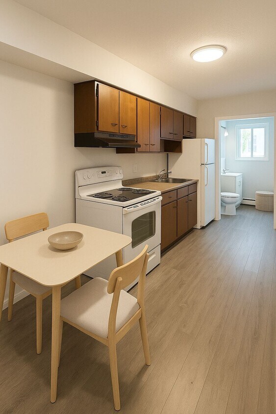
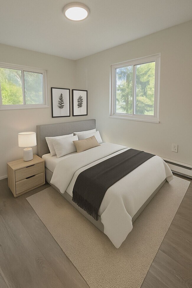
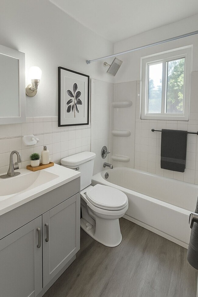
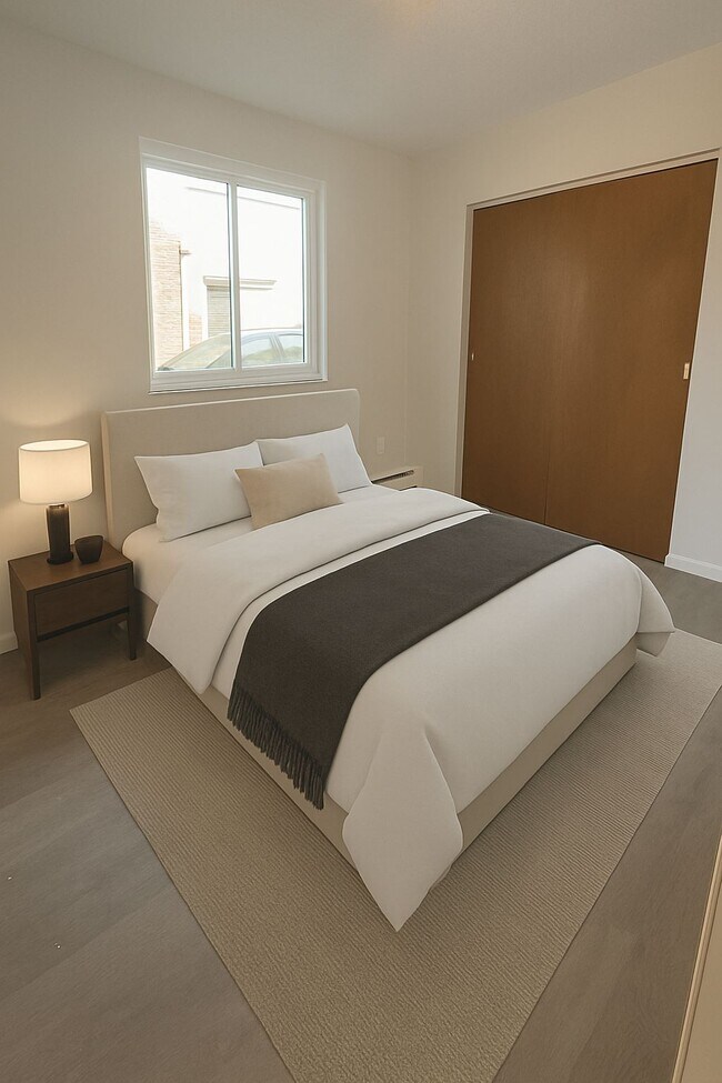
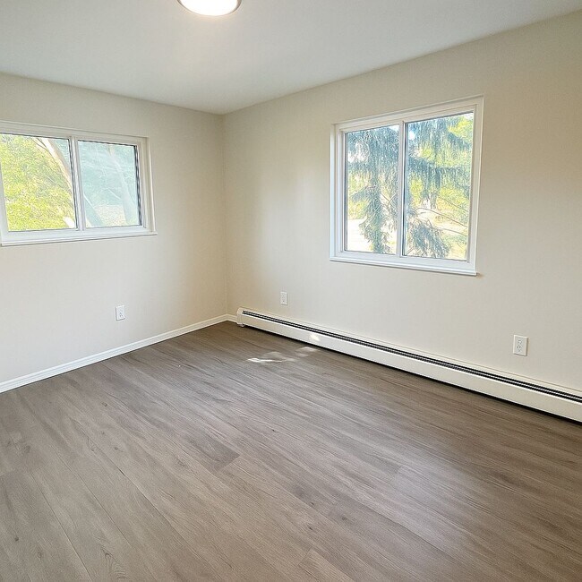
2-Bedroom / 1-Bath apartment Updated with fresh paint and flooring Bright living room with large windows Kitchen with appliances included Bedrooms with closet space On-site laundry Dedicated parking Convenient location near Cheviot and Westwood, close to shopping, dining, and bus lines Professionally managed with responsive maintenance
2606 Montana Ave is an apartment community located in Hamilton County and the 45211 ZIP Code.
* Price shown is base rent. Excludes user-selected optional fees and variable or usage-based fees and required charges due at or prior to move-in or at move-out. Price, availability, fees, and any applicable rent special are subject to change without notice.
* Square footage definitions vary. Displayed square footage is approximate.
Contact
- Listed by Ninth Ave
Location
Get Directions
Situated about five miles northwest of Downtown Cincinnati, Westwood is the largest neighborhood in the city. Residents flock to Westwood for its many affordable historic homes and modern apartments available for rent in addition to its close proximity to I-74, I-75, and all that Downtown Cincinnati has to offer.
While Westwood is a predominantly residential neighborhood, it is also home to a slew of convenient stores and restaurants. Shopping opportunities abound in Westwood, with plenty of national retailers in Western Hills Plaza and local shops in the growing Town Hall District. Numerous neighborhood parks provide ample space to enjoy the outdoors in town as well as the sprawling 1,400-acre Mount Airy Forest, which is partially located in Westwood.
Learn more about living in Westwood
Education
| Colleges & Universities | Distance | ||
|---|---|---|---|
| Colleges & Universities | Distance | ||
| Drive: | 10 min | 4.1 mi | |
| Drive: | 10 min | 5.4 mi | |
| Drive: | 12 min | 5.9 mi | |
| Drive: | 15 min | 6.7 mi |
2606 Montana Ave is within 10 minutes or 4.1 miles from Cincinnati State. It is also near University of Cincinnati and Univ. of Cincinnati, Medical.
Transportation options available in Cincinnati include Brewery District Station, Elm & Henry, located 6.2 miles from 2606 Montana Ave. 2606 Montana Ave is near Cincinnati/Northern Kentucky International, located 20.1 miles or 35 minutes away.
| Transit / Subway | Distance | ||
|---|---|---|---|
| Transit / Subway | Distance | ||
| Drive: | 11 min | 6.2 mi | |
| Drive: | 11 min | 6.2 mi | |
| Drive: | 11 min | 6.3 mi | |
| Drive: | 12 min | 6.3 mi | |
| Drive: | 12 min | 6.5 mi |
| Commuter Rail | Distance | ||
|---|---|---|---|
| Commuter Rail | Distance | ||
|
|
Drive: | 10 min | 6.1 mi |
| Airports | Distance | ||
|---|---|---|---|
| Airports | Distance | ||
|
Cincinnati/Northern Kentucky International
|
Drive: | 35 min | 20.1 mi |
Time and distance from 2606 Montana Ave.
| Shopping Centers | Distance | ||
|---|---|---|---|
| Shopping Centers | Distance | ||
| Drive: | 7 min | 2.5 mi | |
| Drive: | 7 min | 2.9 mi | |
| Drive: | 8 min | 3.1 mi |
2606 Montana Ave has 3 shopping centers within 3.1 miles, which is about a 8-minute drive. The miles and minutes will be for the farthest away property.
| Parks and Recreation | Distance | ||
|---|---|---|---|
| Parks and Recreation | Distance | ||
|
Mt. Airy Forest
|
Drive: | 5 min | 2.2 mi |
|
Buttercup Valley
|
Drive: | 7 min | 3.0 mi |
|
LaBoiteaux Woods
|
Drive: | 10 min | 4.2 mi |
|
Burnet Woods
|
Drive: | 10 min | 5.2 mi |
|
Imago Earth Center
|
Drive: | 14 min | 5.8 mi |
2606 Montana Ave has 5 parks within 5.8 miles, including Mt. Airy Forest, Buttercup Valley, and LaBoiteaux Woods.
| Hospitals | Distance | ||
|---|---|---|---|
| Hospitals | Distance | ||
| Drive: | 8 min | 3.5 mi | |
| Drive: | 9 min | 4.7 mi | |
| Drive: | 12 min | 5.9 mi |
2606 Montana Ave has 3 hospitals within 5.9 miles, the nearest is Mercy Health - West Hospital which is 3.5 miles away and a 8 minute drive.
| Military Bases | Distance | ||
|---|---|---|---|
| Military Bases | Distance | ||
| Drive: | 70 min | 53.8 mi | |
| Drive: | 76 min | 58.9 mi | |
| Drive: | 79 min | 62.2 mi |
2606 Montana Ave has 3 military bases within 62.2 miles, the nearest is Gentile Air Force Station which is 53.8 miles away and a 70 minute drive.
You May Also Like
Similar Rentals Nearby


What Are Walk Score®, Transit Score®, and Bike Score® Ratings?
Walk Score® measures the walkability of any address. Transit Score® measures access to public transit. Bike Score® measures the bikeability of any address.
What is a Sound Score Rating?
A Sound Score Rating aggregates noise caused by vehicle traffic, airplane traffic and local sources

2606 Montana Ave
Cincinnati, OH 45211