

$2,900 Total Monthly Price

26 Parker St

,

Westwood, MA 02090

Share Listing
Favorites
26 Parker St
Share Listing
Favorites

Check Back Soon for Upcoming Availability

Beds Baths Average SF
3 Bedrooms 3 Bedrooms 3 Br 2 Baths 2 Baths 2 Ba 1,400 SF

Fees and Policies

The fees listed below are community-provided and may exclude utilities or add-ons. All payments are made directly to the property and are non-refundable unless otherwise specified.

  • Dogs Allowed
  • Fees not specified
  • Cats Allowed
  • Fees not specified

Details

Utilities Included

  • Water

About This Property

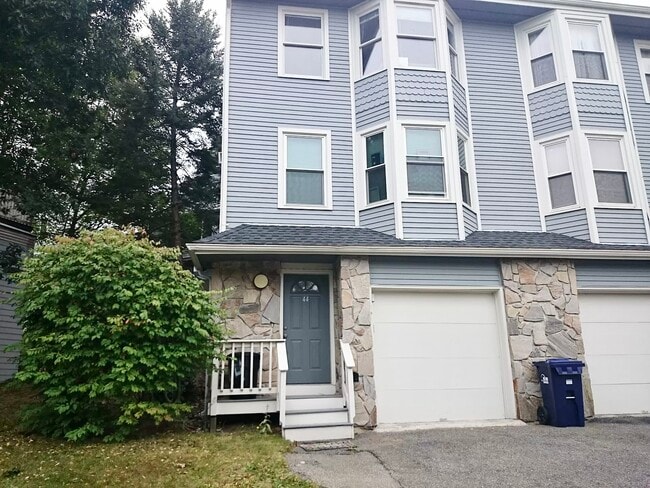
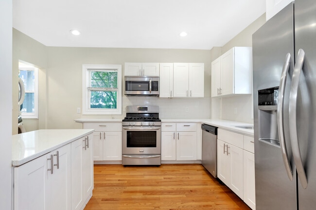
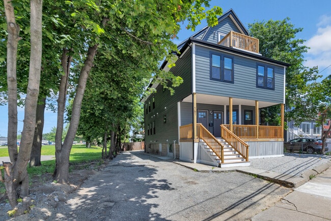
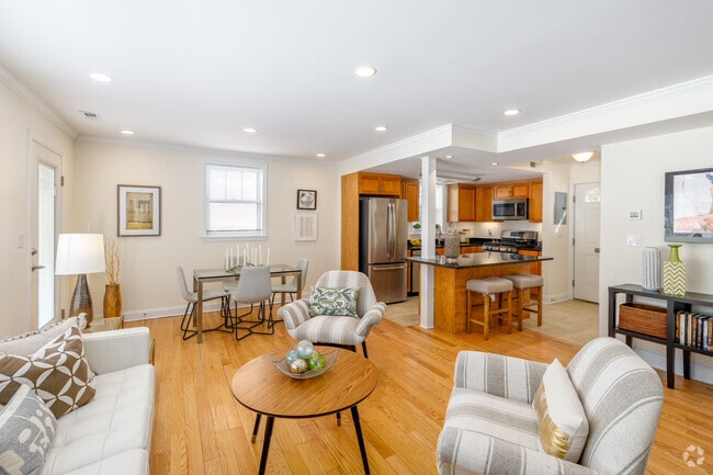
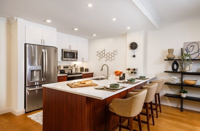
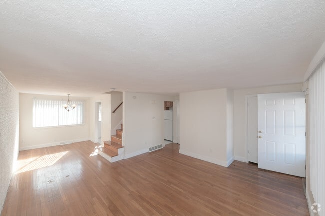
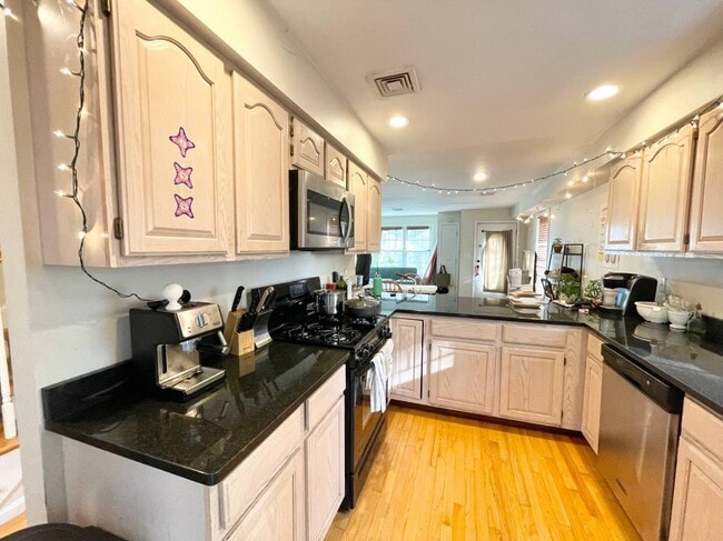
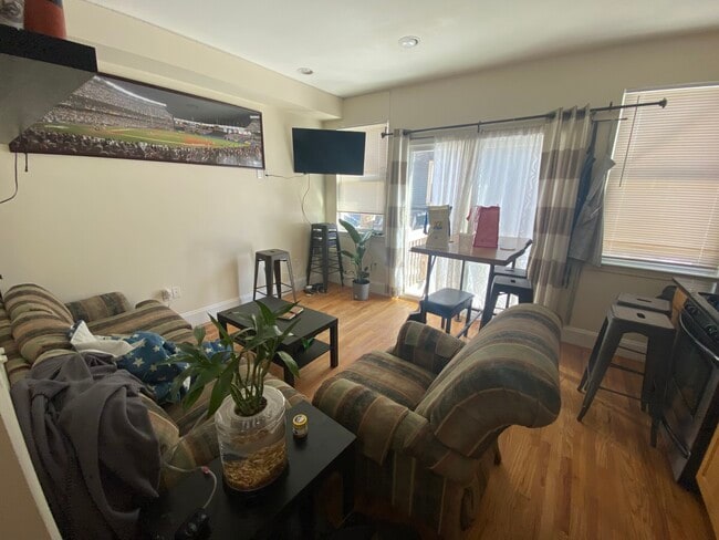
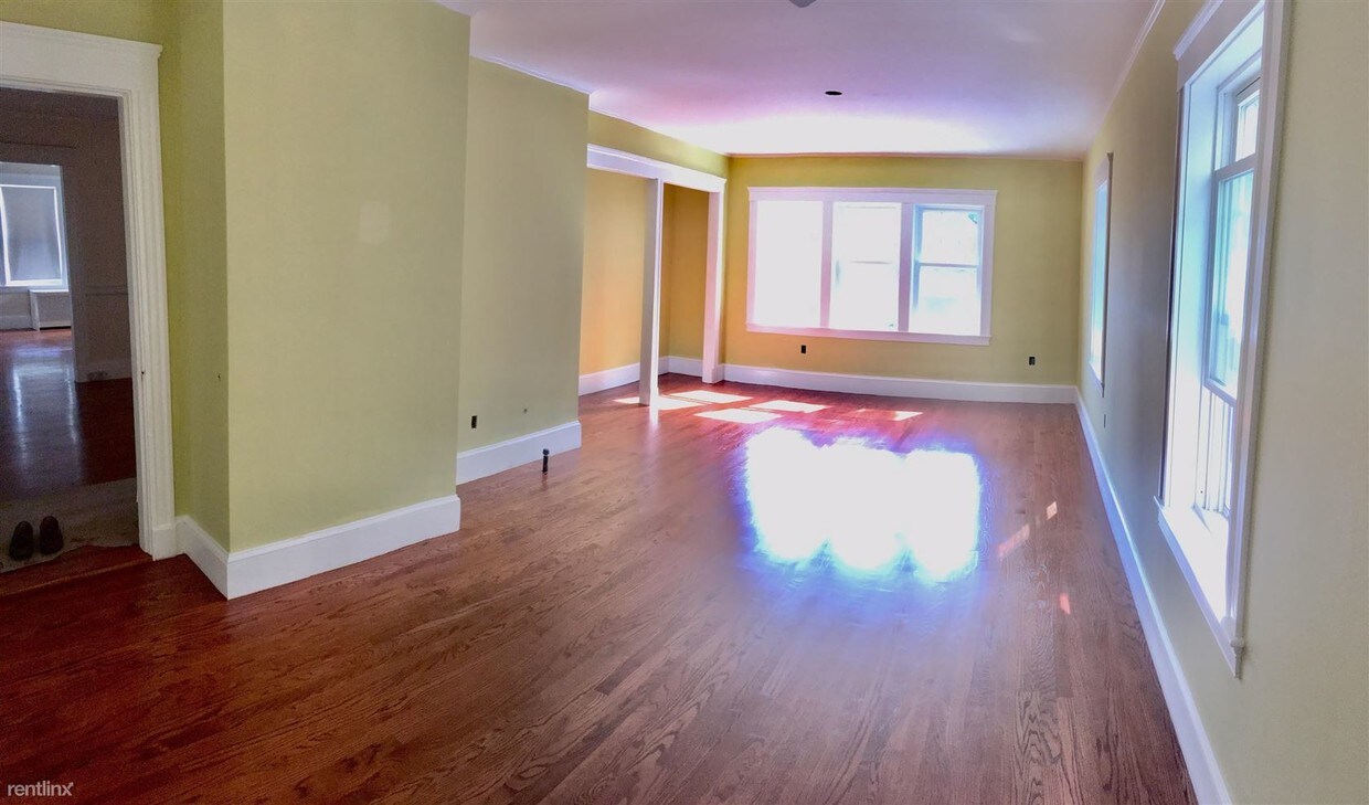
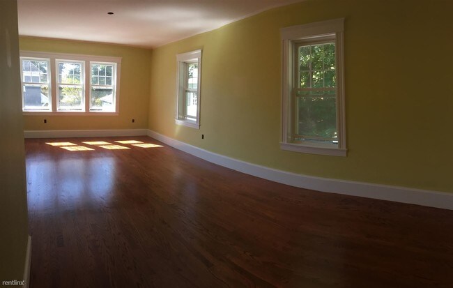
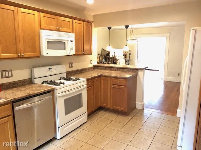
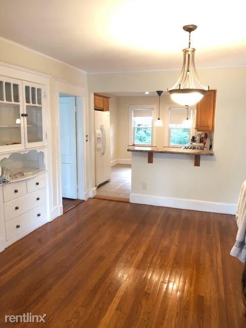
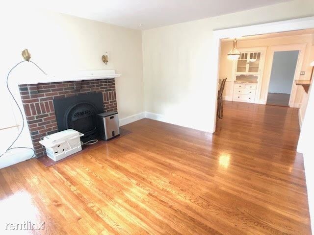
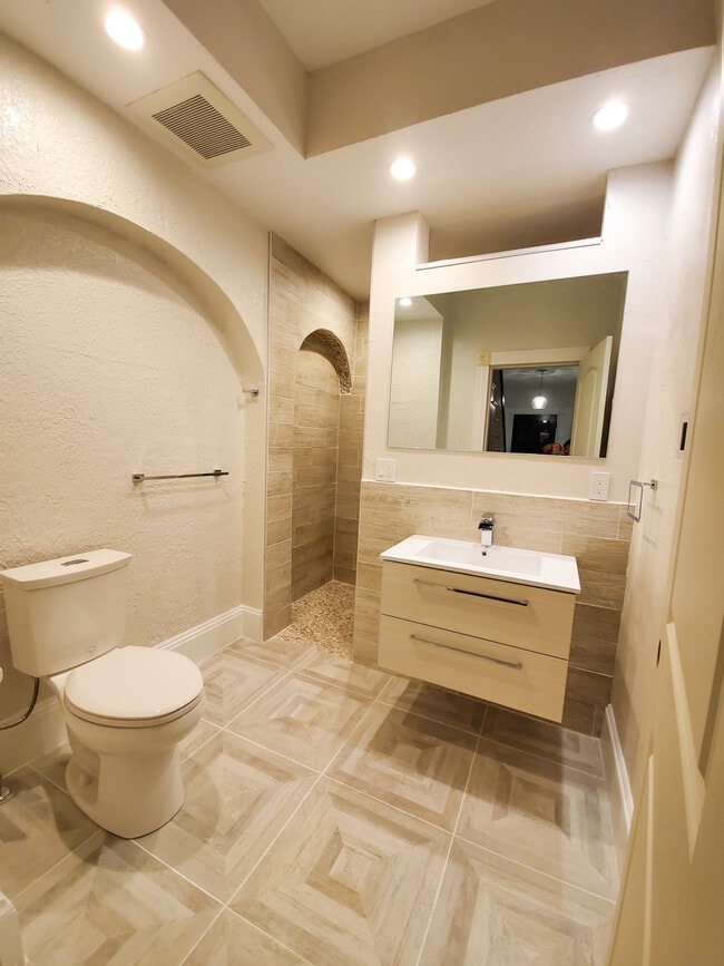
(781) 820-9722 - Available for rent NOW - this absolutely gorgeous 3 bed / 2 bath first floor unit on one of the most picturesque streets in Westwood! This unit features newly refinished gleaming hardwood floors throughout, formal living & dining room, gas cooking and high efficiency hot water heater, newly renovated master bedroom and TONS of natural light! Property has a lead compliance certificate, this unit comes with 2 parking spaces (one in the garage), free washer/dryer on site, and has tremendous storage. Ultra convenient location, very close to 95, the Islington commuter rail, and Legacy Place! (RLNE5156068) Other Amenities: Parking, Garage. Appliances: Dishwasher, Refrigerator, Range, Garbage Disposal, Washer & Dryer, Microwave. Lease lengths: 12 Months. Utilities: Water Included. Pet policies: Small Dogs Allowed, Cats Allowed.

26 Parker St is a townhome located in Norfolk County and the 02090 ZIP Code. This area is served by the Westwood School District attendance zone.

Unique Features

  • Garage

Townhome Features

  • Washer/Dryer
  • Dishwasher
Location
26 Parker St, Westwood,
MA 02090
Get Directions
| Edit

Under 30 minutes

Commute Time is calculated at rush hour.
City - Westwood

Approximately 25 miles from Boston, the town of Westwood offers residents the simplicity of suburban living and the closeness to metropolitan nightlife and attractions. CNN/Money and Money Magazine named Westwood in their “100 Best Places to Live” in 2005.

Expansive greenspaces like Rice Reservation, Mulvehill- and Grimm Conservation, and Pheasant Hill makeup this unique, charming Norfolk County town. Ready for some fun-in-the-sun? Hale Reservation’s North Beach is a prime spot for sun and swim. Shopping and dining destinations include University Station, and college campuses and universities are easily accessible by I-95 and rail services provided by Massachusetts Bay Transportation Authority (MBTA).

Learn more about living in Westwood 
Amenities
  • Washer/Dryer
  • Dishwasher
  • Garage
Expenses
Utilities Included
Water Included
Education
Colleges & Universities Distance
Drive: 12 min 5.6 mi
Drive: 13 min 6.7 mi
Drive: 16 min 8.6 mi
Drive: 22 min 11.0 mi
26 Parker St is within 12 minutes or 5.6 miles from Curry College. It is also near Massasoit C.C., Canton Campus and Babson College.
Schools
Public Elementary School
Grades PK-5
279 Students
Nearby
Public Elementary School
Grades K-5
220 Students
Nearby
Public Middle School
Grades 6-8
633 Students
Nearby
Public High School
Grades 9-12
826 Students
Attendance Zone
Private Elementary & Middle School
Grades PK-8
312 Students
Nearby
Private Middle & High School
Grades 6-12
955 Students
Nearby
Transportation

Transportation options available in Westwood include Forest Hills Station, located 6.8 miles from 26 Parker St. 26 Parker St is near General Edward Lawrence Logan International, located 16.7 miles or 32 minutes away.

Transit / Subway Distance
Drive: 16 min 6.8 mi
Drive: 15 min 7.7 mi
Drive: 16 min 8.1 mi
Drive: 16 min 8.2 mi
Drive: 17 min 8.7 mi
Commuter Rail Distance
Walk: 7 min 0.4 mi
Drive: 4 min 1.7 mi
Drive: 5 min 2.1 mi
Drive: 5 min 2.4 mi
Drive: 6 min 2.9 mi
Airports Distance
Airports Distance
General Edward Lawrence Logan International
Drive: 32 min 16.7 mi

Walkability Near 26 Parker St Westwood, MA 02090

Getting Around
Fairly Walkable
Walkability
50 / 100
Some Public Transit
Transit
50 / 100
Exceptionally Drivable
Drivability
100 / 100
Fairly Bikeable
Bikeability
40 / 100

Scores provided by

What do Walkability, Transit, Drivability, and Bikeability mean? Walkability measures the walking distance to day-to-day needs. Transit measures access to public transportation. Drivability measures congestion, parking availability, and access to major roads. Bikeability measures the suitability for cycling. How It Works
-
Soundscore
- / 100

Traffic

-

Airport

-

Businesses

-

Scores provided by

HowLoud What is a Sound Score Rating? A Sound Score Rating aggregates noise caused by vehicle traffic, airplane traffic and local sources. How It Works
Points of Interest

Time and distance from 26 Parker St.

Shopping Centers Distance
Walk: 12 min 0.6 mi
Drive: 3 min 1.4 mi
Drive: 4 min 1.5 mi
26 Parker St has 3 shopping centers within 1.5 miles, which is about a 4-minute drive. The miles and minutes will be for the farthest away property.
Parks and Recreation Distance
Stony Brook Reservation
Drive: 10 min 4.5 mi
Brook Farm Historic Site
Drive: 10 min 4.8 mi
Mass Audubon's Blue Hills Trailside Museum
Drive: 9 min 5.6 mi
Mass Audubon's Mildred Morse Allen Wildlife Sanctuary
Drive: 11 min 5.7 mi
Museum of American Bird Art at Mass Audubon
Drive: 11 min 5.7 mi
26 Parker St has 5 parks within 5.7 miles, including Stony Brook Reservation, Brook Farm Historic Site, and Mass Audubon's Blue Hills Trailside Museum.
Hospitals Distance
Hospitals Distance
Drive: 5 min 2.5 mi
Drive: 6 min 2.8 mi
Drive: 11 min 6.4 mi
26 Parker St has 3 hospitals within 6.4 miles, the nearest is Norwood Hospital which is 2.5 miles away and a 5 minute drive.
Military Bases Distance
Drive: 25 min 13.6 mi
Drive: 33 min 20.2 mi
Drive: 57 min 33.1 mi
26 Parker St has 3 military bases within 33.1 miles, the nearest is US Military Reservation which is 13.6 miles away and a 25 minute drive.

You May Also Like

Similar Rentals Nearby