

$2,370
/ Month
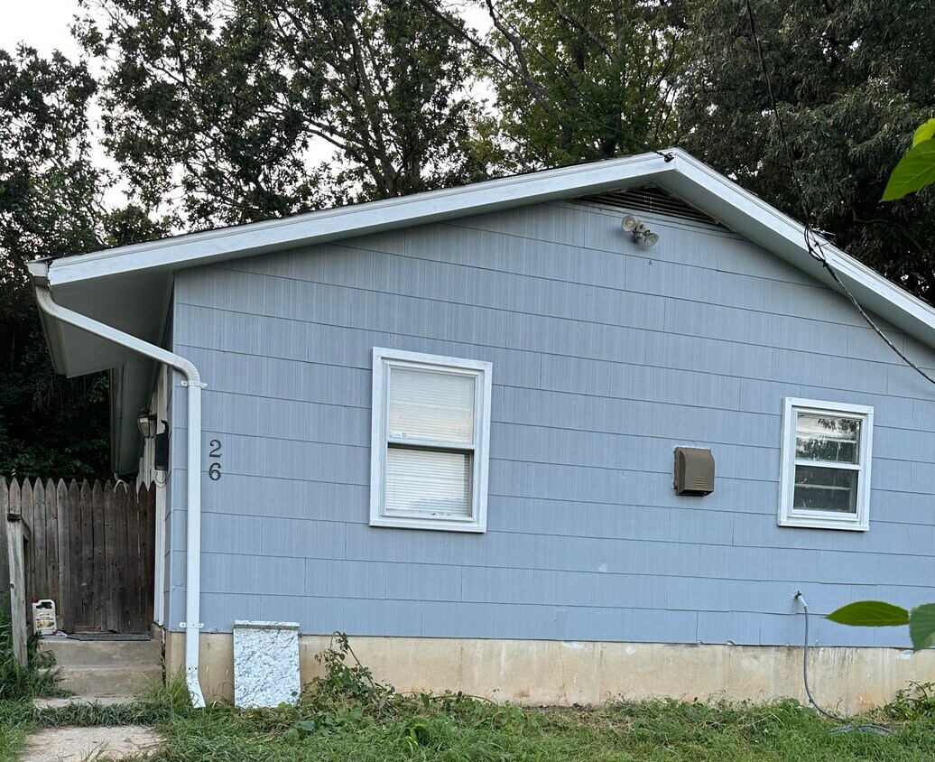
26 Bayou Ave
Capitol Heights, MD 20743
1 Day Ago
Favorites
301-973-5932
-
Bedrooms
3
-
Bathrooms
1
-
Square Feet
864 sq ft
-
Available
Available Now
26 Bayou Ave

Favorites
About This Home
$2,250 deposit,
Available Now
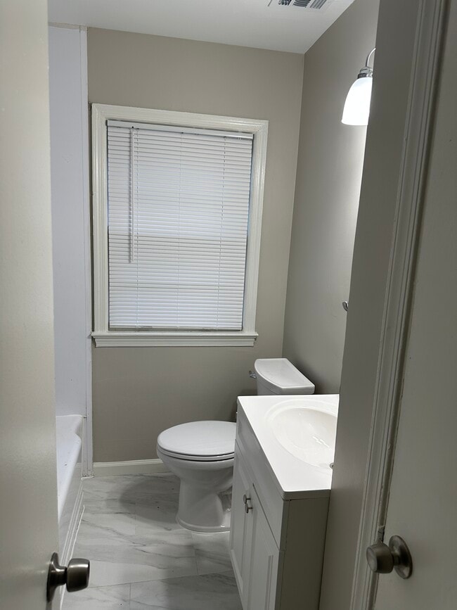
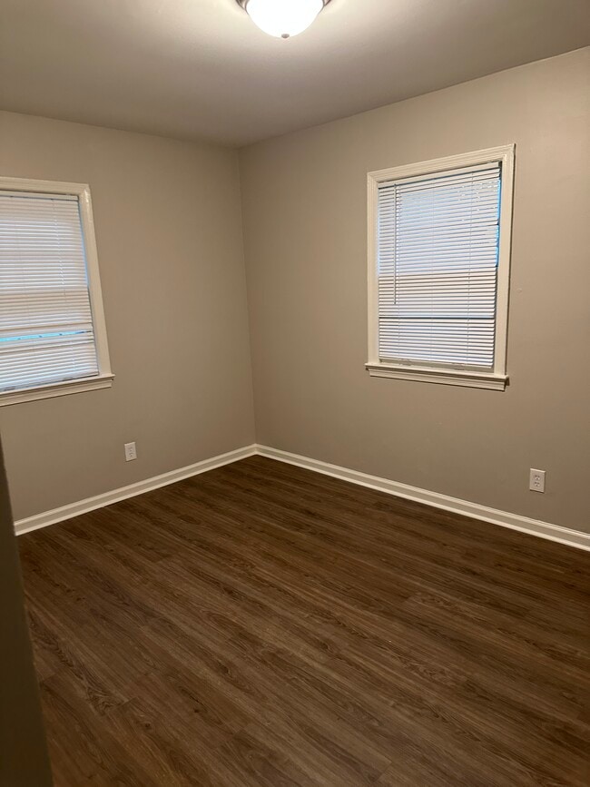
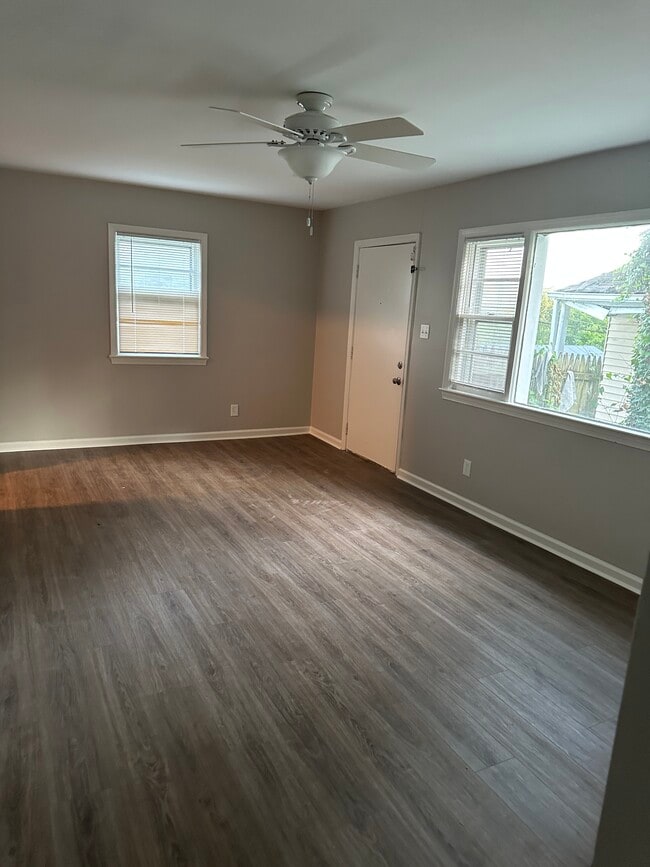
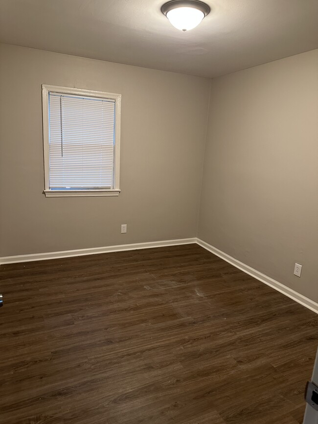
Cozy Updated Home Just Steps from Capitol Heights Metro Looking for convenience and comfort? This charming 3-bedroom, 1-bath home is ideally located within walking distance of the Capitol Heights Metro Station making your commute a breeze. Inside, you'll find fresh updates throughout, including new flooring, a modern bathroom, and updated kitchen counters. While the kitchen is compact, it's smartly designed for everyday function. This home offers a warm, manageable layout that's easy to maintain. Additional features include central heating and cooling, in-unit laundry, and a fully fenced backyard. Please note: pets are not allowed. Whether you're a first-time renter or looking to downsize, this home offers comfort, modern touches, and unbeatable access to transit. Schedule a showing today this Capitol Heights gem won't last long! Renter pays water, gas, electric. Security deposit is first month's rent. No pets allowed. Criteria: 630 Credit Score (negotiable) Employment: 5 years of employment history Housing: 5 years of rental history Income: 3x the rental fee ($6,750)
26 Bayou Ave is a house located in Prince George's County and the 20743 ZIP Code. This area is served by the Prince George's County Public Schools attendance zone.
* Price shown is base rent and may not include non-optional fees and utilities. Price, availability, fees, and any applicable rent special are subject to change without notice.
* Square footage definitions vary. Displayed square footage is approximate.
House Features
- Washer/Dryer
- Washer/Dryer Hookup
Contact
- Listed by Ms. Hunter
- Phone Number
- Contact
Location
Get Directions
Amenities
- Washer/Dryer
- Washer/Dryer Hookup
Capitol Heights -- named for its location near Washington, DC -- provides the perfect location: near DC, near the Capital Beltway, and minutes away from FedEx Field, home of the NFL's Washington Football Team. It is also close to the Anacostia River, the United States National Arboretum, and Joint Base Anacostia-Bolling. Nearby Fort Circle Park provides Capitol Heights residents with 10 miles of hiking trails -- it is also a popular concert venue and is home to Fort Dupont Ice Rink.
Capitol Heights is a terrific location for your DC-area apartment, only about seven miles southeast of downtown. Hop on the Metro at the Capitol Heights Metro Station for a fast, car-free commute. Despite being so close to the historic sites of DC, Capitol Heights was a rural area with no paved roads or streetlights. In 1910, the 200 residents in the area named their town "Capitol Heights," but it wasn't until 1980 and the arrival of the Metro Blue Line that the town began to grow.
Learn more about living in Capitol Heights
Education
| Colleges & Universities | Distance | ||
|---|---|---|---|
| Colleges & Universities | Distance | ||
| Drive: | 11 min | 5.2 mi | |
| Drive: | 10 min | 5.3 mi | |
| Drive: | 11 min | 5.8 mi | |
| Drive: | 12 min | 6.2 mi |
26 Bayou Ave is within 11 minutes or 5.2 miles from Gallaudet University. It is also near Univ. of Md. Univ. Coll. and Georgetown.
Schools

Public Elementary & Middle School
Grades PK-8
496 Students
Attendance Zone
Public High School
Grades 9-12
877 Students
Attendance Zone
Private Elementary School
Grades PK-6
50 Students
Nearby
Private Elementary & Middle School
Grades PK-8
Nearby
Private High School
Grades 9-12
Nearby
School data provided by
 The GreatSchools Rating helps parents compare schools within a state based on a variety of school quality indicators and provides a helpful picture of how effectively each school serves all of its students. Ratings are on a scale of 1 (below average) to 10 (above average) and can include test scores, college readiness, academic progress, advanced courses, equity, discipline and attendance data. We also advise parents to visit schools, consider other information on school performance and programs, and consider family needs as part of the school selection process.
View GreatSchools Rating Methodology
Data provided by GreatSchools.org © 2025. All rights reserved.
View GreatSchools Rating Methodology
Data provided by GreatSchools.org © 2025. All rights reserved.
Transportation options available in Capitol Heights include Capitol Heights, Blue/Silver Line Center Platform, located 0.4 mile from 26 Bayou Ave. 26 Bayou Ave is near Ronald Reagan Washington Ntl, located 11.7 miles or 21 minutes away, and Baltimore/Washington International Thurgood Marshall, located 28.8 miles or 43 minutes away.
| Transit / Subway | Distance | ||
|---|---|---|---|
| Transit / Subway | Distance | ||
|
Capitol Heights, Blue/Silver Line Center Platform
|
Walk: | 7 min | 0.4 mi |
|
|
Drive: | 3 min | 1.3 mi |
|
|
Drive: | 4 min | 1.6 mi |
|
|
Drive: | 5 min | 2.5 mi |
|
|
Drive: | 6 min | 2.8 mi |
| Commuter Rail | Distance | ||
|---|---|---|---|
| Commuter Rail | Distance | ||
|
|
Drive: | 10 min | 5.5 mi |
|
|
Drive: | 11 min | 5.6 mi |
|
|
Drive: | 13 min | 6.6 mi |
| Drive: | 13 min | 8.0 mi | |
|
|
Drive: | 13 min | 8.0 mi |
| Airports | Distance | ||
|---|---|---|---|
| Airports | Distance | ||
|
Ronald Reagan Washington Ntl
|
Drive: | 21 min | 11.7 mi |
|
Baltimore/Washington International Thurgood Marshall
|
Drive: | 43 min | 28.8 mi |
Time and distance from 26 Bayou Ave.
| Shopping Centers | Distance | ||
|---|---|---|---|
| Shopping Centers | Distance | ||
| Walk: | 17 min | 0.9 mi | |
| Drive: | 3 min | 1.1 mi | |
| Drive: | 3 min | 1.2 mi |
26 Bayou Ave has 3 shopping centers within 1.2 miles, which is about a 3-minute walk. The miles and minutes will be for the farthest away property.
| Parks and Recreation | Distance | ||
|---|---|---|---|
| Parks and Recreation | Distance | ||
|
Fort Dupont Park
|
Drive: | 7 min | 2.7 mi |
|
Kingman and Heritage Island Park
|
Drive: | 6 min | 3.4 mi |
|
Walker Mill Regional Park
|
Drive: | 8 min | 3.9 mi |
|
Suitland Bog
|
Drive: | 11 min | 5.0 mi |
|
National Arboretum
|
Drive: | 12 min | 6.2 mi |
26 Bayou Ave has 5 parks within 6.2 miles, including Fort Dupont Park, Kingman and Heritage Island Park, and Walker Mill Regional Park.
| Hospitals | Distance | ||
|---|---|---|---|
| Hospitals | Distance | ||
| Drive: | 8 min | 4.0 mi | |
| Drive: | 15 min | 5.8 mi | |
| Drive: | 14 min | 6.0 mi |
26 Bayou Ave has 3 hospitals within 6.0 miles, the nearest is University of Maryland Prince George's Hospital Center which is 4.0 miles away and a 8 minute drive.
| Military Bases | Distance | ||
|---|---|---|---|
| Military Bases | Distance | ||
| Drive: | 12 min | 5.8 mi | |
| Drive: | 15 min | 6.8 mi |
26 Bayou Ave is 5.8 miles from Washington Navy Yard, and is convenient to other military bases, including Anacostia Naval Station.
You May Also Like
Similar Rentals Nearby


What Are Walk Score®, Transit Score®, and Bike Score® Ratings?
Walk Score® measures the walkability of any address. Transit Score® measures access to public transit. Bike Score® measures the bikeability of any address.
What is a Sound Score Rating?
A Sound Score Rating aggregates noise caused by vehicle traffic, airplane traffic and local sources
26 Bayou Ave
Capitol Heights, MD 20743