$2,100
Total Monthly Price
12 Month Lease
2541 Bittersweet Ln
Saint Paul, MN 55109
Favorites
612-447-0914
-
Bedrooms
3
-
Bathrooms
2
-
Square Feet
1,600 sq ft
-
Available
Available Now
Highlights
- Pets Allowed
- Smoke Free
2541 Bittersweet Ln

Favorites
About This Home
12 Month Lease,
$2,100 deposit,
Available Now
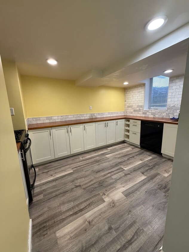
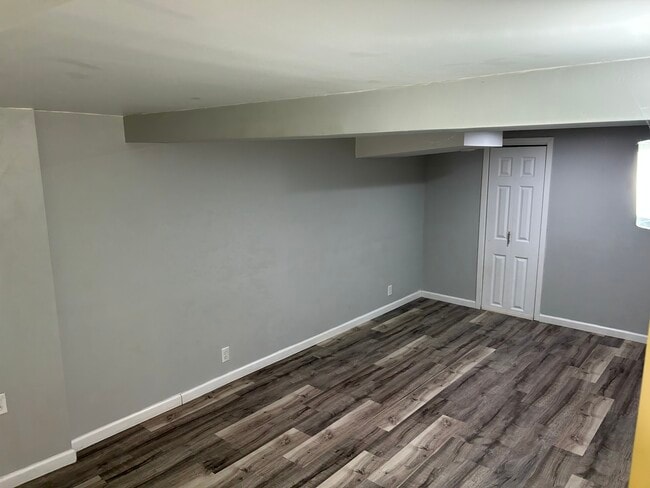
This property at 2541 Bittersweet Ln features 3 bedrooms and 2 bathrooms within a total living space of 1,600 square feet. The living room offers ample space for relaxation and entertainment, while the kitchen includes a dishwasher for convenience. The bedrooms provide sufficient storage space and are designed for comfort. Additional amenities include air conditioning, heating, high-speed internet access, and in-unit washer/dryer. The property is smoke-free, ensuring a clean living environment. The exterior offers a well-maintained appearance, contributing to the overall appeal of the home. The rental price is available upon request.
2541 Bittersweet Ln is a townhome located in Ramsey County and the 55109 ZIP Code.
* Price shown is total price based on community-supplied monthly required fees. Excludes user-selected optional fees and variable or usage-based fees and required charges due at or prior to move-in or at move-out. Price, availability, fees, and any applicable rent special are subject to change without notice.
* Square footage definitions vary. Displayed square footage is approximate.
Townhome Features
Washer/Dryer
Air Conditioning
Dishwasher
High Speed Internet Access
- High Speed Internet Access
- Wi-Fi
- Washer/Dryer
- Air Conditioning
- Heating
- Smoke Free
- Storage Space
- Tub/Shower
- Dishwasher
- Kitchen
- Storage Space
Fees and Policies
The fees listed below are community-provided and may exclude utilities or add-ons. All payments are made directly to the property and are non-refundable unless otherwise specified.
- Dogs Allowed
-
Fees not specified
- Cats Allowed
-
Fees not specified
- Parking
-
Surface Lot--
Details
Utilities Included
-
Gas
-
Water
-
Electricity
-
Heat
-
Trash Removal
-
Sewer
-
Air Conditioning
Contact
- Phone Number
- Contact
Location
Get Directions
Thanks to some odd geography, Maplewood has something of a split personality. This first-ring St. Paul suburb can be described as being shaped like a frying pan. The main business and residential area lies primarily to the north and east of St. Paul, while the chief amenities, such as the community center and an indoor mall, lie in the "pan." South Maplewood, or the "pan handle," runs south along Interstate 494 and has fewer business amenities. Residents of this area tend to shop in bordering Woodbury, since it takes a good half hour to get from the southern tip of Maplewood to the main northern business district.
Meanwhile, Oakdale lies between the two sections, just east of Maplewood's pan handle and north of Woodbury. This young suburb is a quiet bedroom community with a scattering of business districts. Cornfields make up its eastern portion, giving the area a distinctly rural vibe, even though it's just 10 minutes outside of downtown St. Paul.
Learn more about living in Maplewood-Oakdale
Education
| Colleges & Universities | Distance | ||
|---|---|---|---|
| Colleges & Universities | Distance | ||
| Drive: | 7 min | 4.0 mi | |
| Drive: | 13 min | 6.2 mi | |
| Drive: | 16 min | 9.2 mi | |
| Drive: | 15 min | 9.3 mi |
2541 Bittersweet Ln is within 7 minutes or 4.0 miles from Century College. It is also near Metropolitan State University and Saint Paul College.
Transportation options available in Saint Paul include Robert St Station, located 8.2 miles from 2541 Bittersweet Ln. 2541 Bittersweet Ln is near Minneapolis-St Paul International/Wold-Chamberlain, located 17.8 miles or 29 minutes away.
| Transit / Subway | Distance | ||
|---|---|---|---|
| Transit / Subway | Distance | ||
| Drive: | 13 min | 8.2 mi | |
| Drive: | 14 min | 8.3 mi | |
| Drive: | 14 min | 8.4 mi | |
| Drive: | 14 min | 8.4 mi | |
| Drive: | 15 min | 8.5 mi |
| Commuter Rail | Distance | ||
|---|---|---|---|
| Commuter Rail | Distance | ||
|
|
Drive: | 14 min | 8.4 mi |
|
|
Drive: | 26 min | 15.1 mi |
|
|
Drive: | 22 min | 15.9 mi |
|
|
Drive: | 33 min | 24.0 mi |
|
|
Drive: | 34 min | 25.7 mi |
| Airports | Distance | ||
|---|---|---|---|
| Airports | Distance | ||
|
Minneapolis-St Paul International/Wold-Chamberlain
|
Drive: | 29 min | 17.8 mi |
Getting Around
 What do Walkability, Transit, Drivability, and Bikeability mean?
Walkability measures the walking distance to day-to-day needs.
Transit measures access to public transportation.
Drivability measures congestion, parking availability, and access to major roads.
Bikeability measures the suitability for cycling.
How It Works
What do Walkability, Transit, Drivability, and Bikeability mean?
Walkability measures the walking distance to day-to-day needs.
Transit measures access to public transportation.
Drivability measures congestion, parking availability, and access to major roads.
Bikeability measures the suitability for cycling.
How It Works
Fairly Walkable
Walkability
40
/ 100
Limited Public Transit
Transit
20
/ 100
Very Drivable
Drivability
80
/ 100
Moderately Bikeable
Bikeability
60
/ 100
Scores provided by
Active
Soundscore™
79
/ 100
Traffic
BusyAirport
CalmBusinesses
CalmScores provided by
HowLoud What is a Sound Score Rating? A Sound Score Rating aggregates noise caused by vehicle traffic, airplane traffic and local sources. How It WorksTime and distance from 2541 Bittersweet Ln.
| Shopping Centers | Distance | ||
|---|---|---|---|
| Shopping Centers | Distance | ||
| Walk: | 10 min | 0.6 mi | |
| Walk: | 15 min | 0.8 mi | |
| Walk: | 16 min | 0.9 mi |
2541 Bittersweet Ln has 3 shopping centers within 0.9 mile, which is about a 16-minute walk. The miles and minutes will be for the farthest away property.
| Parks and Recreation | Distance | ||
|---|---|---|---|
| Parks and Recreation | Distance | ||
|
Keller Regional Park
|
Drive: | 9 min | 3.9 mi |
|
Phelan Regional Park
|
Drive: | 10 min | 4.3 mi |
|
Phalen Park
|
Drive: | 10 min | 4.4 mi |
|
Arlington/Arkwright Park
|
Drive: | 10 min | 4.9 mi |
|
Maplewood Nature Center
|
Drive: | 13 min | 7.2 mi |
2541 Bittersweet Ln has 5 parks within 7.2 miles, including Keller Regional Park, Phelan Regional Park, and Phalen Park.
| Hospitals | Distance | ||
|---|---|---|---|
| Hospitals | Distance | ||
| Drive: | 4 min | 1.5 mi | |
| Drive: | 13 min | 7.9 mi | |
| Drive: | 13 min | 8.0 mi |
2541 Bittersweet Ln has 3 hospitals within 8.0 miles, the nearest is M Health Fairview St. John's Hospital which is 1.5 miles away and a 4 minute drive.
| Military Bases | Distance | ||
|---|---|---|---|
| Military Bases | Distance | ||
| Drive: | 28 min | 16.6 mi |
2541 Bittersweet Ln is 16.6 miles and a 28 minute drive from Fort Snelling Military Reservation.
Amenities
- High Speed Internet Access
- Wi-Fi
- Washer/Dryer
- Air Conditioning
- Heating
- Smoke Free
- Storage Space
- Tub/Shower
- Dishwasher
- Kitchen
- Storage Space
2541 Bittersweet Ln Photos
-
-
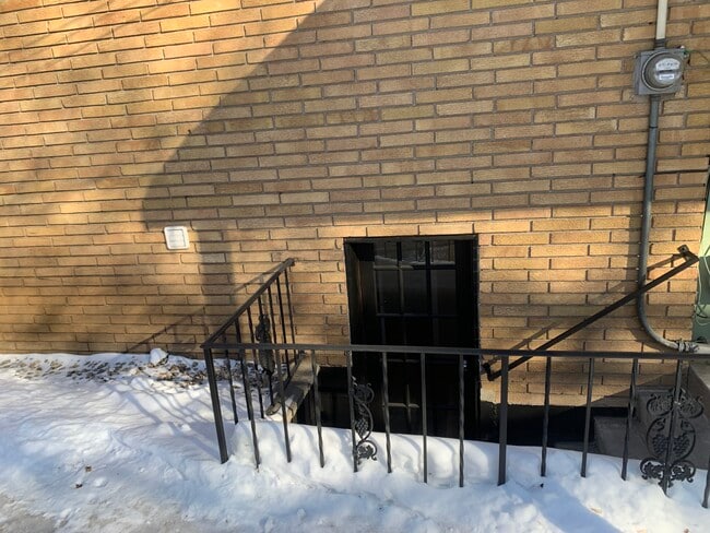
Parking right next to entry
-
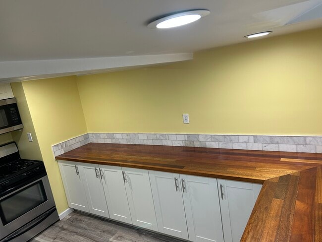
Large butcher block kitchen
-
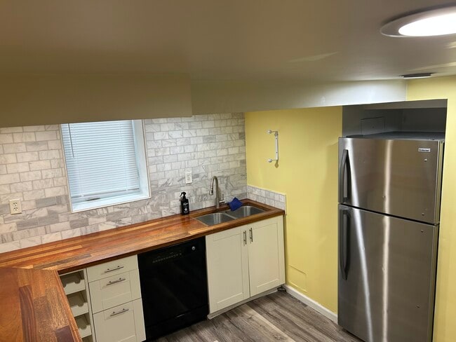
Dishwasher with egress window
-
-
Living room with storage
-
Bathroom #1
-
Bathroom #1
-
Bedroom #1

2541 Bittersweet Ln
Saint Paul, MN 55109