
$1,800
/ Month
2522 S Percy St
Philadelphia, PA 19148
Today
Favorites
610-996-1907
-
Bedrooms
3
-
Bathrooms
2
-
Square Feet
--
-
Available
Available Now
Highlights
- Straight Thru Architecture
- Living Room
- Laundry Room
- Forced Air Heating System
- Dining Room
2522 S Percy St

Favorites
About This Home
Available Now
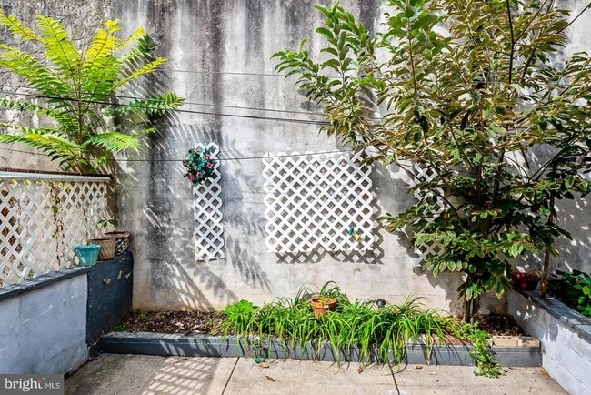
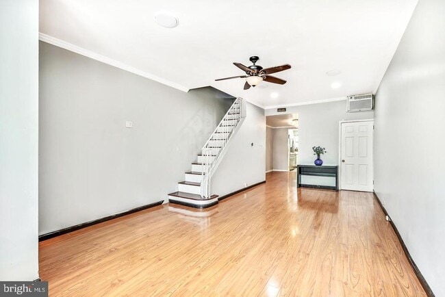
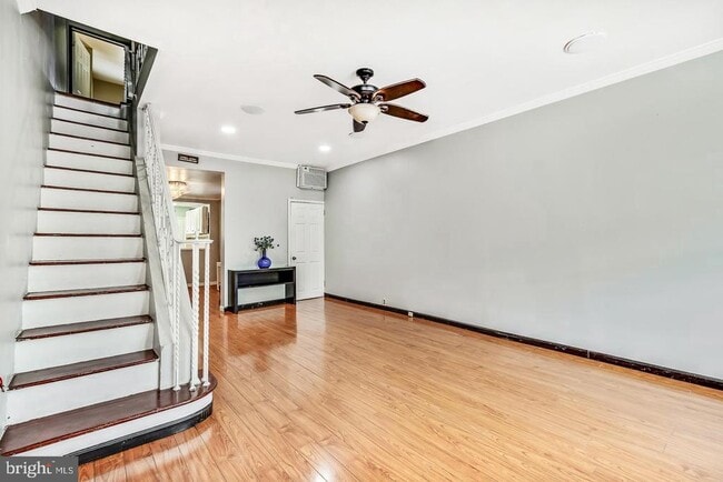
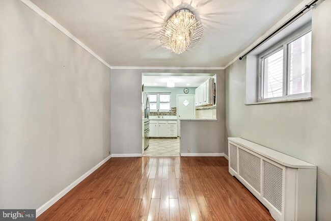
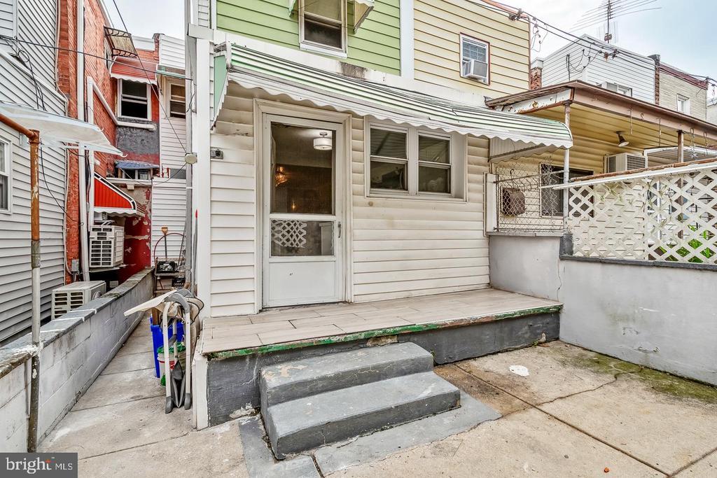
Welcome to 2522 South Percy Street, a well-maintained residence available for lease in the heart of South Philadelphia. This charming rowhome boasts 3 bedrooms and 2 full baths And a thoughtful layout designed for both comfort and functionality. The interior features an open living area filled with natural light, a well-appointed kitchen, and generously sized bedrooms. A private outdoor space enhances the property, creating the perfect setting for relaxation or entertaining. Nestled on a quiet residential street, this home offers an excellent blend of neighborhood charm and city convenience. The location provides proximity to local shops, cafes, and restaurants, as well as easy access to public transportation. Sports and entertainment venues in the Stadium District are just minutes away, while Center City is a short commute. Nearby parks and community amenities further contribute to the appeal of this vibrant neighborhood. This property presents an excellent opportunity to enjoy all that South Philadelphia has to offer. Schedule your private showing today.
2522 S Percy St is a townhome located in Philadelphia County and the 19148 ZIP Code. This area is served by the The School District of Philadelphia attendance zone.
* Price shown is base rent. Excludes user-selected optional fees and variable or usage-based fees and required charges due at or prior to move-in or at move-out. Price, availability, fees, and any applicable rent special are subject to change without notice.
* Square footage definitions vary. Displayed square footage is approximate.
Home Details
Home Type
Interior Unit Townhome
Year Built
Built in 1925
Bedrooms and Bathrooms
2 Full Bathrooms
3 Bedrooms
Home Design
Straight Thru Architecture
Masonry
Stone Foundation
Interior Spaces
Living Room
Dining Room
1,116 Sq Ft Home
Property has 2 Levels
Laundry
Laundry Room
Listing and Financial Details
Security Deposit $1,800
Requires 2 Months of Rent Paid Up Front
12-Month Min and 24-Month Max Lease Term
Available 10/1/25
Assessor Parcel Number 393457700
Tenant pays for all utilities
Residential Lease
Lot Details
1,069 Sq Ft Lot
Lot Dimensions are 14.00 x 75.00
Parking
On-Street Parking
Utilities
Forced Air Heating System
Natural Gas Water Heater
Window Unit Cooling System
Community Details
Overview
Philadelphia Subdivision
Pet Policy
Pets allowed on a case-by-case basis
Contact
- Listed by Brian L Stetler | BHHS Fox & Roach-Center City Walnut
- Phone Number
- Contact
-
Source
 Bright MLS, Inc.
Copyright © 2025 Bright MLS, Inc.
Location
Get Directions
Amenities
- Basement
South Philadelphia East is a fun yet affordable area comprising of several neighborhoods, most consisting of two- to four-bedroom brick row homes, although there are also plenty of apartments and brand-new condos, particularly along Broad Street. This area houses Passyunk Avenue (pronounced "Passh-yunk" by the locals) that has exploded in recent years with stores, bars with plenty of craft beer, and restaurants, including the high-end Laurel, run by a top chef. The Italian Market is also nearby, a blocks-long outdoor food and produce market, making for easy grocery shopping.
The area is diverse, and you can find newcomers alongside native Philadelphians whose families have lived there for several generations. South Philly-living offers more of a community feel than downtown, yet the Broad Street Line and numerous public transit buses flow through this section, Center City is less than 15 minutes away.
Learn more about living in South Philadelphia East
Education
| Colleges & Universities | Distance | ||
|---|---|---|---|
| Colleges & Universities | Distance | ||
| Drive: | 9 min | 2.7 mi | |
| Drive: | 9 min | 3.2 mi | |
| Drive: | 10 min | 3.7 mi | |
| Drive: | 9 min | 4.5 mi |
2522 S Percy St is within 9 minutes or 2.7 miles from Thomas Jefferson University. It is also near The Art Inst. of Philadelphia and Drexel Univ., Hahnemann.
Schools


Public Elementary & Middle School
Grades K-8
486 Students
Attendance Zone
Public High School
Grades PK & 9-12
611 Students
Attendance Zone
Public Elementary & Middle School
Grades PK-8
538 Students
Nearby
Private Elementary School
Grades K
Nearby
Private Elementary & Middle School
Grades PK-8
186 Students
Nearby
Private High School
Grades 9-12
690 Students
Nearby
School data provided by
 The GreatSchools Rating helps parents compare schools within a state based on a variety of school quality indicators and provides a helpful picture of how effectively each school serves all of its students. Ratings are on a scale of 1 (below average) to 10 (above average) and can include test scores, college readiness, academic progress, advanced courses, equity, discipline and attendance data. We also advise parents to visit schools, consider other information on school performance and programs, and consider family needs as part of the school selection process.
View GreatSchools Rating Methodology
Data provided by GreatSchools.org © 2025. All rights reserved.
View GreatSchools Rating Methodology
Data provided by GreatSchools.org © 2025. All rights reserved.
Transportation options available in Philadelphia include Oregon, located 0.5 mile from 2522 S Percy St. 2522 S Percy St is near Philadelphia International, located 8.6 miles or 17 minutes away, and Trenton Mercer, located 36.8 miles or 54 minutes away.
| Transit / Subway | Distance | ||
|---|---|---|---|
| Transit / Subway | Distance | ||
|
|
Walk: | 10 min | 0.5 mi |
|
|
Walk: | 15 min | 0.8 mi |
|
|
Drive: | 4 min | 1.3 mi |
|
|
Drive: | 5 min | 1.7 mi |
|
|
Drive: | 4 min | 1.8 mi |
| Commuter Rail | Distance | ||
|---|---|---|---|
| Commuter Rail | Distance | ||
|
|
Drive: | 9 min | 2.7 mi |
|
|
Drive: | 10 min | 3.3 mi |
| Drive: | 8 min | 4.4 mi | |
|
|
Drive: | 9 min | 4.9 mi |
| Drive: | 10 min | 5.3 mi |
| Airports | Distance | ||
|---|---|---|---|
| Airports | Distance | ||
|
Philadelphia International
|
Drive: | 17 min | 8.6 mi |
|
Trenton Mercer
|
Drive: | 54 min | 36.8 mi |
Time and distance from 2522 S Percy St.
| Shopping Centers | Distance | ||
|---|---|---|---|
| Shopping Centers | Distance | ||
| Walk: | 13 min | 0.7 mi | |
| Walk: | 16 min | 0.9 mi | |
| Drive: | 3 min | 1.1 mi |
2522 S Percy St has 3 shopping centers within 1.1 miles, which is about a 3-minute walk. The miles and minutes will be for the farthest away property.
| Parks and Recreation | Distance | ||
|---|---|---|---|
| Parks and Recreation | Distance | ||
|
Thaddeus Kosciuszko National Memorial
|
Drive: | 7 min | 2.2 mi |
|
Gloria Dei Church National Historic Site
|
Drive: | 6 min | 2.2 mi |
|
Franklin D. Roosevelt Park
|
Drive: | 8 min | 2.6 mi |
|
Great Egg Harbor River
|
Drive: | 8 min | 2.8 mi |
|
Independence Seaport Museum
|
Drive: | 9 min | 3.0 mi |
2522 S Percy St has 5 parks within 3.0 miles, including Franklin D. Roosevelt Park, Gloria Dei Church National Historic Site, and Thaddeus Kosciuszko National Memorial.
| Hospitals | Distance | ||
|---|---|---|---|
| Hospitals | Distance | ||
| Drive: | 4 min | 1.2 mi | |
| Drive: | 8 min | 2.2 mi | |
| Drive: | 9 min | 2.4 mi |
2522 S Percy St has 3 hospitals within 2.4 miles, the nearest is New Hanover Regional Medical Center which is 1.2 miles away and a 4 minute drive.
| Military Bases | Distance | ||
|---|---|---|---|
| Military Bases | Distance | ||
| Drive: | 7 min | 3.0 mi |
2522 S Percy St is 3.0 miles and a 7 minute drive from Philadelphia Naval Busi Center.
You May Also Like
Similar Rentals Nearby
-
-
-
-
-
-
-
-
-
1 / 24

-


What Are Walk Score®, Transit Score®, and Bike Score® Ratings?
Walk Score® measures the walkability of any address. Transit Score® measures access to public transit. Bike Score® measures the bikeability of any address.
What is a Sound Score Rating?
A Sound Score Rating aggregates noise caused by vehicle traffic, airplane traffic and local sources
2522 S Percy St
Philadelphia, PA 19148