

$4,650
Total Monthly Price
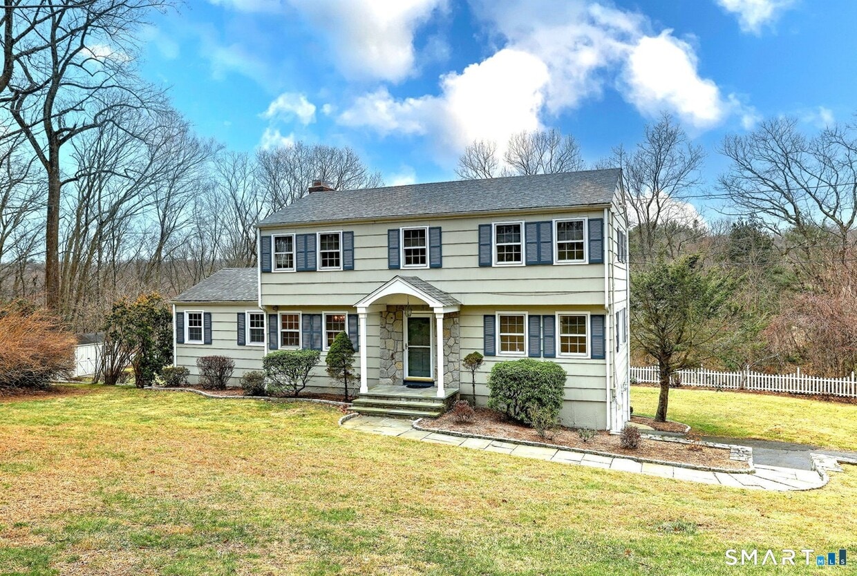
25 Shelter Rock Rd
Trumbull, CT 06611
Today
|
Edit
Favorites
203-257-2323
-
Bedrooms
4
-
Bathrooms
2.5
-
Square Feet
2,588 sq ft
-
Available
Not Available
Highlights
- Colonial Architecture
- Vaulted Ceiling
- Attic
- 1 Fireplace
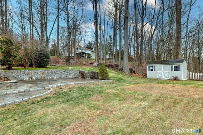
- Patio
- Laundry Room
25 Shelter Rock Rd

Favorites
About This Home
Not Available
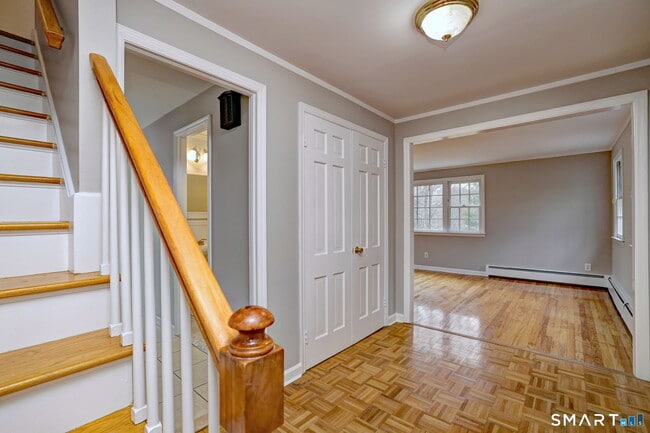
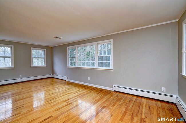
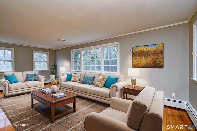
Call for Availability - Well maintained Traditional Colonial with many updates located in a central location on a picturesque lot in the Hillandale area of town. This home features a nicely updated Kitchen with granite counter tops, SS appliances, tile backsplash and includes a unique brick accented grill. Additionally there is a convenient walk-in Pantry/Laundry Room. Upon entering there are formal Living and Dining Rooms with HWD Floors. Then through the Kitchen to the spacious Family Room highlighted by the brick wood burning fireplace. As an added bonus you will find a bright 4-season Sunroom with plenty of natural light , vaulted ceilings, ceiling fan and slider to the level backyard. The rear yard is partially fenced and has plenty of room on this 1 acre property. Finally there is a Playroom in the walk-out lower level with new laminate flooring. And plenty of room for storage as well as the newer natural gas mechanicals. The interior of the entire home has just been freshly painted and also includes a 2-car garage. All this conveniently located close to schools, shopping and highways. MLS# 24144398
25 Shelter Rock Rd is a house located in Fairfield County and the 06611 ZIP Code. This area is served by the Trumbull attendance zone.
* Price shown is total price based on community-supplied monthly required fees. Excludes user-selected optional fees and variable or usage-based fees and required charges due at or prior to move-in or at move-out. Price, availability, fees, and any applicable rent special are subject to change without notice.
* Square footage definitions vary. Displayed square footage is approximate.
Home Details
Year Built
Built in 1969
Attic
Pull Down Stairs to Attic
Bedrooms and Bathrooms
2.5 Bathrooms
4 Bedrooms
Home Design
Colonial Architecture
Wood Siding
Shingle Siding
Interior Spaces
Vaulted Ceiling
1 Fireplace
2,588 Sq Ft Home
Kitchen
Electric Range
Microwave
Dishwasher
Laundry
Laundry Room
Dryer
Laundry on main level
Washer
Listing and Financial Details
Assessor Parcel Number 397616
Lot Details
1.07 Acre Lot
Stone Wall
Property is zoned AA
Outdoor Features
Patio
Rain Gutters
Parking
Automatic Garage Door Opener
2 Car Garage
Partially Finished Basement
Walk-Out Basement
Basement Fills Entire Space Under The House
Basement Storage
Schools
Hillcrest Middle School
Trumbull High School
Utilities
Zoned Heating and Cooling System
Hot Water Circulator
Baseboard Heating
Hot Water Heating System
Cable TV Available
Heating System Uses Natural Gas
Community Details
Pet Policy
No Pets Allowed
Contact
- Listed by Joe Kapell | Re/Max Right Choice
- Phone Number
- Contact
-
Source
 Smart MLS
The data relating to real estate for sale on this website appears in part through the SMARTMLS Internet Data Exchange program, a voluntary cooperative exchange of property listing data between licensed real estate brokerage firms, and is provided by SMARTMLS through a licensing agreement. Listing information is from various brokers who participate in the SMARTMLS IDX program and not all listings may be visible on the site. The property information being provided on or through the website is for the personal, non-commercial use of consumers and such information may not be used for any purpose other than to identify prospective properties consumers may be interested in purchasing. Some properties which appear for sale on the website may no longer be available because they are for instance, under contract, sold or are no longer being offered for sale. Property information displayed is deemed reliable but is not guaranteed. Copyright 2026 SmartMLS, Inc.
Location
Get Directions
Trumbull/Upper Stratford/Shelton is an expansive area encompassing the land north of Bridgeport and Lower Stratford. The area is largely residential and complemented by lush woods. Renters have options of modern apartments and townhomes for rent. Although this community is mostly residential, Highways 25 and 8 allow for easy travel to surrounding areas, including the 25-mile drive east to New Haven and the 70-mile drive to New York. These two roads also hold the main retail areas including places like Hawley Lane Mall and Westfield Trumbull. Outside of this area, residents are in proximity to some of Connecticut’s best attractions like the Connecticut’s Beardsley Zoo and the Roosevelt Forest.
Learn more about living in Trumbull/Upper Stratford/Shelton
Education
| Colleges & Universities | Distance | ||
|---|---|---|---|
| Colleges & Universities | Distance | ||
| Drive: | 14 min | 6.4 mi | |
| Drive: | 13 min | 9.1 mi | |
| Drive: | 20 min | 13.2 mi | |
| Drive: | 23 min | 13.6 mi |
25 Shelter Rock Rd is within 14 minutes or 6.4 miles from Sacred Heart University. It is also near University of Bridgeport and Fairfield University.
Schools


Public Elementary School
Grades K-4
353 Students
Nearby
Public Elementary School
Grades K-5
495 Students
Attendance Zone
Public Middle School
Grades 6-8
767 Students
Attendance Zone
Public High School
Grades 9-12
2,134 Students
Attendance Zone
Private Elementary & Middle School
Grades PK-8
246 Students
Nearby
Private High School
Grades 9-12
813 Students
Nearby
School data provided by
 The GreatSchools Rating helps parents compare schools within a state based on a variety of school quality indicators and provides a helpful picture of how effectively each school serves all of its students. Ratings are on a scale of 1 (below average) to 10 (above average) and can include test scores, college readiness, academic progress, advanced courses, equity, discipline and attendance data. We also advise parents to visit schools, consider other information on school performance and programs, and consider family needs as part of the school selection process.
View GreatSchools Rating Methodology
Data provided by GreatSchools.org © 2026. All rights reserved.
View GreatSchools Rating Methodology
Data provided by GreatSchools.org © 2026. All rights reserved.
You May Also Like
Similar Rentals Nearby


What Are Walk Score®, Transit Score®, and Bike Score® Ratings?
Walk Score® measures the walkability of any address. Transit Score® measures access to public transit. Bike Score® measures the bikeability of any address.
What is a Sound Score Rating?
A Sound Score Rating aggregates noise caused by vehicle traffic, airplane traffic and local sources
25 Shelter Rock Rd
Trumbull, CT 06611