
$3,300
/ Month
2443 NW 56th St
Miami, FL 33142
Today
|
Edit
Favorites
786-606-7980
-
Bedrooms
3
-
Bathrooms
2
-
Square Feet
--
-
Available
Available Now
2443 NW 56th St

Favorites
About This Home
Available Now
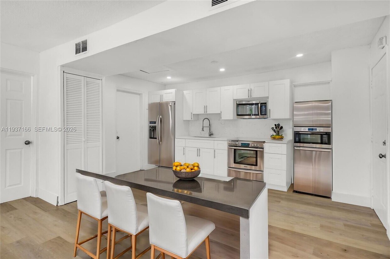
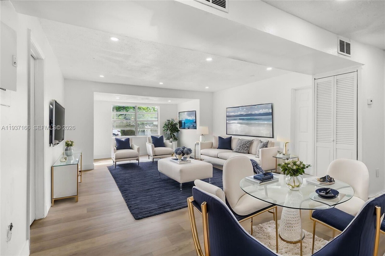
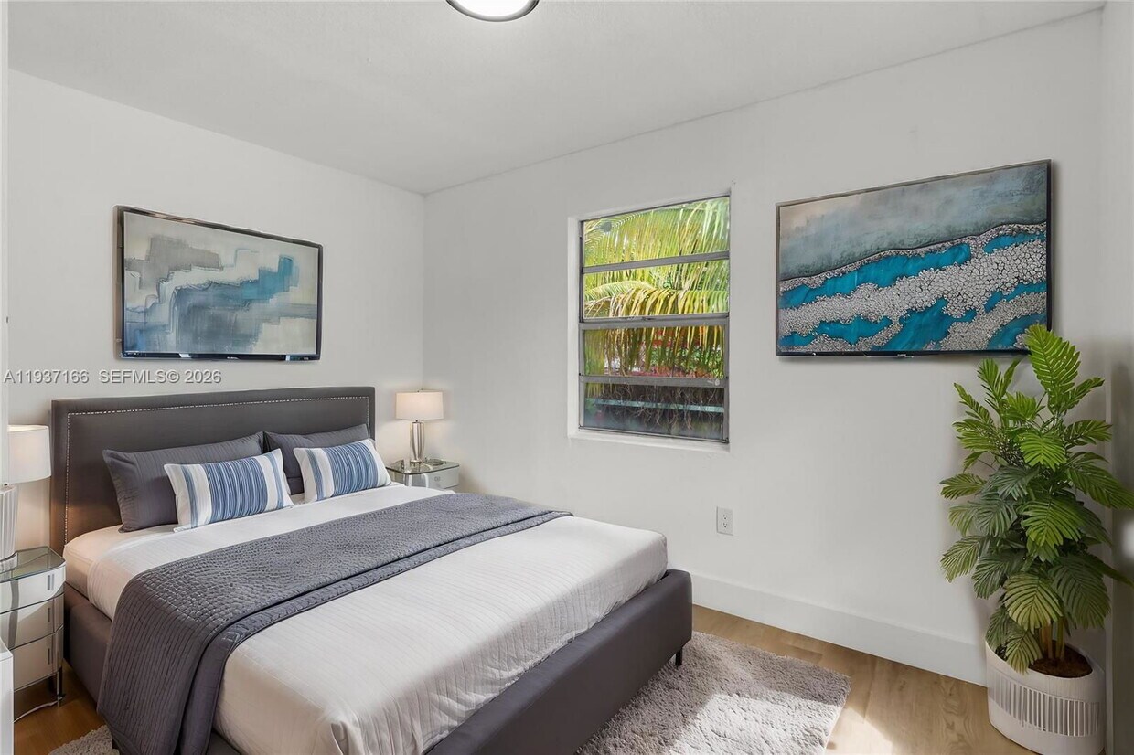
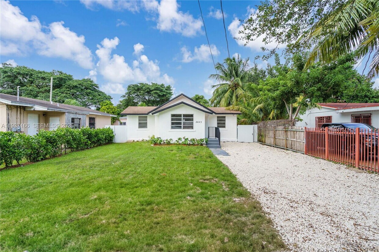
Welcome to this beautiful 3-bedroom residence that is perfectly situated in the vibrant heart of Miami, offering both comfort and style. Sparkling Kitchen, Vinyl Flooring throughout, Updated Bathrooms and Hurricane Impact Windows! Plenty of backyard space and centrally located in the heart of Miami! Close to Wynwood, Miami International Airport, Downtown, Little Havana, and easy access to I-95. Come see this beauty today before its gone! Listing posted by Stephanie inchausti [SYNDID 4149669 01162026]
2443 NW 56Th St is a house located in Miami/Dade County and the 33142 ZIP Code. This area is served by the Miami-Dade County Public Schools attendance zone.
* Price shown is base rent. Excludes user-selected optional fees and variable or usage-based fees and required charges due at or prior to move-in or at move-out. Price, availability, fees, and any applicable rent special are subject to change without notice.
* Square footage definitions vary. Displayed square footage is approximate.
Contact
- Listed by Stephanie inchausti
- Phone Number
- Contact
Location
Get Directions
The neighborhood of Brownsville sits just under four miles northeast of Miami International airport and seven miles northwest of downtown Miami. You can find a house for rent in Brownsville and have easy access through the Brownsville train station along with several Metrobus lines.
Within easy walking distance of Brownsville station, locals positively rave about Lemon Peppers Miami for their signature lemon pepper wings and scrumptious lobster bites. Order these with a tall, cold glass of lemonade and some candied yams. For a great meal served with a smile, head a little further south on 27th Ave for a seafood lover’s delight at Crab Stop Miami. Crabs, conch, or crawfish top the bill dished up with roasted potatoes in garlic butter sauce.
Learn more about living in Brownsville
Education
| Colleges & Universities | Distance | ||
|---|---|---|---|
| Colleges & Universities | Distance | ||
| Drive: | 8 min | 3.8 mi | |
| Drive: | 9 min | 3.9 mi | |
| Drive: | 10 min | 4.4 mi | |
| Drive: | 11 min | 5.6 mi |
2443 NW 56th St is within 8 minutes or 3.8 miles from Miami Dade College, Medical. It is also near Univ. of Miami, Uhealth and Miami Dade College, North.
Schools


Public Elementary School
Grades PK-5
340 Students
Attendance Zone
Public Middle School
Grades 6-8
487 Students
Attendance Zone
Public High School
Grades 9-12
1,429 Students
Attendance Zone
Private Elementary, Middle & High School
Grades 1-12
Nearby
Private Elementary School
Grades PK-4
113 Students
Nearby
School data provided by
 The GreatSchools Rating helps parents compare schools within a state based on a variety of school quality indicators and provides a helpful picture of how effectively each school serves all of its students. Ratings are on a scale of 1 (below average) to 10 (above average) and can include test scores, college readiness, academic progress, advanced courses, equity, discipline and attendance data. We also advise parents to visit schools, consider other information on school performance and programs, and consider family needs as part of the school selection process.
View GreatSchools Rating Methodology
Data provided by GreatSchools.org © 2026. All rights reserved.
View GreatSchools Rating Methodology
Data provided by GreatSchools.org © 2026. All rights reserved.
Transportation options available in Miami include Miami Intl Airport Ground Level, located 4.4 miles from 2443 NW 56th St. 2443 NW 56th St is near Miami International, located 7.2 miles or 18 minutes away, and Fort Lauderdale/Hollywood International, located 21.3 miles or 32 minutes away.
| Transit / Subway | Distance | ||
|---|---|---|---|
| Transit / Subway | Distance | ||
|
Miami Intl Airport Ground Level
|
Drive: | 10 min | 4.4 mi |
|
Airport Station
|
Drive: | 12 min | 4.4 mi |
|
|
Drive: | 11 min | 5.3 mi |
|
|
Drive: | 10 min | 5.4 mi |
|
|
Drive: | 11 min | 5.8 mi |
| Commuter Rail | Distance | ||
|---|---|---|---|
| Commuter Rail | Distance | ||
|
|
Walk: | 9 min | 0.5 mi |
|
|
Walk: | 12 min | 0.6 mi |
|
|
Drive: | 4 min | 2.1 mi |
|
|
Drive: | 6 min | 2.8 mi |
|
|
Drive: | 9 min | 5.0 mi |
| Airports | Distance | ||
|---|---|---|---|
| Airports | Distance | ||
|
Miami International
|
Drive: | 18 min | 7.2 mi |
|
Fort Lauderdale/Hollywood International
|
Drive: | 32 min | 21.3 mi |
Time and distance from 2443 NW 56th St.
| Shopping Centers | Distance | ||
|---|---|---|---|
| Shopping Centers | Distance | ||
| Walk: | 5 min | 0.3 mi | |
| Drive: | 5 min | 1.7 mi | |
| Drive: | 5 min | 1.8 mi |
2443 NW 56th St has 3 shopping centers within 1.8 miles, which is about a 5-minute drive. The miles and minutes will be for the farthest away property.
| Parks and Recreation | Distance | ||
|---|---|---|---|
| Parks and Recreation | Distance | ||
|
Miami Children's Museum
|
Drive: | 13 min | 6.9 mi |
|
Jungle Island
|
Drive: | 14 min | 7.2 mi |
|
Miami Science Museum - Closed
|
Drive: | 13 min | 7.8 mi |
|
Vizcaya Museum and Gardens
|
Drive: | 15 min | 8.0 mi |
|
Enchanted Forest Elaine Gordon Park
|
Drive: | 18 min | 9.5 mi |
2443 NW 56th St has 5 parks within 9.5 miles, including Miami Children's Museum, Jungle Island, and Miami Science Museum - Closed.
| Hospitals | Distance | ||
|---|---|---|---|
| Hospitals | Distance | ||
| Drive: | 7 min | 3.2 mi | |
| Drive: | 7 min | 3.3 mi | |
| Drive: | 8 min | 3.9 mi |
2443 NW 56th St has 3 hospitals within 3.9 miles, the nearest is Douglas Gardens Hospital which is 3.2 miles away and a 7 minute drive.
You May Also Like
Similar Rentals Nearby


What Are Walk Score®, Transit Score®, and Bike Score® Ratings?
Walk Score® measures the walkability of any address. Transit Score® measures access to public transit. Bike Score® measures the bikeability of any address.
What is a Sound Score Rating?
A Sound Score Rating aggregates noise caused by vehicle traffic, airplane traffic and local sources
2443 NW 56th St
Miami, FL 33142