
The Village at Town Center
6410 Schmidt Ln,
El Cerrito, CA 94530
$2,340 - $2,380
Studio - 2 Beds
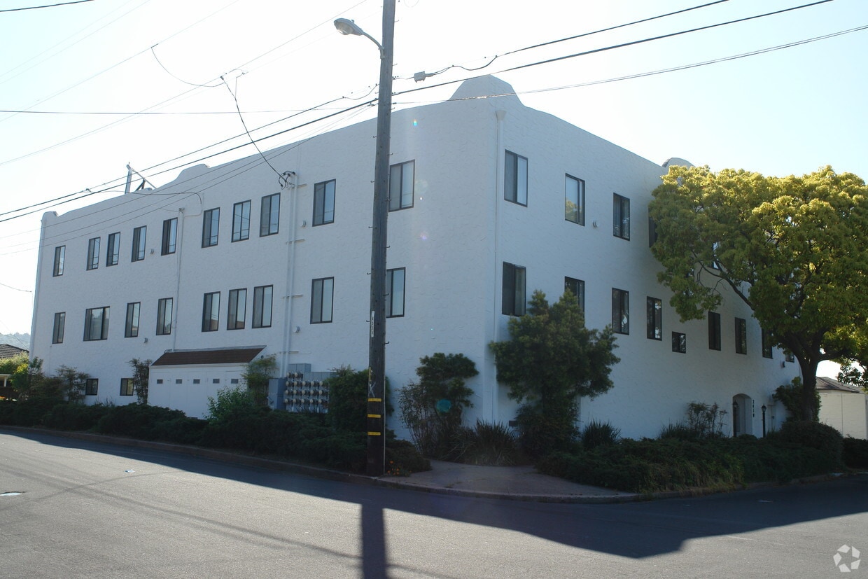
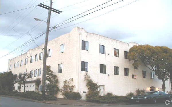
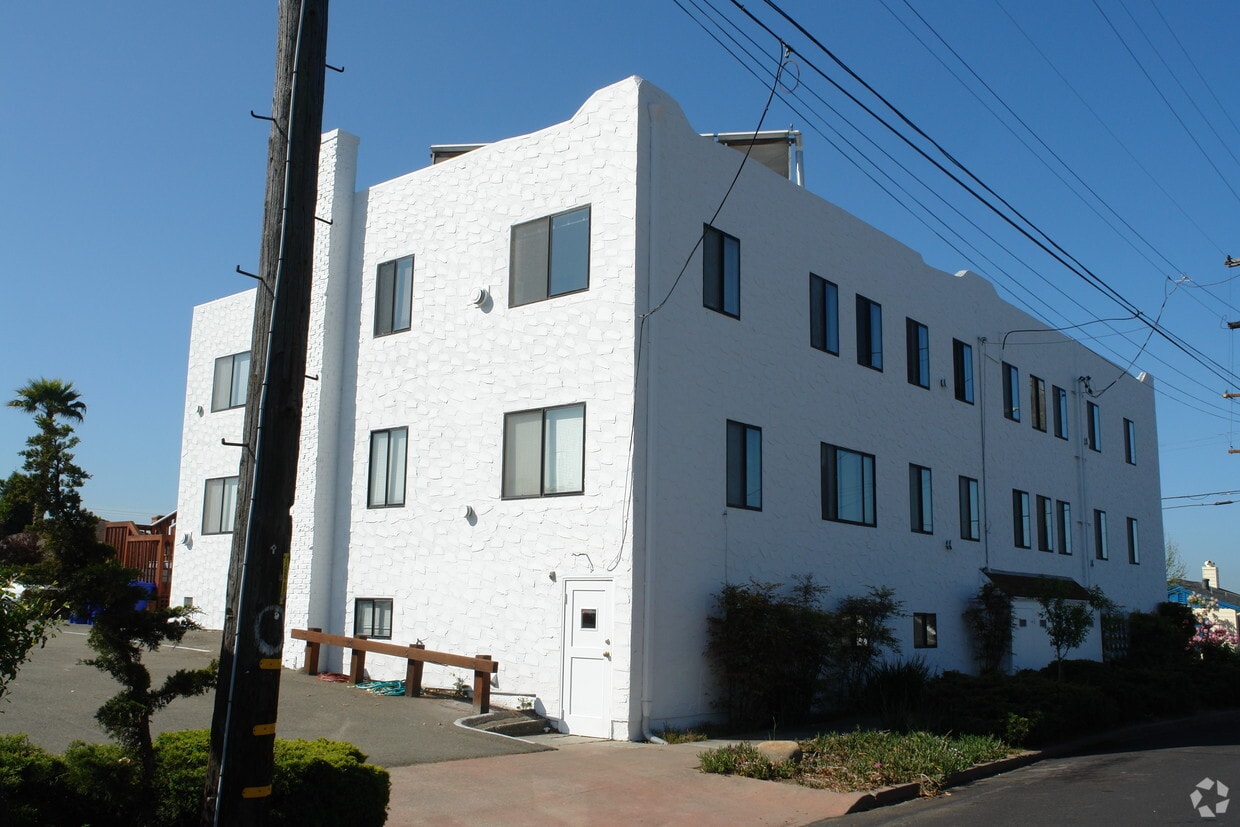
Experience a new place to live at 2410 San Mateo St in Richmond, CA. In a convenient location on San Mateo St. in Richmond's 94804 area, you can easily connect with a number of nearby points of interest. This community offers amenities and features that you'll enjoy. These include: smoke free options, high-speed internet access, and convenient on-site parking options. Here at this community, the community staff is ready to help match you with your perfect floorplan option. It's time to love where you live. Stop by for a visit today.
2410 San Mateo St is an apartment community located in Contra Costa County and the 94804 ZIP Code. This area is served by the West Contra Costa Unified School District attendance zone.
Rent an apartment in the Richmond Annex and enjoy easy access to I-80, which takes you into San Francisco. Central Avenue leads to Point Isabel, a small peninsula in San Francisco Bay.
Just across the Richmond Annex's southern border sits Albany Hill Park. Hike to the top of Albany Hill, and take in a panoramic view of the Bay Area. More trails await at the Albany Mudflats State Marine Park, just west of I-580.
Explore Playland-Not-at-the-Beach at the northern end of the neighborhood. This local hangout, with a museum and community center, features games and events for all ages. San Pablo Avenue, the hotspot for local restaurants, features international cuisine for a wide range taste buds.
Learn more about living in Richmond AnnexCompare neighborhood and city base rent averages by bedroom.
| Richmond Annex | Richmond, CA | |
|---|---|---|
| Studio | $1,761 | $1,118 |
| 1 Bedroom | $2,285 | $1,811 |
| 2 Bedrooms | $2,402 | $2,092 |
| 3 Bedrooms | $3,656 | $2,506 |
| Colleges & Universities | Distance | ||
|---|---|---|---|
| Colleges & Universities | Distance | ||
| Drive: | 11 min | 5.1 mi | |
| Drive: | 10 min | 6.0 mi | |
| Drive: | 15 min | 6.2 mi | |
| Drive: | 12 min | 7.8 mi |


Transportation options available in Richmond include El Cerrito Plaza Station, located 1.2 miles from 2410 San Mateo St. 2410 San Mateo St is near Metro Oakland International, located 18.2 miles or 26 minutes away, and San Francisco International, located 25.8 miles or 39 minutes away.
| Transit / Subway | Distance | ||
|---|---|---|---|
| Transit / Subway | Distance | ||
|
|
Drive: | 3 min | 1.2 mi |
|
|
Drive: | 5 min | 1.8 mi |
|
|
Drive: | 9 min | 3.6 mi |
|
|
Drive: | 8 min | 4.1 mi |
|
|
Drive: | 12 min | 5.2 mi |
| Commuter Rail | Distance | ||
|---|---|---|---|
| Commuter Rail | Distance | ||
|
|
Drive: | 5 min | 3.3 mi |
| Drive: | 9 min | 3.9 mi | |
| Drive: | 9 min | 5.6 mi | |
|
|
Drive: | 15 min | 9.7 mi |
| Drive: | 20 min | 13.4 mi |
| Airports | Distance | ||
|---|---|---|---|
| Airports | Distance | ||
|
Metro Oakland International
|
Drive: | 26 min | 18.2 mi |
|
San Francisco International
|
Drive: | 39 min | 25.8 mi |
Scores provided by
Traffic
-Airport
-Businesses
-Scores provided by
HowLoud What is a Sound Score Rating? A Sound Score Rating aggregates noise caused by vehicle traffic, airplane traffic and local sources. How It WorksTime and distance from 2410 San Mateo St.
| Shopping Centers | Distance | ||
|---|---|---|---|
| Shopping Centers | Distance | ||
| Walk: | 10 min | 0.6 mi | |
| Walk: | 11 min | 0.6 mi | |
| Walk: | 12 min | 0.7 mi |
| Parks and Recreation | Distance | ||
|---|---|---|---|
| Parks and Recreation | Distance | ||
|
Eddy Arboretum
|
Drive: | 4 min | 1.5 mi |
|
Point Isabel Regional Shoreline
|
Drive: | 6 min | 1.5 mi |
|
Blake Garden
|
Drive: | 8 min | 2.8 mi |
|
Marina Park & Green
|
Drive: | 8 min | 3.4 mi |
|
Shimada Friendship Park
|
Drive: | 9 min | 3.8 mi |
| Hospitals | Distance | ||
|---|---|---|---|
| Hospitals | Distance | ||
| Drive: | 14 min | 6.8 mi | |
| Drive: | 12 min | 7.7 mi | |
| Drive: | 11 min | 7.7 mi |
| Military Bases | Distance | ||
|---|---|---|---|
| Military Bases | Distance | ||
| Drive: | 7 min | 2.4 mi | |
| Drive: | 10 min | 5.0 mi | |
| Drive: | 17 min | 8.8 mi |
Pets Allowed Fitness Center In Unit Washer & Dryer Stainless Steel Appliances Business Center Package Service Elevator
Pets Allowed Fitness Center In Unit Washer & Dryer Walk-In Closets Stainless Steel Appliances Hardwood Floors EV Charging
What Are Walk Score®, Transit Score®, and Bike Score® Ratings?
Walk Score® measures the walkability of any address. Transit Score® measures access to public transit. Bike Score® measures the bikeability of any address.
What is a Sound Score Rating?
A Sound Score Rating aggregates noise caused by vehicle traffic, airplane traffic and local sources.

2410 San Mateo St
Richmond, CA 94804


