
$1,700 / Month
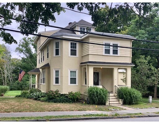
24 State St Unit 1R
Wellesley, MA 02482
2 Weeks Ago
Favorites
24 State St Unit 1R

Favorites
Check Back Soon for Upcoming Availability
| Beds | Baths | Average SF |
|---|---|---|
| 1 Bedroom 1 Bedroom 1 Br | 1 Bath 1 Bath 1 Ba | 1,000 SF |
Fees and Policies
The fees below are based on community-supplied data and may exclude additional fees and utilities.
Pet policies are negotiable.
Details
Utilities Included
-
Water
-
Trash Removal
About This Property
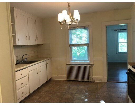
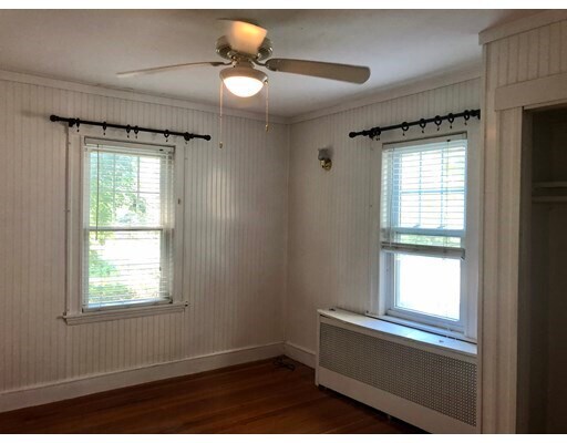
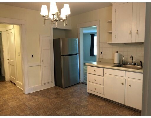
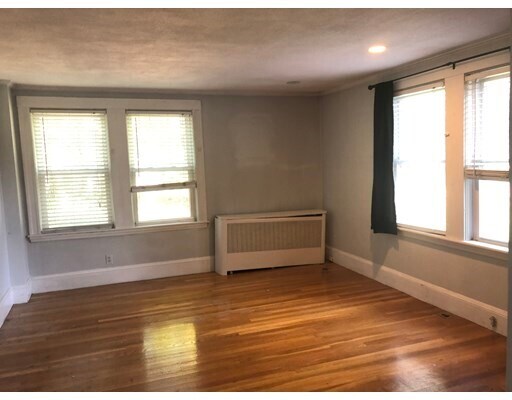
This lovely apartment pours in sunshine! Close to train, town, Whole Foods market, parks and paths. 1 bedroom w walk in closet + living space &1 bath, hardwood floors throughout. 1 car assigned driveway pkg. Shared w/d in basement. No smoking. Water, Landscaping, rubbish removal and snow plowing included! Don’t miss!
24 State St is an apartment community located in Norfolk County and the 02482 ZIP Code.
Features
- Cable Ready
- Range
- Refrigerator
- Tennis Court
- Walking/Biking Trails
Location
Get Directions
Just west of Boston and East of Worcester sits Metro West, a region that houses a group of towns and cities with significant historical backgrounds. A total of 19 municipalities make up the core of this community, but other municipalities are considered to be a part of the Interstate 495/Metro West Corridor.
Learn more about living in Metro WestBelow are rent ranges for similar nearby apartments
| Beds | Average Size | Lowest | Typical | Premium |
|---|---|---|---|---|
| Studio Studio Studio | 523-526 Sq Ft | $895 | $2,522 | $7,552 |
| 1 Bed 1 Bed 1 Bed | 792-794 Sq Ft | $1,495 | $3,057 | $10,753 |
| 2 Beds 2 Beds 2 Beds | 1170-1172 Sq Ft | $1,600 | $3,724 | $16,073 |
| 3 Beds 3 Beds 3 Beds | 1675-1680 Sq Ft | $2,190 | $4,916 | $23,065 |
| 4 Beds 4 Beds 4 Beds | 3432 Sq Ft | $1,050 | $6,408 | $20,000 |
Amenities
- Cable Ready
- Range
- Refrigerator
- Tennis Court
- Walking/Biking Trails
Expenses
Utilities Included
Water, Trash Removal
Included
Education
| Colleges & Universities | Distance | ||
|---|---|---|---|
| Colleges & Universities | Distance | ||
| Drive: | 4 min | 1.4 mi | |
| Drive: | 5 min | 1.7 mi | |
| Drive: | 13 min | 5.9 mi | |
| Drive: | 15 min | 8.0 mi |
24 State St Unit 1R is within 4 minutes or 1.4 miles from Babson College. It is also near Wellesley College and Brandeis University.
Transportation options available in Wellesley include Woodland Station, located 3.4 miles from 24 State St Unit 1R. 24 State St Unit 1R is near General Edward Lawrence Logan International, located 17.4 miles or 28 minutes away, and Worcester Regional, located 32.5 miles or 55 minutes away.
| Transit / Subway | Distance | ||
|---|---|---|---|
| Transit / Subway | Distance | ||
|
|
Drive: | 6 min | 3.4 mi |
|
|
Drive: | 8 min | 3.5 mi |
|
|
Drive: | 8 min | 4.1 mi |
|
|
Drive: | 9 min | 4.7 mi |
|
|
Drive: | 9 min | 4.9 mi |
| Commuter Rail | Distance | ||
|---|---|---|---|
| Commuter Rail | Distance | ||
|
|
Walk: | 16 min | 0.9 mi |
|
|
Walk: | 19 min | 1.0 mi |
|
|
Drive: | 5 min | 2.1 mi |
|
|
Drive: | 6 min | 3.1 mi |
|
|
Drive: | 8 min | 3.1 mi |
| Airports | Distance | ||
|---|---|---|---|
| Airports | Distance | ||
|
General Edward Lawrence Logan International
|
Drive: | 28 min | 17.4 mi |
|
Worcester Regional
|
Drive: | 55 min | 32.5 mi |
Time and distance from 24 State St Unit 1R.
| Shopping Centers | Distance | ||
|---|---|---|---|
| Shopping Centers | Distance | ||
| Walk: | 2 min | 0.1 mi | |
| Walk: | 9 min | 0.5 mi | |
| Walk: | 13 min | 0.7 mi |
24 State St Unit 1R has 3 shopping centers within 0.7 mile, which is about a 13-minute walk. The miles and minutes will be for the farthest away property.
| Parks and Recreation | Distance | ||
|---|---|---|---|
| Parks and Recreation | Distance | ||
|
Whitin Observatory
|
Drive: | 3 min | 1.2 mi |
|
Wellesley College Botanic Gardens
|
Drive: | 2 min | 1.4 mi |
|
Weezie's Garden for Children
|
Drive: | 8 min | 2.9 mi |
|
Elm Bank Reservation
|
Drive: | 8 min | 2.9 mi |
|
Horticultural Society at Elm Bank
|
Drive: | 9 min | 3.1 mi |
24 State St Unit 1R has 5 parks within 3.1 miles, including Whitin Observatory, Wellesley College Botanic Gardens, and Horticultural Society at Elm Bank.
| Hospitals | Distance | ||
|---|---|---|---|
| Hospitals | Distance | ||
| Drive: | 5 min | 3.1 mi | |
| Drive: | 6 min | 3.3 mi | |
| Drive: | 13 min | 6.3 mi |
24 State St Unit 1R has 3 hospitals within 6.3 miles, the nearest is Newton - Wellesley Hospital which is 3.1 miles away and a 5 minute drive.
| Military Bases | Distance | ||
|---|---|---|---|
| Military Bases | Distance | ||
| Drive: | 8 min | 4.3 mi | |
| Drive: | 24 min | 13.3 mi |
24 State St Unit 1R is 4.3 miles from US Military Reservation, and is convenient to other military bases, including Hanscom Air Force Base.
You May Also Like
Similar Rentals Nearby


What Are Walk Score®, Transit Score®, and Bike Score® Ratings?
Walk Score® measures the walkability of any address. Transit Score® measures access to public transit. Bike Score® measures the bikeability of any address.
What is a Sound Score Rating?
A Sound Score Rating aggregates noise caused by vehicle traffic, airplane traffic and local sources
24 State St
Wellesley, MA 02482