
Presidential Towers
555 W Madison St,
Chicago, IL 60661
$1,698 - $6,620
Studio - 2 Beds
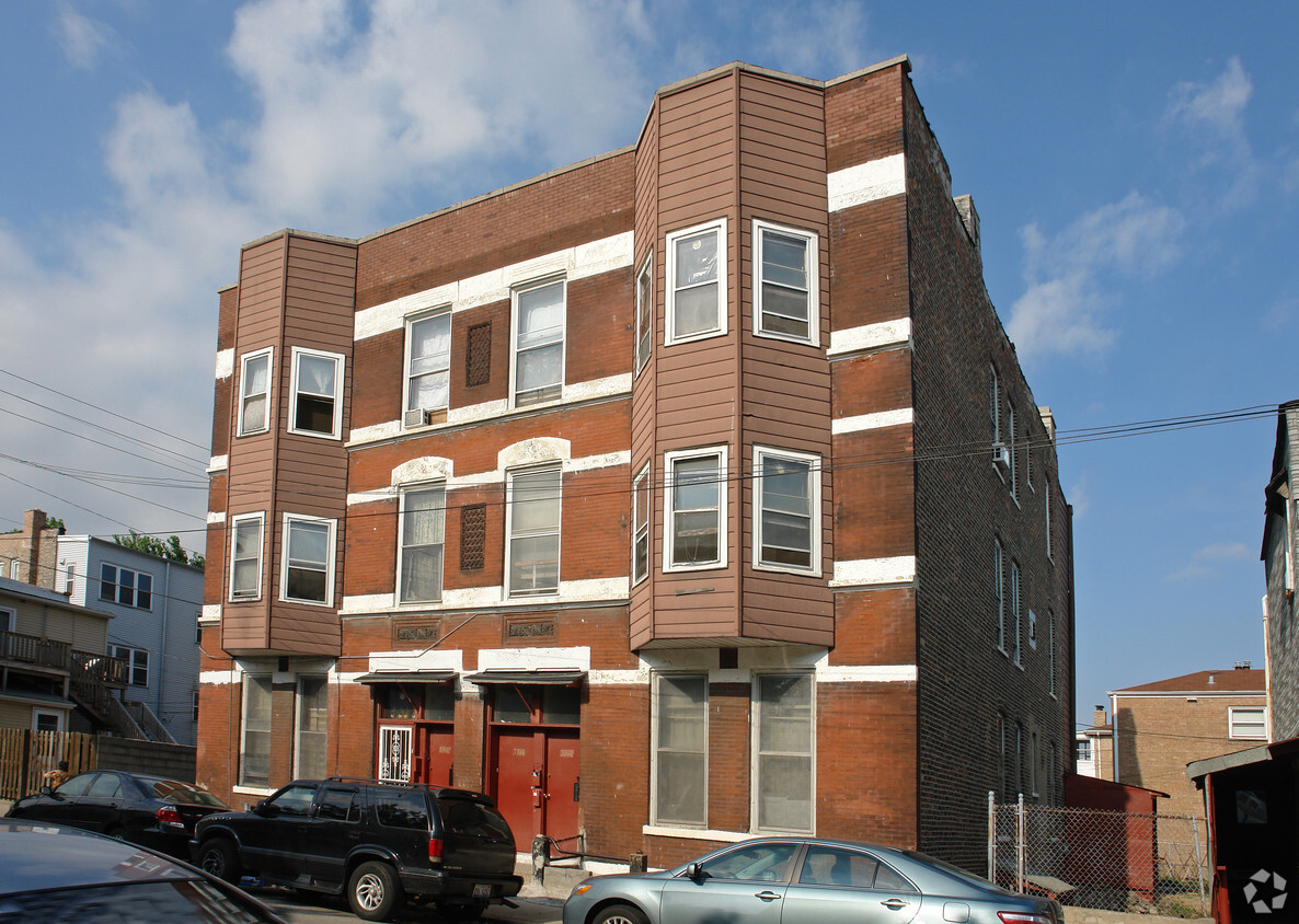
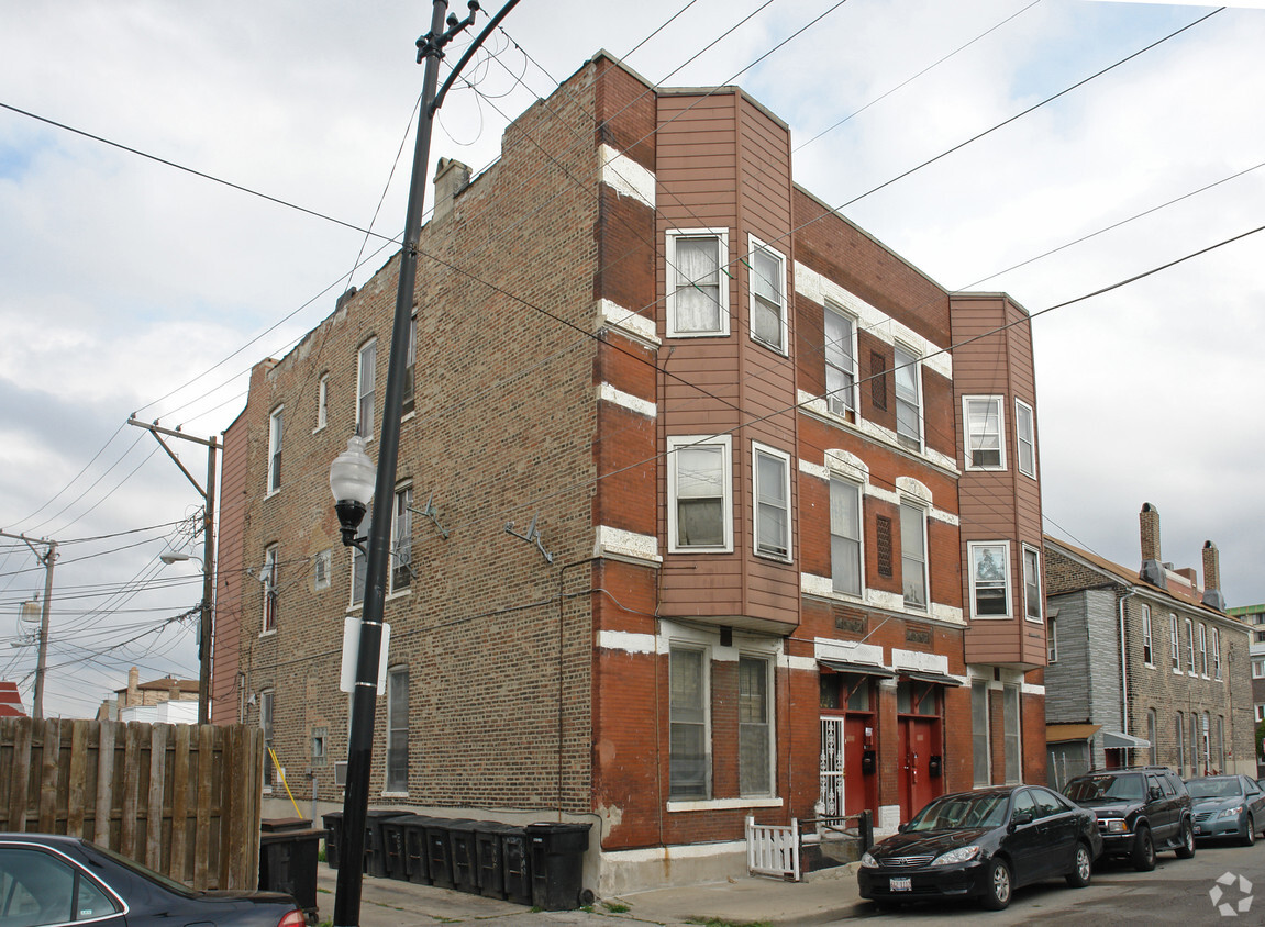

Experience Chicago living at 2340-2342 S Princeton Ave. Based in Chicago's 60616 area, moving to this community offers a wide variety of nearby experiences. The professional leasing team is excited to help you find your new home. Come by to see the current floorplan options. So get a head start on your move. Contact or stop by 2340-2342 S Princeton Ave to talk about leasing your next apartment!
2340-2342 S Princeton Ave is an apartment community located in Cook County and the 60616 ZIP Code. This area is served by the Chicago Public Schools attendance zone.
Located on Chicago’s South Side, Chinatown is a vibrant business district brimming with an array of specialty shops, cafes, dim sum spots, and teahouses. The robust Chinatown Square outdoor mall boasts plenty of additional shopping and dining opportunities as well as intricate murals and sculptures.
Chinatown residents enjoy a peaceful reprieve from an otherwise bustling atmosphere at the 12-acre Ping Tom Memorial Park, situated along the south branch of the Chicago River. The neighborhood provides a strong sense of community at numerous year-round events, from the annual Summer Fair to the Lunar New Year Parade. Getting around from Chinatown is easy with access to the Red Line, I-55, and I-90.
Learn more about living in ChinatownCompare neighborhood and city base rent averages by bedroom.
| Chinatown | Chicago, IL | |
|---|---|---|
| Studio | $3,427 | $1,658 |
| 1 Bedroom | $4,224 | $2,055 |
| 2 Bedrooms | $5,993 | $2,601 |
| 3 Bedrooms | $8,570 | $3,111 |
| Colleges & Universities | Distance | ||
|---|---|---|---|
| Colleges & Universities | Distance | ||
| Drive: | 4 min | 1.6 mi | |
| Drive: | 4 min | 1.7 mi | |
| Drive: | 5 min | 2.1 mi | |
| Drive: | 6 min | 2.5 mi |


Transportation options available in Chicago include Cermak-Chinatown Station, located 0.4 mile from 2340-2342 S Princeton Ave. 2340-2342 S Princeton Ave is near Chicago Midway International, located 9.3 miles or 15 minutes away, and Chicago O'Hare International, located 19.7 miles or 32 minutes away.
| Transit / Subway | Distance | ||
|---|---|---|---|
| Transit / Subway | Distance | ||
|
|
Walk: | 8 min | 0.4 mi |
|
|
Walk: | 14 min | 0.8 mi |
|
|
Walk: | 17 min | 0.9 mi |
|
|
Drive: | 3 min | 1.5 mi |
|
|
Drive: | 4 min | 1.8 mi |
| Commuter Rail | Distance | ||
|---|---|---|---|
| Commuter Rail | Distance | ||
|
|
Drive: | 4 min | 1.4 mi |
| Drive: | 4 min | 1.6 mi | |
|
|
Drive: | 5 min | 1.8 mi |
|
|
Drive: | 7 min | 2.9 mi |
|
|
Drive: | 7 min | 3.0 mi |
| Airports | Distance | ||
|---|---|---|---|
| Airports | Distance | ||
|
Chicago Midway International
|
Drive: | 15 min | 9.3 mi |
|
Chicago O'Hare International
|
Drive: | 32 min | 19.7 mi |
Scores provided by
Traffic
-Airport
-Businesses
-Scores provided by
HowLoud What is a Sound Score Rating? A Sound Score Rating aggregates noise caused by vehicle traffic, airplane traffic and local sources. How It WorksTime and distance from 2340-2342 S Princeton Ave.
| Shopping Centers | Distance | ||
|---|---|---|---|
| Shopping Centers | Distance | ||
| Walk: | 7 min | 0.4 mi |
| Parks and Recreation | Distance | ||
|---|---|---|---|
| Parks and Recreation | Distance | ||
|
Women's Park and Gardens
|
Drive: | 3 min | 1.2 mi |
|
Dunbar Park
|
Drive: | 4 min | 1.6 mi |
|
Field Museum of Natural History
|
Drive: | 5 min | 2.2 mi |
|
Burnham Park
|
Drive: | 5 min | 2.2 mi |
|
John G. Shedd Aquarium
|
Drive: | 5 min | 2.4 mi |
| Hospitals | Distance | ||
|---|---|---|---|
| Hospitals | Distance | ||
| Walk: | 18 min | 1.0 mi | |
| Drive: | 7 min | 3.2 mi | |
| Drive: | 9 min | 3.6 mi |
| Military Bases | Distance | ||
|---|---|---|---|
| Military Bases | Distance | ||
| Drive: | 40 min | 27.3 mi | |
| Drive: | 46 min | 31.0 mi | |
| Drive: | 57 min | 36.1 mi |
What Are Walk Score®, Transit Score®, and Bike Score® Ratings?
Walk Score® measures the walkability of any address. Transit Score® measures access to public transit. Bike Score® measures the bikeability of any address.
What is a Sound Score Rating?
A Sound Score Rating aggregates noise caused by vehicle traffic, airplane traffic and local sources.


