
Williamsburg
200 W Galbraith Rd,
Cincinnati, OH 45215
$658 - $2,852
Studio - 3 Beds
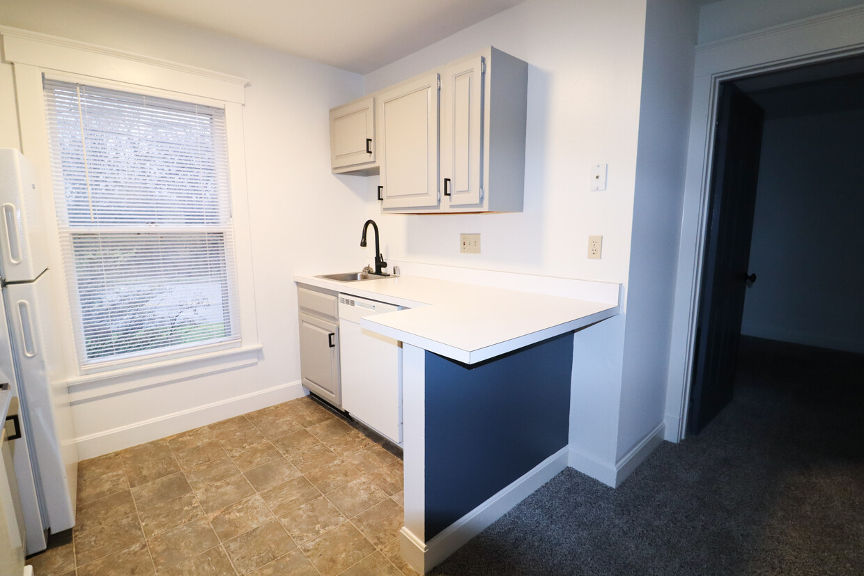

This building is in the perfect location! These units are within a 15 minute drive to downtown Cincinnati, and minutes away from “The Mount Washington Water Tower District!” In The Water Tower District you can find various shops and food joints both local and chain. Mt. Washington is a family-friendly neighborhood that is right on the city limits. In less than 5 minutes you can reach the Mt. Washington Recreational Facility as well as Stanberry Park which provides some of the city’s most extensive hiking trails, playgrounds, picnic shelters, and premier sledding hills. From the newly updated kitchen and bathroom to the spacious bedroom as well as the added modern amenities, this is the perfect apartment for you. New carpet and tile floors provide a fresh and clean look!Tenant pays a $39 water, sewer and trash utility fee. Electric is billed separately.
2332 Beechmont is an apartment community located in Hamilton County and the 45230 ZIP Code. This area is served by the Cincinnati Public Schools attendance zone.
Cincinnati sits on the northern bank of the Ohio River, where rolling hills meet a city that helped establish the Midwest long before other major metros existed. Settled in 1788, the Queen City sits west of the Appalachian Mountains and combines historic culture with urban living.
Today, neighborhoods like Over-the-Rhine, Hyde Park, and Mount Adams each bring a distinct character to city life. Over-the-Rhine is packed with restored 19th-century architecture, Findlay Market, and Music Hall. Mount Adams perches beside Eden Park with stunning river views, while Hyde Park Square draws locals and tourists alike with local cafes and walkable streets.
Renters will find a wide range of housing options across the city, from converted lofts and townhouses in Over-the-Rhine to sleek high-rise apartment communities along the riverfront at The Banks. Clifton and Oakley offer everything from charming older buildings to newer developments with modern amenities.
Learn more about living in Cincinnati| Colleges & Universities | Distance | ||
|---|---|---|---|
| Colleges & Universities | Distance | ||
| Drive: | 17 min | 7.0 mi | |
| Drive: | 16 min | 8.1 mi | |
| Drive: | 19 min | 9.0 mi | |
| Drive: | 19 min | 9.1 mi |


Transportation options available in Cincinnati include Richter & Phillips Station - 6Th & Main, located 9.4 miles from 2332 Beechmont. 2332 Beechmont is near Cincinnati/Northern Kentucky International, located 20.5 miles or 37 minutes away.
| Transit / Subway | Distance | ||
|---|---|---|---|
| Transit / Subway | Distance | ||
| Drive: | 17 min | 9.4 mi | |
| Drive: | 17 min | 9.4 mi | |
| Drive: | 18 min | 9.5 mi | |
| Drive: | 18 min | 9.5 mi | |
| Drive: | 18 min | 9.5 mi |
| Commuter Rail | Distance | ||
|---|---|---|---|
| Commuter Rail | Distance | ||
|
|
Drive: | 22 min | 11.4 mi |
| Airports | Distance | ||
|---|---|---|---|
| Airports | Distance | ||
|
Cincinnati/Northern Kentucky International
|
Drive: | 37 min | 20.5 mi |
Scores provided by
Traffic
-Airport
-Businesses
-Scores provided by
HowLoud What is a Sound Score Rating? A Sound Score Rating aggregates noise caused by vehicle traffic, airplane traffic and local sources. How It WorksTime and distance from 2332 Beechmont.
| Shopping Centers | Distance | ||
|---|---|---|---|
| Shopping Centers | Distance | ||
| Walk: | 9 min | 0.5 mi | |
| Walk: | 10 min | 0.5 mi |
| Parks and Recreation | Distance | ||
|---|---|---|---|
| Parks and Recreation | Distance | ||
|
Stanbery Park
|
Walk: | 5 min | 0.3 mi |
|
Otto Armleder Park
|
Drive: | 7 min | 3.0 mi |
|
Withrow Nature Preserve
|
Drive: | 9 min | 4.0 mi |
|
California Woods Nature Preserve
|
Drive: | 10 min | 4.2 mi |
|
Ault Park
|
Drive: | 10 min | 4.2 mi |
| Hospitals | Distance | ||
|---|---|---|---|
| Hospitals | Distance | ||
| Drive: | 6 min | 2.9 mi | |
| Drive: | 17 min | 7.4 mi | |
| Drive: | 18 min | 8.7 mi |
| Military Bases | Distance | ||
|---|---|---|---|
| Military Bases | Distance | ||
| Drive: | 79 min | 58.7 mi | |
| Drive: | 85 min | 63.8 mi | |
| Drive: | 88 min | 67.1 mi |
What Are Walk Score®, Transit Score®, and Bike Score® Ratings?
Walk Score® measures the walkability of any address. Transit Score® measures access to public transit. Bike Score® measures the bikeability of any address.
What is a Sound Score Rating?
A Sound Score Rating aggregates noise caused by vehicle traffic, airplane traffic and local sources.

2332 Beechmont Ave
Cincinnati, OH 45230


